Tag: Fauna

Fauna – all animal life occurring in particular region or time.

  • Itinerary for 7-day Holiday in Tenerife, Spain

    Itinerary for 7-day Holiday in Tenerife, Spain

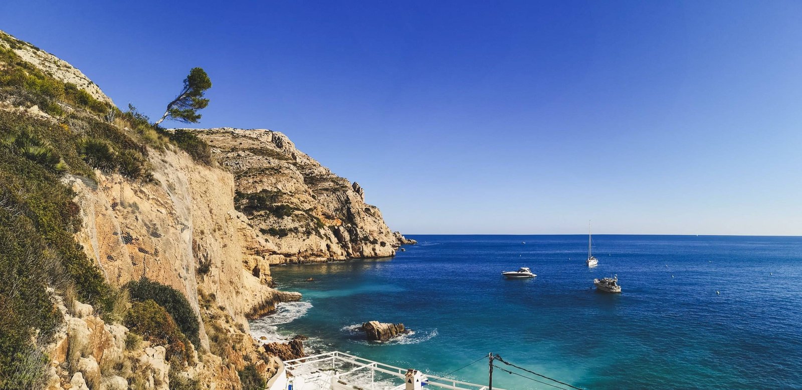
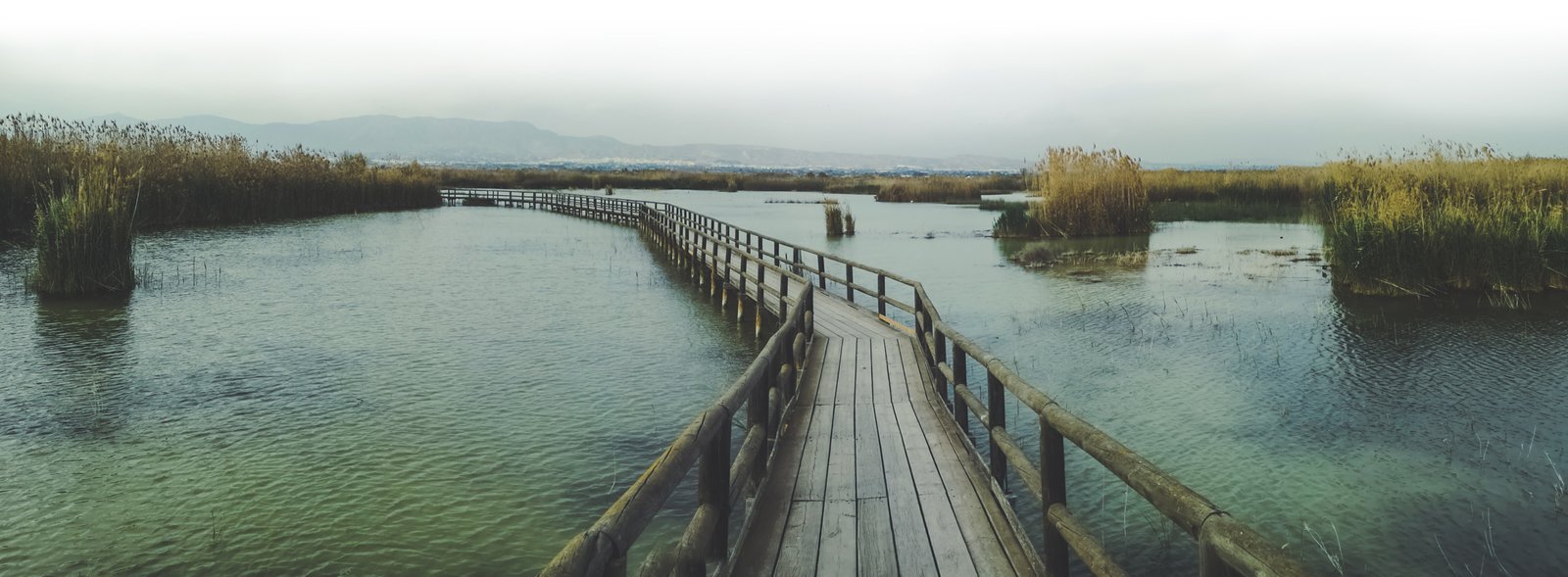
    Sunny Winter Holidays in Europe

    Winter… Winter always comes and once it does, somehow it feels that it never leaves. I hardly meet a person who doesn’t want to migrate somewhere warmer during the cold season. Here in Europe, we don’t have many places to run away from the bitter cold of winter, but the Canary Islands are one of them. Yes, it lies just next to Africa in the Atlantic, but technically – it is Europe. This Spanish territory is a legacy of the empire’s illustrious past.

    Today, Tenerife stands as a year-round haven for those seeking balmy weather and diverse experiences. In this guide, I’ll share a tried-and-true 7-day itinerary that showcases the best of Tenerife, from its stunning beaches to its majestic mountains.

    And don’t you feel like you deserve holidays on a sunny beach too? Maybe, with a mix of one or two adventures every now and then? That would be nice, isn’t it? I think any month could be a perfect time to put your umbrellas down and head to the biggest island of all the Canary Islands – Tenerife. Whether you’re basking in the sun or embarking on an adventure, Tenerife promises a dose of vitamin D and joy for every traveler.

    A road to Teide Volcano in Tenerife, Spain
    Teide Volcano is the crown jewel of the Canary Islands. Photo by Alis Monte [CC BY-SA 4.0], via Connecting the Dots

    7-Day Tenerife Itinerary

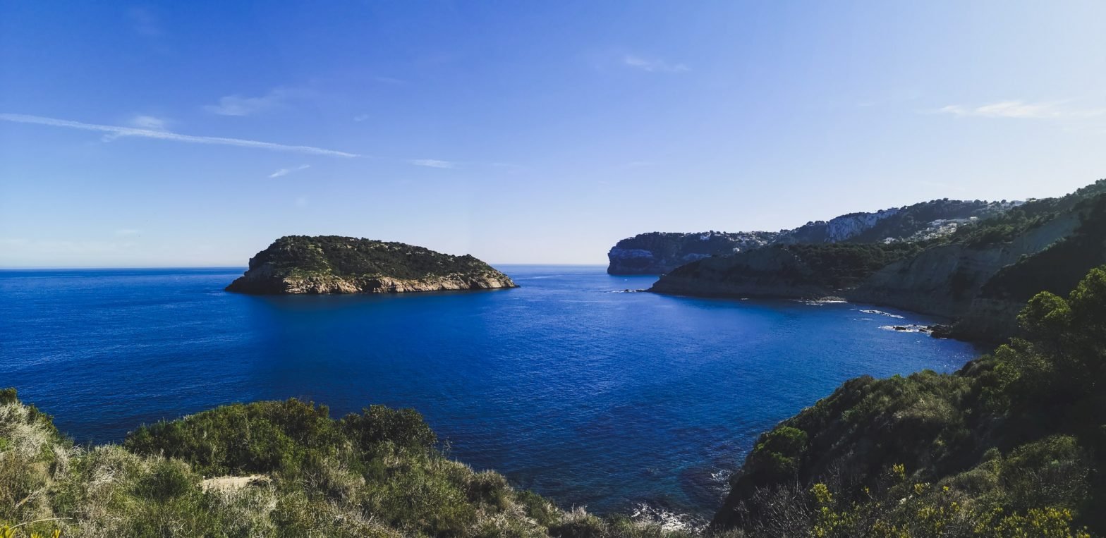
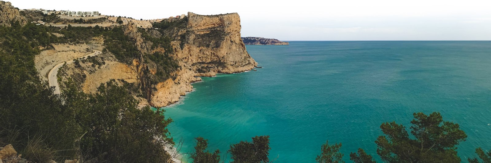
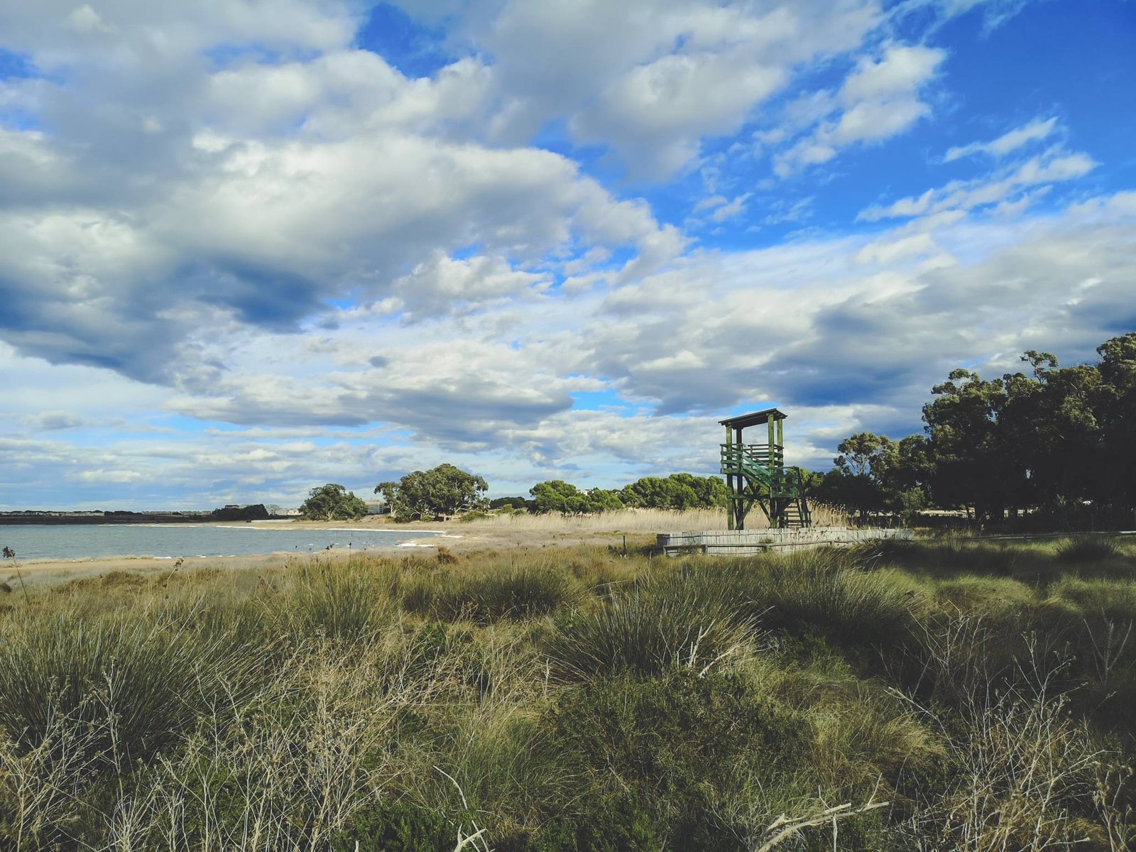
    • Day 1: Tenerife’s Beach Paradise – Begin your adventure by unwinding on some of Europe’s most beautiful beaches. Bask in the sun and soak in the picturesque views of the Atlantic.
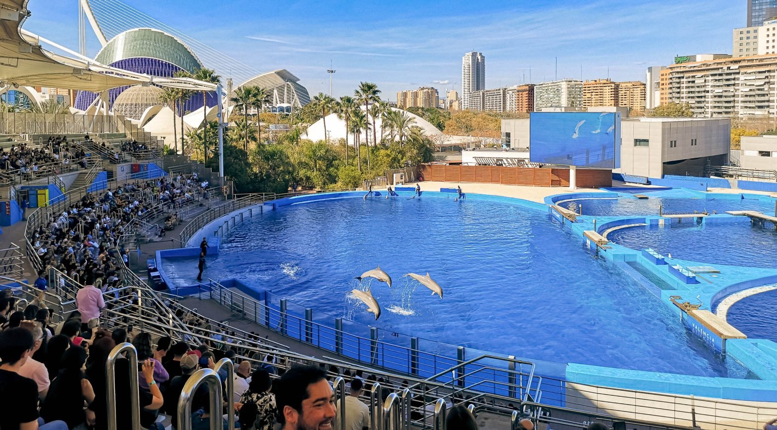
    • Day 2: Marine Majesty – Dolphin and Whale Watching – Set sail on the azure waters for a chance to encounter playful dolphins and majestic whales, a highlight of Tenerife’s natural wonders.
    • Day 3: The Enchantment of Masca Village – Step into the quaint and captivating world of Masca, a hidden gem offering breathtaking views and rich history.
    • Day 4: Conquering Mount Teide – Ascend Spain’s highest peak for awe-inspiring vistas and an up-close experience with Tenerife’s volcanic majesty.
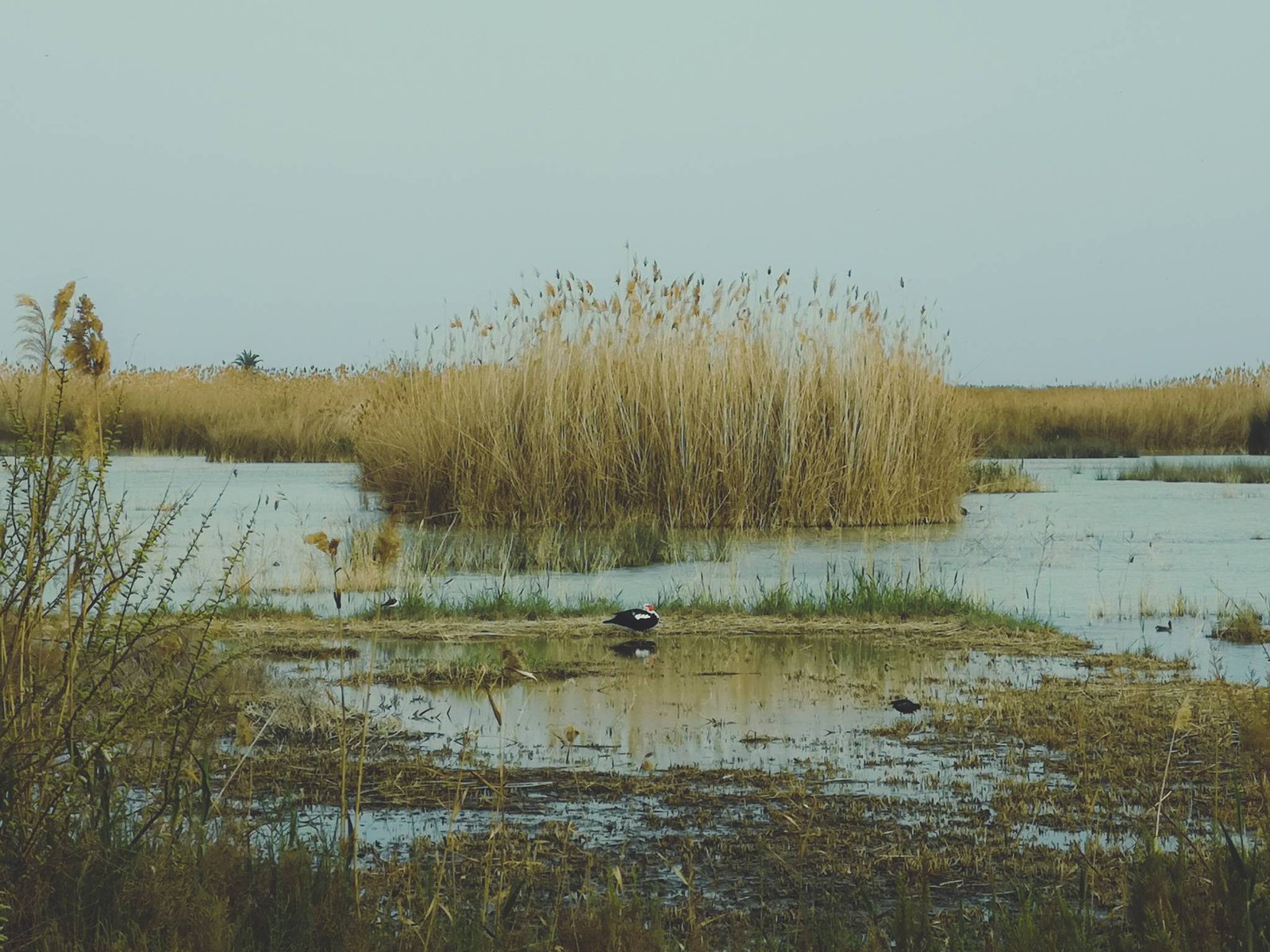
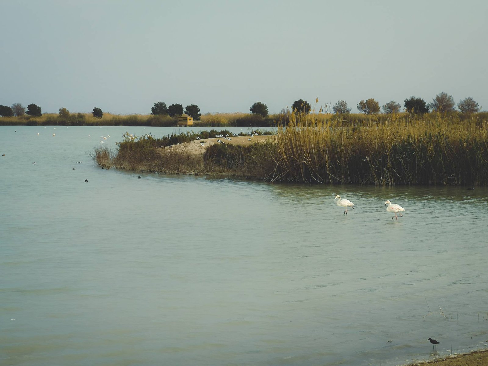
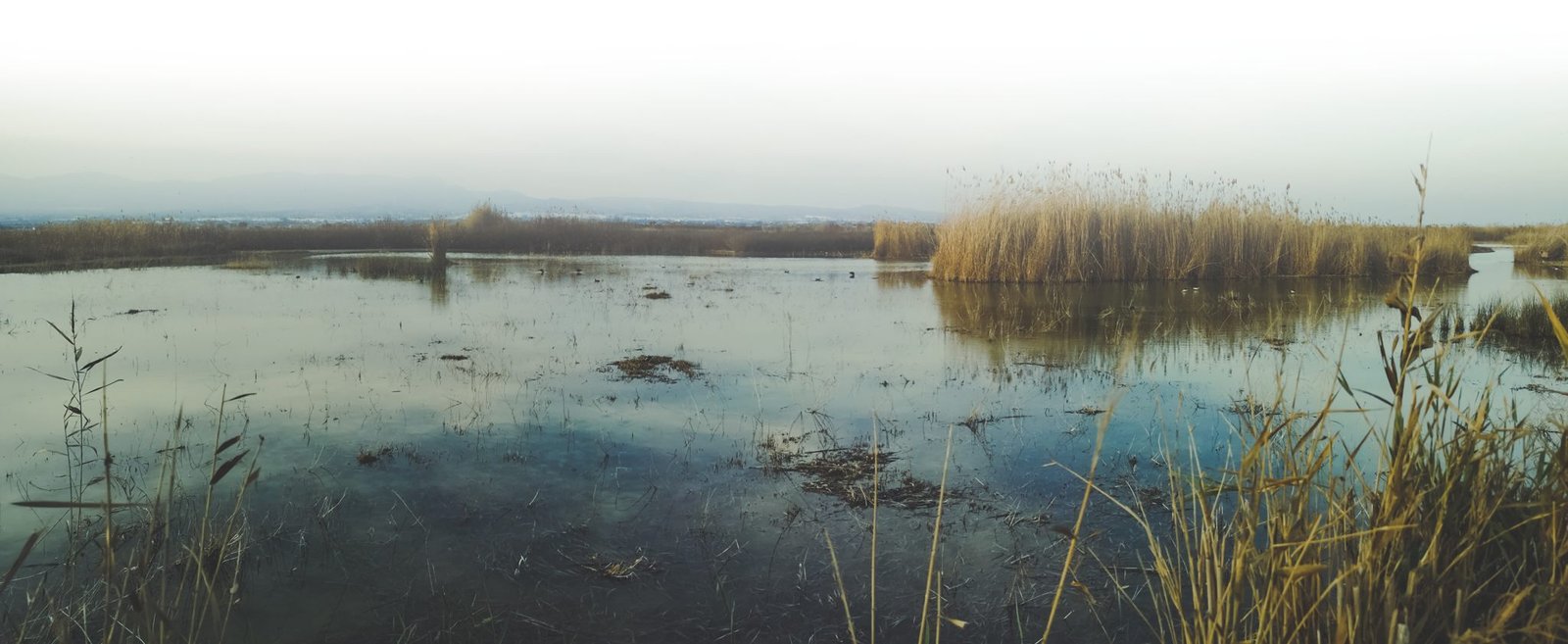
    • Day 5: Northern Tenerife – A Journey of Discovery – Venture into the island’s northern region to explore its unique landscapes and cultural richness, from Garachico to the lush Anaga Rural Park.
    • Day 6: Anaga Rural Park – Nature’s Masterpiece – Immerse yourself in the lush, green heart of Tenerife, a haven for hikers and nature lovers alike.
    • Day 7: Santa Cruz de Tenerife – Culture and Celebration – Conclude your journey in Tenerife’s vibrant capital, where culture, history, and modernity blend
    The view from Playa de los Roques, Puerto de la Cruz
    A typical view in the northern part of Tenerife. Photo by Alis Monte [CC BY-SA 4.0], via Connecting the Dots

    Tenerife Island Details

    Tenerife Map

    Panorama from Sendero de los Sentidos, Tenerife
    You wouldn’t guess that Anaga Rural Park is located on the same island as an active volcano. Photo by Alis Monte [CC BY-SA 4.0], via Connecting the Dots

    How is the Weather in Tenerife?

    The weather in Tenerife is just fantastic throughout the year. In winter months like February – visiting Tenerife is just surreal. Not only do you get to take out your summer outfits out of the closet but to swim outdoors in a warm sea. One thing is for sure – there are not so many places with such pleasant weather during winter. Tenerife & the rest of the Canary Islands get to enjoy one of the best climates in the world. Why won’t you enjoy it too?

    People watching sunset on Playa de Arena, Tenerife
    Most of the beaches in Tenerife has its sand colored black by Teide volcano. Photo by Alis Monte [CC BY-SA 4.0], via Connecting the Dots

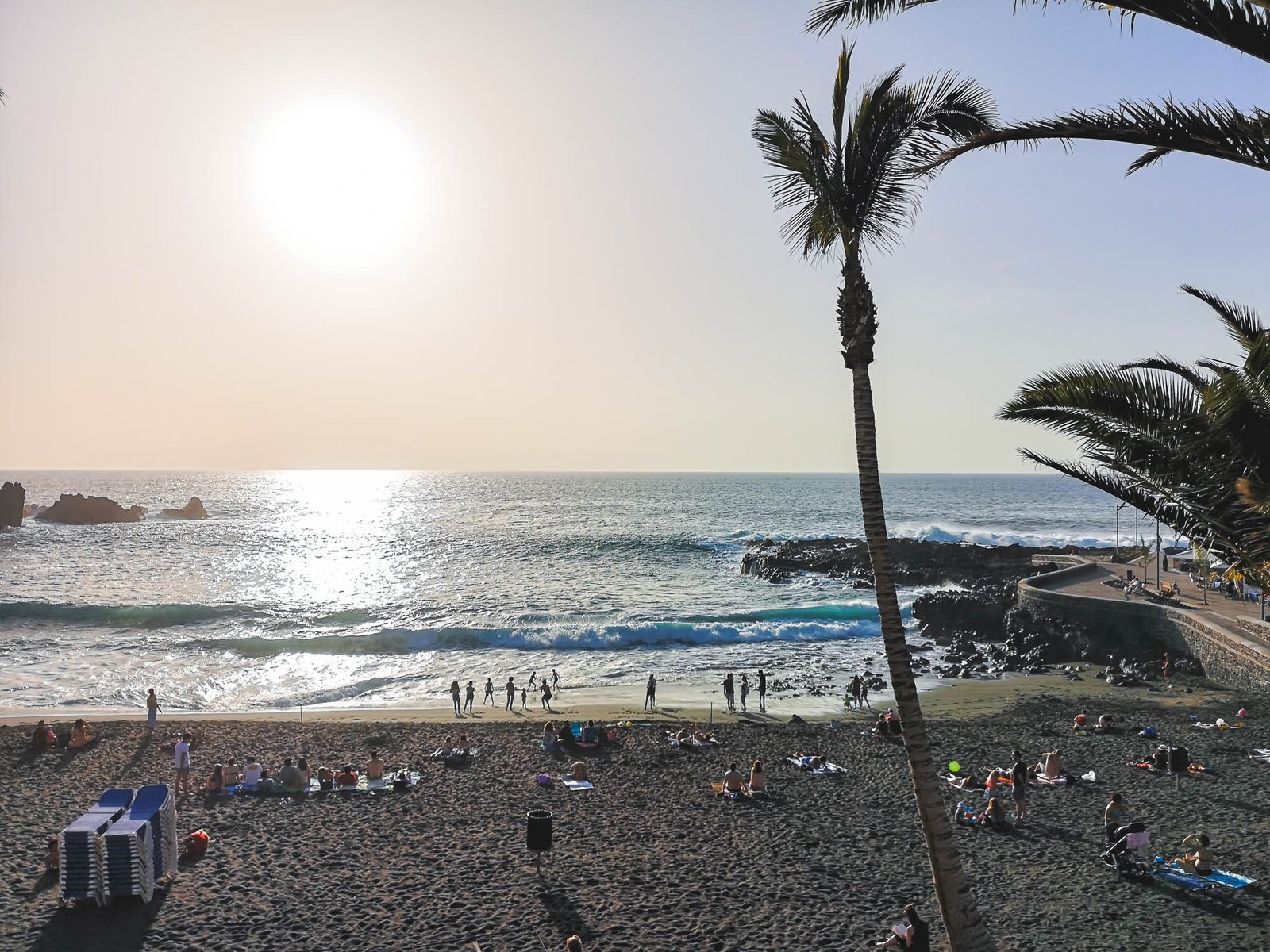
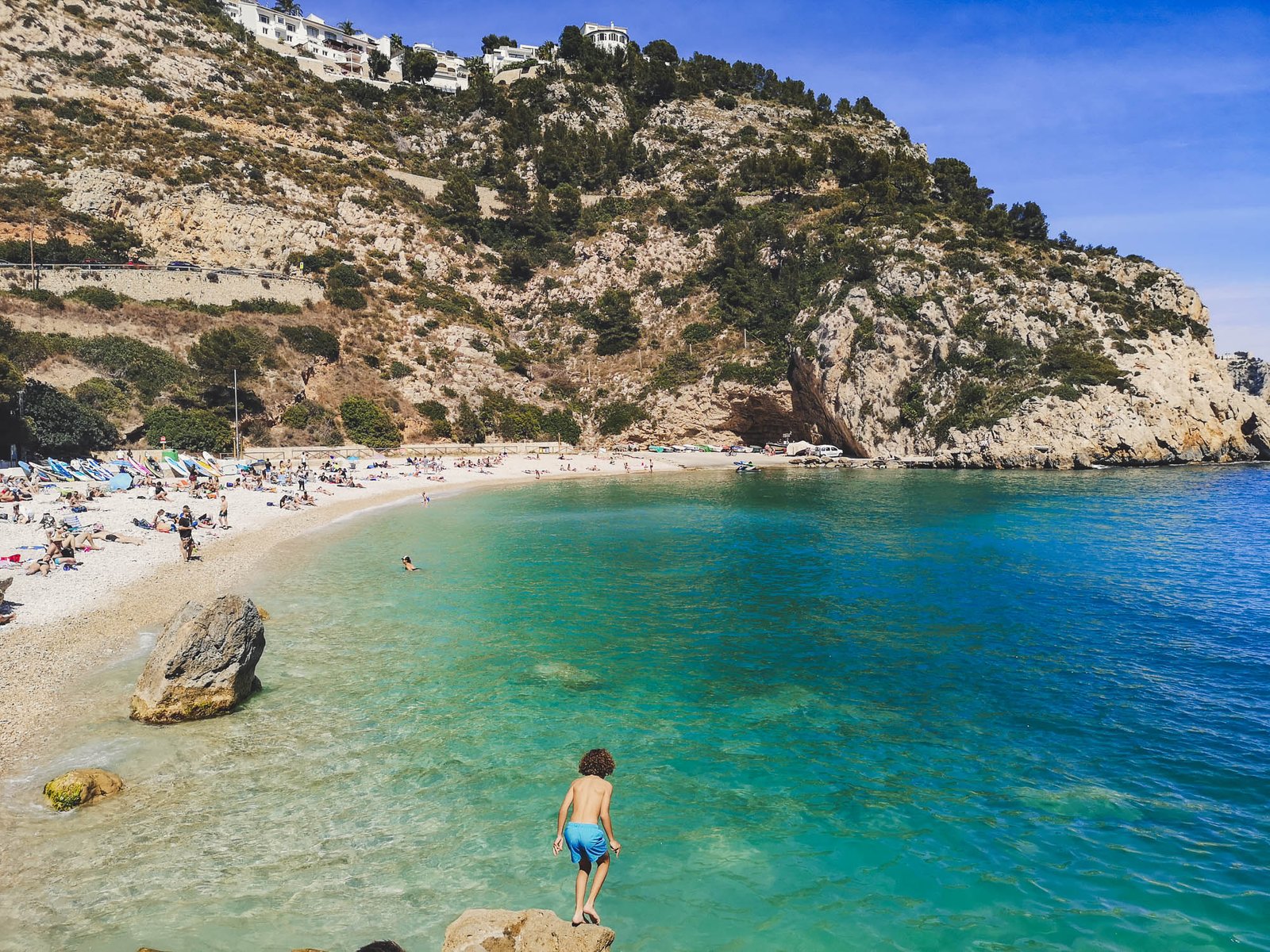
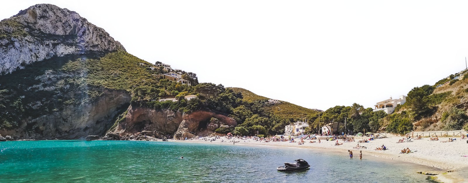
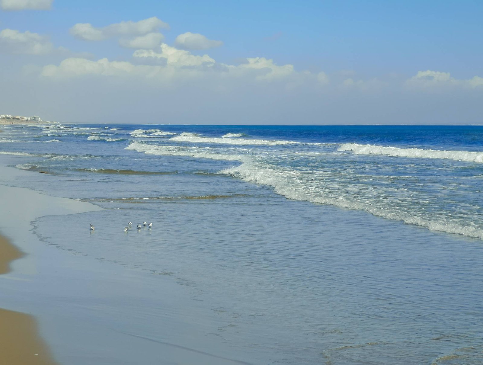
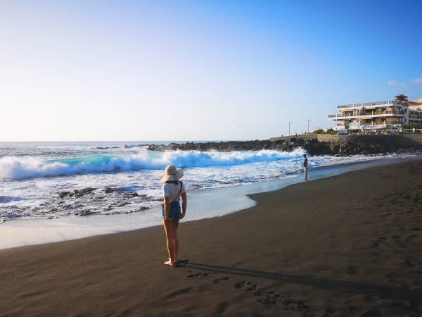
    Day 1 – Enjoy Sun & the Best Tenerife Beaches

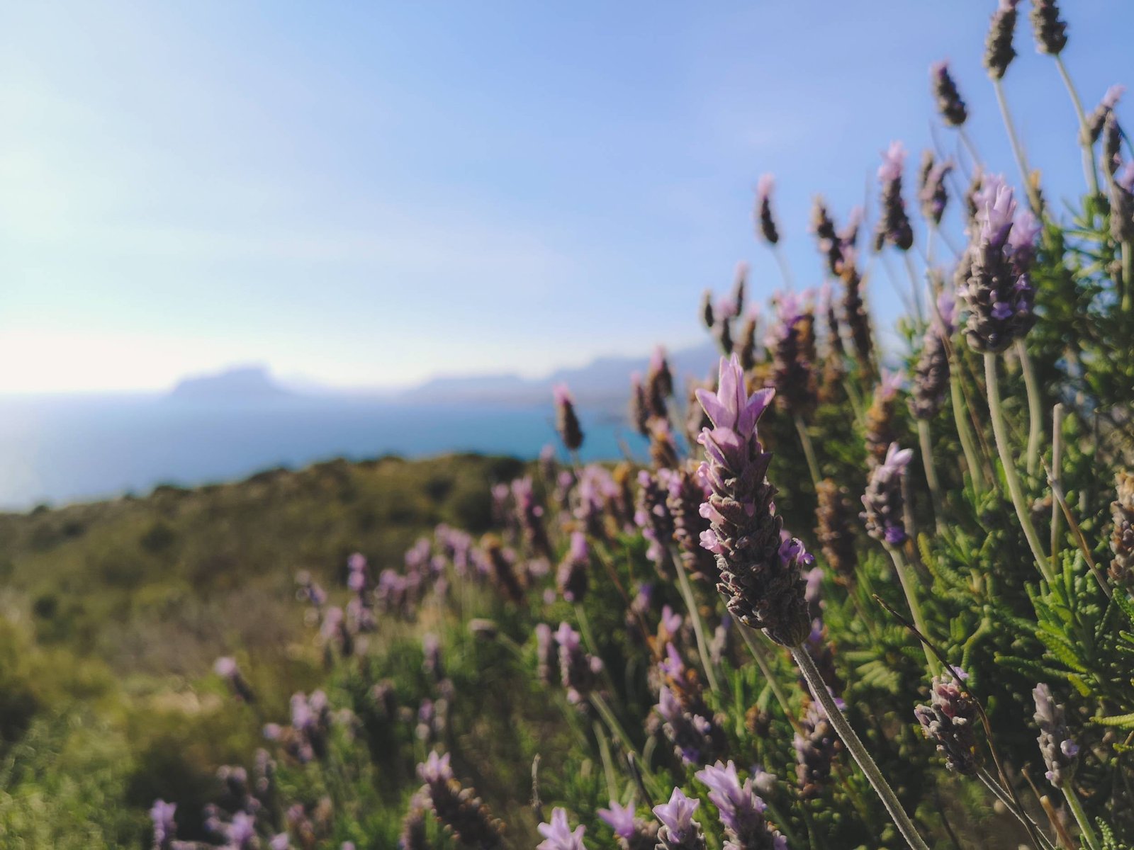
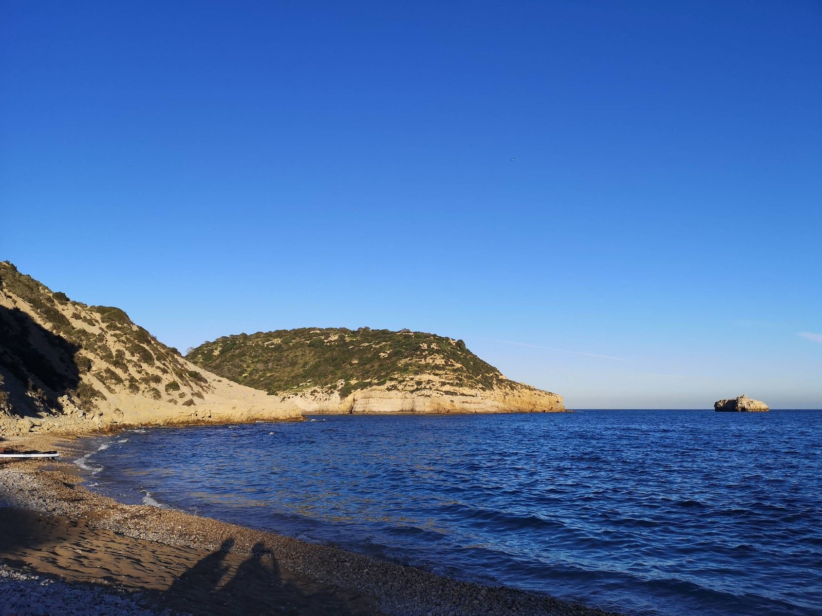
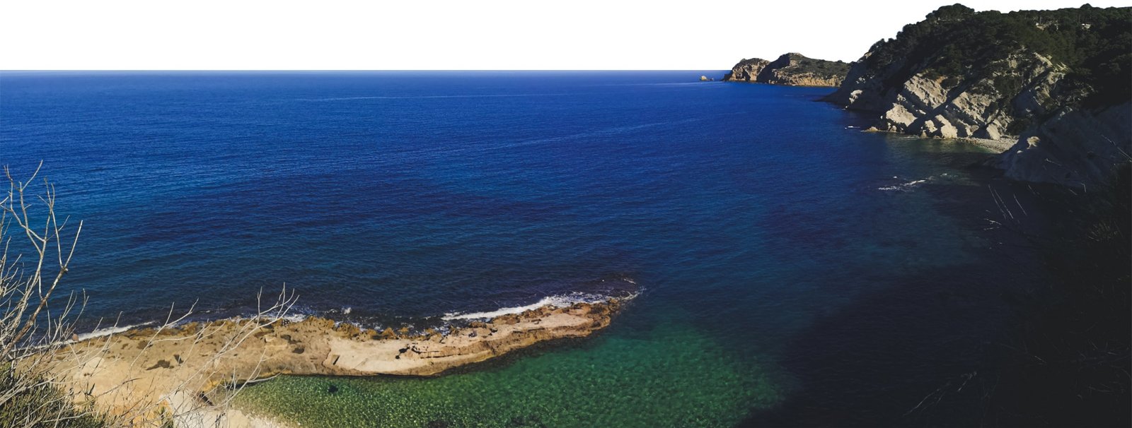
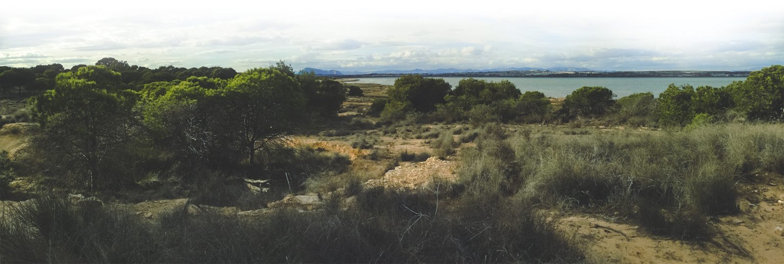
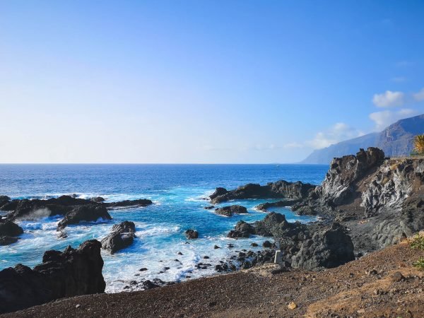
    Today is all about indulging in the simple pleasures of a beach holiday, setting the tone for an unforgettable week in Tenerife. To some, I imagine, this might sound a bit lame, but once you get your keys to a car and an apartment, the first thing you should do is to go out and head for the closest beach. Let’s start with a big chunk of Vitamin D, you know that it improves your mood, right? ² Good feels are what we are here for, be ready for a week of happiness as this feeling won’t leave you for the rest of the trip. A sunny beach with warm ocean water for sure is surreal once you get here on a winter out of cold Europe.

    Keep in mind that due to possible big waves, some of the beaches might be closed. In that case, just head for any beach with a breakwater, I marked some on the map.

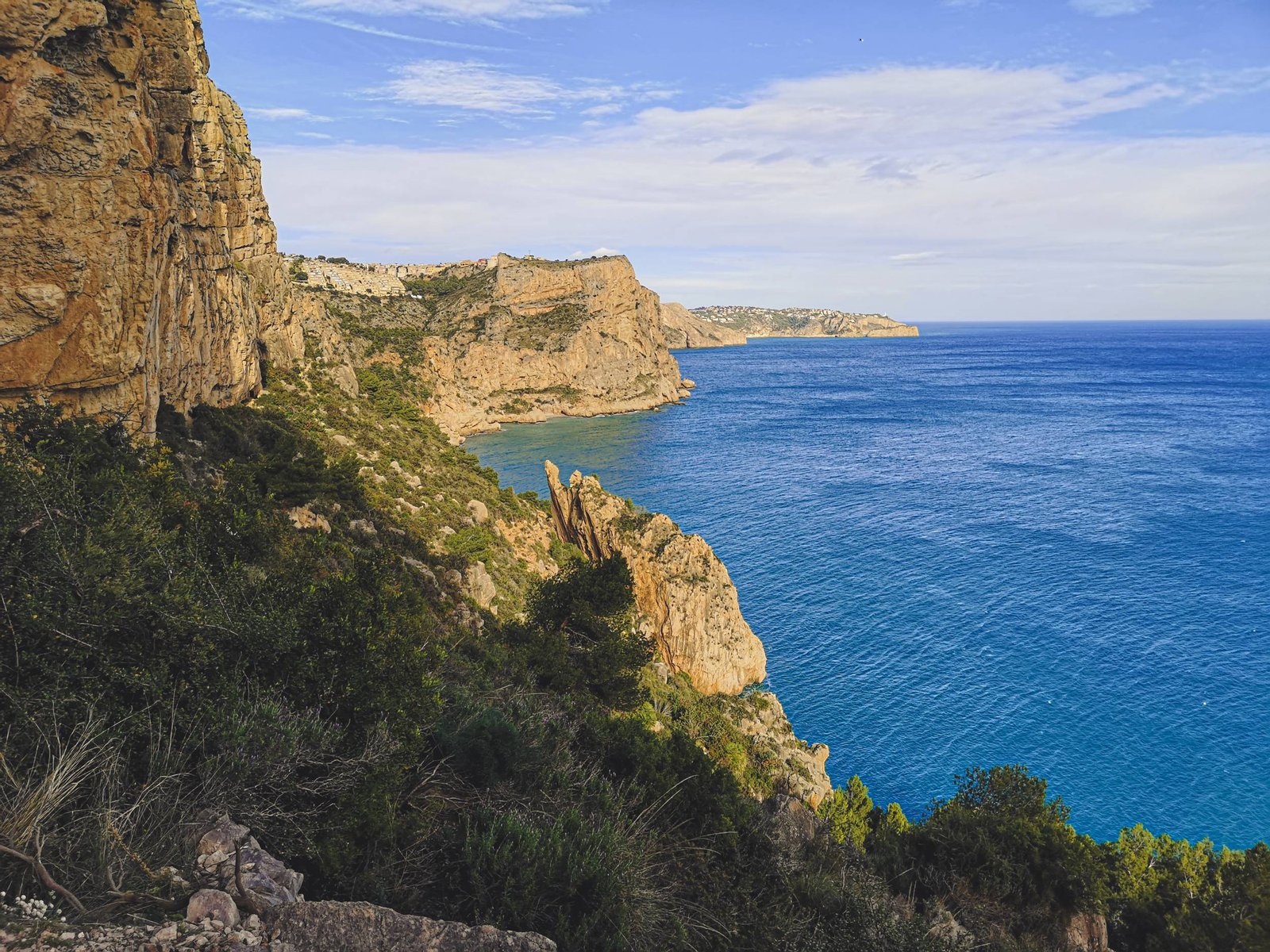
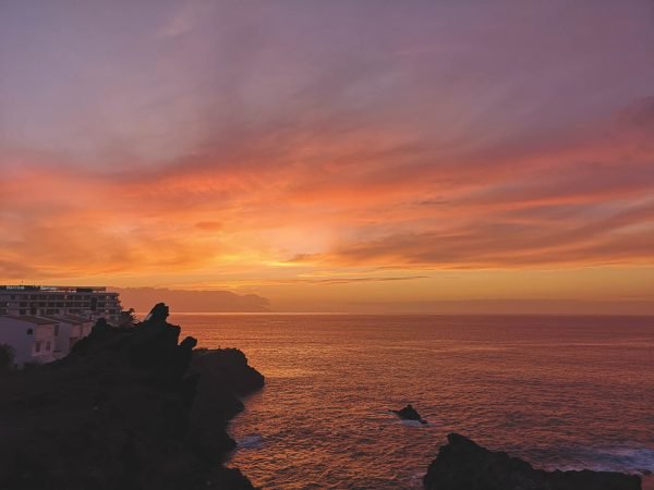
    After the beach, you should walk around, and get to know your neighborhood – find those grocery shops for the morning milk runs and the pubs for the late-night drinks. Picking the best area for your base will vary based on yout personal preferences, but I highly recommend the area around Los Gigantes for its breathtaking evening views, where the sky and sea meet in a spectacular display of colors.


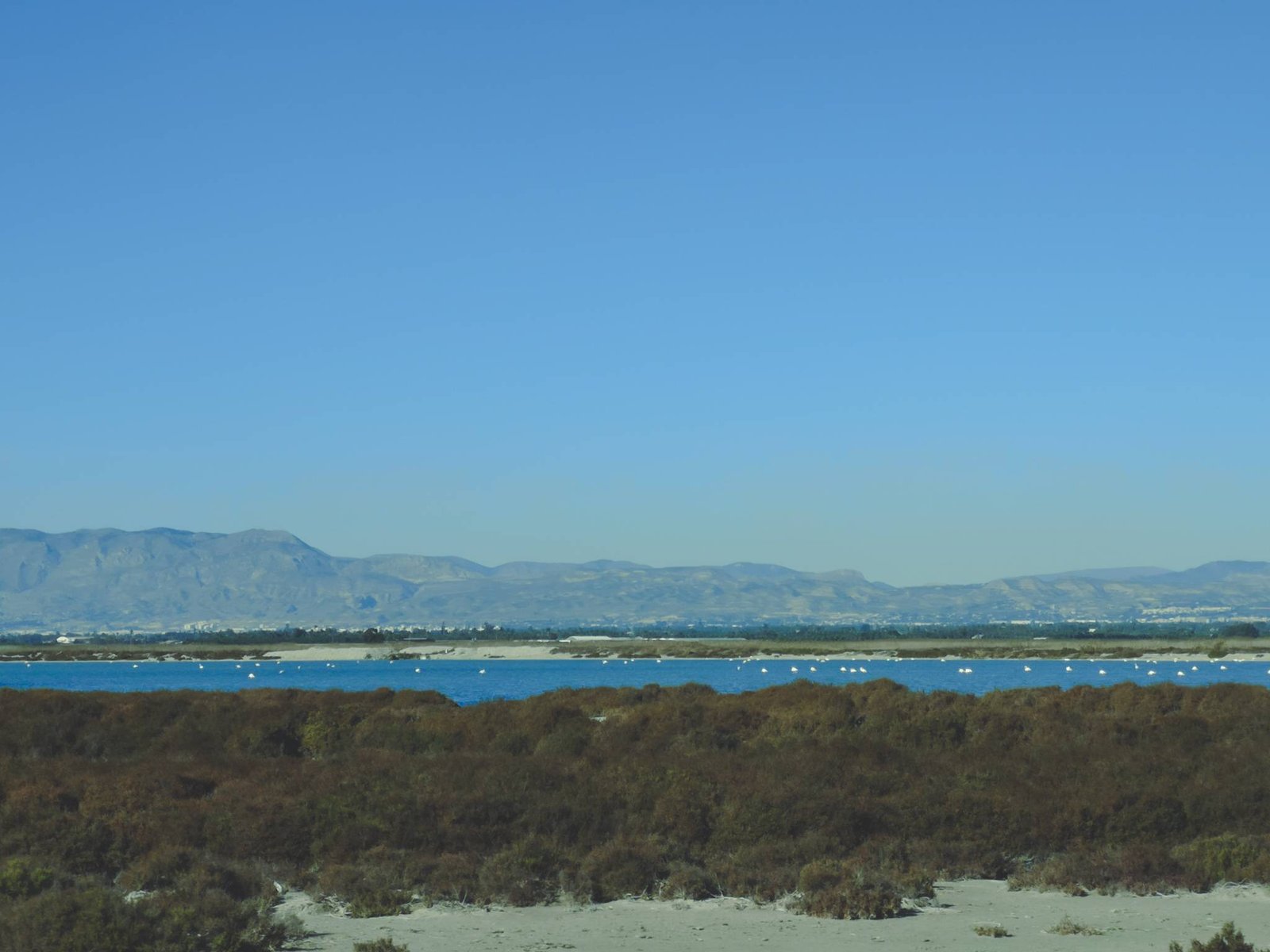
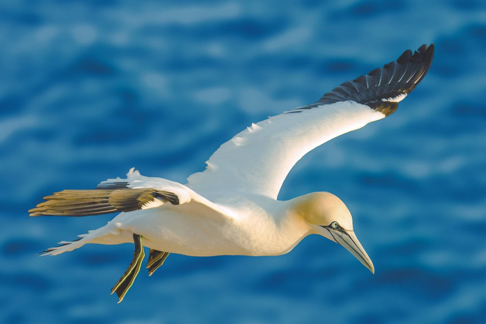
    Day 2 – Take the Dolphin and Whale Watching Tour

    Due to past experience on some other islands, I wasn’t expecting more than beautiful vistas of the island out of the tour. That was true but so was the following. From what I learned the chances of encountering these playful and intelligent creatures are exceptionally high. It might sound strange, but most of the dolphins seek out the boats themselves. They do it either for some wave-riding along the human vessels or simply just because they want to befriend you. Either way, you won’t be able to tell the difference. The dolphins will be there to cheer you up and that combined, with more sea, and more sun will guarantee some quality time. Based on my personal experience (besides the North Atlantic), Tenerife was the only island where dolphins still reach out for boats. In many places, like Mauritius and other coasts suffering from over-tourism, the opposite is true. Therefore, it is very important to take one of the eco-dolphin-friendly tours to keep these majestic creatures still interested in us.

    While dolphin sightings are common, spotting a whale is a moment of serendipity, a special gift from the sea.

    Alternatively, you can take a ferry or tour to La Gomera Island and spend your day there. Most of the dolphin and whale watching tours are heading for territory between Tenerife and La Gomera anyway, where these encounters are very common.

    If you are afraid to get seasick, I would still recommend spending this day not too far from the sea. You just got here and there is still plenty of time to see the rest of the island. Today is the day for the sea and the further enjoyment of the beautiful beaches of Tenerife.


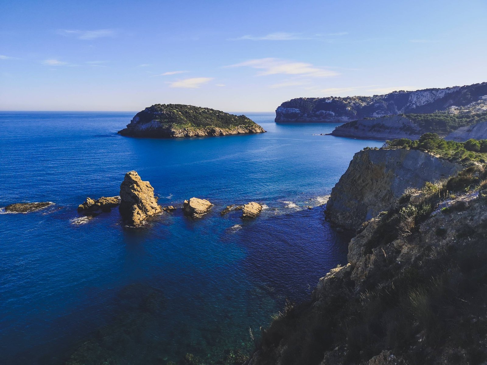
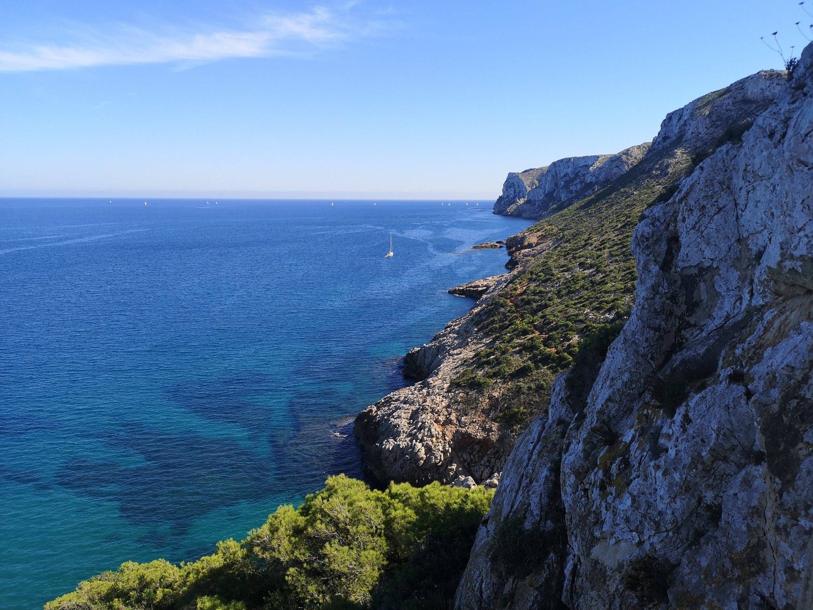
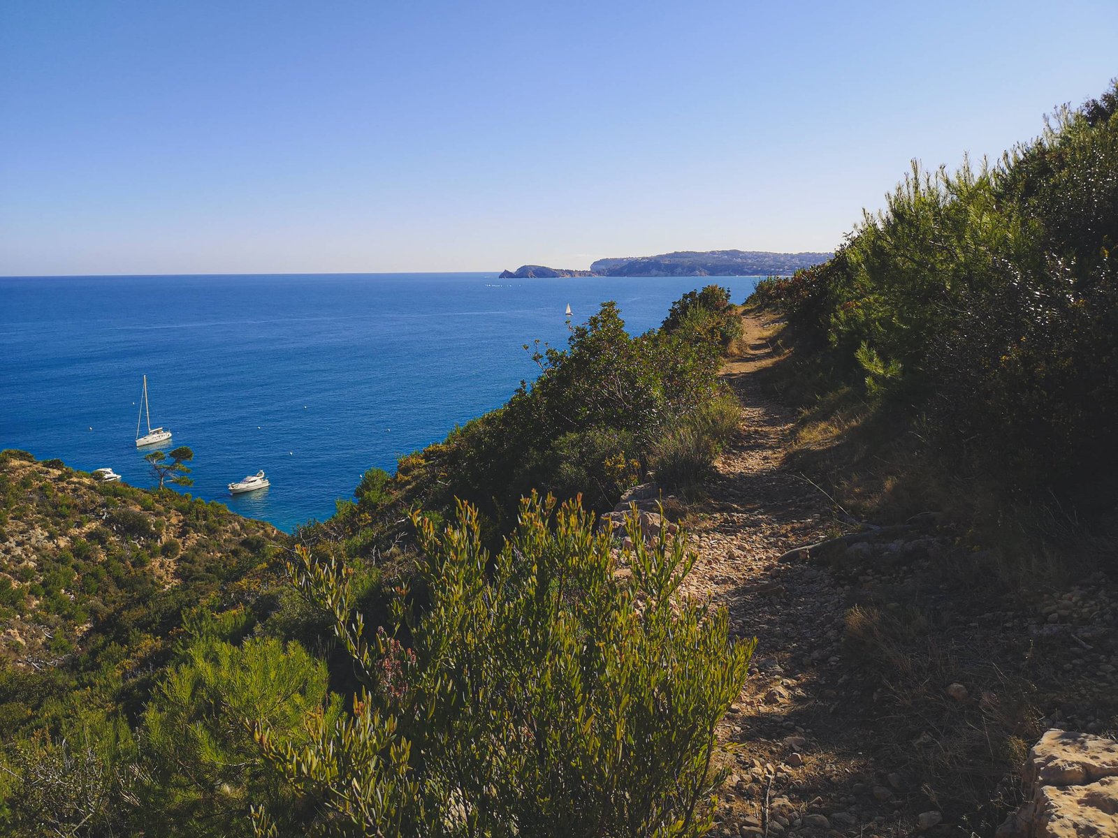
    Day 3 – Visit Masca Village

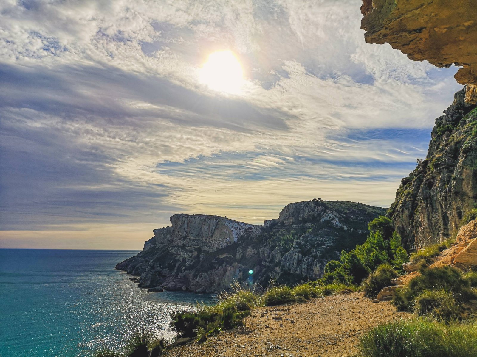
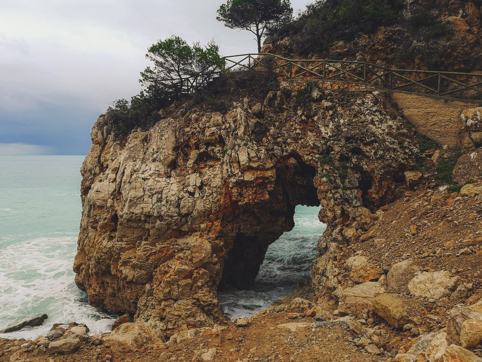
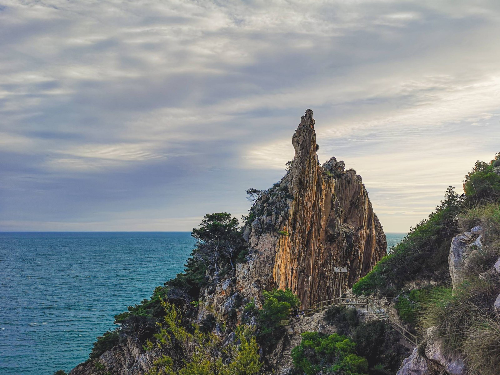
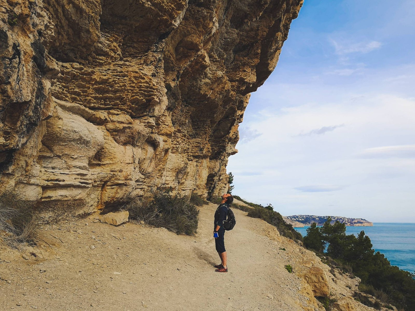
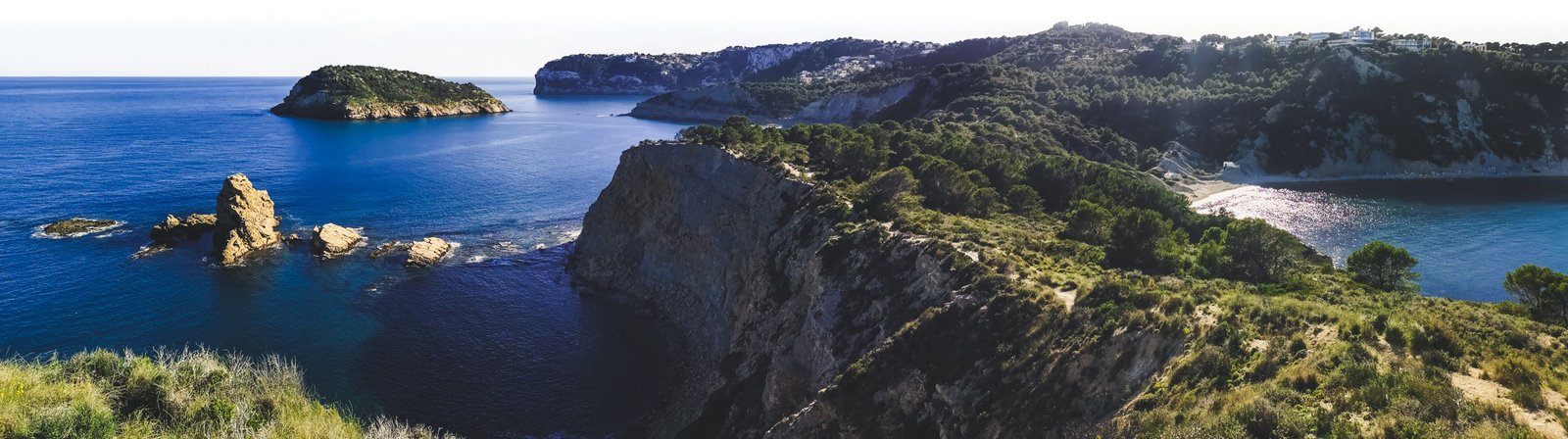
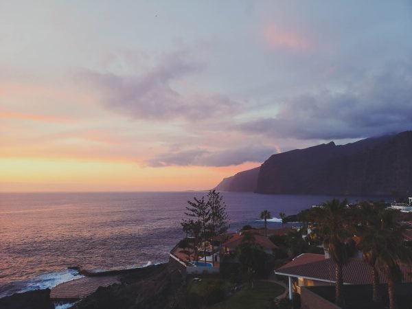
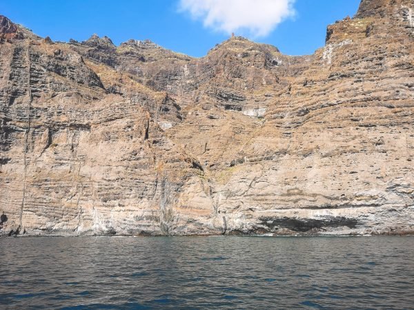
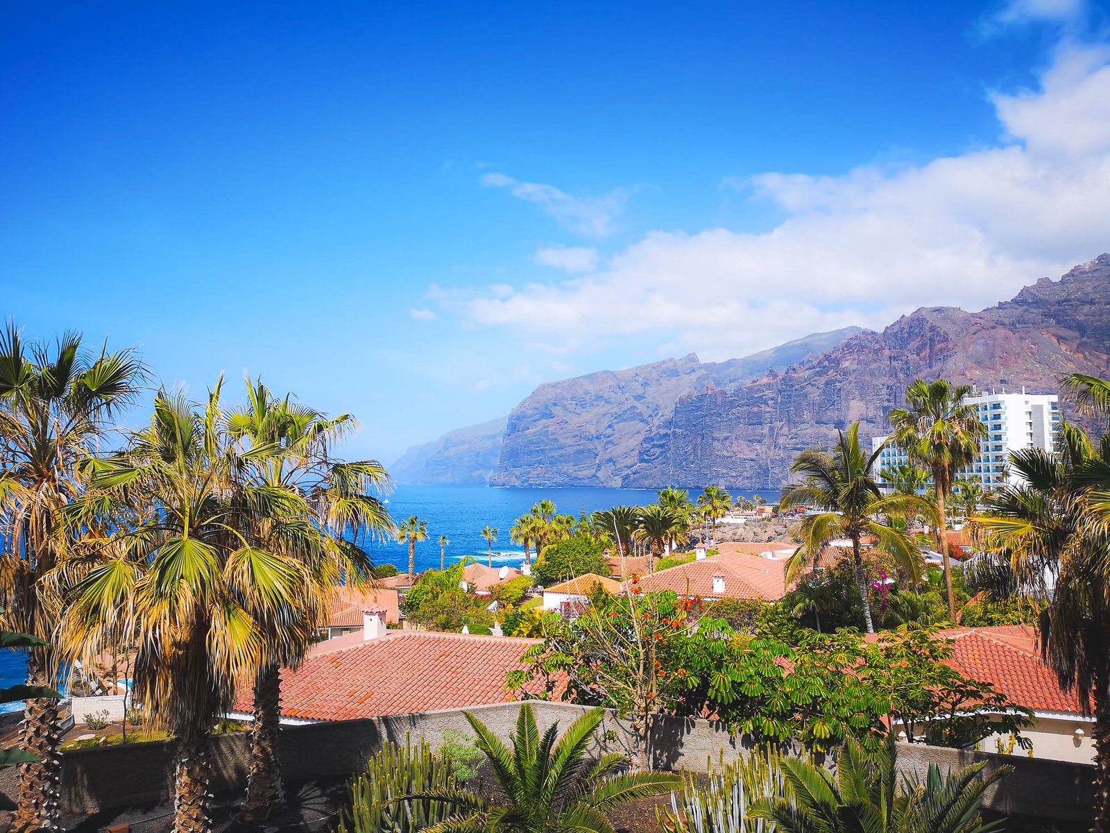
    By now you probably gotten used to warm weather and the sun (hopefully without too much of a sunburn). It is time to turn your holidays into an adventure to remember. Not like it is boring to lay down on a mattress by the sea reading a book and sipping one Gin Topic after another, but by now you probably have noticed a giant mountain overlooking the island. It kinda looks interesting, doesn’t it? We’ll get there on time, don’t worry, but for now, let’s get closer to the sea. What about getting on that big cliff called Los Gigantes?

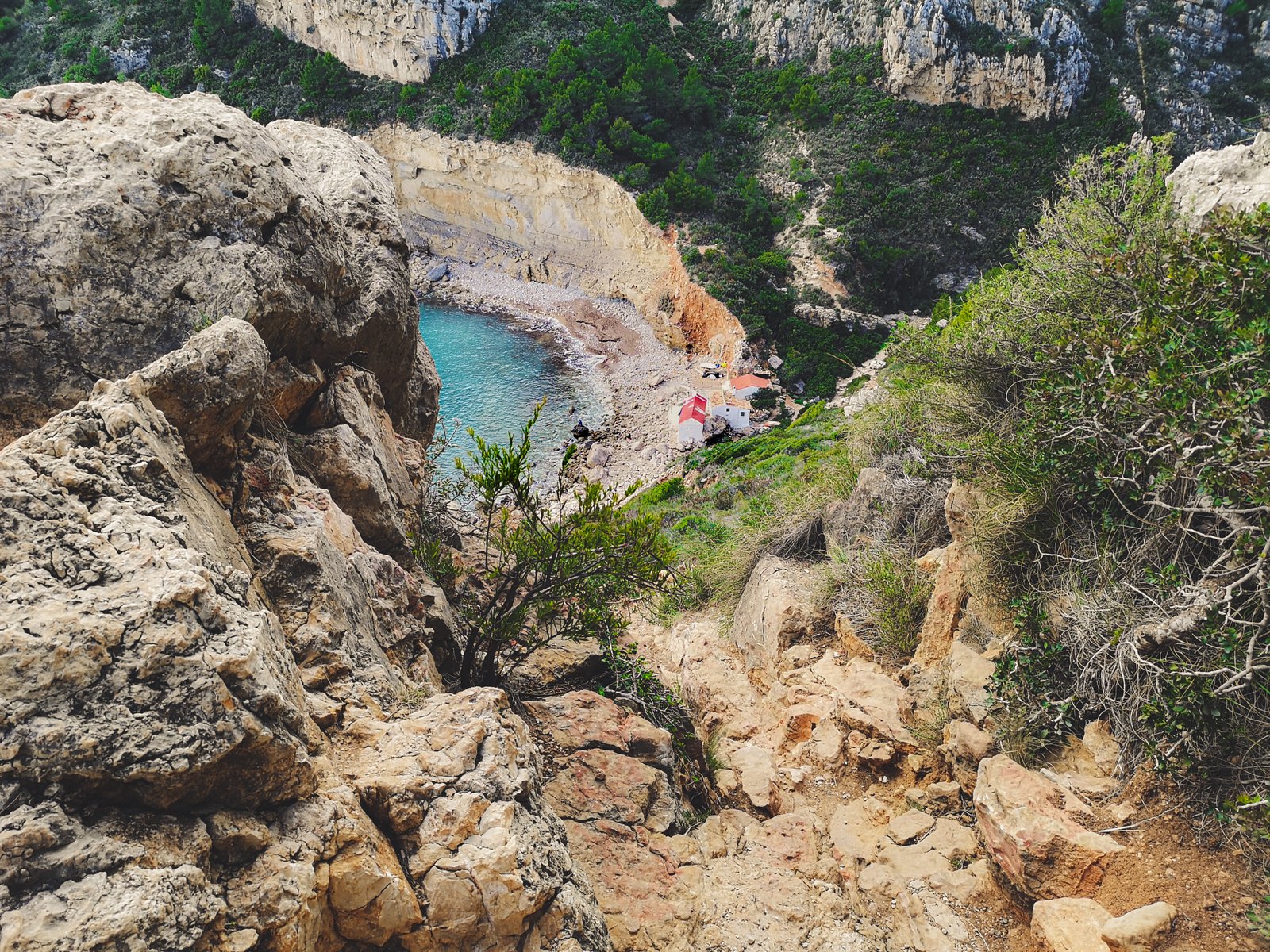
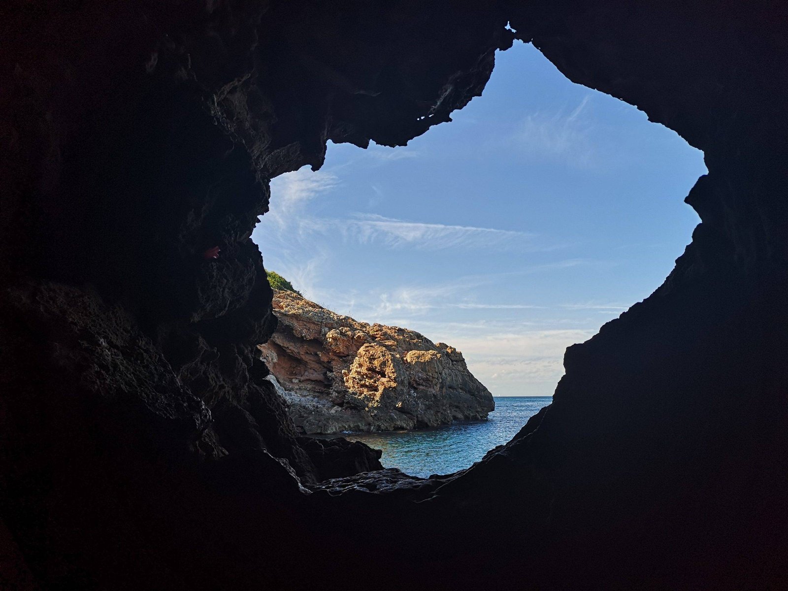
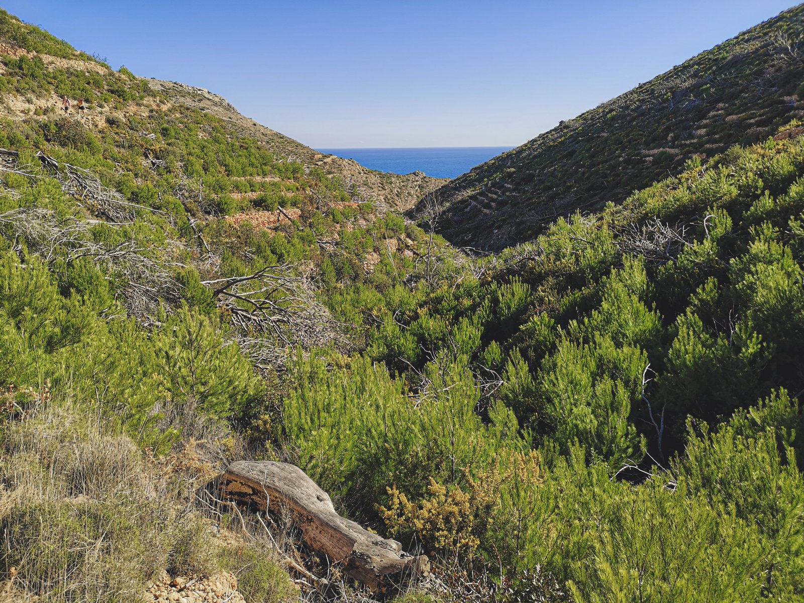
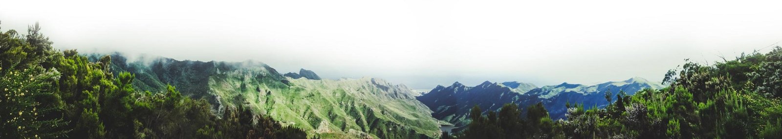
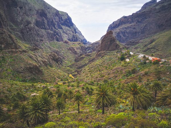
    Besides Mount Teide itself, probably the most popular natural attraction on Tenerife island is Masca village, and the so-called Masca hike. The route goes down from the village through Masca Gorge to Playa de Masca at sea level. As of 2019, it was closed down for safety upgrades because some genius decided to do the hike with slippers – don’t be that person, it is not the same as going to the closest supermarket to buy another six-pack.

    Despite the hike being open or closed, Masca Village is highly recommended for any visitor to Tenerife Island. The Teno Massif surrounding the settlement is absolutely mesmerizing. In fact, the whole Teno region used to be a separate small island, which later joined forces with other islets to form what is now called Tenerife Island.

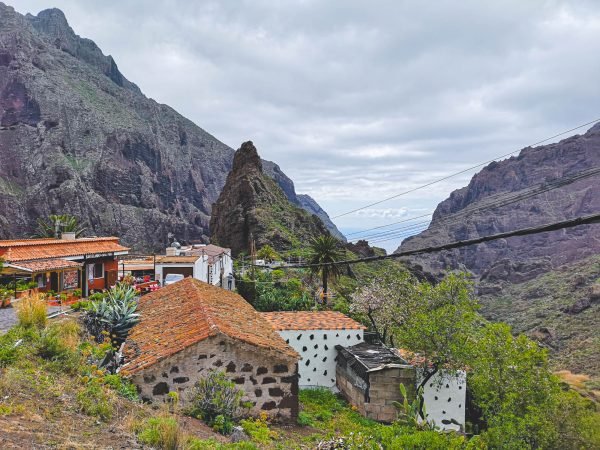
    Sadly, I never had a chance to do the track but by now I hope it is open again for visitors. From what I read and from what I saw, the Masca hike is usually a one-way walk to the beach from where a water taxi will take you back to Los Gigantes but the times might have changed. What definitely has changed is that Masca village is no longer reachable by car. You’ll need to take a bus from the nearest town. Alternatively, you can do a longer and more spectacular guided hike to the ocean from Santiago del Teide. Apparently, you’ll also need a permit to access Masca Gorge Trail, but guided tours will handle this for you.


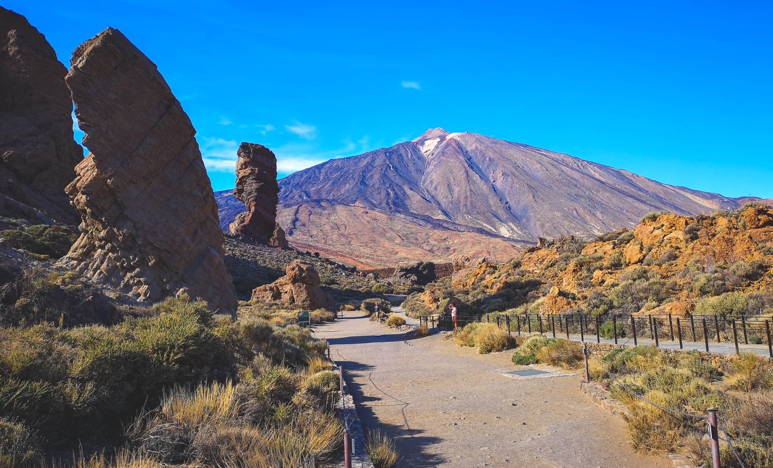
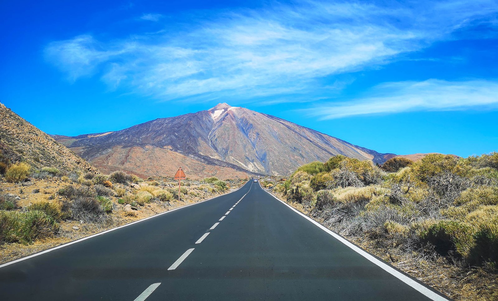
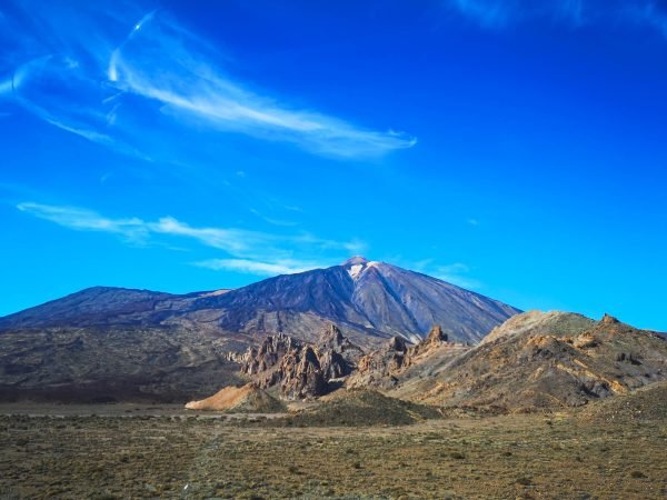
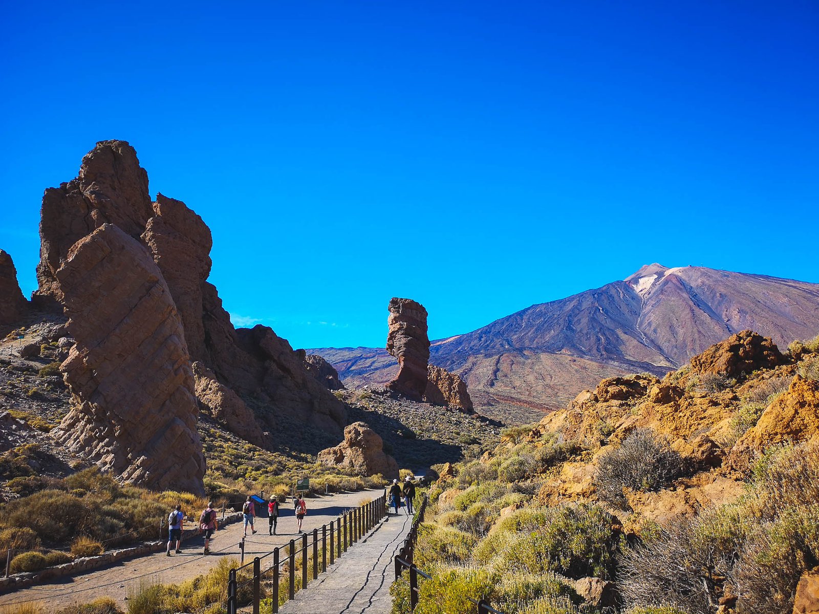
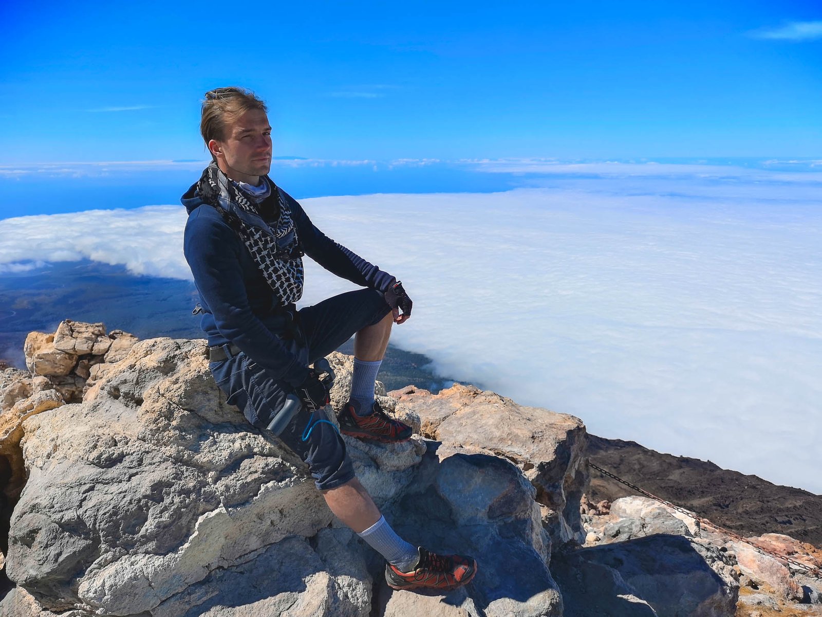
    Day 4 – Get on the Top of Tenerife Island – Teide Volcano

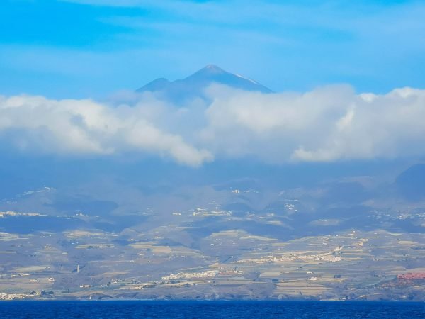
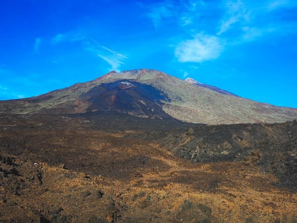
    While the main reason to go to the Canary Islands is its stable climate, the main reason to pick Tenerife Island for your holidays in the Canary Islands is Mount Teide. Yes, it is the biggest island of all the archipelago and it is amazing – infrastructure and beaches are as good as it gets. Nevertheless, there is nothing similar to Mount Teide on the other islands of the Canaries, and as a matter of fact – the whole of Spain. Mount Teide is the highest mountain in the whole country and did I mention that it is an active volcano too? At the narrowest point up in the north, the sea level and the top of Mount Teide are separated only by 13km / 8 mi. That alone makes the landscape of the island truly awe-inspiring. The one you cannot mistake with anything else.

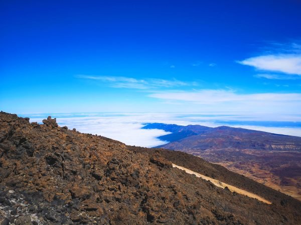
    What is even better – is the various possibilities to reach the peak of Mount Teide. Most of us will reach it by the cable car running from the base station (2,356m / 7,730ft) to La Rambleta (3,555m / 11,663ft). The very peak of Mount Teide (3,718 / 12,198ft) could be only reached by foot with a special permit that you can get here from the park authorities. In the recent years, with the growth of visitors and the necessity of eco-tourism as a result, guided group tours to Teide Volcano have become very popular – no more worries about parking slots or any other organizational stuff.

    If anybody wants to see more of Teide National Park, they can climb the whole mountain on foot. The hike could start almost from anywhere, including the full challenge of climbing Mount Teide from the sea level. More adventurous people might also want to try the Teide Volcano sunrise hike or sunset tour.


    Day 5 – Visit the North of Tenerife Island

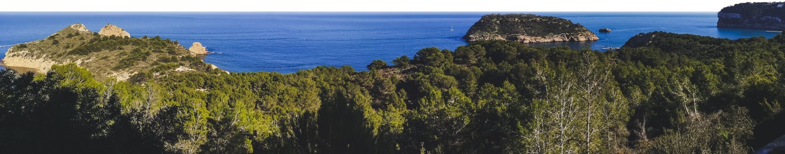
    Many ask which side of Tenerife they should go. North or South? There is no such thing as the right answer to this question. Both faces of Tenerife Island are totally different. It is like Two-Face from the Batman series. While the south is sun-drenched, has more spaces and golden beaches, the north is totally different. This part of Tenerife is where the island’s volcanic heritage and lush landscapes come to life, offering a blend of nature, history, and culture.

    Garachico in Tenerife, Canary Islands, Spain
    Garachico is listed among top most beautiful villages in Spain. Photo by Alis Monte [CC BY-SA 4.0], via Connecting the Dots

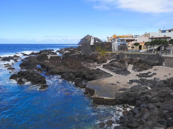
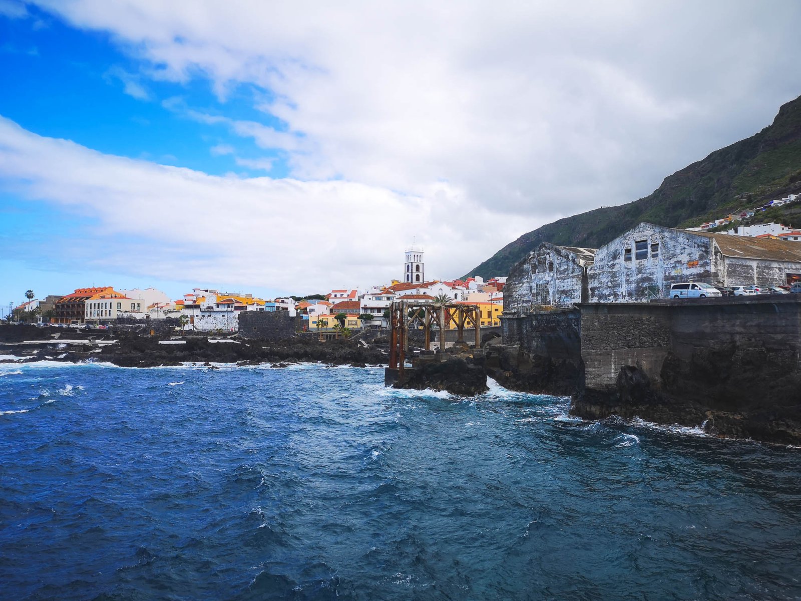
    Los Gigantes is located on the edge of both sides. Today we go further to the North than we ever did before. The whole route will slowly bring you to a totally different world. First stop – Garachico – an old port founded in 1496 by a Genoese banker after Tenerife was conquered by the Crown of Castille. Its importance diminished in 1706 when a volcanic eruption destroyed part of the town. Today, Garachico is an interesting tourist destination offering informational historical walks around the city surrounded by 500m+ / 1500ft cliffs.

    After visiting Garachico, drive along the coast towards Puerto de la Cruz, where you no longer have to worry about the road quality. The areas beyond the Teno region, offer smooth travel, allowing you to immerse yourself fully in the experience with everything on the table.

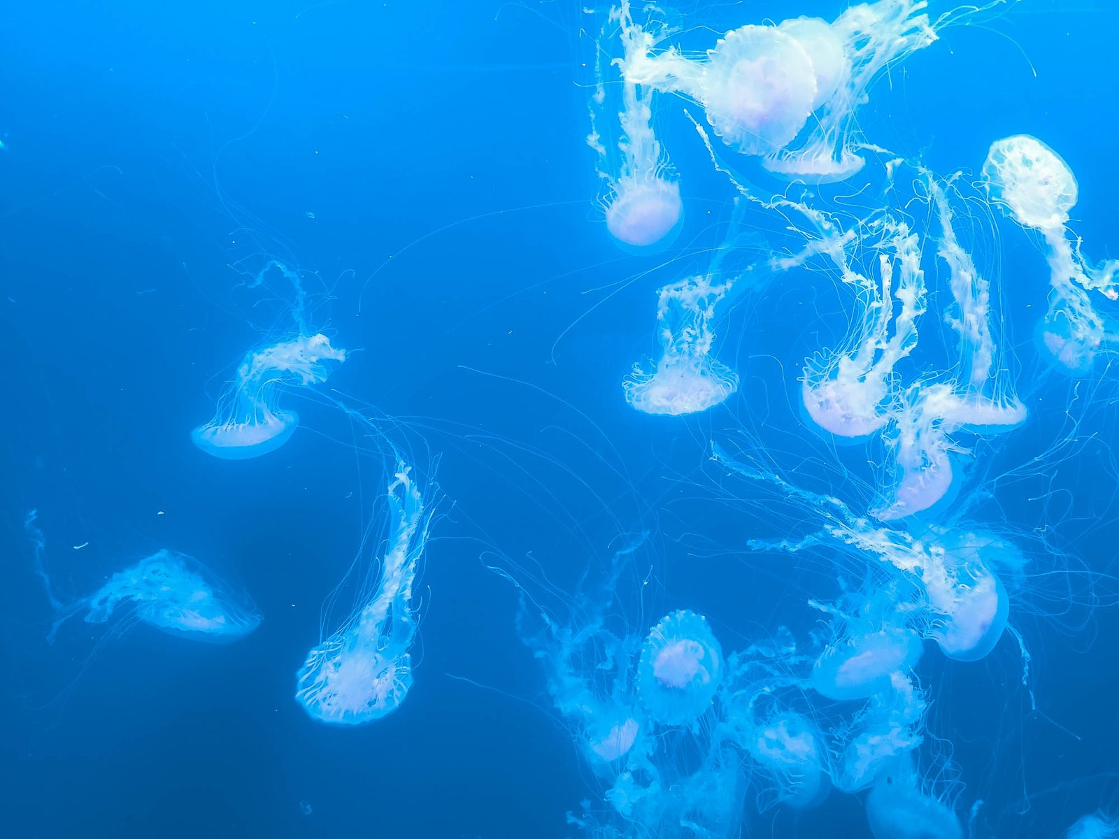
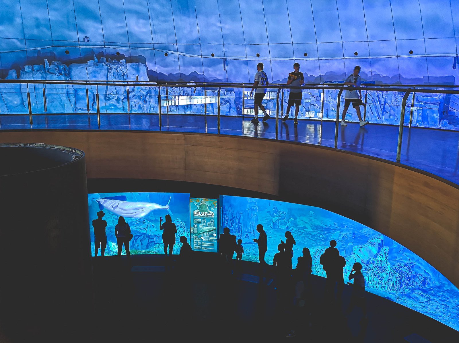
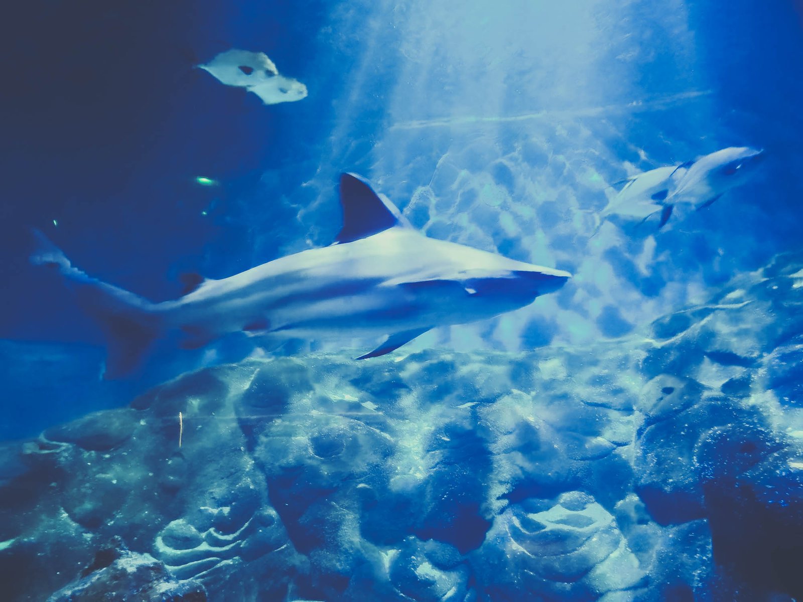
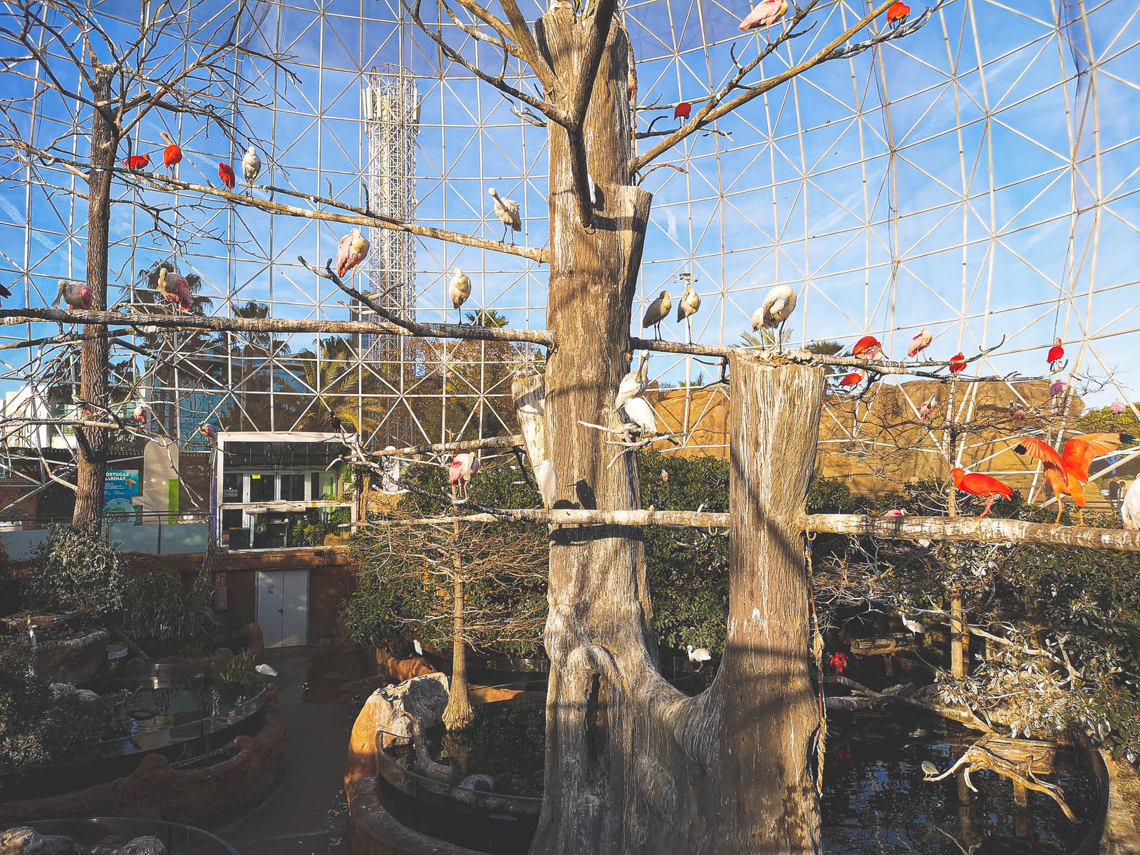
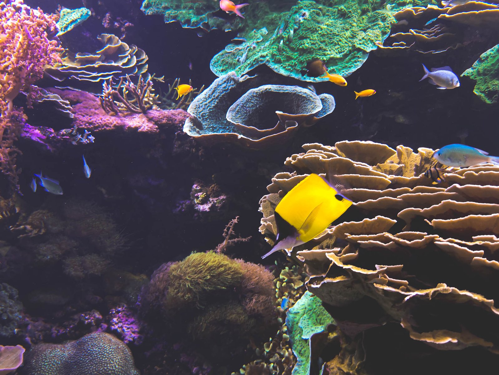
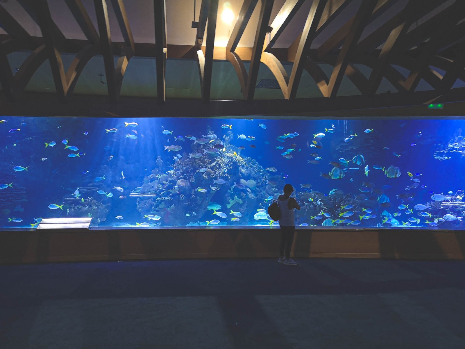
    The rest of the day should be spent based on your preference. It is the time to visit Loro Park or walk around Puerto de la Cruz. Our choice was to have a picnic in Playa de los Roques, or you can visit La Orotova instead. Just don’t press too far – tomorrow is the time for La Laguna and Anaga Rural Park.

    Playa de los Roques near Puerto de Santago, Tenerife
    The northern side is not as spacious as the southern one. Eveything feels like it was molded by Teide itself. Photo by Alis Monte [CC BY-SA 4.0], via Connecting the Dots

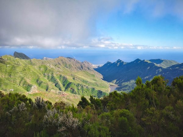
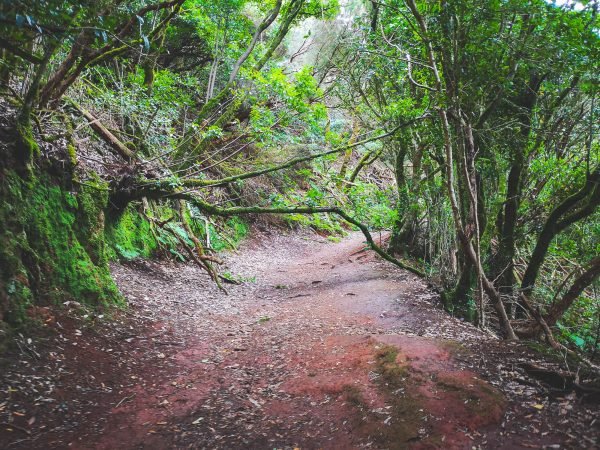
    Day 6 – Enter the Hikers’ Paradise – Anaga Rural Park

    Most of us associate Tenerife and the whole Canary Islands with volcanic formations. Anaga Forest is a totally different landscape. It is a true jungle from the movies: lush green with the sunlight blocked by the trees – alive & dangerous – nothing in common with desolate volcanic rocks. Well, at least, from the first sight.

    The whole Anaga Forest is growing in a mountainous area formed between 7-9mya, after a volcanic eruption. Ever since life transformed this landscape to something more exotic than you’d expect from Tenerife. That is so for a reason – Anaga Rural Park has more endemic species than any other area in the whole of Europe. For that reason, it was recognized as a UNESCO World Heritage Biosphere Reserve in 2015. Actually, a pity it happened so recently.

    These unique natural features attract many outdoor enthusiasts but the Anaga Forest does something way more important. The forest controls the humidity and fertility of the island. Back in the days, when wood was the most important building material, people started deforesting the area. It was noted that the microclimate of Tenerife has changed. Ever since the forest preservation took place. Unfortunately, not so many places in Spain remain with an authentic forest.

    Tip: No matter where you plan to stay for the first days, you should consider relocating to Santa Cruz de Tenerife on this day as you’ll spend the rest of your time in the western part of the island.

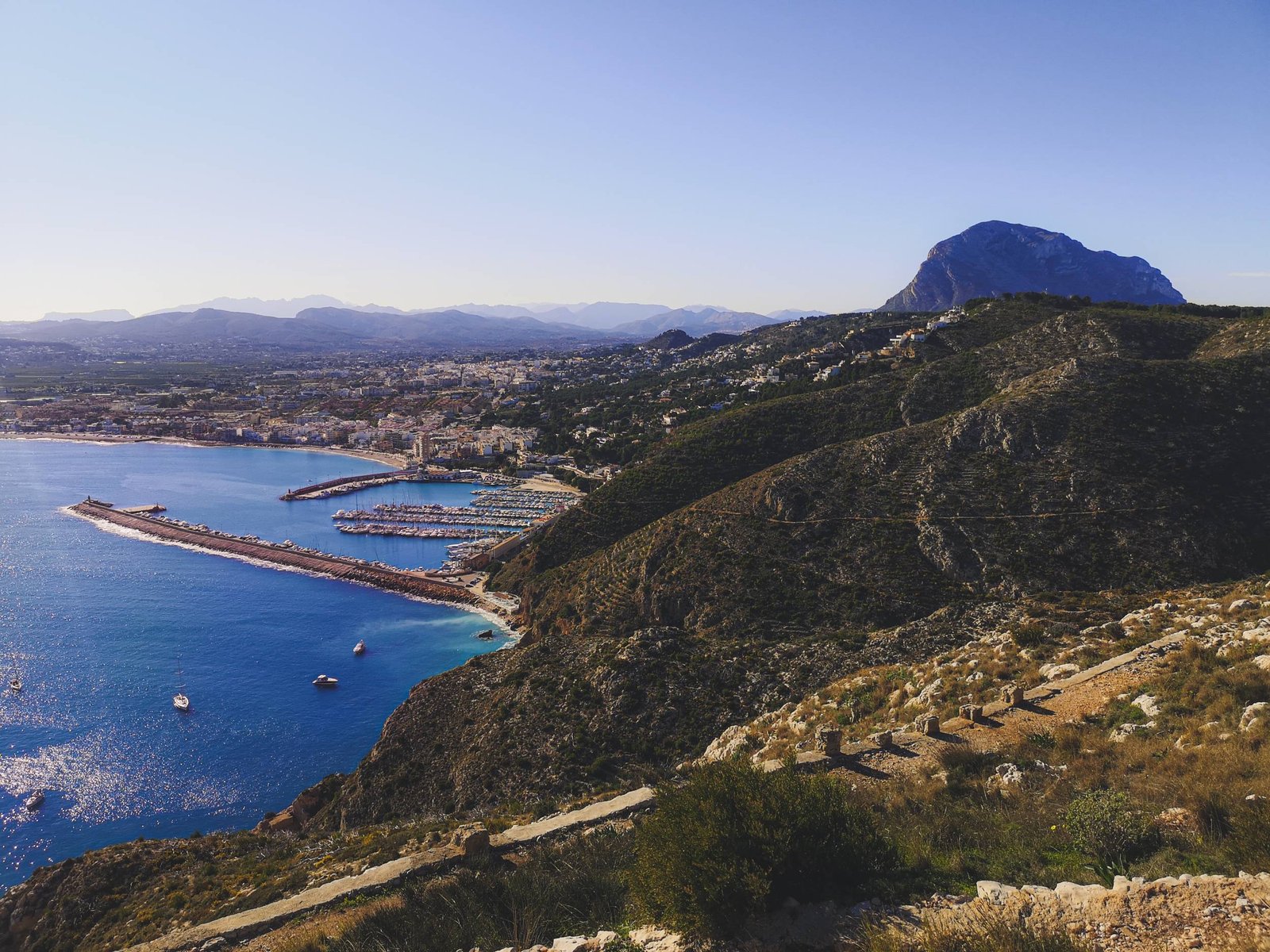
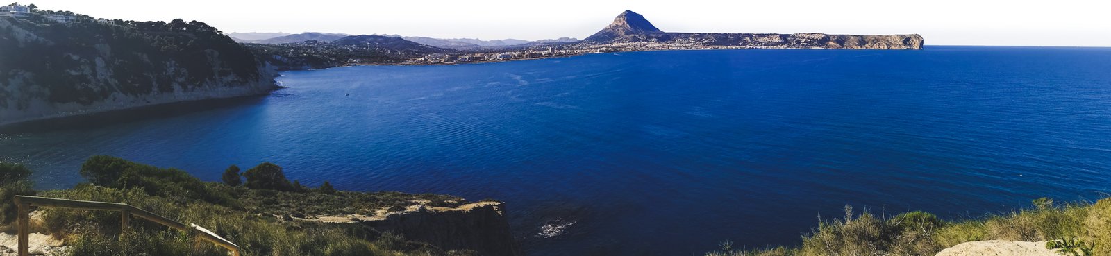
    Day 7 – Party at the Capital of Tenerife Island – Santa Cruz

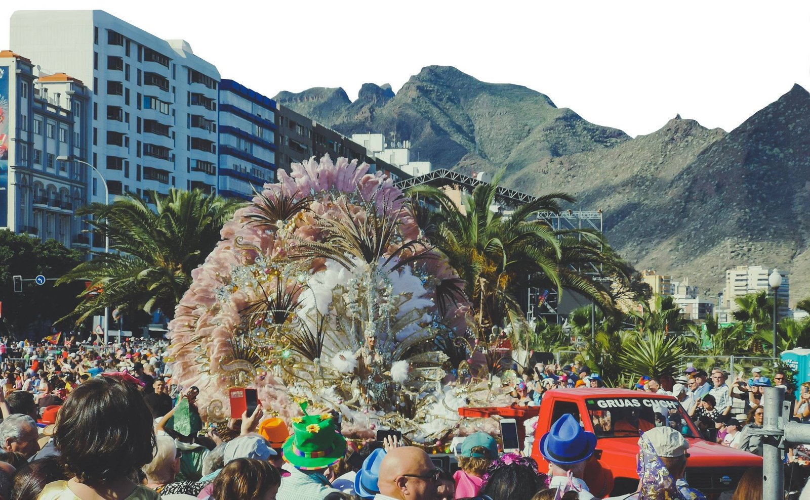
    After all the breathtaking variety of nature, Tenerife Island has, it is finally the time to see some of the local culture. I can hardly think of a better place to do so than the Capital of the island – Santa Cruz de Tenerife.

    Even though Las Palmas de Gran Canaria is the most populated city in the whole archipelago, don’t underestimate Santa Cruz. After all, it does share the Capital status of the Canary Islands with Las Palmas and has that feeling of a major city. There is plenty of cultural stuff to do during the day, and more than enough things to do at night. It is especially true during the Carnival at the end of February or at the beginning of March. It is not a well-known fact that Santa Cruz de Tenerife hosts the second biggest Carnival in the whole world, bowing down only to the famous Rio de Janeiro.

    The dates of the event vary from year to year but you can read more about it in my different article about the schedule of Carnival de Santa Cruz de Tenerife 2024. This is surely one hell of an event not to miss if you are around. The whole Santa Cruz de Tenerife turns into a party day after day.

    The big parade in Santa Cruz de Tenerife Carnival
    The Carnival of Santa Cruz de Tenerife is the second biggest in the whole world. Photo by Alis Monte [CC BY-SA 4.0], via Connecting the Dots

    Where to Stay in Tenerife?

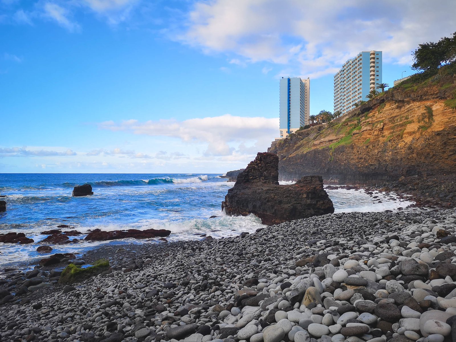
    Most of the visitors to Tenerife holidays head to resort towns located around Playa de las Americas like Costa Adeje and Los Cristianos. Unless you are visiting Tenerife for beach holidays only, I would recommend getting a bit further from the crowds instead.

    From what I saw, the popular destinations feel like they were built for people seeking package holiday getaways. It was done in the most uninteresting part of Tenerife Island. All the cool stuff is somewhere else.

    If you want to get intimate with the natural beauty of the island, Los Gigantes or La Laguna are the better choices. If you don’t like calm places, Santa Cruz de Tenerife or Puerto de la Cruz are the places to go.

    Los Gigantes in Tenerife, Canary Islands
    Los Gigantes provides the most dramatic everyday views from all the resort areas in Tenerife. Photo by Alis Monte [CC BY-SA 4.0], via Connecting the Dots

    Personal Experience

    There were things I expected with high expectations and they didn’t disappoint me. The Crown Jewel of Tenerife – Mount Teide exceeded even my most optimistic hopes. At the time of my visit, the whole Teide National Park was beyond my imagination. I never expected to see a new type of landscape ever again, and here it was a somewhat barren, yet rich, in both case alien and bizarre surroundings of the tallest point in all territories of Spain.

    Despite its uniqueness and beauty, it was not only Mount Teide that made the whole journey across the island so exceptional. Not a single day left me disappointed. Every day it felt like a different adventure on a different island. It is not your one trick pony like paradise beach island Mahe in Seychelles, or Mauritius snorkeling heaven. Tenerife has many faces and excels to perfection in some of them. If you follow this itinerary, I’m sure you’ll experience the same. The largest islands in the Canaries have more than enough to offer to anybody.

    Man sitting on the top of Mount Teide, 3,718m
    The Cable Car will take you almost to the top of Mount Teide, but to reach the very peak you’ll need a permit. Photo by Alis Monte [CC BY-SA 4.0], via Connecting the Dots

    Sources:

    ¹ https://www.metoffice.gov.uk/weather/travel-and-events/holiday-weather/europe/canary-islands/tenerife
    ² Young S. N. (2007). How to increase serotonin in the human brain without drugs. Journal of psychiatry & neuroscience : JPN, 32(6), 394–399.

  • Discover the Oceanographic of Valencia – Largest Aquarium in Europe

    Discover the Oceanographic of Valencia – Largest Aquarium in Europe

    About the Oceanographic

    Enter a world of aquatic splendour at the Oceanographic in Valencia, a crowning gem among the city’s cultural treasures. With an impressive array of marine species, groundbreaking exhibits, and awe-inspiring architecture, this marvelous establishment is a beacon for nature lovers, families, and tourists alike. Its significance extends beyond being a mere tourist attraction, doubling as a hub for marine research and conservation.The themed exhibits varies between different habitat pavilions among whom you can find famous Beluga Whales, the Dolphinarium & a huge shark aquarium!

    Having so many things to see in such a short time, it is very helpful to come to the park prepared. This guide to the Oceanographic will be your compass, helping you to take the most out of your visit to the aquarium and navigate the thrilling experiences that await you. It will provide all the information you need – from the museum’s history to its conservation efforts, special features, and practical tips for visitors.

    So, whether you are planning your next family holiday, looking for an educational experience, or simply seeking the next great ‘Thing to do in Valencia’, a visit to the Oceanographic is a must. The magic of the aquatic world awaits!

    Dolphins playing in the Oceanographic in Valencia, Spain
    If you don’t like dolphin shows, visit delphinarium during the rest hours. You’ll see what these majestic animals love to do on their free time. Photo by Alis Monte [CC BY-SA 4.0], via Connecting the Dots

    History of Oceanographic Valencia

    Opened to the public in 2003, the Oceanographic quickly rose to prominence as a key highlight of the City of Arts and Sciences. This grand project was conceived by renowned architect Santiago Calatrava, whose visionary design effortlessly marries science, nature, and art. A unique fact about this architectural marvel is that it is designed to represent various aquatic ecosystems, further cementing the authenticity of the Oceanographic museum experience.

    What is the Oceanographic in Valencia?

    Stepping into the Oceanographic is akin to diving into an alternate universe, one that teems with vibrant marine life and astonishing exhibits. Its mission is twofold: to foster a sense of wonderment and curiosity about our oceans and to propagate awareness and knowledge about marine conservation. Spanning across an expansive area of 110,000 m² / 1,184,030 ft², the Oceanographic is a spectacle to behold.

    Often referred to as the Valencia Aquarium, the Oceanographic holds the prestigious title of being Europe’s largest aquarium. This colossal aquatic hub has redefined the conventional notions of a museum, providing a sanctuary to over 45,000 marine creatures across 500 different species. A true testament to diversity and magnificence of life under the sea.

    The entrance to the Oceanographic in Valencia, Spain
    The Oceanographic in Valencia gets really busy during peak seasons. Skip-the-line tickets are recommended. Photo by Alis Monte [CC BY-SA 4.0], via Connecting the Dots

    The Oceanografic Details

    • Highlights: The largest aquarium in Europe featuring various marine habitats, a dolphinarium, an underwater restaurant, and beluga whales.
    • Location: Ciutat de les Arts i les Ciències
    • Coordinates: 39°27′20″N 0°21′00″W
    • Address: Carrer d’Eduardo Primo Yúfera, 1B, 46013 València, Spain
    • Built: 2002
    • Entrance fee: Adults – €36.00, children (4-12 years), disabled & seniors (65+) – €26.50, children under 4 – Free.
    • Opening hours: 10:00AM – 6:00PM (Hours may vary depending on the season)
    • Weather: Valencia weather
    • Good accommodation: Ciutat Vella, Eixample & El Pla del Real
    • Tickets: Skip-the-line Tickets to Oceanografic

    Tickets & Discounts to the Oceanographic

    For a more cost-effective visit, you can consider purchasing combined tickets or packages that include other attractions within the City of Arts and Sciences. There are special discounts for groups, children, seniors, and students. The Valencia Tourist Card also offers attractive discounts and a free public transport.

    Pro tip: Remember, the Oceanographic in Valencia is a popular attraction, so it’s advised to book your tickets in advance, especially during peak season and holidays.

    What Can You See at the Oceanographic?

    The Oceanographic is home to a vast array of marine species from different parts of the world’s oceans, all meticulously housed in environments that mimic their natural habitats. The Oceanographic exhibits provide a close-up view of the ocean’s magnificent inhabitants, right from tiny, darting fish to lumbering walruses, all the while amplifying the importance of preserving the natural world.

    When you’re planning your ‘Visit Valencia’ itinerary, you will be enthralled to learn that the Oceanographic boasts nine underwater towers spread over two levels, each representing some of the most significant ecosystems on our planet. This is where marine life Valencia comes alive, offering unparalleled experiences such as walking through a glass tunnel as sharks swim overhead or watching vibrant corals and tropical fish in their colorful reef settings. It’s like stepping into a vibrant National Geographic spread!

    Remember to carry your camera as the Oceanographic provides innumerable photogenic spots, contributing to an unforgettable visual diary of your visit to Valencia. Also, you can find exclusive and high-quality images and videos of these exhibits on our website to enhance your understanding and expectations.

    List of Themed Exhibits

    From the frigid Arctic waters to the warm Mediterranean seas, the Oceanographic themed exhibits immerse you in a diverse range of habitats in 11 different pavilions. Now, isn’t that an exciting ‘thing to do in Valencia’?

    Thank you for visiting Connecting the Dots Journal’s official website!

    You got lucky! We have no ad to show for you. If you still want to support my work in a different way, please, subscribe to newsletter or become a Patron

    Click on the Ad to support my work.

    Thank you for visiting Connecting the Dots Journal’s official website!

    You got lucky! We have no ad to show for you. If you still want to support my work in a different way, please, subscribe to newsletter or become a Patron

    Click on the Ad to support my work.

    Thank you for visiting Connecting the Dots Journal’s official website!

    You got lucky! We have no ad to show for you. If you still want to support my work in a different way, please, subscribe to newsletter or become a Patron

    Click on the Ad to support my work.

    Antarctic

    This pavilion represents the Southern Ocean surrounding the Antarctic continent. It is notable for its vast biomass, despite its relatively low biodiversity. Light lasts for extended periods in this region, leading to plankton explosions that serve as the basis of life for many other species​.


    Beluga whale in the Arctic exhibit of Oceanographic of Valencia, Spain
    Beluga whales are the highlight of the Oceanographic. Photo by Alis Monte [CC BY-SA 4.0], via Connecting the Dots

    Arctic

    Welcome to a giant igloo, twelve meters tall, representing the habitat of Beluga Whales family. The upper level offers a view of immense ice blocks, the perfect habitat for beluga whales. Meanwhile, the lower level provides an underwater perspective, where visitors can immerse themselves in the frozen water​.


    Crocodile Preserve

    This 450m² habitat, located in the living lake of the aquarium, features a large outdoor space notable for an area prepared to facilitate the nesting of reptiles. It includes 2×1 meter pits with a drainage system to protect eggs in case of rain before being transferred to the incubator of the aquarium to finish their development​.


    Bottlenose Dolphin in the Oceanographic in Valencia, Spain
    Bottlenose Dolphin in the largest Dolphinarium in Europe. Photo by Alis Monte [CC BY-SA 4.0], via Connecting the Dots

    Dolphinarium

    The Oceanogràfic boasts the largest dolphinarium in Europe, home to a group of Bottlenose Dolphins. With a grandstand capacity of over 1,500 people, the dolphinarium has a main pool for the study and observation of the dolphins and four auxiliary pools for training, reproduction, and medical care. Visitors can enjoy a bio-educational exhibition several times each day, demonstrating the abilities of these animals and explaining the most important aspects of their biology, behavior, and conservation​.


    Wetlands / Aviary

    Housed in a large, 26-meter-tall sphere, this pavilion represents two of the most characteristic coastal wetlands of the planet: the American mangrove and the Mediterranean marshland. Wetlands are among the richest, most productive ecosystems on the planet, home to hundreds of endemic and endangered species​.


    Black Clownfish in Oceanographic in Valencia, Spain
    The Aquarium of Clownfishes is probably the most attractive in Tropical Seas habitat pavillion. Photo by Alis Monte [CC BY-SA 4.0], via Connecting the Dots

    Temperate & Tropical

    This pavilion represents the majority of the oceans, extending from the equator to latitudes close to the polar circles. Tropical seas have an average surface water temperature of 25 degrees Celsius, allowing for great biodiversity. Temperate seas have thermal oscillations, reaching a minimal 12 degrees Celsius, and are characterized by very high productivity due to annual plankton outbreaks​.


    Islands

    This outdoor installation replicates the habitat of the southern coast of South America, allowing visitors to observe the behavior of South American sea lions. This area will soon also contain Oceanic Island habitats​.

    Thank you for visiting Connecting the Dots Journal’s official website!

    You got lucky! We have no ad to show for you. If you still want to support my work in a different way, please, subscribe to newsletter or become a Patron

    Click on the Ad to support my work.

    Thank you for visiting Connecting the Dots Journal’s official website!

    You got lucky! We have no ad to show for you. If you still want to support my work in a different way, please, subscribe to newsletter or become a Patron

    Click on the Ad to support my work.

    Thank you for visiting Connecting the Dots Journal’s official website!

    You got lucky! We have no ad to show for you. If you still want to support my work in a different way, please, subscribe to newsletter or become a Patron

    Click on the Ad to support my work.

    Cattle Egret in the Oceanographic lakes habitat pavilion, Valencia, Spain
    Among the local bird species, Cattle Egret is the most often visitor. Photo by Alis Monte [CC BY-SA 4.0], via Connecting the Dots

    Lakes

    The Living Lake of the aquarium is home to a variety of aquatic birds such as Red-crested Pochard, Common Shelduck, and the Whooper Swan. The installations are also used by some species of birds that visit throughout the year, coming mainly from the Albufera Natural Park and the former bed of the Turia River​​.


    Oceans

    The Oceans Pavilion is the largest aquarium in the Oceanographic, representing the vast oceans that cover our planet. This pavilion typically houses a multitude of marine species, showcasing the incredible biodiversity found in the world’s oceans. Visitors can expect a journey through different ocean habitats, discovering various marine creatures along the way.

    A sea turtle in the Oceanographic in Valencia, Spain
    The Oceanographic houses Loggerhead Sea Turtle, Green Sea Turtle, Hawksbill Sea Turtle, Kemp’s Ridley Sea Turtle & Leatherback Sea Turtle species. Photo by Alis Monte [CC BY-SA 4.0], via Connecting the Dots

    Red Sea

    This pavilion recreates the unique marine environment of the Red Sea, renowned for its vibrant coral reefs and diverse marine life. Visitors can explore a variety of colorful tropical fish, including the beautiful angelfish, while gaining insights into the importance of marine conservation.


    Mediterranean

    This pavilion represents a stretch of the Mediterranean Sea, a temperate sea that’s not very deep, relatively small, and practically closed in by continents. As depth increases, visitors will see different ecosystems, starting from the coastal areas of the Posidonia aquarium to port areas, ending in the deepest Mediterranean zones. It houses the biggest gorgonions in the Mediterranean, the fluorescent jewel anemone, and the threatened red coral​.

    Common Octopus in Mediterranean Habitat Pavvilion in Oceanographic in Valencia, Spain
    Common Octopus is a very common inhabitant of the Mediterranean Sea. Photo by Alis Monte [CC BY-SA 4.0], via Connecting the Dots

    Events & Educational Programs

    At the Oceanographic, your journey of exploration and learning extends beyond observing the marine life on display. The Oceanographic takes pride in its diverse range of events and educational programs designed to engage visitors of all ages, making it an ideal destination not just for family outings, but for school trips too.

    One such educational offering is the ‘Sleeping with Sharks’ program, a unique overnight experience that allows children and adults to learn about sharks, their behaviors, and the threats they face. Imagine falling asleep watching these majestic creatures glide above you! You may also be interested in the ‘Behind the Scenes’ tour, which provides insights into the daily operations of Europe’s largest aquarium. These are truly some of the most exciting ‘things to do in Valencia’.

    Unique Features of the Oceanographic

    The Oceanographic in Valencia, besides being Europe’s largest aquarium, stands out for its unique and innovative features that attract tourists worldwide. Here, every element is designed to make your visit an unforgettable experience.

    Thank you for visiting Connecting the Dots Journal’s official website!

    You got lucky! We have no ad to show for you. If you still want to support my work in a different way, please, subscribe to newsletter or become a Patron

    Click on the Ad to support my work.

    Thank you for visiting Connecting the Dots Journal’s official website!

    You got lucky! We have no ad to show for you. If you still want to support my work in a different way, please, subscribe to newsletter or become a Patron

    Click on the Ad to support my work.

    Thank you for visiting Connecting the Dots Journal’s official website!

    You got lucky! We have no ad to show for you. If you still want to support my work in a different way, please, subscribe to newsletter or become a Patron

    Click on the Ad to support my work.

    Submarine Dining Experience

    One of the standout features of the Oceanographic is its underwater restaurant. As part of this unique dining experience, guests are surrounded by an expansive aquarium filled with various marine species. As you enjoy your meal, you can witness marine life gracefully swimming around you. Dining at this underwater restaurant makes for a story worth sharing back home!

    Architectural Brilliance

    The architectural design of the Oceanographic, conceived by renowned architect Santiago Calatrava, is a sight to behold. The aesthetically pleasing and technologically advanced structure enhances your experience, making it more than just a visit to an aquarium.

    Spellbinding Dolphin Show

    The dolphin show in Valencia is another highlight that you wouldn’t want to miss. This mesmerizing spectacle showcases the intelligence and agility of these wonderful creatures, leaving visitors of all ages in absolute awe.

    The dolphinarium in teh Oceanographic in Valencia, Spain
    The controversial dolphinarium is important for scientific research of dolphins. Photo by Alis Monte [CC BY-SA 4.0], via Connecting the Dots

    Conservation Programs of the Oceanographic

    At the heart of the Oceanographic lies a deep commitment to marine conservation. While the aquarium is a spectacle for visitors, it also plays a pivotal role in protecting and preserving the local marine species, making it more than just a destination for entertainment.

    Through its various conservation programs, Oceanographic has been actively involved in the rescue, rehabilitation, and release of marine animals, like endangered sea turtles of the Mediterranean. It has also initiated programs focusing on the breeding of threatened species, thereby contributing to the preservation of marine biodiversity.

    The Oceanographic’s commitment to conservation extends beyond its premises. The aquarium actively collaborates with global institutions on research projects aimed at marine conservation. It is also involved in numerous conservation initiatives, such as beach clean-ups and campaigns to reduce plastic waste in the oceans.

    Why Conservation Matters

    Marine conservation is vital for maintaining the health of our planet. Oceans produce a significant portion of the world’s oxygen, absorb carbon dioxide, and serve as habitats for a diverse array of species. By supporting institutions like the Oceanographic, you’re playing a part in the larger mission of preserving our blue planet. The Oceanographic isn’t just about witnessing the beauty of marine life and exploiting the animals; it’s about understanding our role in preserving that beauty for future generations.

    Gallery of Animals

    Personal Experience

    In conclusion, I think that the Oceanographic in Valencia isn’t just another stop on your sightseeing tour – it’s a gateway into an underwater world that will leave you awestruck and enlightened. It definitely affected me and still does, as I keep getting back to embrace the beautiful lifeforms found in the aquarium and learn about the new initiatives to protect the local species in the area. The aquarium offers a unique blend of entertainment, education, and engagement with its wide variety of exhibits. I also appreciated the park’s active involvement in marine conservation, which seems only to be improving with time. The stunning architecture of the buildings only adds to the whole package of awesome things you get after signing up for a visit to the Oceanographic.

    Let the underwater world enchant you with its beauty, its diversity, and its silent plea for preservation. Visit the Oceanographic, immerse yourself in the wonder of marine life, and carry back memories that will last a lifetime. Whether you’re a family seeking a fun and educational outing, a couple looking for a unique date experience, or a solo traveler eager to explore the best of Valencia, the Oceanographic beckons. So, why wait? Plan your visit to the Oceanographic today and prepare to be captivated by the marvels of the marine world.


    Catamaran Cruise with Sunset Option

    Enjoy a relaxing catamaran cruise, day or sunset, with a glass of cava.

    Book now


    Caves of San José Half-day Boat Tour

    Explore the Caves of San José by boat and foot on a half-day trip.

    Book now


    24 or 48-Hour Hop-on Hop-off Bus

    Discover Valencia at your pace with a 24 or 48-hour hop-on hop-off bus ticket.

    Book now

  • Best Scenic Hikes in Marina Alta Coast

    Best Scenic Hikes in Marina Alta Coast

    About Marina Alta

    Without a doubt, Marina Alta is the most beautiful region of Costa Blanca. It wouldn’t surprise me if it was ranked right there at the top on a hypothetical factual “the most beautiful Mediterranean coastlines of mainland Europe”. There is no such list but what I’m trying to say – Marina Alta is exceptionally beautiful. You might not have heard of it but sure you have heard of Ibiza and Balearic Islands? Marina Alta is the part of Spain between the gulf of Valencia and the gulf of Alicante, which is the closest point to these iconic Spanish islands. I would argue that the cliffs and some of the beaches are just as beautiful as in the islands. One way or another, any of the best hikes in Marina Alta could be a very pleasant surprise.

    Levanders on top of Cap d'Or in Marina Alta, Spain
    Due to the beauty and magic of its landscape, Marina Alta was densely populated by Iberian Culture from about 8th century BC. Photo by Alis Monte [CC BY-SA 4.0], via Connecting the Dots

    Geography & Geology

    The direct translation of Marina Alta from Spanish to English is the “high port”, as an opposition to the nearby Marina Baixa, or the “low docks”, the region surrounding Benidorm. The name of Marina Alta could be easily explained by geography and geology. The region is located on the southernmost edge of mainland Spain, which has raised from the sea millions of years ago, when the Eurasian plate collided with the African one. This massive event led to the genesis of many mountains in Europe, but the closest to the point of origin are the Betic Mountains, with Marina Alta located on one end of it. The other being nothing else but famous Gibraltar and Betic Mountains dominating the scenery of the whole landscape in-between in one way or another.

    As Phoenicians themselves noticed in ancient times, Betic Mountains is more or less the area between the Western Rock (Gibraltar) and the Eastern Rock (Penon de Ifach). Technically, the latter one being a part of Marina Alta but since I wrote about climbing Penon de Ifach so much, this hiking route will escape the list at least for now. Despite that, the famous Cape rock adds to the region of Marina Alta, which is simply could be called a hikers’ paradise.

    Hiking Los Acantilados in Benitachell, Spain
    I’m yet to find a corner of Marina Alta to disappoint me. Photo by A.L. [CC BY-SA 4.0], via Connecting the Dots

    Marina Alta Details

    • Location: Costa Blanca
    • Province: Alicante
    • Coordinates: 38.7787° N, 0.0373°
    • Biggest cities: Denia, Javea & Calp
    • Population: 175,156 (2018)
    • Area: 767.2 km2 (296.21 sq mi)
    • Time zone: Central European Standard Time (GMT+1)
    • Currency: Euro
    • Driving side: left
    • Forecast: Javea forecast
    • Best time to visit: April, June, September & October

    Marina Alta Hiking Map

    Cap Prim, Island of Pertixol and Cap Negre in Marina Alta, Spain
    From left to right: Cap Prim, Island of Portixol and Cap Negre. Photo by Alis Monte [CC BY-SA 4.0], via Connecting the Dots

    Calla del Moraig – Calla del Llebeig (Los Acantilados)

    Los Acantilados hike is probably the most popular outdoor destination in the area for the high and exceptionally beautiful beaches: Cala del Moraig and Cala Llebeig. The first one is a very popular attraction on its own, offering very unique geological formations, and the latter one is a pristine remote fishing beach, straight out from a postcard. They are connected via the Los Acantilados hike, which a semi-easy walk amid very high cliffs. The route offers majestic views all the way. If you can deal with some steps, the heights, and the crowds, this could be easily the hike to pursue in Marina Alta.

    Key features

    • High cliffs
    • Pristine beaches
    • Caves
    • Geological formations
    • Hermit houses
    Cap d'Or from Los Anactilados hiking trail - one of the best hikes in Marina Alta, Spain
    The high cliffs of Benitachell ends at Cap d’Or (eng. Golden Cape). Photo by Alis Monte [CC BY-SA 4.0], via Connecting the Dots

    Hike Details

    • Location: Benitachell Cliffs
    • Starting location: Moraig Cove
    • Target location: Llebeig Beach
    • Distance: ~2 km / 1.24 mi x2
    • Ascend: 100 m / 328 ft
    • Type: Linear
    • Duration: ~0h50 x2
    • Difficulty: Intermediate
    • Color: Yellow
    Falla del Moraig from Los Avantilados in Marina Alta, Spain
    From left to right: Cap de la Nao, La Granadella, Morro Falqui & Falla del Moraig. Photo by Alis Monte [CC BY-SA 4.0], via Connecting the Dots

    Though the official hiking trail of Los Acantilados goes past Cala Llebeig back upwards the mountain, there is no reasonable option to make it a circle route. I did not find it to be a major problem as the views are equally stunning in both directions. The hiking trail goes along the cliffs, somewhere in a midst of it. This gives an illusion of being somewhere remote in nature, though in reality the cliff is heavily urbanized just above your head. Along Los Acantilados you’ll find a few remote hermit houses, used to shelter animals by shepherds almost 100 years ago.

    While the hiking trail between the two beaches is relatively short, it is not possible to quickly cruise through the whole route. Parts of the hike require extra attention due to the narrow passages by the steep cliffs. The final section of the hike gives breath-taking views of Cala Llebeig, but descending to the beach might be not for everybody. Climbing back up will literally going to take your breath away.

    Steps to Calla Llebeig of benitachell in marina Alta, Spain
    The descend to Calla Llebeig might be not for everybody, but the viewpoint itself is worth the hike. Photo by Alis Monte [CC BY-SA 4.0], via Connecting the Dots

    Cova dels Arcs

    Los Acantilados might be the most sought hiking trail in Marina Alta, but it doesn’t define everything this gorgeous corner has to offer. At the edge of Cala dėl Moraig lies a beautiful cave – Cova dels Arcs. It has a few entrances forming a spider-like rock sculpture Cova dels Arcs is a perfect example of what happens when a continental karst system goes underwater. Today, this exceptional geological formation is a symbol of the Valencian coastline and challenges Los Acantilados for the top tourist destination in Benitachell. 

    Cova dels Arcs in Marina Alta, Spain
    You’ll find a short walking trail up to Cova dels Arcs. Photo by Alis Monte [CC BY-SA 4.0], via Connecting the Dots

    Falla del Moraig Walking Trail

    Another interesting geological formation found right next to Cala del Moraig and Cova dels Arcs is Falla del Moraig. You can access it on a short 15-min walking trail (marked pink) right from Cala del Moraig. Many people mistake this hiking route with Los Acantilados, thus be sure to check the hiking map, I provided above.

    Hike Details

    • Location: Benitachell Cliffs
    • Starting location: Moraig Cove
    • Target location: Falla del Moraig
    • Distance: 0.3 km / 0.19 mi x2
    • Ascend: 15 m / 49 ft
    • Type: Linear
    • Duration: ~0h15 x2
    • Difficulty: Easy
    • Color: Pink
    Falla del Moraig in Benitachell of Marina Alta, Spain
    I bet Falla del Moraig animated the imagination of many people. Photo by Alis Monte [CC BY-SA 4.0], via Connecting the Dots

    Though Falla del Moraig resembles a phallus, the word “falla” stands for a fault, because this geological formation is a good example of a normal fault line. This creative term describes a crack within the earth, where the upper block slides down relative to the block below. These kinds of slides are possible causation of earthquakes. The gap between geological blocks formed because waves of the Mediterranean eroded the lower part of the upper block and the rock have collapsed. It is possible to see the continuation of this fault line on the other side of Cala del Moraig. 

    Cala Moraig in Marina Alta, Spain
    Los Acantilados hikign trail begins at the parking of Cala Moraig not the beach itself. Photo by Alis Monte [CC BY-SA 4.0], via Connecting the Dots

    Cala Barraca – Cap Prim Hike

    A hike to an exceptionally beautiful narrow piece of nature pressed to the very edge of high cliffs by countless fancy mansions. Cap Prim (eng. Prim Cape) is a very tip of a larger peninsula of mainland Spain – the closest point to the Balearic islands. That explains both the reason why it attracts so many rich people and the awe-inspiring views of a landscape, which is more similar to a south Asian than a European one. The people are not the only inhabitants of Cap Prim. Many bird species find this narrow piece of land as their home, which is still dwarfed by the colonies living on the Island of Portixol that dominates the scenery throughout most of the time during this wonderful hike.

    Thank you for visiting Connecting the Dots Journal’s official website!

    You got lucky! We have no ad to show for you. If you still want to support my work in a different way, please, subscribe to newsletter or become a Patron

    Click on the Ad to support my work.

    Thank you for visiting Connecting the Dots Journal’s official website!

    You got lucky! We have no ad to show for you. If you still want to support my work in a different way, please, subscribe to newsletter or become a Patron

    Click on the Ad to support my work.

    Thank you for visiting Connecting the Dots Journal’s official website!

    You got lucky! We have no ad to show for you. If you still want to support my work in a different way, please, subscribe to newsletter or become a Patron

    Click on the Ad to support my work.

    Key features

    • High cliffs
    • Islands
    • Pristine beaches
    • Fancy estates
    • Birdwatching
    Portixol island from Cap Prim in Marina Alta, Spain
    The view from Cap Prim looks like Las Vegas of nature. Photo by Alis Monte [CC BY-SA 4.0], via Connecting the Dots

    Hike Details

    • Location: El Portitxol
    • Starting location: Cala Barraca
    • Target location: Cap Prim
    • Distance: 3.67 km / 2.28 mi x2
    • Ascend: Flat (~80 m / 260 ft)
    • Type: Linear
    • Duration: ~1h45 x2
    • Difficulty: Easy
    • Color: Green
    Portixol Island from Cala Barraca in Marina Alta, Spain
    Calla Barraca is located just around the corner of Cap Prim. Photo by Alis Monte [CC BY-SA 4.0], via Connecting the Dots

    The Cap Prim is a real paradise on the edge of the Betic Mountains, whose high cliffs dip into the Mediterranean. The close encounter of mountains and sea sculpted out this majestic landscape throughout the endless years and today – to put it bluntly – it is absolutely stunning. Cap Prim is a true hidden secret as there not much information on the Internet but once you are in the area, something naturally draws you there. As my experience has shown me, this is that kind of hike, which literally sucks you in. A real step-turner, if you pardon the pun. It doesn’t matter, where you’d start the route, you’ll end up in Cap Prim.

    Though accidentally I walked to Cap Prim from Cala Blanca (3.94 km / 2.45 mi), I intended and recommend doing so via the official route. You could either start at Cala Barraca (3.67 km / 2.28 mi) or Creu de Portixol (2.14 km / 1.33 mi). Though have in mind that the latter one has very limited parking options, and getting to Cala Barraca might be not an option for less experienced drivers. If you have time, hiking from Cala Blanca is still a very viable option.

    Caleta de Dins and Cap Prim in Marina Alta, Spain
    If the road leads toward the end of those cliffs, how can you stop? Photo by Alis Monte [CC BY-SA 4.0], via Connecting the Dots

    Torre de Vigia Walking Trail (El Portet Beach – Cap d’Or)

    The climb up to the watchtower of Cap d’Or (eng. d’Or Cape) is an hour-long hike, beginning at El Portet Beach in Moraira, which is an outstanding travel destination on its own. The first part of the hike leads through some fancy estates, facing the Mediterranean but soon the road leads into the protected areas of micro-reserve. From there on, the rich history of this small area unveils itself. Besides the expected watchtower, Cap d’Or houses an ancient Iberian settlement and a prehistoric cave. Thanks to a recent infrastructure investment all these places could be reached on foot. At the end of the day, the climb to the Watchtower of Cap d’Or is a magical experience. Let alone the views of the Mediterranean or El Portet beach, but the cape has a positive aura attached to it.

    Thank you for visiting Connecting the Dots Journal’s official website!

    You got lucky! We have no ad to show for you. If you still want to support my work in a different way, please, subscribe to newsletter or become a Patron

    Click on the Ad to support my work.

    Thank you for visiting Connecting the Dots Journal’s official website!

    You got lucky! We have no ad to show for you. If you still want to support my work in a different way, please, subscribe to newsletter or become a Patron

    Click on the Ad to support my work.

    Thank you for visiting Connecting the Dots Journal’s official website!

    You got lucky! We have no ad to show for you. If you still want to support my work in a different way, please, subscribe to newsletter or become a Patron

    Click on the Ad to support my work.

    Key features

    • High cliffs
    • Neolithic Cave
    • Archeological site
    • Flora
    • Fauna
    Cap d'Or from Moraina in Marina Alta, Spain
    Torre de Vigia Walking Trail starts at the gorgeous El Portet beach. Photo by Alis Monte [CC BY-SA 4.0], via Connecting the Dots

    Hike details

    • Location: Teulada-Moraira
    • Starting Location: El Portet Beach
    • Target Location: Watchtower of Cap d’Or
    • Distance: 1.6 km / 1 mi x2
    • Ascend: 166 m / 545 ft
    • Type: Linear
    • Duration: 60 min x2
    • Difficulty: Easy
    • Color: Green
    Cendra Cave walking trail in Moraira, Spain
    The trail down to Cendra Cave is the most recent gem, constructed in the area. Photo by Alis Monte [CC BY-SA 4.0], via Connecting the Dots

    Cova de les Cendres

    La Cova de les Cendres (eng. Cendra Cave) is considered to be one of the most important archeological sites in the Iberian Peninsula. The cave was inhabited since the prehistoric times some 20,000 years ago to the Neolithic period 8,000 years ago (The final stage of the Stone Age, characterized by domesticated animals and crops).

    The trail down to the Cendra Cave a recent addition as a part of the renewal project of Torre de Vigia walking trail. Making it a good choice for either history fans or off-beaten path adventurers. The trail has a few but very steep steps. It leaves me wondering about the toughness of the prehistoric people – one thing is to descend to or ascend from the cave, but keeping cattle over there?

    Cendra Cave in Cap d'Or of Marina Alta, Spain
    Caves facing the Mediterranean with an evidence of the prehistoric people are found across the coastline of Marina Alta. Photo by Alis Monte [CC BY-SA 4.0], via Connecting the Dots

    Cap d’Or

    The name of d’Or Cap translates into the Golden Cape, which is associated with the Sun Cult of the Iberian Culture. It is the same word from the infamous “matador”, or “atoreador” from bullfighting, which possibly derived from some ancient Iberian ritual of sacrificing a bull to the Golden Sun.

    At the foot of the 16th watchtower of Cap d’Or, lies the ruins of ancient Iberian town. It is not the first such archeological site in the Province of Alicante that gives this energized feeling. Like many ancient cultures, Iberians chose magic places for their settlements or sacred places, based on the movements of the Sun or constellations. Given the rich scenery visible from the top of Cap d’Or: Penon de Ifach, Sierra de Bernia, Sierra de Gelada, and even Puig Campana, I imagine the whole calendar could be laid-out on the horizon.

    El Portet beach in Moraira from Cap d'Or of Marina Alta, Spain
    From left to right: Penon de Ifach, Sierra Gelada, Sierra Bernia & Puig Campana. Photo by Alis Monte [CC BY-SA 4.0], via Connecting the Dots

    Hiking Granadella

    Luckily for us, the Granadella Forest Park area for some reason was left uninhabited, making it one of only two such areas by the coast of Marina Alta. (The other one is, of course, the natural park of El Montgo). Though this park is labeled as a forest, almost no trees are here today. The reason behind this is the terrible wildfires in 2016 that completely devastated vast areas between Javea and Granadella. Remember that most such wildfires are caused by people, so if you chose to hike during a dry season, be extra careful with fire.

    Key features

    • Wilderness
    • Flora
    • Fauna
    • Good beach
    Granadella beach hike in Marina Alta, Spain
    This area used to be a forest. Photo by Alis Monte [CC BY-SA 4.0], via Connecting the Dots

    Today, despite being nothing exceptional compared to the famous Park in Marina Alta – El Montgo, being uninhabited alone makes the area around Granadella special. The reason is the possibility to find traces of the original flora and fauna here, which is very rare on the coastline in Marina Alta. To be honest, across the whole country. Among the interesting fauna that you might encounter are hedgehogs, dormice and beetles. You might be not lucky enough to spot these but I’m sure that across the hike you’ll encounter various species of plants and birds like larks, serins, and swallows.

    Tip: Note that this area lacks shade, so it is better to come early or in the evening.

    Hike Details

    • Location: Benitachell
    • Starting Location: Hípica Cañada del Sol
    • Target Location: Granadella Beach
    • Distance: ±3.5 km / 2.18 mi x2
    • Ascend: ±210 m / 700 ft
    • Type: Linear
    • Duration: 60 min x2
    • Difficulty: Easy
    • Color: Colored
    Granadella beach in Marina Alta, Spain
    Granadella Beach could accessed by car and has two restaurants. Photo by Alis Monte [CC BY-SA 4.0], via Connecting the Dots

    Granadella beach hike is going to unveil most of this unique green space has to offer. The hike will start from urbanización located by the foot of Mount Llorenca and will lead you through a plateau with some ravines. The road will slowly take you towards the cliffs with beautiful vistas of the Mediterranean and Granadella Beach itself. Though the descent to the sea level is relatively steep it is not dangerous at all like in some other hikes on the list. Unfortunately, the beach could be reached by car as well, so it won’t feel as remote as some other places. The upside of this is a couple of cozy restaurants and water sports gear rent. The hike should be perceived as a semi-circular trail in a green area by the sea anyway. Access to Granadella Beach on the midway is just a bonus. It is a perfect option if you are not sure if you want to spend a day in nature or by the beach.

    Granadella beach in Marina Alta, Spain 2
    Granadella Beach is located in a beautiful cove. Photo by Alis Monte [CC BY-SA 4.0], via Connecting the Dots

    Hiking in Montgo Nature Park

    Mount Montgo Massif homes the largest natural park in Marina Alta. Located between the two most populous towns in the region – Denia and Javea – Montgo Nature Park is a naturally popular location for hiking. It has the biggest variety of different difficult routes, and probably is the best destination for a decent outdoors challenge.

    Key features

    • High cliffs
    • Large green areas
    • Variety of hikes
    Mount Montgo Nature Park from Cova Talada in Marina Alta, Spain
    Mount Montgo massive faces the Mediterranean forming giant cliffs along the coast. Photo by Alis Monte [CC BY-SA 4.0], via Connecting the Dots


    Denia – Cova Tallada Hike

    This is a very rewarding, semi-short but a bit difficult hike for inexperienced outdoors people. To most of us, it would be an easy walk in a park without a need for a map but due to the high traffic of visitors, the route becomes a bit more dangerous than it should, so you must be careful of other people’s actions. Otherwise, it is an enjoyable walk along the cliffs, facing the Mediterranean with a few steps and narrow passages with chains.

    Key features

    • Cova Tallada cave system
    • Mount Montgo high cliffs
    • Good snorkeling
    • Cliff diving
    • Kayaking alternative
    The entrance to Cova Tallada (Curved Cave) in Costa Blanca, Spain
    The entrance to Cova Talada is hidden down a small cliff, just above the Mediterranean. Photo by Alis Monte [CC BY-SA 4.0], via Connecting the Dots

    Hike details

    • Location: Montgo Natural Park
    • Starting Location: Denia
    • Target Location: La Cova Tallada
    • Distance: 1km / 0.62mi x2
    • Ascend: Flat (~80 m / 260 ft)
    • Type: Linear
    • Duration: 30-40min x2
    • Difficulty: Intermediate
    • Color: Yellow

    Despite all the obstacles, the hike to Cova Tallada is a wonderful destination to an inland rocky island paradise. Though the red route itself won’t take a lot of your time – be prepared to spend a better half of a day there. Cova Tallada is a beautiful cave system surrounded by pristine Mediterranean water, small islets, and giant cliffs. This spectacular landscape is a great place for a picnic, snorkeling, cliff diving, reading a book, or simply contemplating your thoughts. Just be sure to wear a good pair of hiking boots, take water shoes, and pick up all your trash.

    Montgo Natural Park on Costa Blanca in Spain
    Montgo Natural Park from Mirador las Rotas (viewpoint of broken). Photo by Alis Monte [CC BY-SA 4.0], via Connecting the Dots

    Have in mind that the described Cova Tallada hiking route starts from the Denia side of Mount Montgo Natural Park. Though it is possible to hike to the cave from the Javea side, this is the easiest way to do so. If you want more information on this particular route, you can read my detailed guide of hiking from Denia to Cova Tallada.

    Playa de Pope from Port Javea in Marina Alta, Spain
    The name of Playa de Pope comes after a Russian Orthodox priest, who used to come to bathe in this beach. Photo by Alis Monte [CC BY-SA 4.0], via Connecting the Dots

    Sant Antoni Cape Hike

    This short hike from the port of Javea to Cap Sant Antoni (eng. Saint Anthony Cape) is just the first steps of the longer hiking trail all the way up to Mount Montgo – PR-CV 355 Port Xàbia-Montgo. Regardless of it, the hiking route stands out on its own as a worthy walk. The climb up to the lighthouse of Cap Sant Antoni is not that challenging but rewarding in different ways. To be more precise, the hiking route has spectacular views of the beaches of Javea, Mount Montgo, Portixol Island, and Cap Prim. Possibly the most impressive part of the hike is the local vegetation, which just seems to be greener than everywhere else. All things considered, the Cap Sant Antoni hike is an easily accessible and rewarding hiking destination.

    Thank you for visiting Connecting the Dots Journal’s official website!

    You got lucky! We have no ad to show for you. If you still want to support my work in a different way, please, subscribe to newsletter or become a Patron

    Click on the Ad to support my work.

    Thank you for visiting Connecting the Dots Journal’s official website!

    You got lucky! We have no ad to show for you. If you still want to support my work in a different way, please, subscribe to newsletter or become a Patron

    Click on the Ad to support my work.

    Thank you for visiting Connecting the Dots Journal’s official website!

    You got lucky! We have no ad to show for you. If you still want to support my work in a different way, please, subscribe to newsletter or become a Patron

    Click on the Ad to support my work.

    Key features

    • High cliffs
    • Pristine beach
    • Lighthouse
    • Flora
    Port Javea - Cap Sant Antoni hike in Marina Alta, Spain
    It is not as demanding but a very rewarding hike. Photo by Alis Monte [CC BY-SA 4.0], via Connecting the Dots

    Hike details

    • Location: Montgo Natural Park
    • Starting Location: Javea port
    • Target Location: Cap Sant Antoni
    • Distance: 1.9 km / 1.18 mi x2
    • Ascend: 154 m / 505 ft
    • Type: Linear
    • Duration: 1h00 x2
    • Difficulty: Easy
    • Color: Red
    View from Sant Antoni Cape in Mount Montgo nature Park, Spain
    Sant Antoni hiking trail starts from the back of yacht club of Javea. Photo by Alis Monte [CC BY-SA 4.0], via Connecting the Dots

    From my own experience of hiking in Marina Alta, I would consider Port Javea – Cap Sant Antoni hiking trail to be the least demanding one. The whole route is a gradual climb up the cliff without any major obstacles ensuring maximum pleasure. Even more so, this straight-up-forward hike doesn’t have any really dangerous passages, thus it is a viable option for more experienced families. I’ve seen many people walking their dogs on this hiking route and I can’t blame them. If I was living in Javea and had a dog – I would probably do the same. 

    Once you get on top of Cap Sant Antoni don’t forget to visit all viewpoints to enjoy the beautiful scenery of Javea Bay and beyond while doing so. I wouldn’t recommend going off the official route as things might get ugly rather quickly. Along with Sant Antoni lighthouse, you’ll find remains of the past eras. Though I haven’t found any information on this, I’m sure Cap Sant Antoni was inhabited by humans since the deep stone age. 

    Sant Antoni Cape in Mount Montgo Nature Park, Spain
    Mount Montgo dominates the scenery across the most of Marina Alta. Photo by Alis Monte [CC BY-SA 4.0], via Connecting the Dots

    Jesus Pobre – Montgo Mountain Hiking Trail

    There is not much to say – getting on the top of Mount Montgo is the ultimate challenge in Marina Alta. The only question is how you want to do it. The route I chose is not the shortest, but still doable within a day, and the upside is that the climb from Jesus Pobre is not as steep as the alternative options. Neither route is recommended for less experienced hikers. Climbing mountains is very rewarding but the hike itself might be tough and not as interesting as the amazing alternatives in Marina Alta I mentioned before. Nevertheless, Mount Montgo will open breath-taking views to those who dare to challenge it.

    During the hike, be sure to appreciate the walls of an ancient Iberian town – La Penya de l’Àguila, which dates as far as to the 5th century BC.

    Thank you for visiting Connecting the Dots Journal’s official website!

    You got lucky! We have no ad to show for you. If you still want to support my work in a different way, please, subscribe to newsletter or become a Patron

    Click on the Ad to support my work.

    Thank you for visiting Connecting the Dots Journal’s official website!

    You got lucky! We have no ad to show for you. If you still want to support my work in a different way, please, subscribe to newsletter or become a Patron

    Click on the Ad to support my work.

    Thank you for visiting Connecting the Dots Journal’s official website!

    You got lucky! We have no ad to show for you. If you still want to support my work in a different way, please, subscribe to newsletter or become a Patron

    Click on the Ad to support my work.

    Key features

    • Mountain peak
    • Iberian ruins
    • Challenge
    • Flora
    Flora in Montgo Natura Park, Spain
    The grass is greener everywhere across Mount Montgo Nature Park. Photo by Alis Monte [CC BY-SA 4.0], via Connecting the Dots

    Hike details

    • Location: Montgo Natural Park
    • Starting Location: Jesus Pobre
    • Target Location: Mount Montgo
    • Distance: 6.27 km / 3.9 mi x2
    • Ascend: 746 m / 2,447 ft
    • Type: Linear
    • Duration: 3h45 x2
    • Difficulty: Hard
    • Color: Green

    How to get to Marina Alta

    Since Marina Alta is the easternmost part of mainland Spain, the main roads tend to cut this beautiful “corner”. While most of the region could be easily accessed, getting to the coastline of Marina Alta is not as simple as anywhere else in the Province of Alicante. Given that, the quality of the local roads is very good compared to the other regions due to the richness of the area. 

    You can reach Marina Alta by either AP-7 Autopista Mediterraneo (eng the Mediterranean Motorway), or the lesser N-332, which will get you just a bit closer to the heartland of Marina Alta. Either way, you need to look for Benissa or Teulada (CV-740) – the main gateways to the rest of the region. Both can only be accessed from N-332, thus you’ll need to enter it from AP-7 first to get any further.

    Pro tip: From 2021, most of AP-7 in Marina Alta is free. 

    Cliffs of Los Acantilados hike in Benitachell, Spain
    Every time I get back to Marina Alta, it keeps surprising me. Photo by A.L. [CC BY-SA 4.0], via Connecting the Dots

    Personal Experience

    Without a doubt, Marina Alta is the most beautiful part of a really attractive Costa Blanca. The same case could be made not only for the Valencian Community but for the whole coastline of the Spanish mainland of the Mediterranean. Having that in mind, I must admit that it was not a love from first sight for me. Most of Costa Blanca is massively urbanized and almost exclusively for ex-pats and tourists. As a result, it is even hard to find that desired temperament of Spanish culture in the area. Of course, there is one upside to that – you’ll find communicating in English around these areas much easier than in most of Spain. 

    Having all that in mind, it took me a while to learn to see all the prettiness of the region through the crowds of tourists and ex-pat houses. What did I find? Exceptionally beautiful landscape, where mountains meet the sea. Marina Alta has everything a true nature lover desires. Traveling through Marina Alta’s inland and coastal areas made me wonder what the whole landscape looked like without all the urbanization, especially during the magic times of the Iberian Culture. These people chose Marina Alta and the surrounding landscape as their home for a reason and so do thousands of people today.

    The panorama from Cap Prim in Marina Alta, Spain
    All content and photos by Alis Monte. If you want to collaborate, contact me on info@wp.connectingcosta.com Photo by Alis Monte [CC BY-SA 4.0], via Connecting the Dots
  • Torrevieja Birding Guide & Map for the Best Spots

    Torrevieja Birding Guide & Map for the Best Spots

    Bird-Watching in Vega Baja del Segura

    Torrevieja is located within a unique area of Spain. Its low profile made it so that some parts of the region are below sea level. This has produced various water bodies within the area and when it comes to it in terms of bird habitats, whatever that occurred naturally, or was done by humans centuries ago to extract salt from the sea, the origins are not relevant. The plains of Vega Baja del Segura are natural wetlands, which provide good conditions to many migrating birds and some species who adapted to live here throughout the year. I’m confident that you’ll have many interesting encounters with various birds whichever you look for them or not. Certainly, the area is densely populated by both humans and birds. Situated between prime bird-watching locations like El Hondo, San Pedro del Pinatar, and the local salt lagoons of the city, one thing is certain – Torrevieja is great for birding enthusiasts.

    Muscovy duck in El Hondo Nature Park, Spain
    Muscovy Duck – there are usual and unusual visitors of El Hondo Nature Reserve. Photo by Alis Monte [CC BY-SA 4.0], via Connecting the Dots

    Birding Spots Map


    El Hondo Nature Reserve

    If Costa Blanca belongs to ex-pats and tourists, El Hondo is a real metropolis of birds. Situated just about 30km / 19 mi from the Mediterranean Sea, this birds’ paradise would impress even casual visitors. Though El Fondo consists of many lakes and ponds, the main attraction is situated just next to the center of El Hondo Nature Park. A 1km long hiking trail is like a “bird safari”. You could spend hours observing the marvelous species even without actually starting the trail. Across the whole range of the hiking route, you’ll find four bird-watching cabins and a bridge over a pond filled with various ducks, hens, and other bird species. All of it covers only a small part of El Hondo. While most of it is preserved for the birds and the staff of the park only, it is possible to reach much more bird-watching cabins in the south, or contact the park rangers to arrange a bird-watching tour deep within El Hondo Nature Park. 

    Two flamingos walking in El Hondo Nature Reserve, Spain
    Though Greater Flamingos are a common sight, it is rare to see them from up-close. Photo by Alis Monte [CC BY-SA 4.0], via Connecting the Dots

    Bird to See

    • Marbled teal
    • White-headed duck
    • Red-knobbed coot
    • Purple swamphen
    • Glossy ibis

    Glossy Ibis, Plegadis falcinellus at Marievale Nature Reserve, G
    Derek Keats from Johannesburg, South Africa, CC BY 2.0 <https://creativecommons.org/licenses/by/2.0>, via Wikimedia Commons
    El Hondo Nature Reserve, Spain
    El Hondo Nature Reserve is located just 30 km / 18.6 mi from Torrevieja. Photo by Alis Monte [CC BY-SA 4.0], via Connecting the Dots

    Torrevieja and La Mata Nature Park

    Salt lagoons of Torrevieja and La Mata are an obvious destination for bird-watching. Together with the Segura River, they build a natural sanctuary for many birds. The vineyards surrounding the southeastern side of La Mata Lagoon make this part of the area exceptionally attractive to a great variety of species. No surprise that the very heart of the nature park resides here. From what I saw this is the best place for bird-spotting around Torrevieja, especially if you are a casual bird watcher. My personal favorites are hoopoes, red-legged partridges, Iberian grey shrikes, and many smaller species of birdies.

    Bird watchtower near La mata Lagoon, Spain
    There are plenty of bird-watching towers around the perimeter of La Mata Salt Lagoon. Photo by Alis Monte [CC BY-SA 4.0], via Connecting the Dots

    In the water of salt lagoons lookout for avocets, stilts, and various species of plovers. Endangered Kentish Plover is the dearest one of the area. Trees are the home for countless small birdies. You’ll probably be going to hear wrynecks from afar, but good luck spotting them. Graceful doves will be what you’d get. This is only a small forecast of what you’ll see in this birds’ paradise, the salt lagoons of Torrevieja and La Mata are. 

    Birds to See

    • Kentish plover
    • Iberian Magpie
    • Eurasian hoopoe
    • Red-legged padridge
    • Stone curlew

    Common_Hoopoe_Upupa_Epops_31_cm-2
    Nrik kiran, CC BY-SA 4.0 <https://creativecommons.org/licenses/by-sa/4.0>, via Wikimedia Commons
    La Mata Nature Park in Spain
    La Mata Nature Park has a high variety of natural environments and all of them are dominated by birds. Photo by Alis Monte [CC BY-SA 4.0], via Connecting the Dots

    Santa Pola Lagoons

    Pink Flamingos – the main and certainly a good enough reason to visit the salt lagoons of Santa Pola. It is one of the sanctuaries of these majestic birds in the Valencian Community. Flamingos are so plentiful that spotting them is almost 100% guarantee at any time. No gear is required either, all you have to do is simply drive through the lagoons on the road N-332 between Santa Pola and Torrevieja. There are few parking lots, where you can stop to observe flamingos in detail but generally, they tend to shy away from these ponds to the ones further from the road.

    Greater Flamingos in Santa Pola Salt Lagoons, Spain
    Greater Flamingos tend to shy away from spotlight in Santa Pola Salt Lagoons. Photo by Alis Monte [CC BY-SA 4.0], via Connecting the Dots

    This is where binoculars or spotting scope comes in handy. Though spotting birds here is generally easy, the gear is mandatory to enjoy the company of pink greater flamingos and other birds. Together with gulls and stilts, these elegant birds usually dominate the lagoons, but keep your eye on

    Bird to See

    • Greater flamingo
    • Lesser flamingo
    • Black-winged stilt
    • Avocet
    • Kentish plover

    Pied_avocet_(Recurvirostra_avosetta)_France-2
    Charles J. Sharp, CC BY-SA 4.0 <https://creativecommons.org/licenses/by-sa/4.0>, via Wikimedia Commons
    Santa Pola Salt Lagoon Tower (Torre del Tamarit) in Spain
    Tower of Tamarit is a perfect place for a quick birding stop in Santa Pola. Photo by Alis Monte [CC BY-SA 4.0], via Connecting the Dots

    Cabo Cervera

    Big numbers of bird species find the sea as their natural home. The problem for bird-watchers is that the spaces are even bigger, thus observing birds might be not as convenient. The general rule of bird spotting by the sea – if they don’t come to you, you go to them. Walking along the coast will ensure encounters with many different bird species. My favorite place for birdwatching around Torrevieja is Cabo Cervera. This rocky cape is a wonder of nature worth exploring on its own but given the birds which feed here – walking along the coast is never boring.

    Kentish plover sin La Mata beach, Spain
    A Gang of Kentish Plovers – An endangered species in the area. Photo by Alis Monte [CC BY-SA 4.0], via Connecting the Dots

    Don’t forget to look out the vast waters of the Mediterranean, where among various species of gulls, Northern gannets dive the sea for food. If you are lucky – you can observe an unlucky individual of these beautiful birds chased by a Great skua. During the off-season of tourism, the walking route could be extended to La Mata beaches for the small Sanderlings and Kentish Plovers. 

    Bird to See

    • Kentish plover
    • Northern gannet
    • Little egret
    • Common kestrel
    • Audouin’s Gull

    Morus_bassanus_adu-2
    Andreas Trepte, CC BY-SA 2.5 <https://creativecommons.org/licenses/by-sa/2.5>, via Wikimedia Commons
    The Mediterranean Sea from Cabo Cervera in Torrevieja, Spain
    Wader birds, which dominate Cabo Cervera, specialize in finding hidden food. Photo by Alis Monte [CC BY-SA 4.0], via Connecting the Dots

    Segura River Channel

    Segura is the longest river in the Province of Alicante. Naturally, it has been the source of life not only for people since prehistoric times but other lifeforms as well. To this day, the river plays an important role in human life and as the result – the delta of Segura river has been heavily industrialized. This greatly affects the potential of this natural hub for many animals including birds. Even despite all the human activities, the river is still filled with birds. The best spotting route from my experience goes from Guardamar de Segura, following the river to the Mediterranean Sea. From there you can follow the coastline and then turn inland through the Park of Alfonse XIII for the maximum variety of bird species. You’ll most likely be going to spot some grey herons, little egrets, great cormorants along with various ducks and hens. Be sure to visit Queen Sofia Park, located between Park of Alfonse XII and Guardamar, for semi-domesticated peacocks and other birds.

    Segura river delta in Guardamar, Spain
    Most of the birds are a bit further from the very delta of Segura river. Photo by Alis Monte [CC BY-SA 4.0], via Connecting the Dots

    Birds to See

    • Grey heron
    • Iberian grey shrike
    • Eurasian coot
    • Great Cormorant
    • Eurasian moorhen

    Ardea_cinerea_(14172633837)-2
    xulescu_g, CC BY-SA 2.0 <https://creativecommons.org/licenses/by-sa/2.0>, via Wikimedia Commons

    Salt Lagoons of San Pedro del Pinatar

    There are many reasons to visit the Salt Lagoons of San Pedro del Pinatar and birds are definitely one of them. Within a fairly limited area, you can find the Mediterranean, Mar Menor, and salt lagoons themselves. No surprise this variety attracts a wide range of bird species. The lagoons are dominated by Greater flamingos, elsewhere look for the usual suspects of the Spanish coastline like Kentish plovers and their cousins, accompanied by countless species of gulls and smaller bird species. San Pedro del Pinatar has an exceptional landscape, worth a visit by itself, but you never know who else going to show up on any given day. 

    Bird to See

    • Greater flamingo
    • Kentish plover
    • Black-necked-grebe
    • Common shelduck
    • Audouin’s Gull

    Greater_flamingo_David_Raju-2
    Davidvraju, CC BY-SA 4.0 <https://creativecommons.org/licenses/by-sa/4.0>, via Wikimedia Commons
    Flamingos in Salindas de San Pedro del Pinatar, Spain
    Even in urbanized salty ponds, flamingos are flamingos. Photo by Alis Monte [CC BY-SA 4.0], via Connecting the Dots

    Personal Experience

    Without a doubt, I’m yet to fully explore all the depths of birding possibilities in the wetlands surrounding Torrevieja. The potential is so high that I imagine it can only be done throughout years of constant bird watching. There might be very few people alive who actually saw everything the area could show and even so – the diversity is probably always changing. Climate change for sure leaves its marks here. Nevertheless, the high diversity of different salinity water bodies provide in the region provide all year round or temporarily home to a great variety of birds. Birding around Torrevieja will be a real joy to any enthusiast of this endeavor. 

    El Hondo Nature Park, Spain
    All content and photos by Alis Monte. If you want to collaborate, contact me on info@wp.connectingcosta.com Photo by Alis Monte [CC BY-SA 4.0], via Connecting the Dots