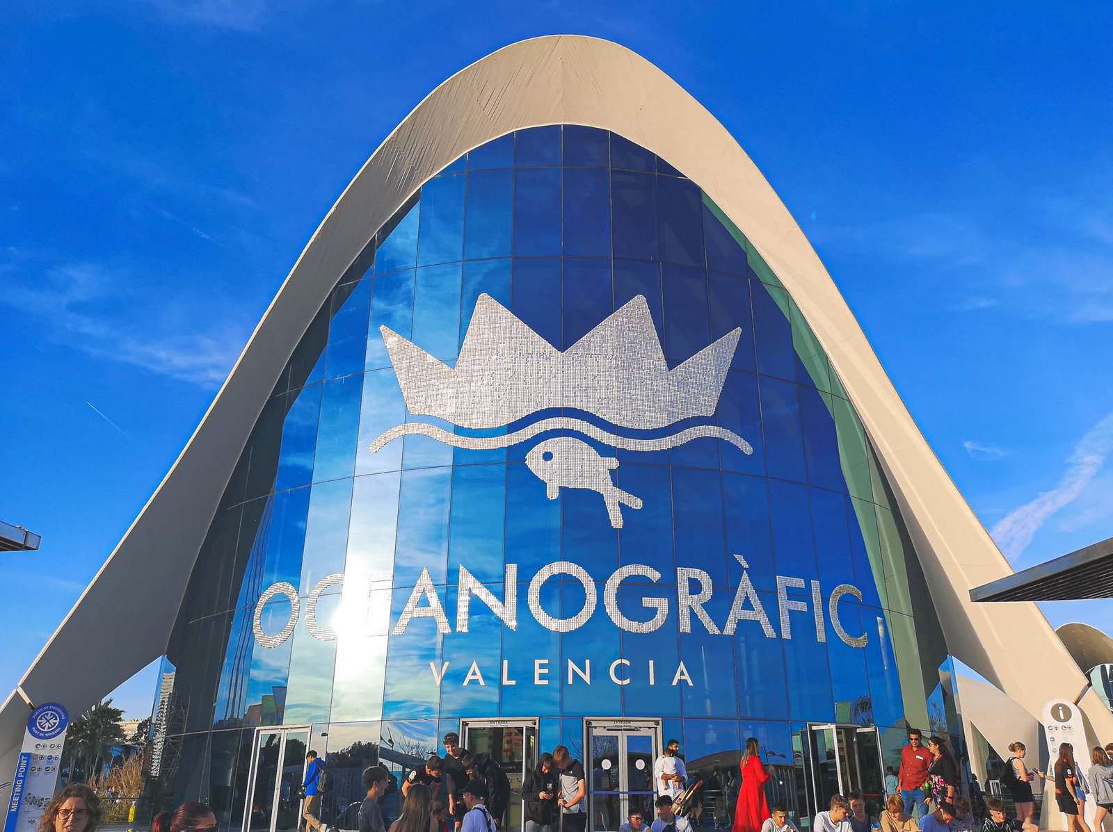
About the Oceanographic
Enter a world of aquatic splendour at the Oceanographic in Valencia, a crowning gem among the city’s cultural treasures. With an impressive array of marine species, groundbreaking exhibits, and awe-inspiring architecture, this marvelous establishment is a beacon for nature lovers, families, and tourists alike. Its significance extends beyond being a mere tourist attraction, doubling as a hub for marine research and conservation.The themed exhibits varies between different habitat pavilions among whom you can find famous Beluga Whales, the Dolphinarium & a huge shark aquarium!
Having so many things to see in such a short time, it is very helpful to come to the park prepared. This guide to the Oceanographic will be your compass, helping you to take the most out of your visit to the aquarium and navigate the thrilling experiences that await you. It will provide all the information you need – from the museum’s history to its conservation efforts, special features, and practical tips for visitors.
So, whether you are planning your next family holiday, looking for an educational experience, or simply seeking the next great ‘Thing to do in Valencia’, a visit to the Oceanographic is a must. The magic of the aquatic world awaits!
History of Oceanographic Valencia
Opened to the public in 2003, the Oceanographic quickly rose to prominence as a key highlight of the City of Arts and Sciences. This grand project was conceived by renowned architect Santiago Calatrava, whose visionary design effortlessly marries science, nature, and art. A unique fact about this architectural marvel is that it is designed to represent various aquatic ecosystems, further cementing the authenticity of the Oceanographic museum experience.
What is the Oceanographic in Valencia?
Stepping into the Oceanographic is akin to diving into an alternate universe, one that teems with vibrant marine life and astonishing exhibits. Its mission is twofold: to foster a sense of wonderment and curiosity about our oceans and to propagate awareness and knowledge about marine conservation. Spanning across an expansive area of 110,000 m² / 1,184,030 ft², the Oceanographic is a spectacle to behold.
Often referred to as the Valencia Aquarium, the Oceanographic holds the prestigious title of being Europe’s largest aquarium. This colossal aquatic hub has redefined the conventional notions of a museum, providing a sanctuary to over 45,000 marine creatures across 500 different species. A true testament to diversity and magnificence of life under the sea.
The Oceanografic Details
- Highlights: The largest aquarium in Europe featuring various marine habitats, a dolphinarium, an underwater restaurant, and beluga whales.
- Location: Ciutat de les Arts i les Ciències
- Coordinates: 39°27′20″N 0°21′00″W
- Address: Carrer d’Eduardo Primo Yúfera, 1B, 46013 València, Spain
- Built: 2002
- Entrance fee: Adults – €36.00, children (4-12 years), disabled & seniors (65+) – €26.50, children under 4 – Free.
- Opening hours: 10:00AM – 6:00PM (Hours may vary depending on the season)
- Weather: Valencia weather
- Good accommodation: Ciutat Vella, Eixample & El Pla del Real
- Tickets: Skip-the-line Tickets to Oceanografic
Tickets & Discounts to the Oceanographic
For a more cost-effective visit, you can consider purchasing combined tickets or packages that include other attractions within the City of Arts and Sciences. There are special discounts for groups, children, seniors, and students. The Valencia Tourist Card also offers attractive discounts and a free public transport.
Pro tip: Remember, the Oceanographic in Valencia is a popular attraction, so it’s advised to book your tickets in advance, especially during peak season and holidays.
What Can You See at the Oceanographic?
The Oceanographic is home to a vast array of marine species from different parts of the world’s oceans, all meticulously housed in environments that mimic their natural habitats. The Oceanographic exhibits provide a close-up view of the ocean’s magnificent inhabitants, right from tiny, darting fish to lumbering walruses, all the while amplifying the importance of preserving the natural world.
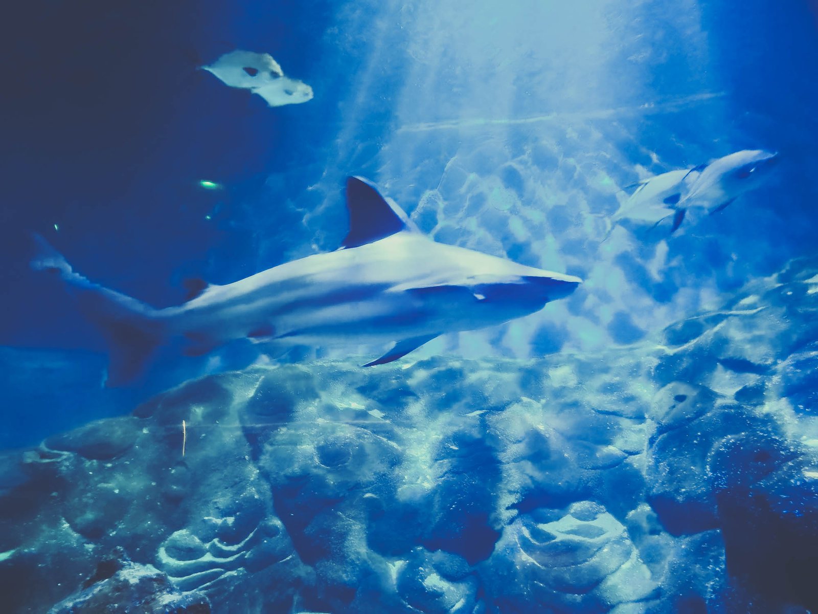
When you’re planning your ‘Visit Valencia’ itinerary, you will be enthralled to learn that the Oceanographic boasts nine underwater towers spread over two levels, each representing some of the most significant ecosystems on our planet. This is where marine life Valencia comes alive, offering unparalleled experiences such as walking through a glass tunnel as sharks swim overhead or watching vibrant corals and tropical fish in their colorful reef settings. It’s like stepping into a vibrant National Geographic spread!
Remember to carry your camera as the Oceanographic provides innumerable photogenic spots, contributing to an unforgettable visual diary of your visit to Valencia. Also, you can find exclusive and high-quality images and videos of these exhibits on our website to enhance your understanding and expectations.
List of Themed Exhibits
From the frigid Arctic waters to the warm Mediterranean seas, the Oceanographic themed exhibits immerse you in a diverse range of habitats in 11 different pavilions. Now, isn’t that an exciting ‘thing to do in Valencia’?
Antarctic
This pavilion represents the Southern Ocean surrounding the Antarctic continent. It is notable for its vast biomass, despite its relatively low biodiversity. Light lasts for extended periods in this region, leading to plankton explosions that serve as the basis of life for many other species.
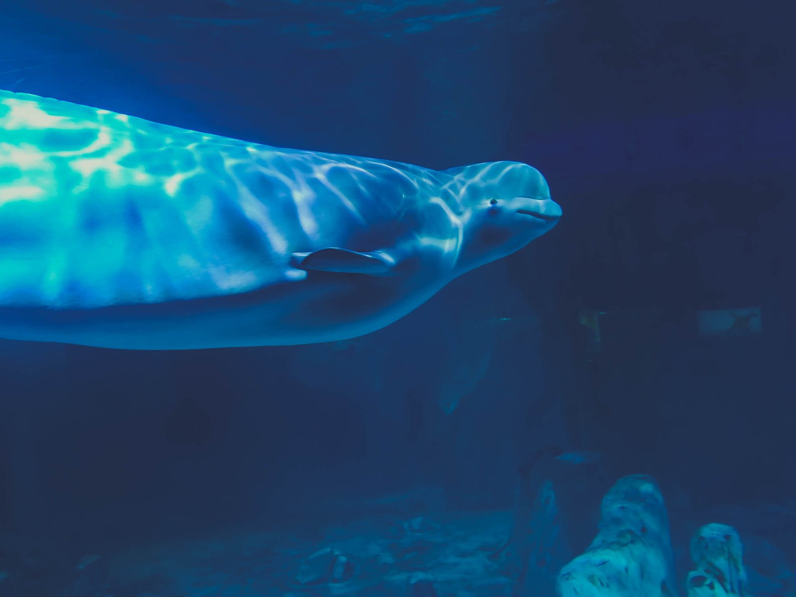
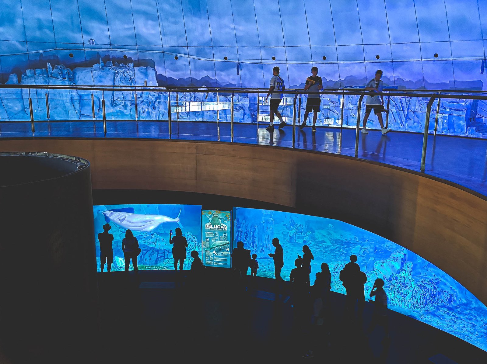
Arctic
Welcome to a giant igloo, twelve meters tall, representing the habitat of Beluga Whales family. The upper level offers a view of immense ice blocks, the perfect habitat for beluga whales. Meanwhile, the lower level provides an underwater perspective, where visitors can immerse themselves in the frozen water.
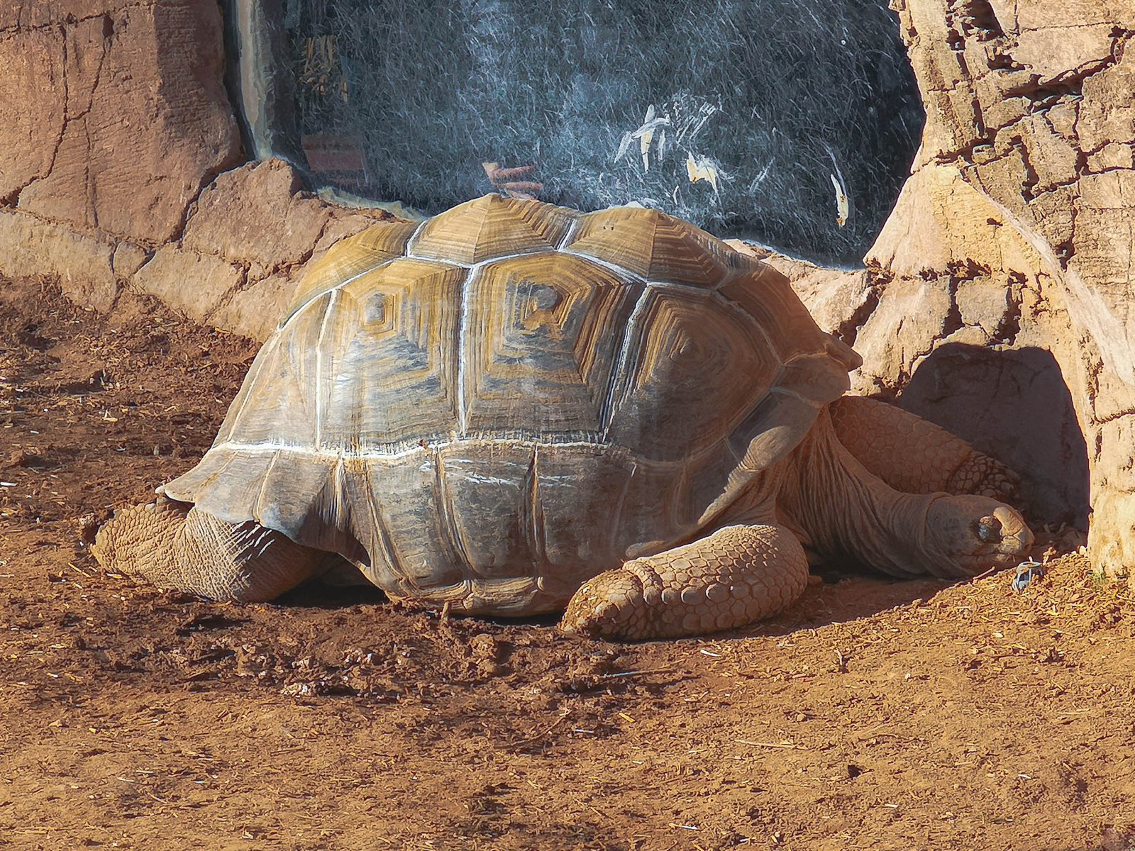
Crocodile Preserve
This 450m² habitat, located in the living lake of the aquarium, features a large outdoor space notable for an area prepared to facilitate the nesting of reptiles. It includes 2×1 meter pits with a drainage system to protect eggs in case of rain before being transferred to the incubator of the aquarium to finish their development.

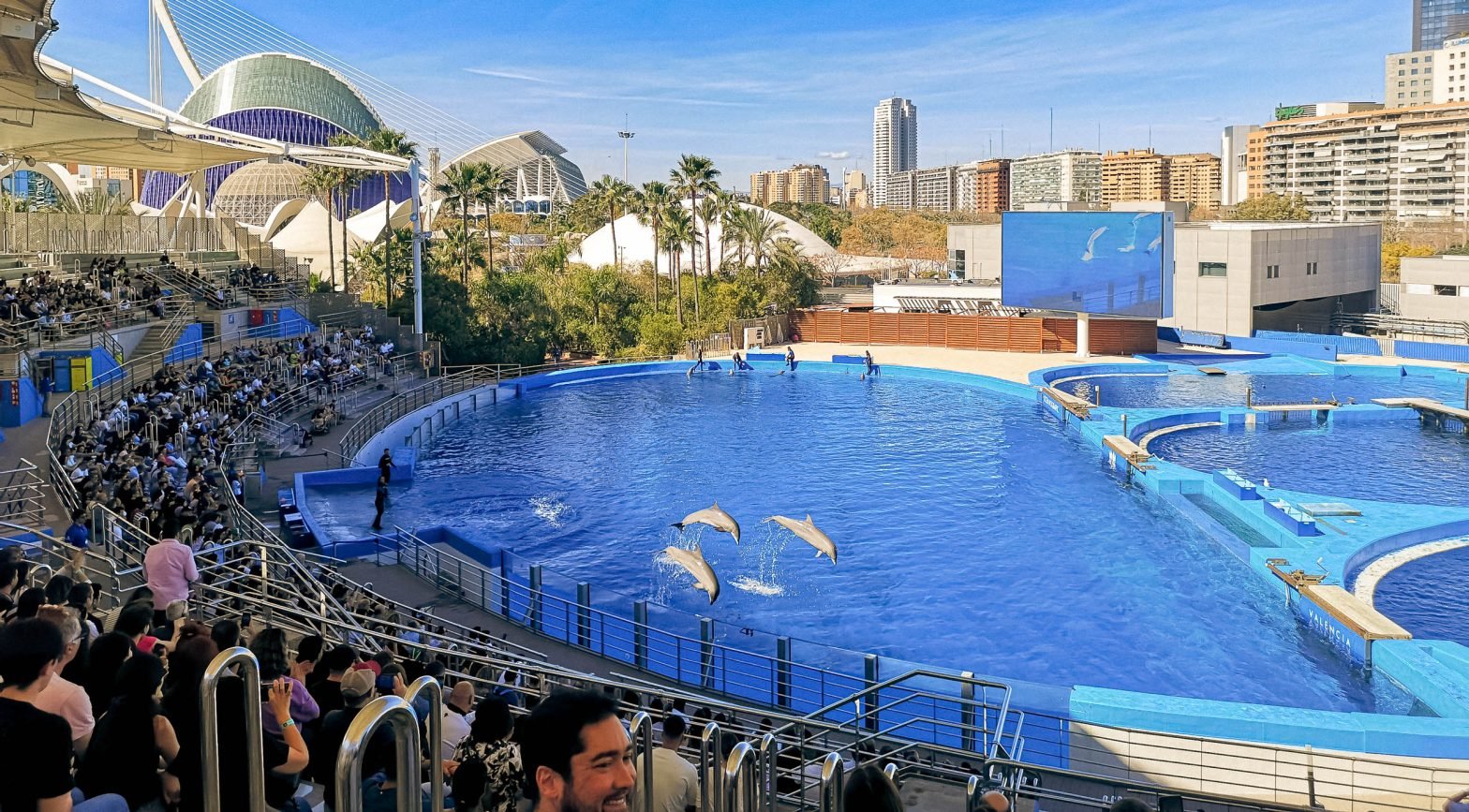
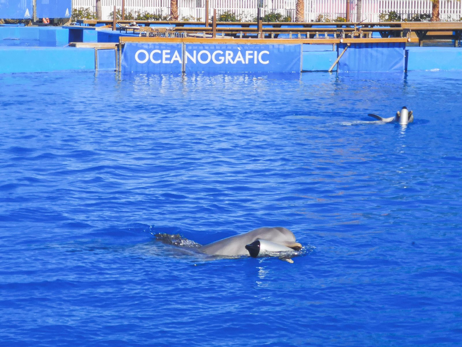
Dolphinarium
The Oceanogràfic boasts the largest dolphinarium in Europe, home to a group of Bottlenose Dolphins. With a grandstand capacity of over 1,500 people, the dolphinarium has a main pool for the study and observation of the dolphins and four auxiliary pools for training, reproduction, and medical care. Visitors can enjoy a bio-educational exhibition several times each day, demonstrating the abilities of these animals and explaining the most important aspects of their biology, behavior, and conservation.
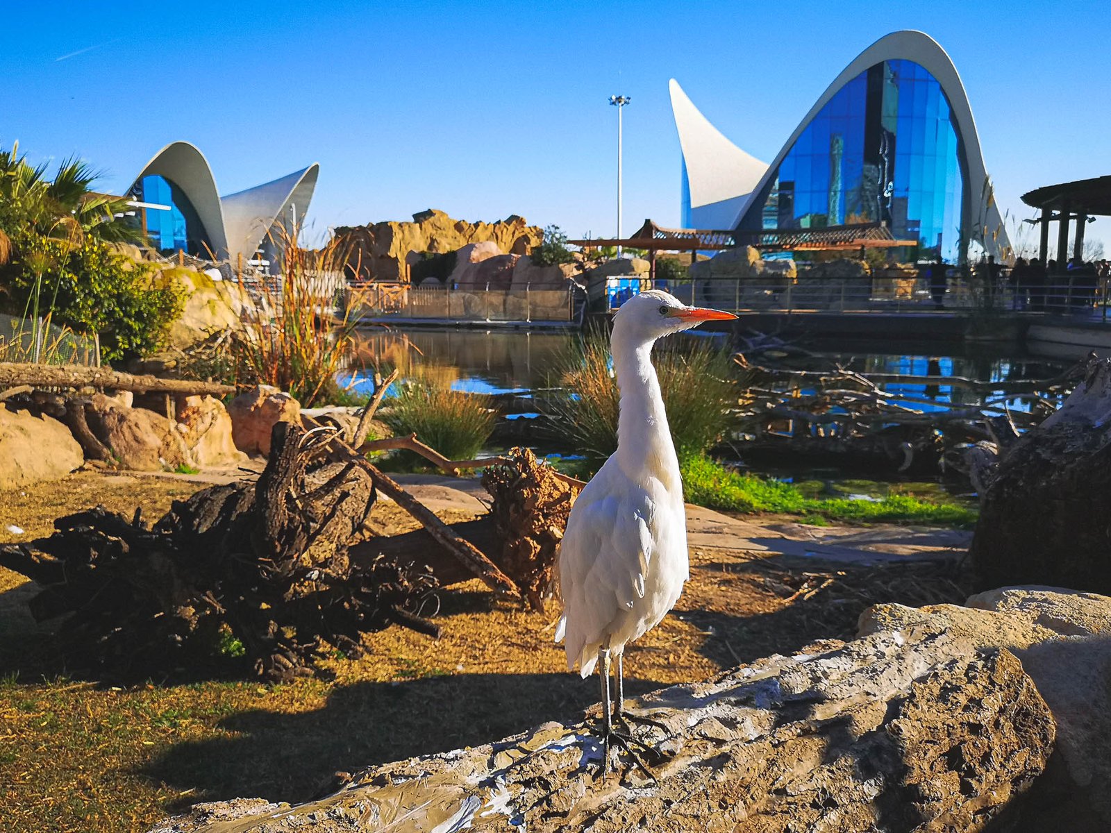
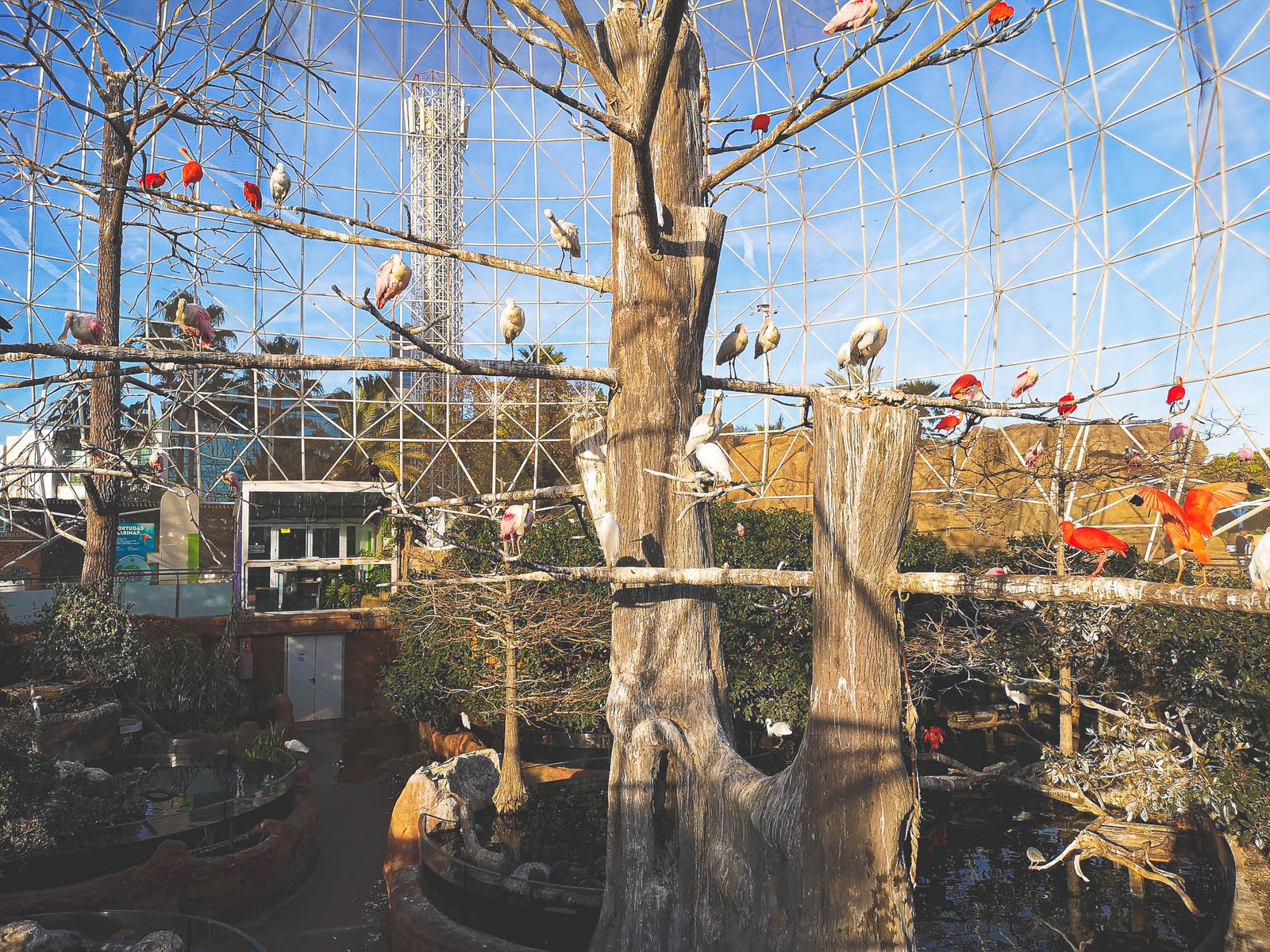
Wetlands / Aviary
Housed in a large, 26-meter-tall sphere, this pavilion represents two of the most characteristic coastal wetlands of the planet: the American mangrove and the Mediterranean marshland. Wetlands are among the richest, most productive ecosystems on the planet, home to hundreds of endemic and endangered species.
Temperate & Tropical
This pavilion represents the majority of the oceans, extending from the equator to latitudes close to the polar circles. Tropical seas have an average surface water temperature of 25 degrees Celsius, allowing for great biodiversity. Temperate seas have thermal oscillations, reaching a minimal 12 degrees Celsius, and are characterized by very high productivity due to annual plankton outbreaks.
Islands
This outdoor installation replicates the habitat of the southern coast of South America, allowing visitors to observe the behavior of South American sea lions. This area will soon also contain Oceanic Island habitats.
Lakes
The Living Lake of the aquarium is home to a variety of aquatic birds such as Red-crested Pochard, Common Shelduck, and the Whooper Swan. The installations are also used by some species of birds that visit throughout the year, coming mainly from the Albufera Natural Park and the former bed of the Turia River.
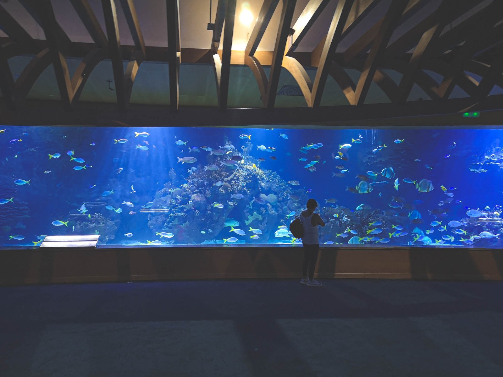
Oceans
The Oceans Pavilion is the largest aquarium in the Oceanographic, representing the vast oceans that cover our planet. This pavilion typically houses a multitude of marine species, showcasing the incredible biodiversity found in the world’s oceans. Visitors can expect a journey through different ocean habitats, discovering various marine creatures along the way.
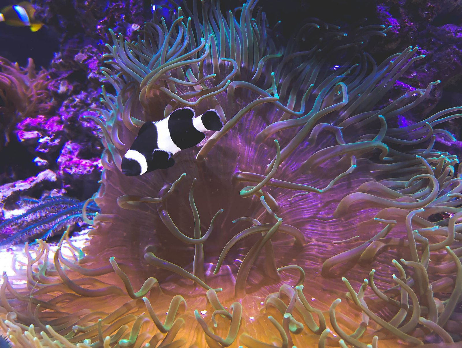
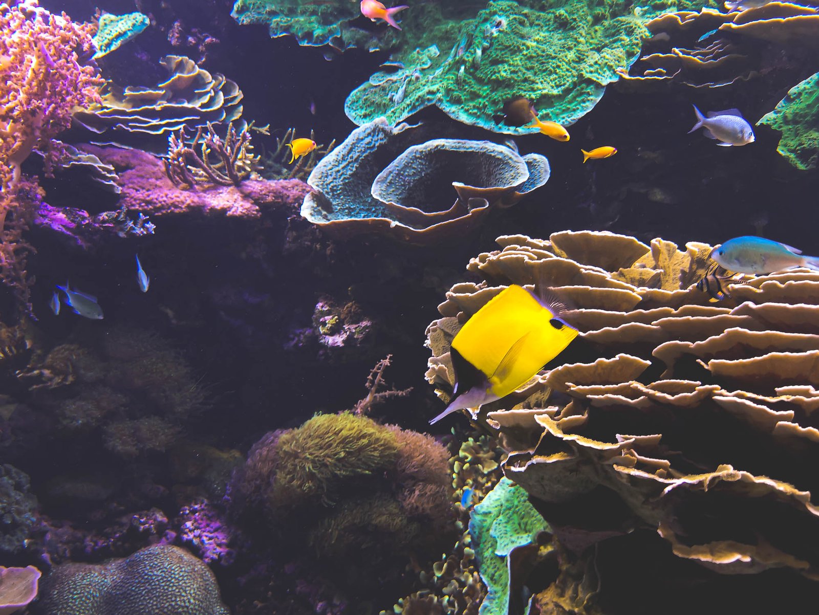
Red Sea
This pavilion recreates the unique marine environment of the Red Sea, renowned for its vibrant coral reefs and diverse marine life. Visitors can explore a variety of colorful tropical fish, including the beautiful angelfish, while gaining insights into the importance of marine conservation.
Mediterranean
This pavilion represents a stretch of the Mediterranean Sea, a temperate sea that’s not very deep, relatively small, and practically closed in by continents. As depth increases, visitors will see different ecosystems, starting from the coastal areas of the Posidonia aquarium to port areas, ending in the deepest Mediterranean zones. It houses the biggest gorgonions in the Mediterranean, the fluorescent jewel anemone, and the threatened red coral.
Events & Educational Programs
At the Oceanographic, your journey of exploration and learning extends beyond observing the marine life on display. The Oceanographic takes pride in its diverse range of events and educational programs designed to engage visitors of all ages, making it an ideal destination not just for family outings, but for school trips too.
One such educational offering is the ‘Sleeping with Sharks’ program, a unique overnight experience that allows children and adults to learn about sharks, their behaviors, and the threats they face. Imagine falling asleep watching these majestic creatures glide above you! You may also be interested in the ‘Behind the Scenes’ tour, which provides insights into the daily operations of Europe’s largest aquarium. These are truly some of the most exciting ‘things to do in Valencia’.
Unique Features of the Oceanographic
The Oceanographic in Valencia, besides being Europe’s largest aquarium, stands out for its unique and innovative features that attract tourists worldwide. Here, every element is designed to make your visit an unforgettable experience.
Submarine Dining Experience
One of the standout features of the Oceanographic is its underwater restaurant. As part of this unique dining experience, guests are surrounded by an expansive aquarium filled with various marine species. As you enjoy your meal, you can witness marine life gracefully swimming around you. Dining at this underwater restaurant makes for a story worth sharing back home!
Architectural Brilliance
The architectural design of the Oceanographic, conceived by renowned architect Santiago Calatrava, is a sight to behold. The aesthetically pleasing and technologically advanced structure enhances your experience, making it more than just a visit to an aquarium.
Spellbinding Dolphin Show
The dolphin show in Valencia is another highlight that you wouldn’t want to miss. This mesmerizing spectacle showcases the intelligence and agility of these wonderful creatures, leaving visitors of all ages in absolute awe.

Conservation Programs of the Oceanographic
At the heart of the Oceanographic lies a deep commitment to marine conservation. While the aquarium is a spectacle for visitors, it also plays a pivotal role in protecting and preserving the local marine species, making it more than just a destination for entertainment.
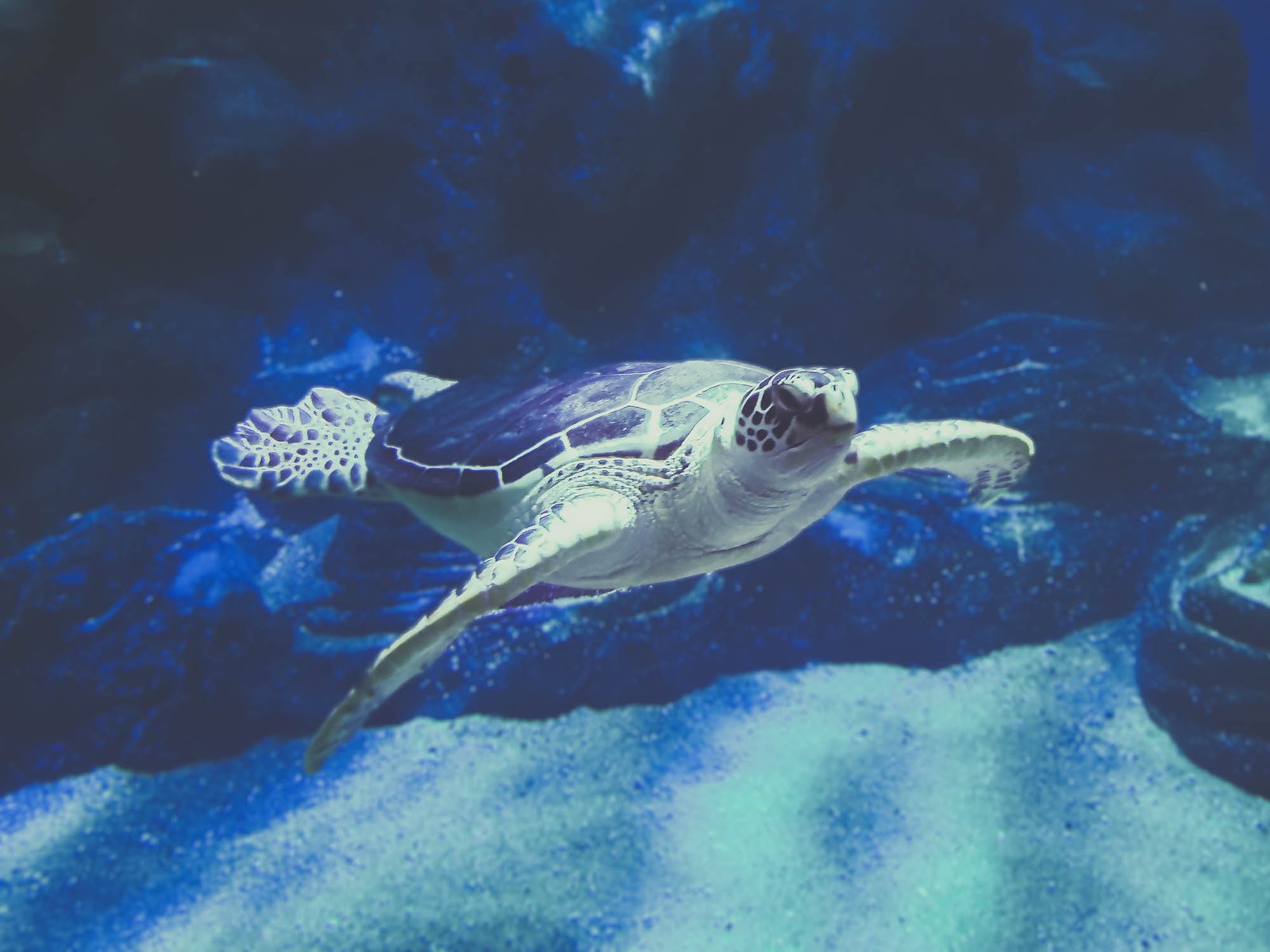
Through its various conservation programs, Oceanographic has been actively involved in the rescue, rehabilitation, and release of marine animals, like endangered sea turtles of the Mediterranean. It has also initiated programs focusing on the breeding of threatened species, thereby contributing to the preservation of marine biodiversity.
The Oceanographic’s commitment to conservation extends beyond its premises. The aquarium actively collaborates with global institutions on research projects aimed at marine conservation. It is also involved in numerous conservation initiatives, such as beach clean-ups and campaigns to reduce plastic waste in the oceans.
Why Conservation Matters
Marine conservation is vital for maintaining the health of our planet. Oceans produce a significant portion of the world’s oxygen, absorb carbon dioxide, and serve as habitats for a diverse array of species. By supporting institutions like the Oceanographic, you’re playing a part in the larger mission of preserving our blue planet. The Oceanographic isn’t just about witnessing the beauty of marine life and exploiting the animals; it’s about understanding our role in preserving that beauty for future generations.
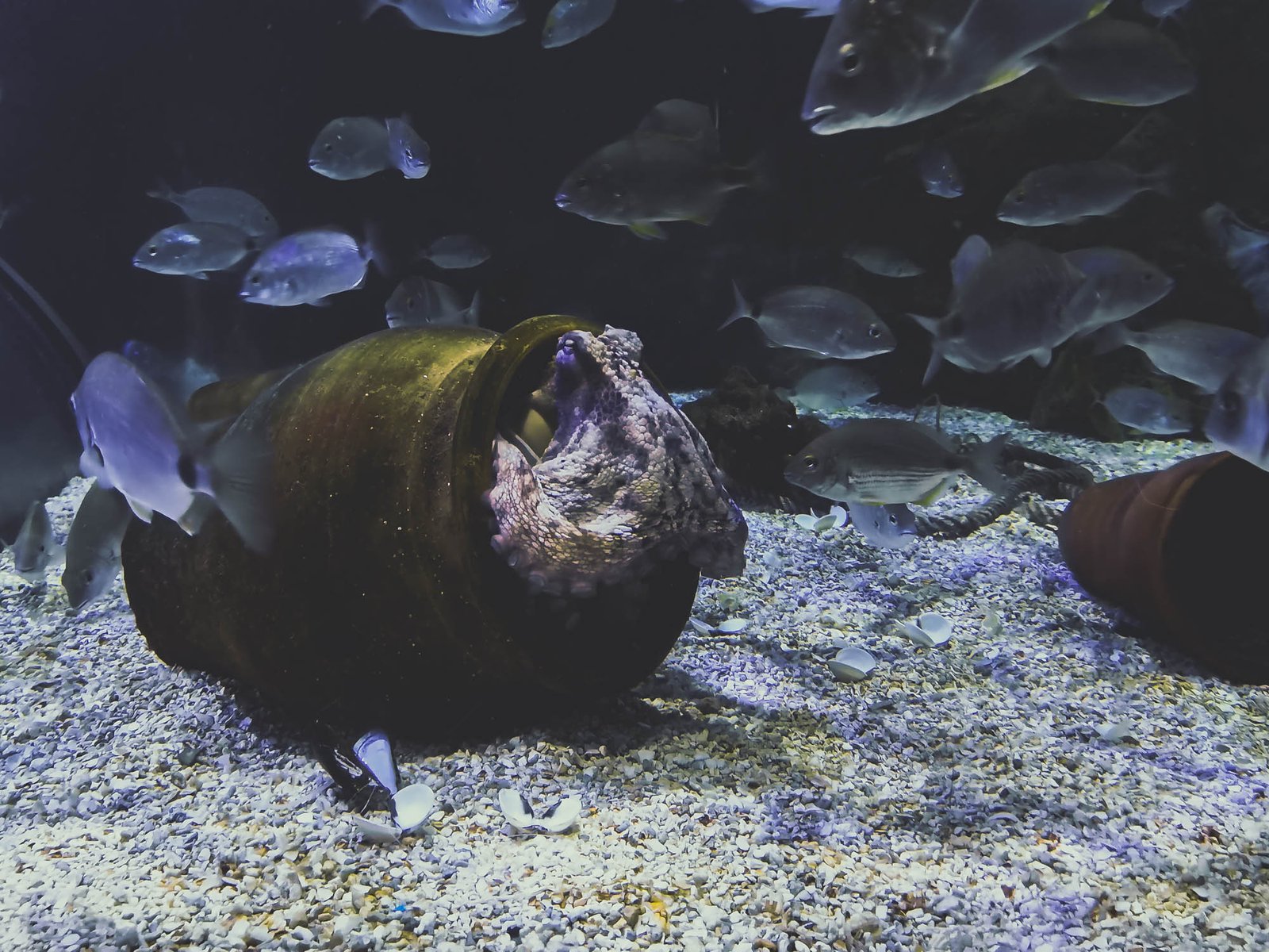
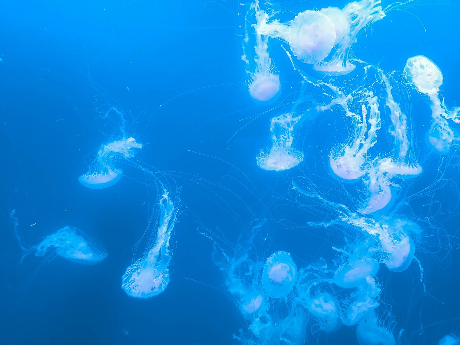
Gallery of Animals

Personal Experience
In conclusion, I think that the Oceanographic in Valencia isn’t just another stop on your sightseeing tour – it’s a gateway into an underwater world that will leave you awestruck and enlightened. It definitely affected me and still does, as I keep getting back to embrace the beautiful lifeforms found in the aquarium and learn about the new initiatives to protect the local species in the area. The aquarium offers a unique blend of entertainment, education, and engagement with its wide variety of exhibits. I also appreciated the park’s active involvement in marine conservation, which seems only to be improving with time. The stunning architecture of the buildings only adds to the whole package of awesome things you get after signing up for a visit to the Oceanographic.
Let the underwater world enchant you with its beauty, its diversity, and its silent plea for preservation. Visit the Oceanographic, immerse yourself in the wonder of marine life, and carry back memories that will last a lifetime. Whether you’re a family seeking a fun and educational outing, a couple looking for a unique date experience, or a solo traveler eager to explore the best of Valencia, the Oceanographic beckons. So, why wait? Plan your visit to the Oceanographic today and prepare to be captivated by the marvels of the marine world.