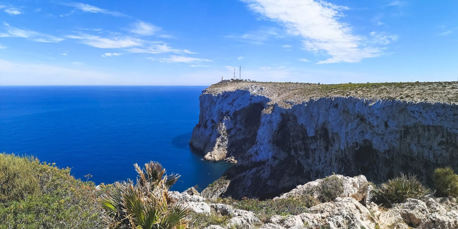
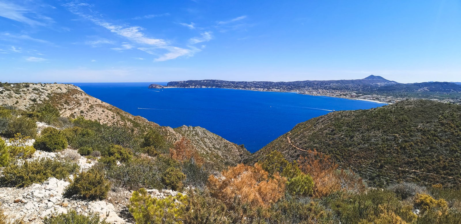
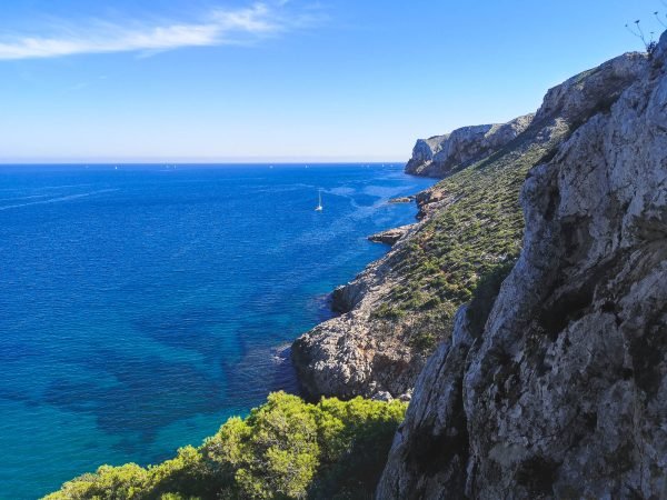
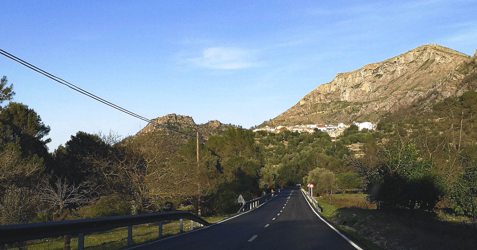
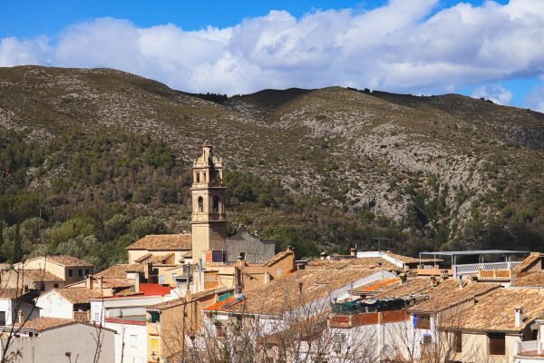
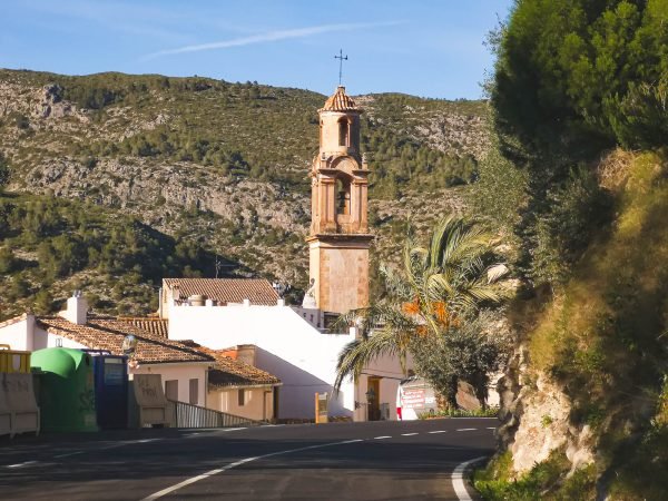
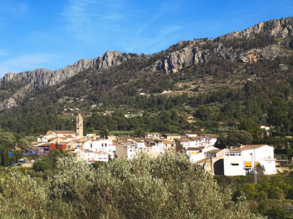
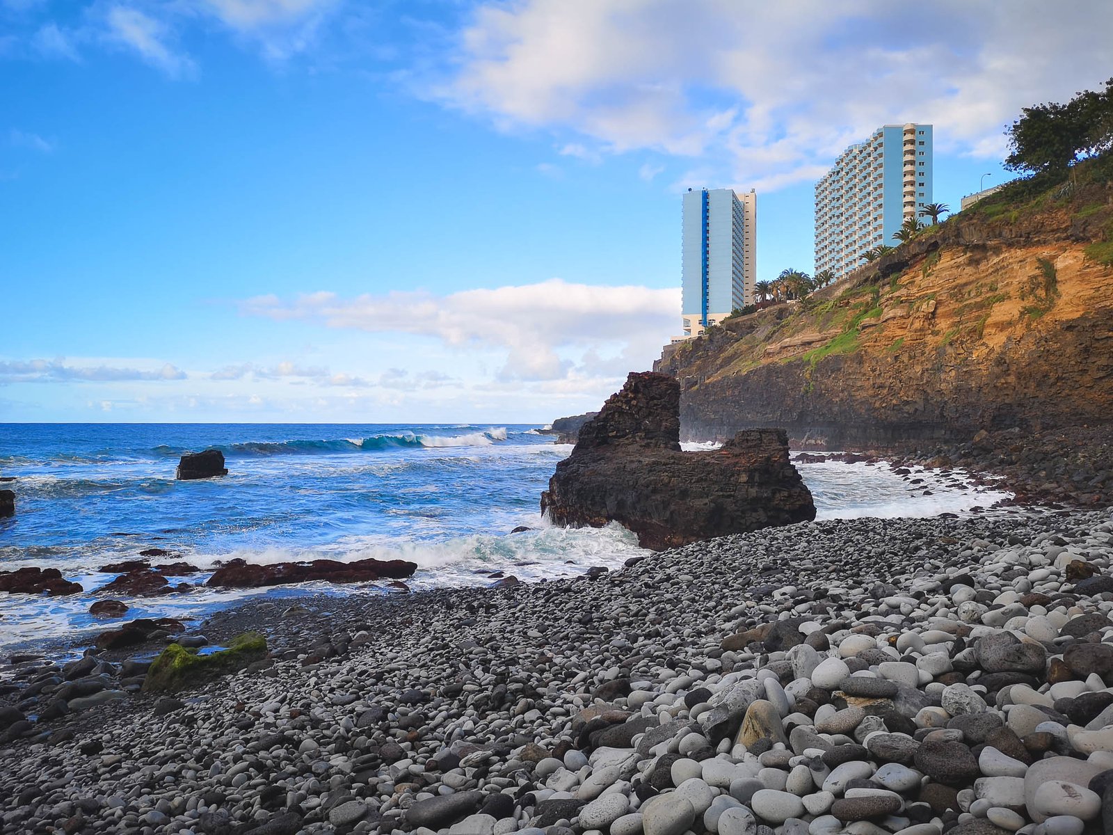
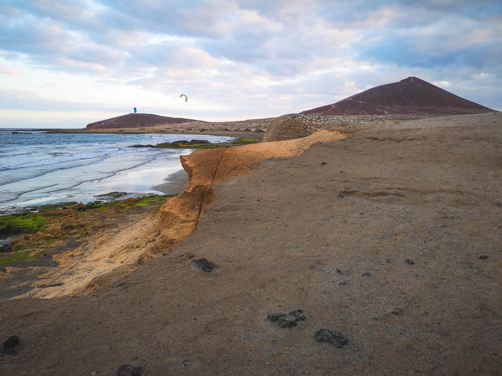
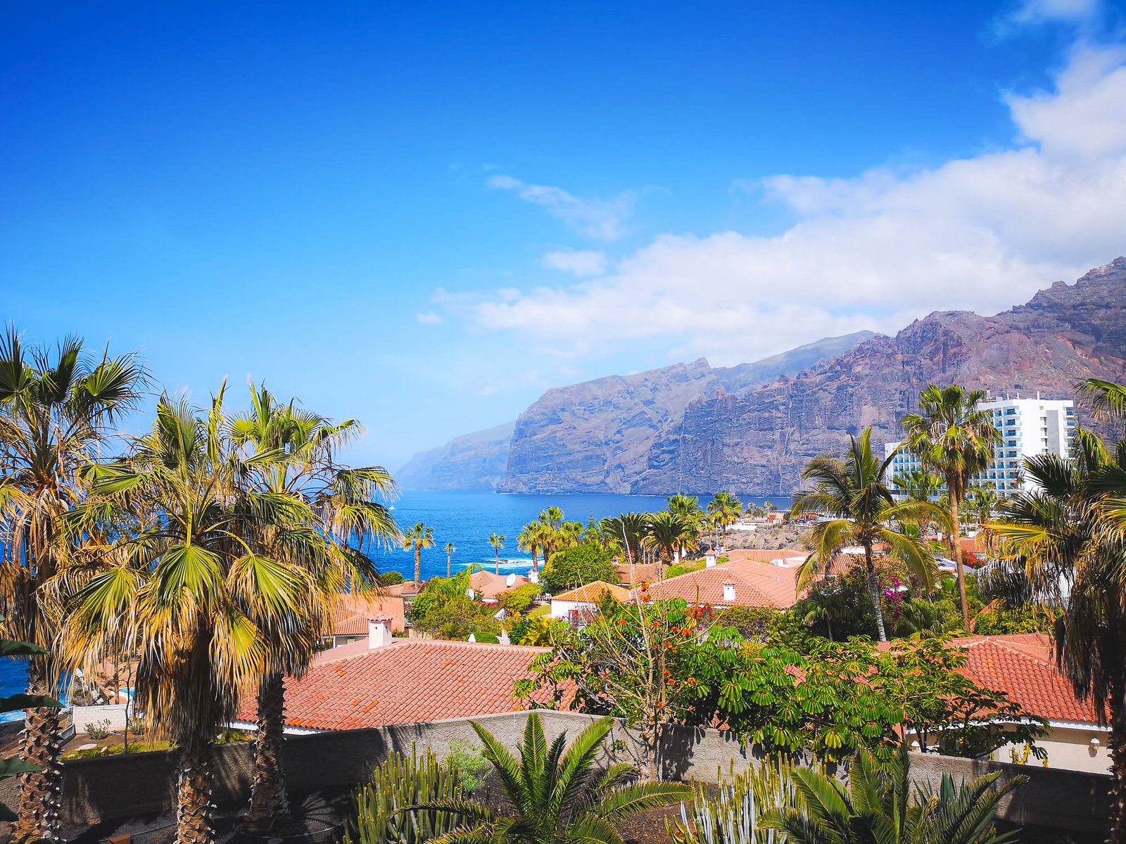
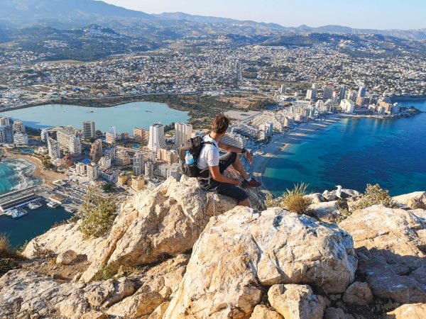
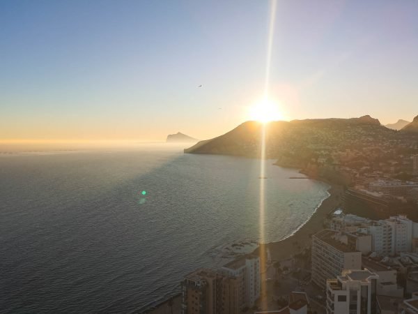
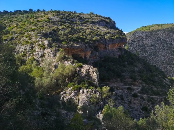
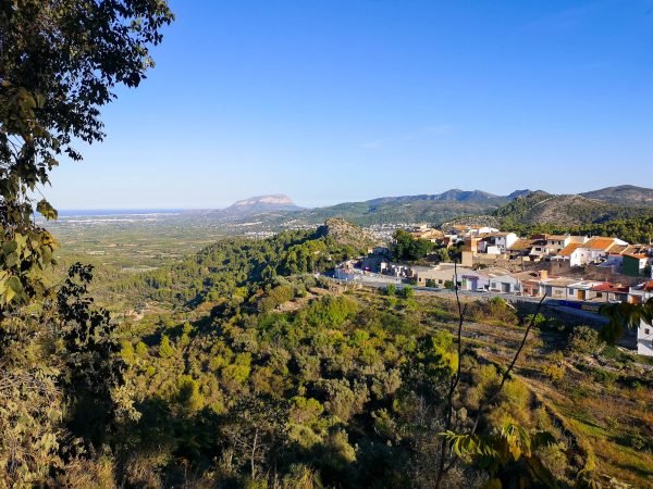
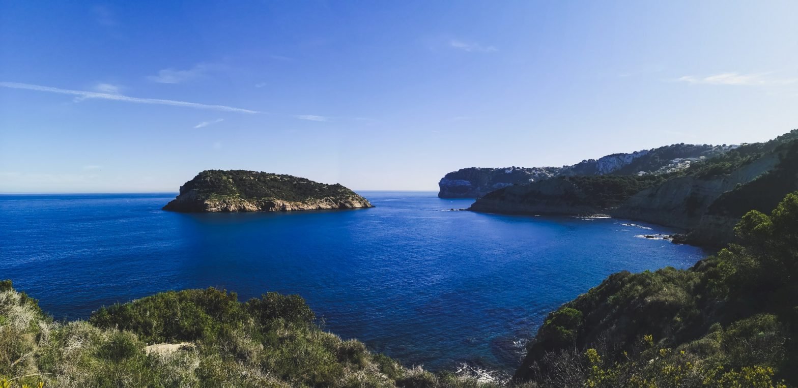
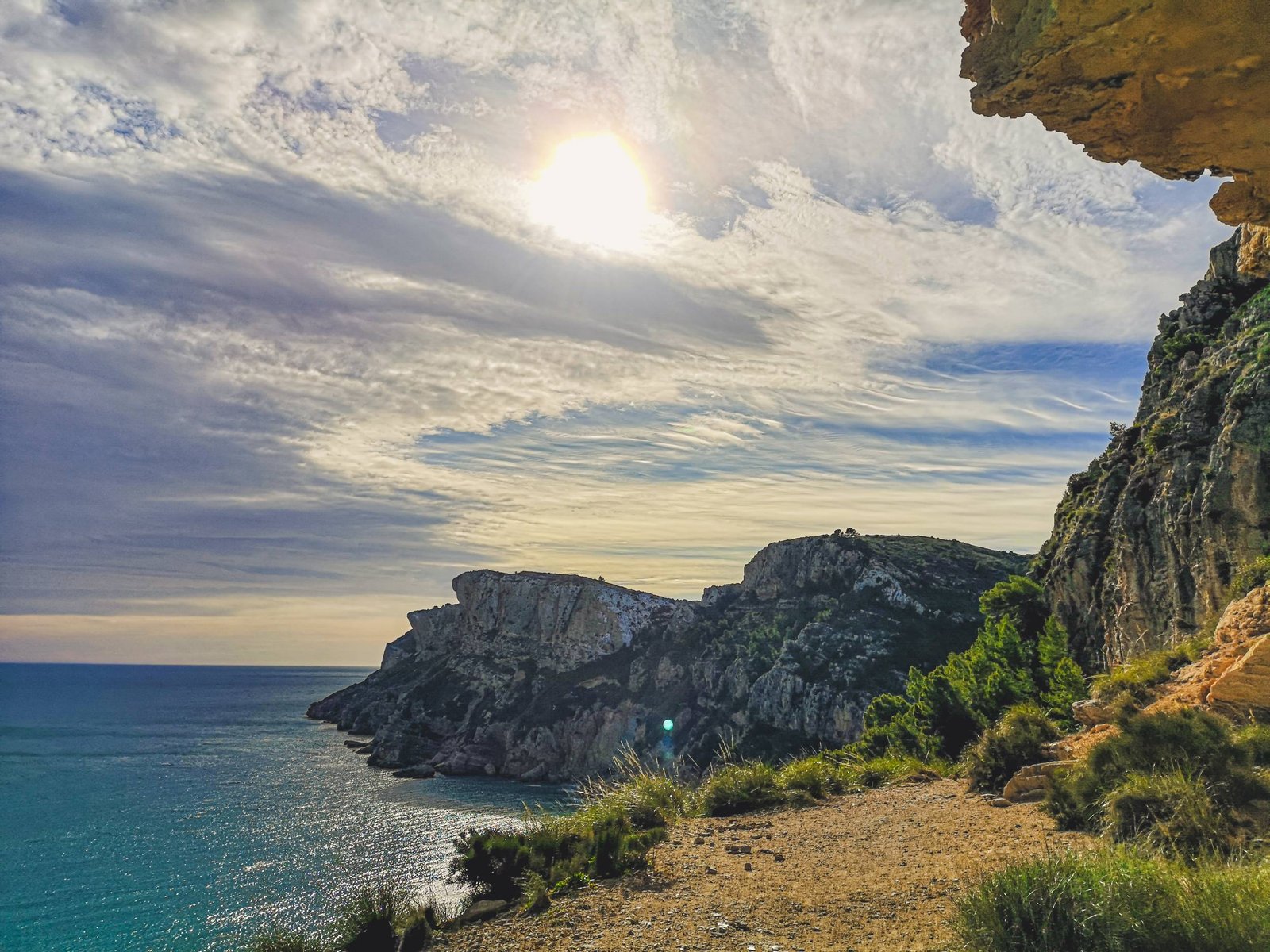
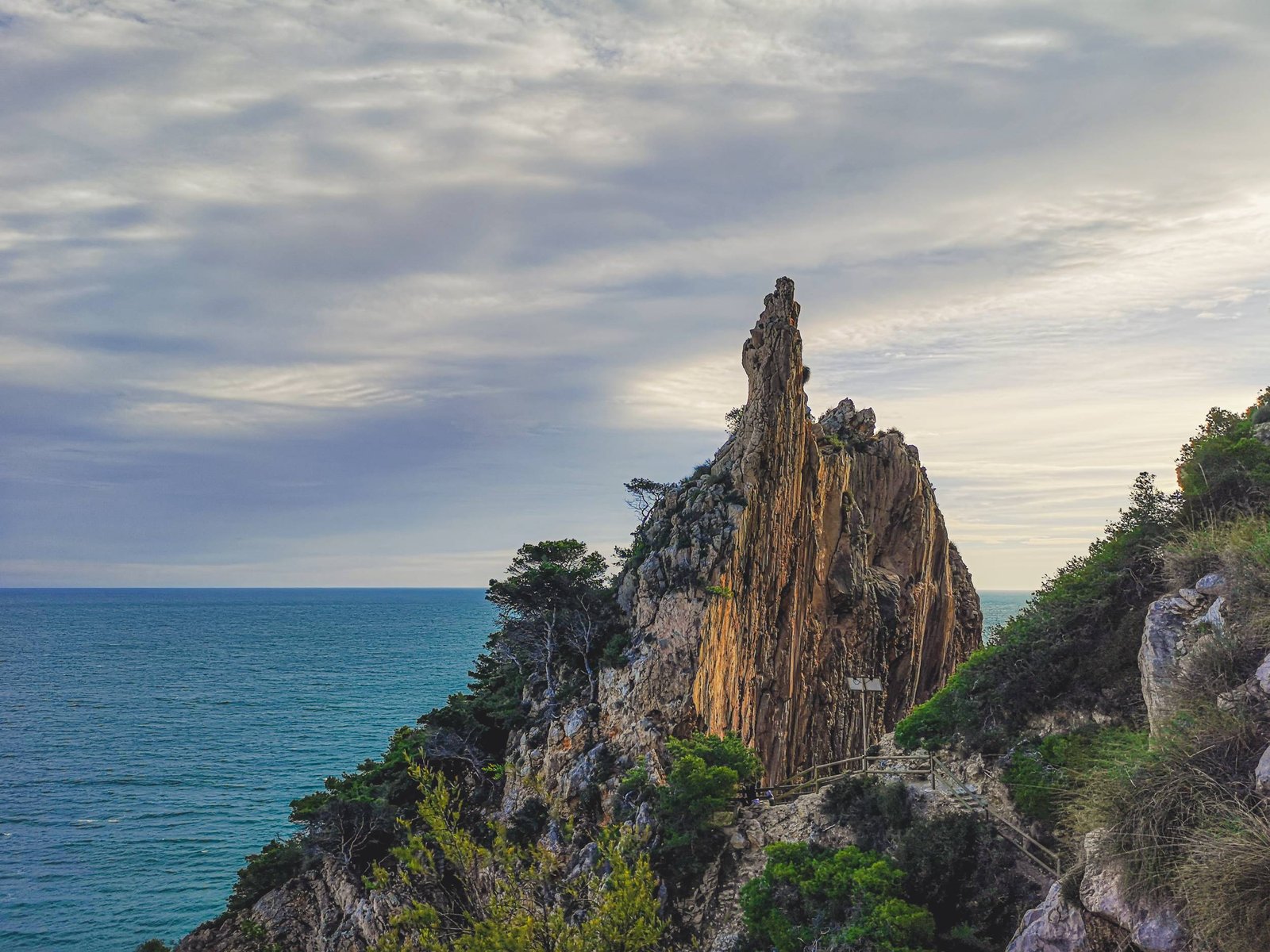
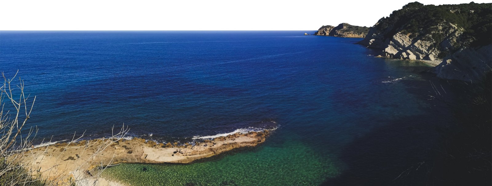
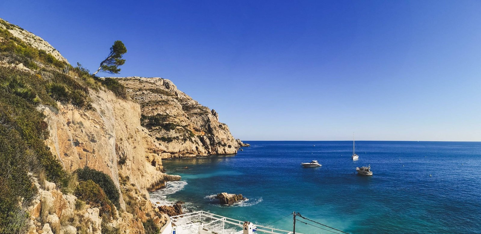
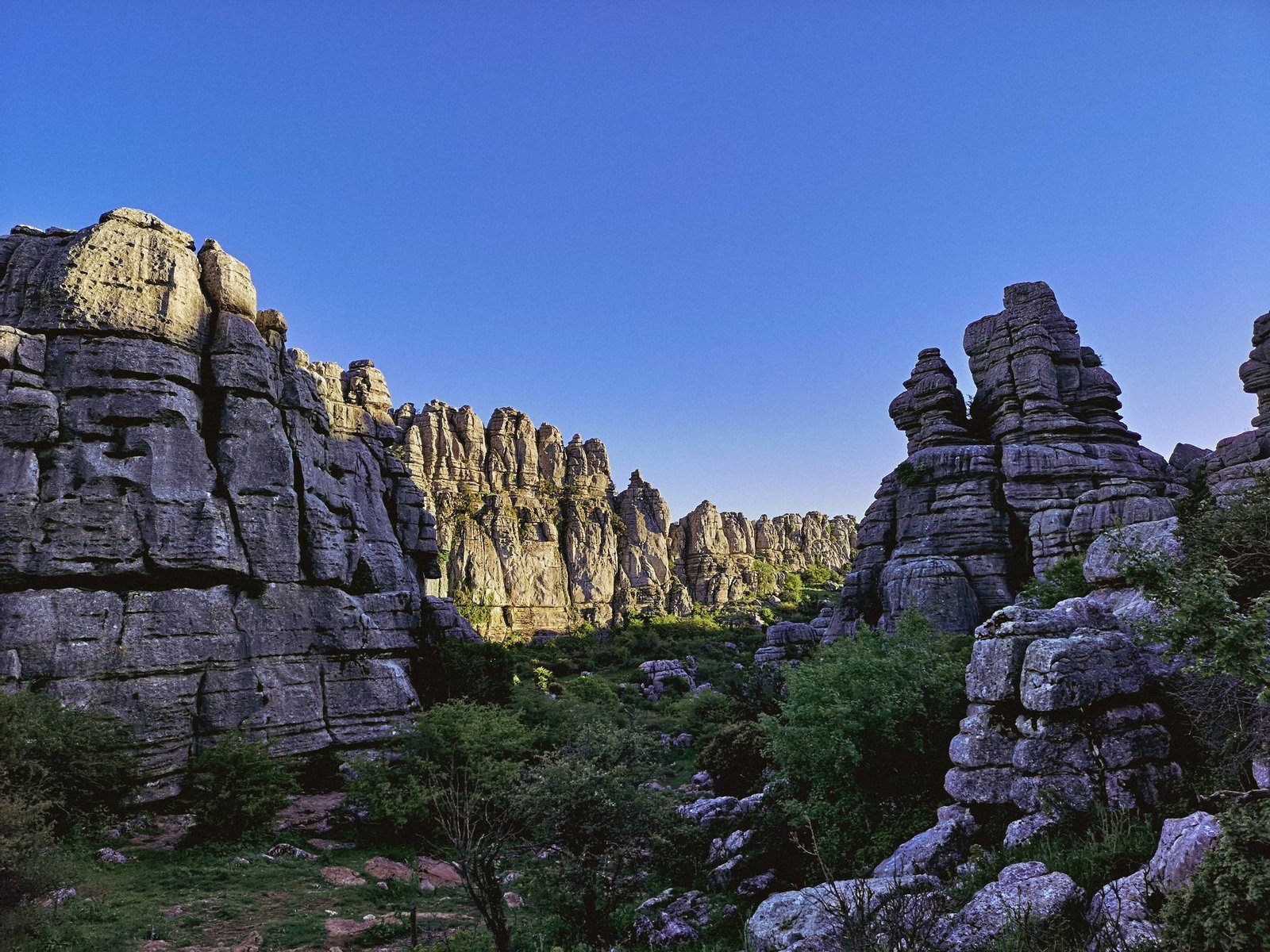
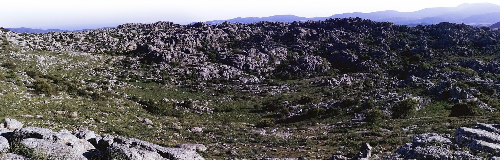
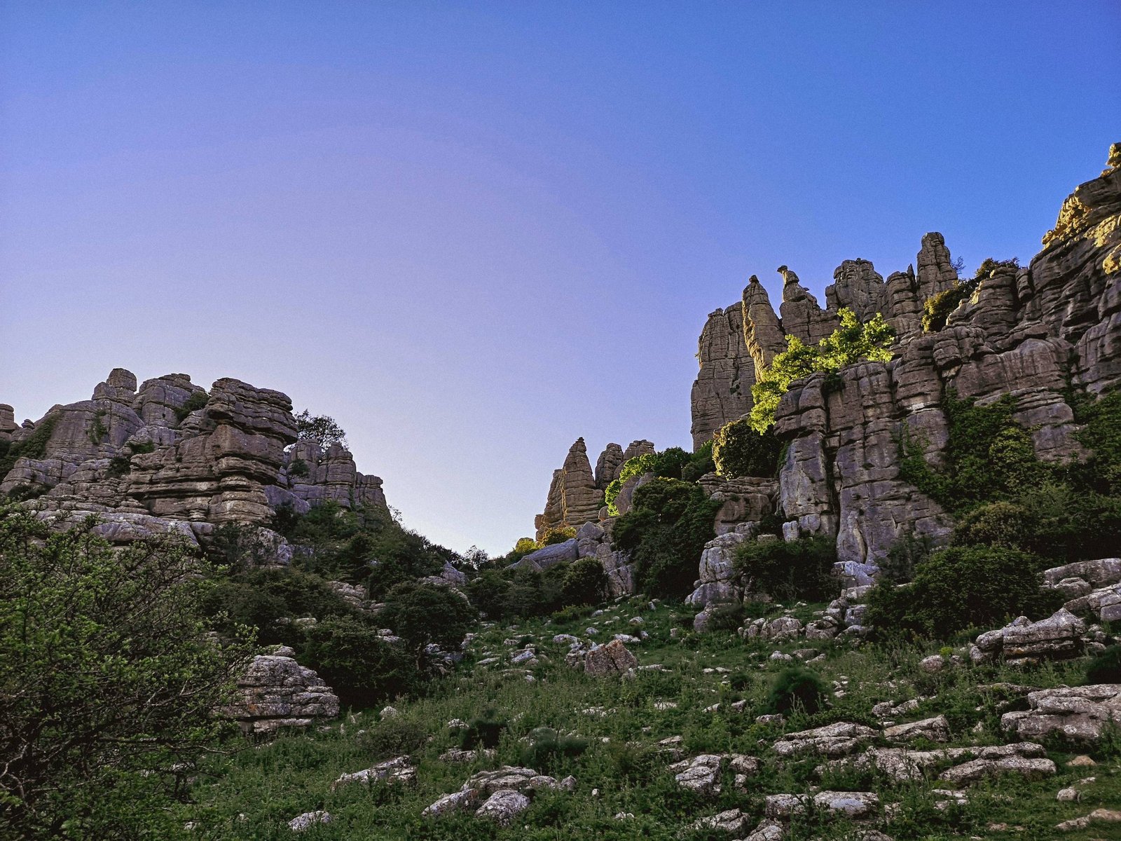
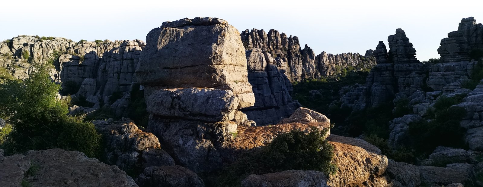
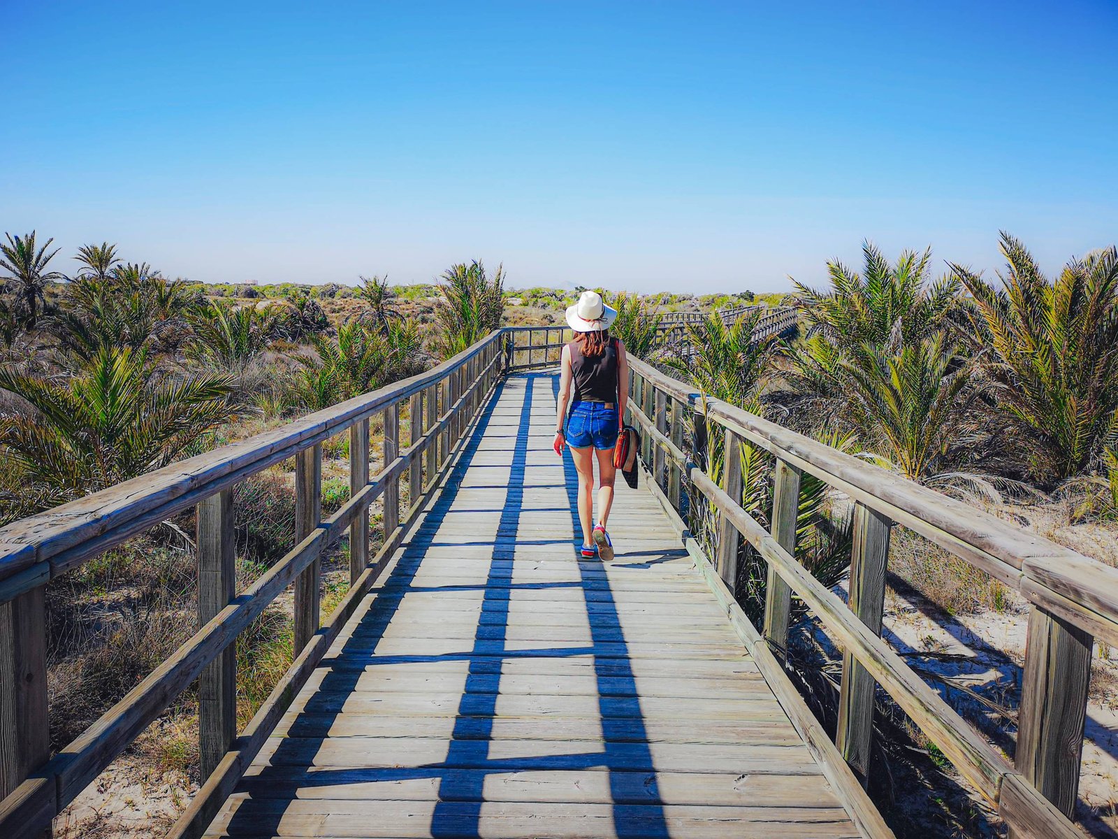
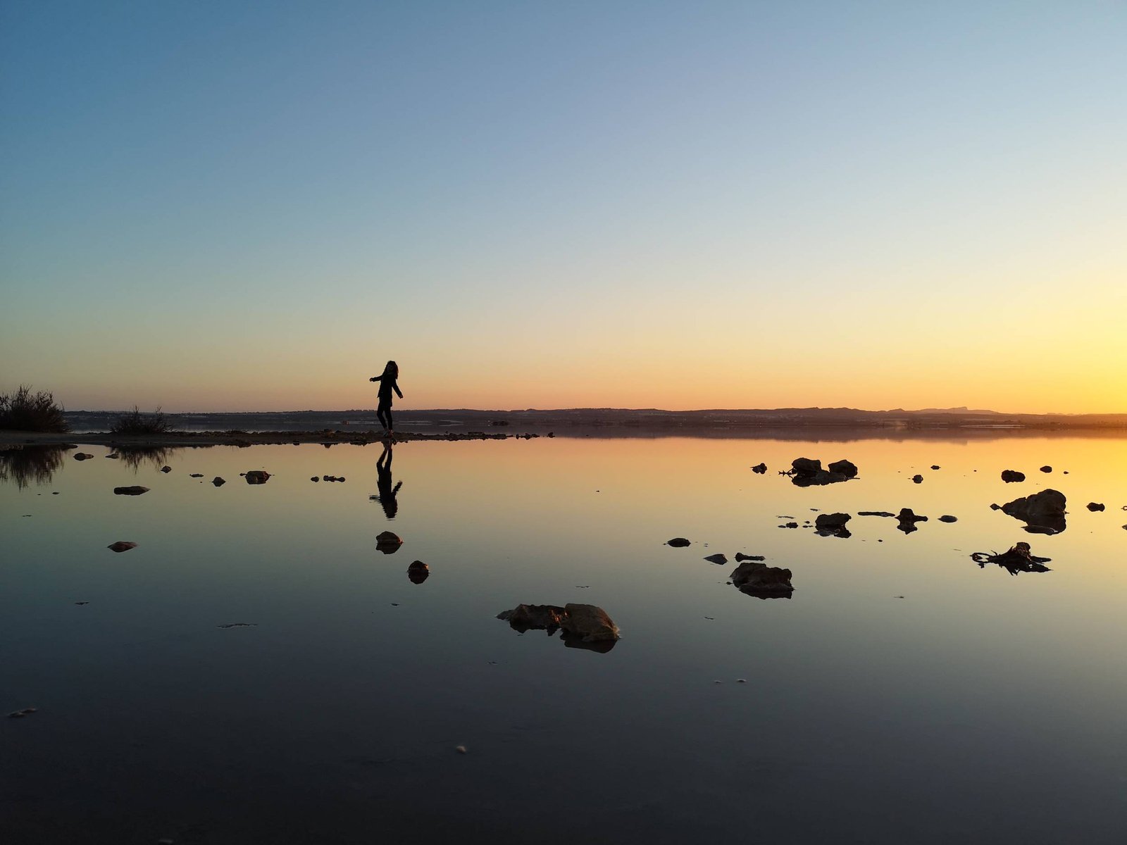
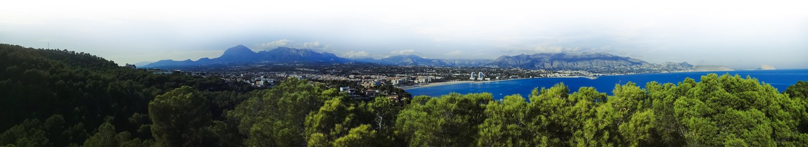
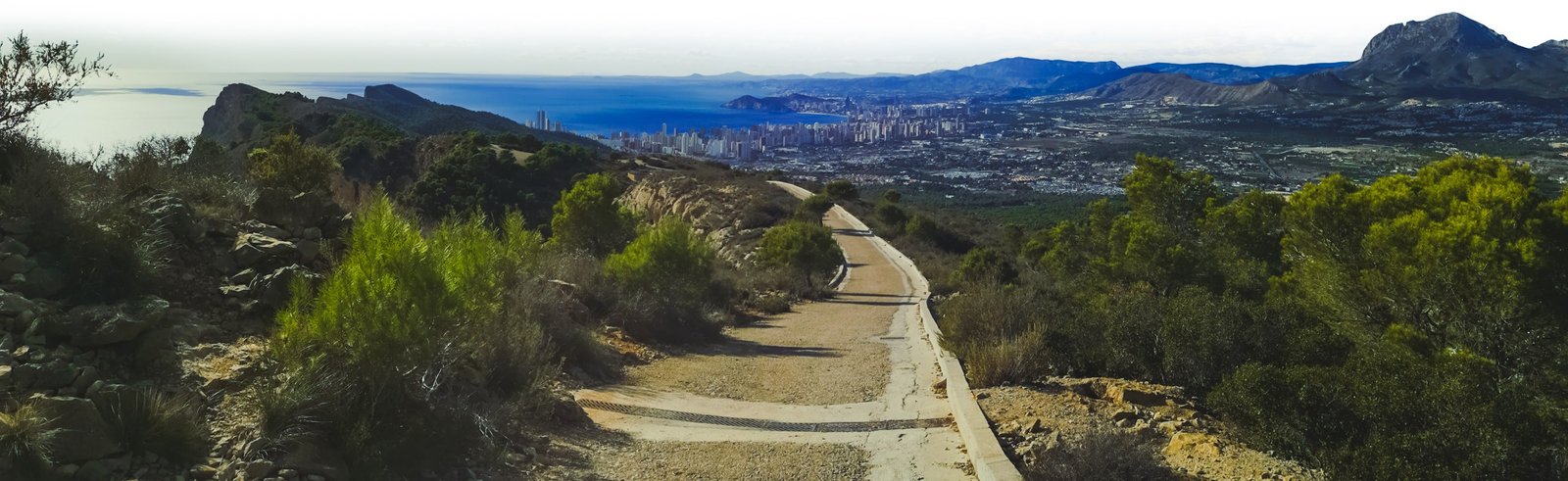
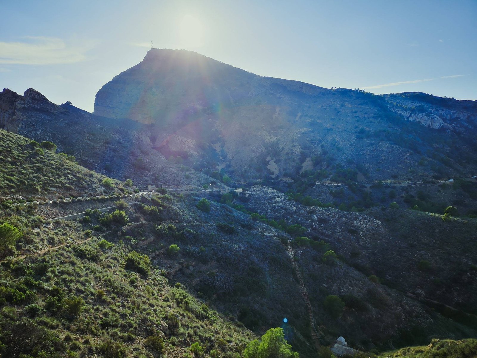
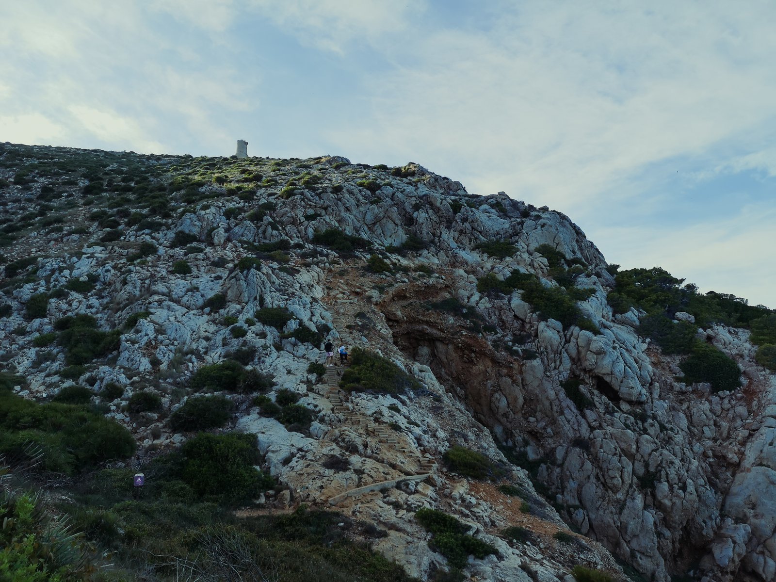
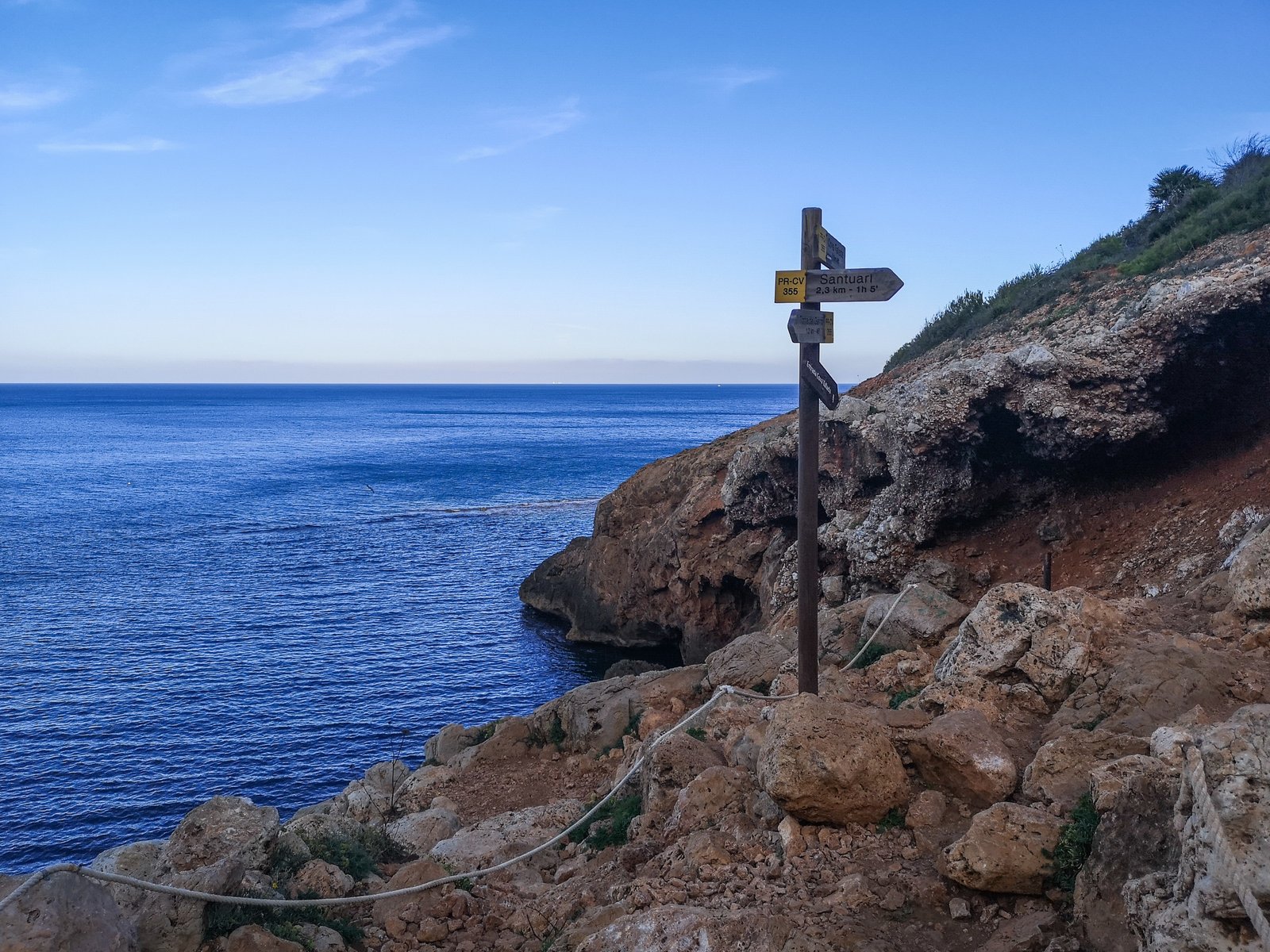
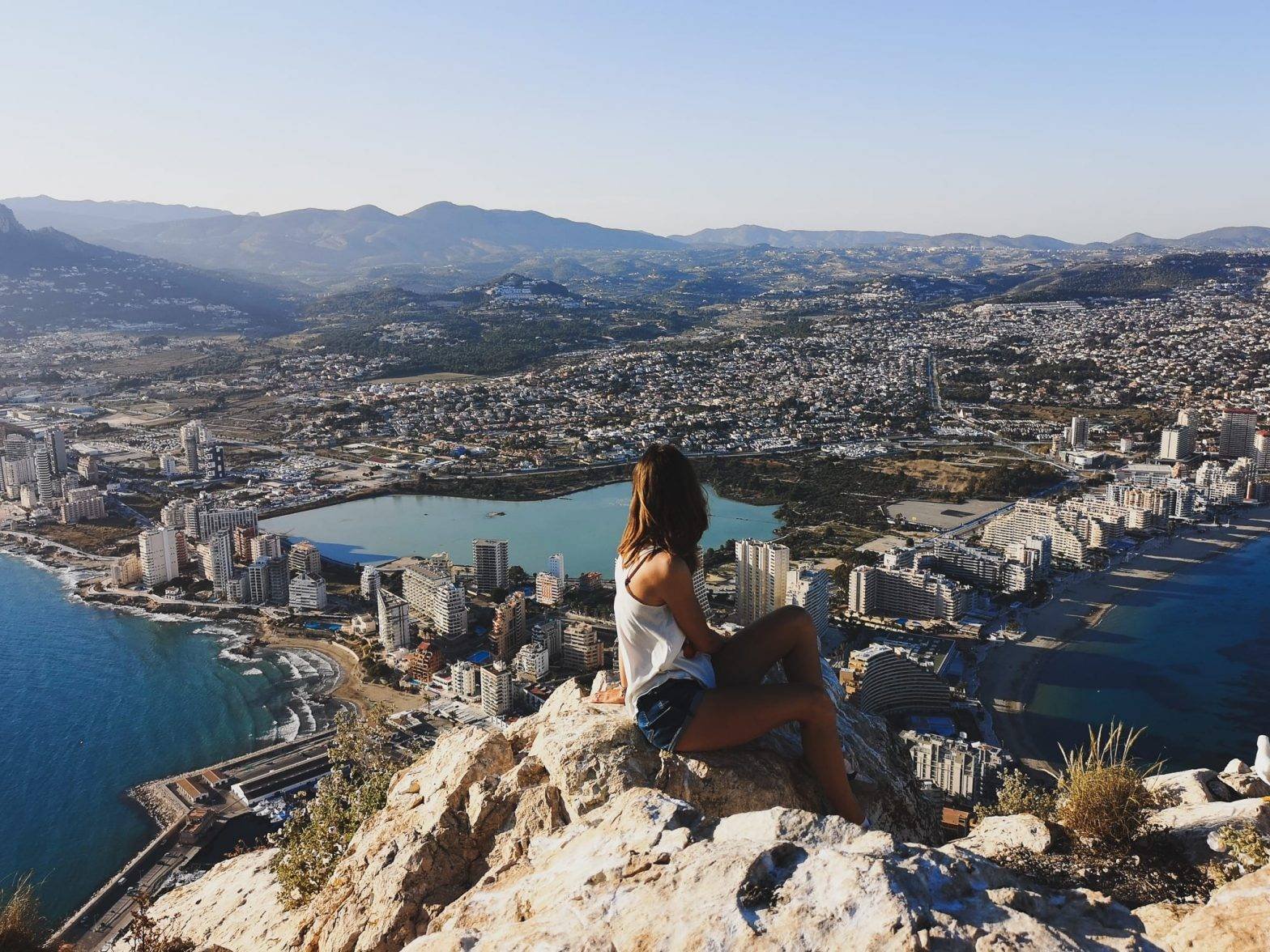
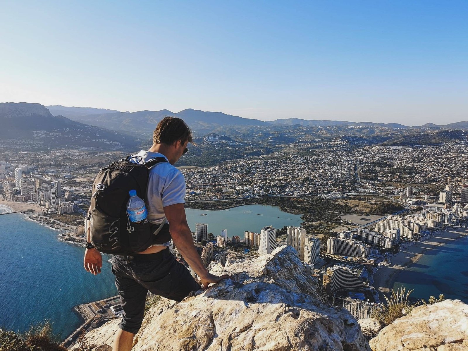
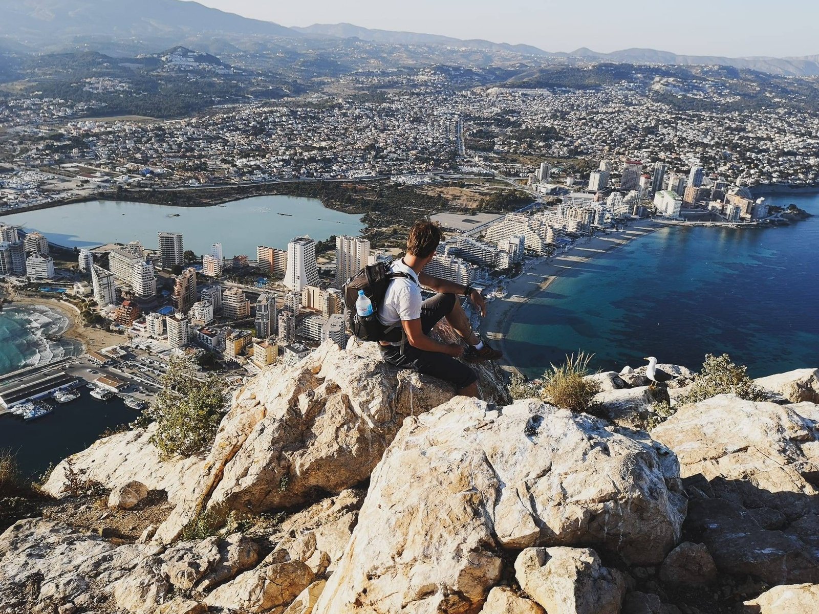
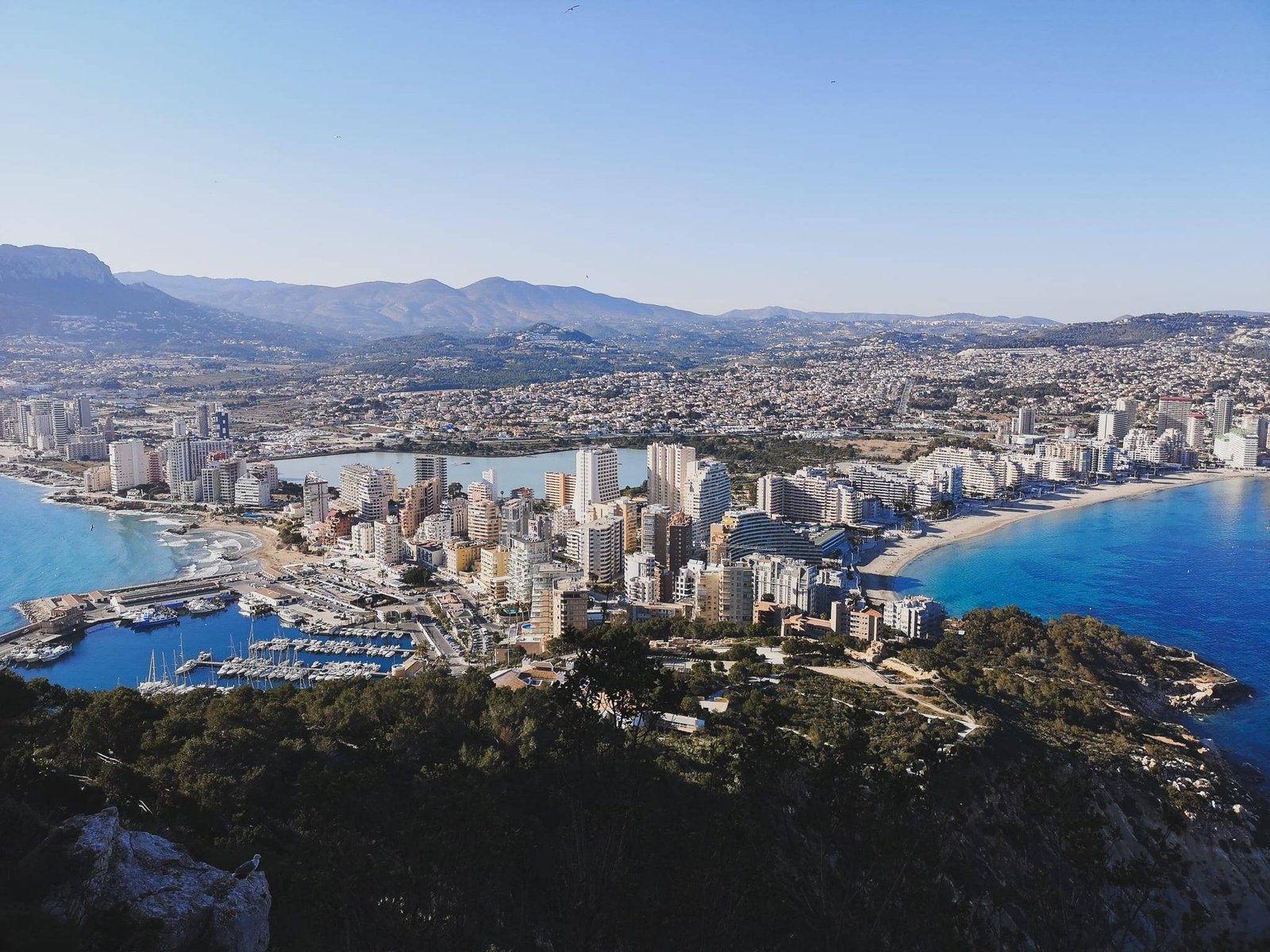
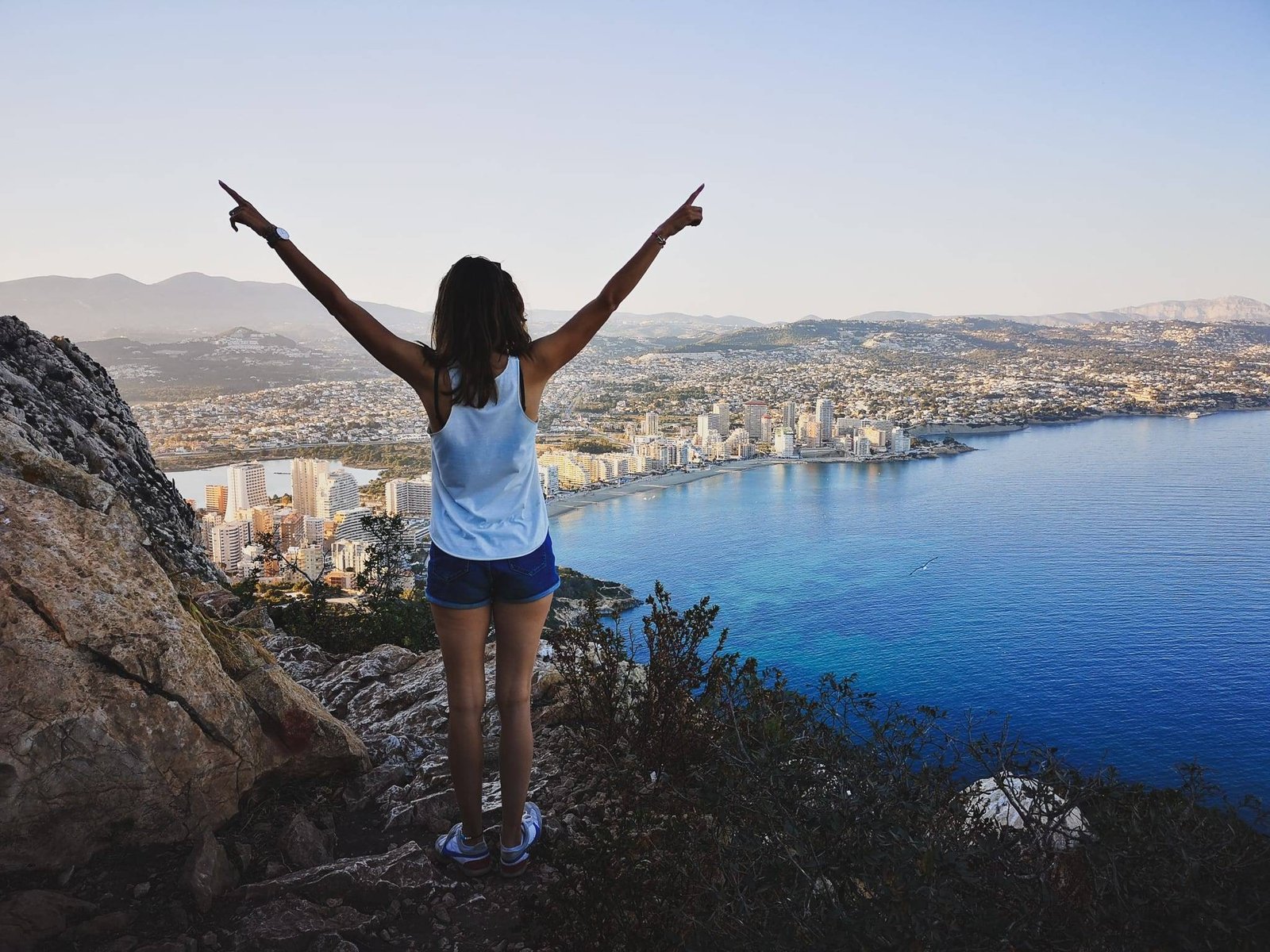
Most of the hiking routes listed in this article are just sections of the PR-CV 355 hiking trail between Port Javea and El Montgo Peak. You might as well just do it, but for those less fitted, or not being able to spare a day for such a trail, there are more accessible options. Actually, everything except getting the names right is easy Cap de Sant Antoni.
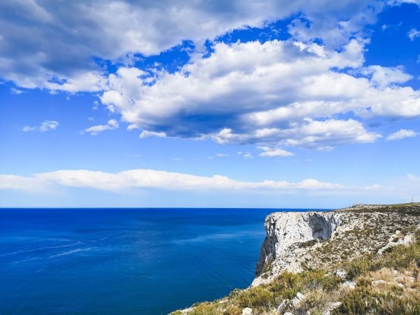
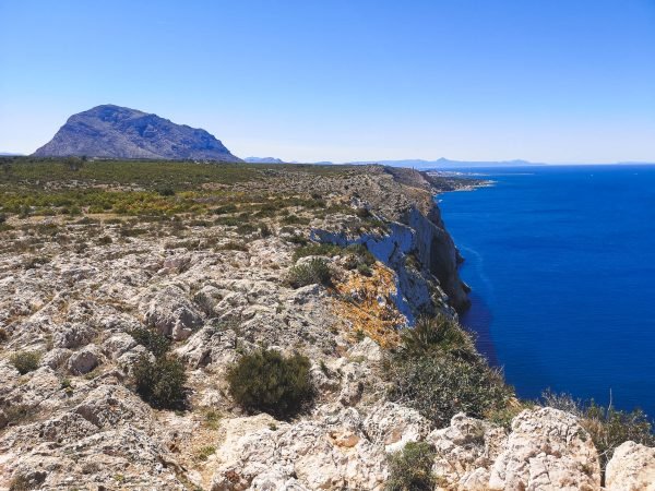
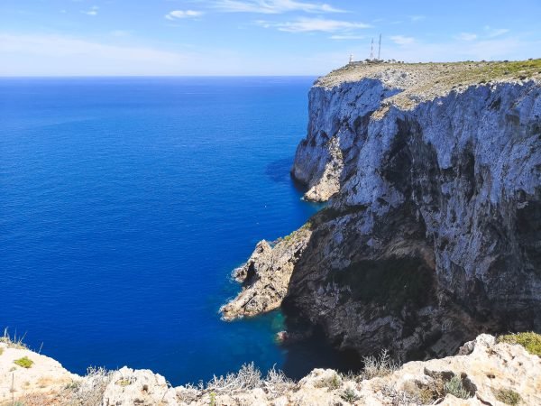
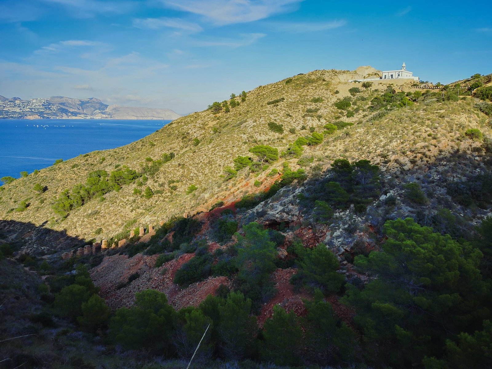
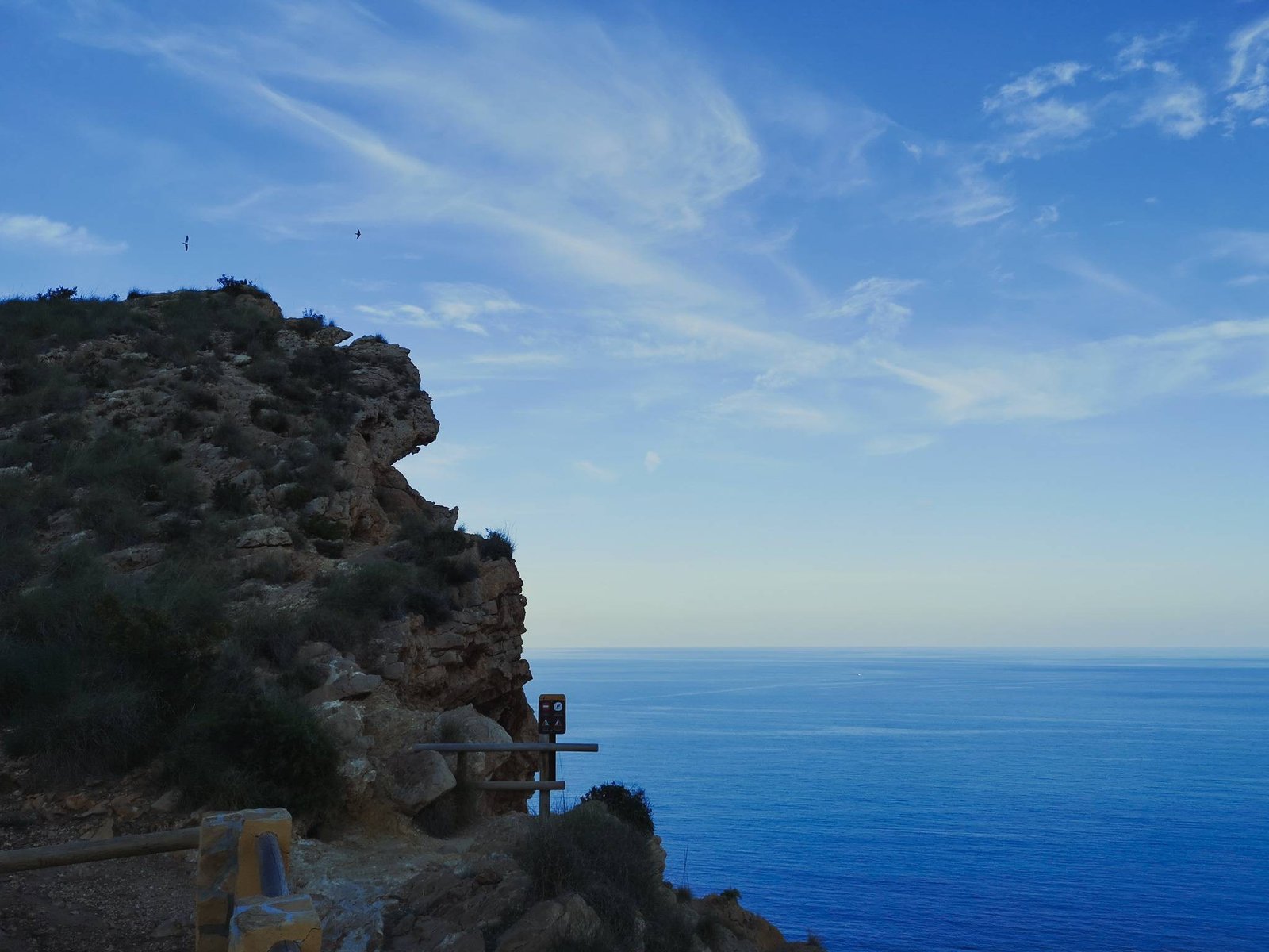
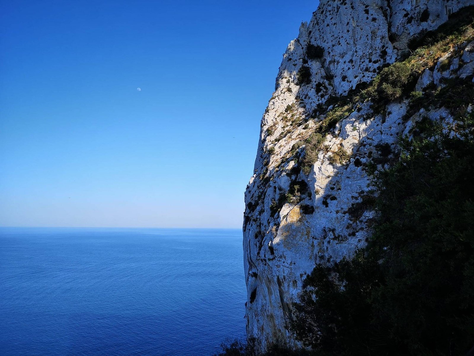
This natural marvel is named after the same saint as a famous city in Texas San Antonio, which is the Spanish name. The most common name – Cap Sant Antoni – is in the local Valenciano language, but it is also known in English as Saint Anthony’s Cape or Cape San Antonio, and in Spanish: Cabo San Antonio). In case you get confused it is all the same thing. The good part, as I said, everything else is simple, especially, getting good vistas with little to no effort. Though some cliffs of the Cape rise about 150 m / 500 ft above the sea level, the Cape is very flat. Walking here is a breeze, especially if you start hiking from one of the parking spaces on top of Cap de Sant Antoni.
Cap de Sant Antoni Details
Location: Spain
Region: Valencia
Main hub: Javea & Denia
Distance from Alicante: 90km / 55.92mi
Distance from Valencia: 105km / 65.24mi
Distance from Benidorm: 55km / 34.18mi
Area: 1.1 km² / 0.42 mi²
Lat/Lon: 38°47’30″N 0°11’41”E
Highest point: Cap de Sant Antoni (170 m / 557 ft)
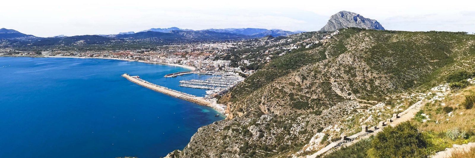
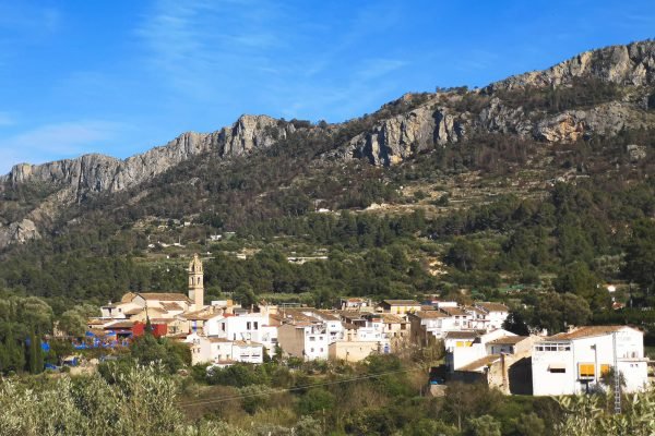
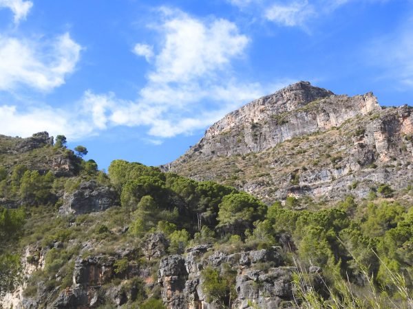
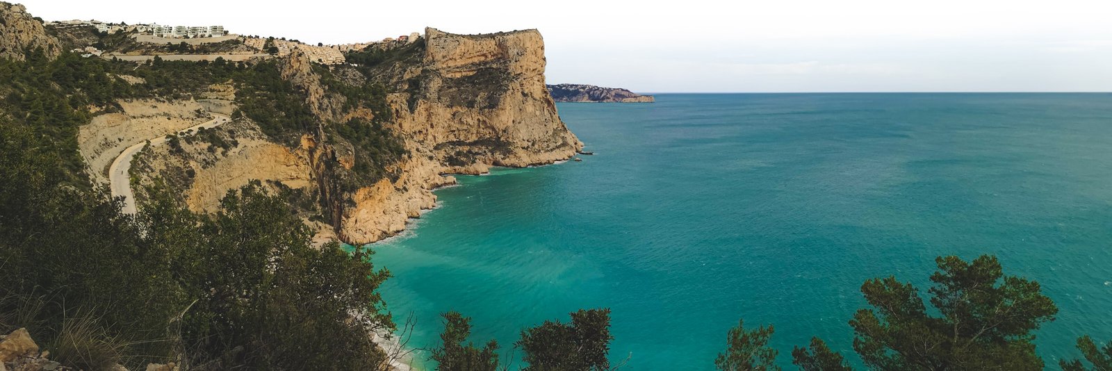
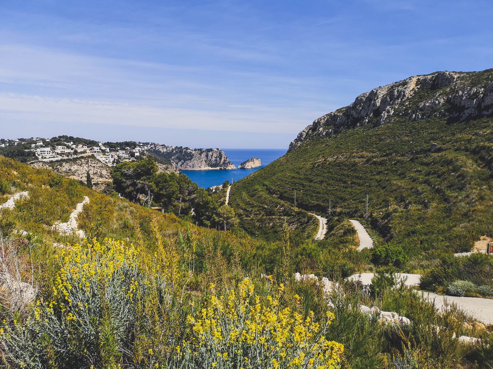
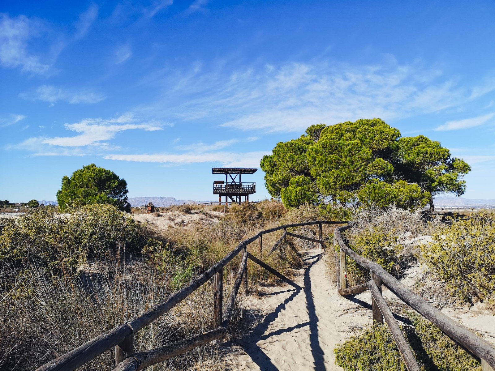
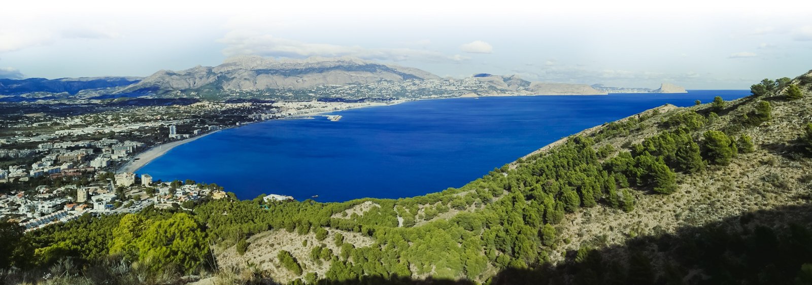
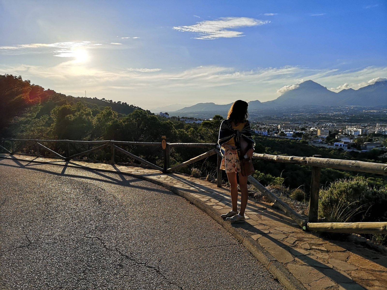
Situated on the plateau of Cap de San Antoni, this circular hike suits almost everyone. Given the easy access via Denia-Javea CV-736, it offers almost free exceptional vistas that would otherwise require a steep climb. Molins Circular Hike offers amazing views towards both sides of the cape, with its crown jewel being the mesmerizing view towards Javea from the windmill area.
Pro tip: Make a small detour on Denia’s side to a beautiful viewpoint: Mirador del Cuni.
Hike Details
Distance: 5.5km / 3.4mi
Duration: 1h30-2h00
Difficulty: Easy
Color: Yellow
Type: Circular
Route: Aparcamiento Merendero – Mirador del Cuni – Els Molins – Santuario de Nuestra Señora de los Ángeles
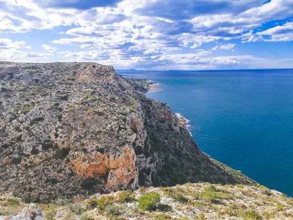
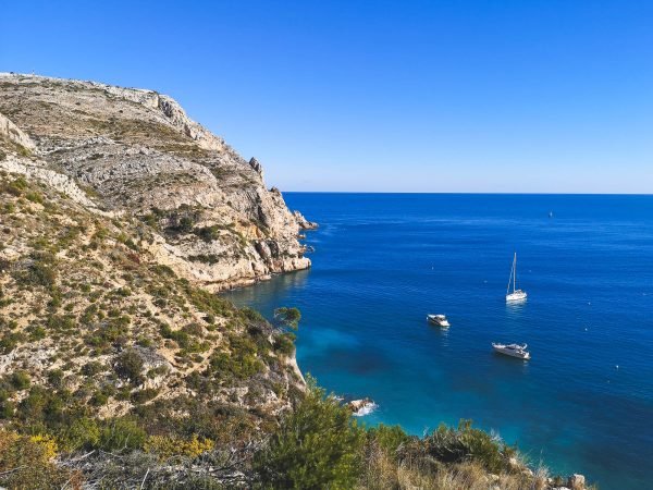
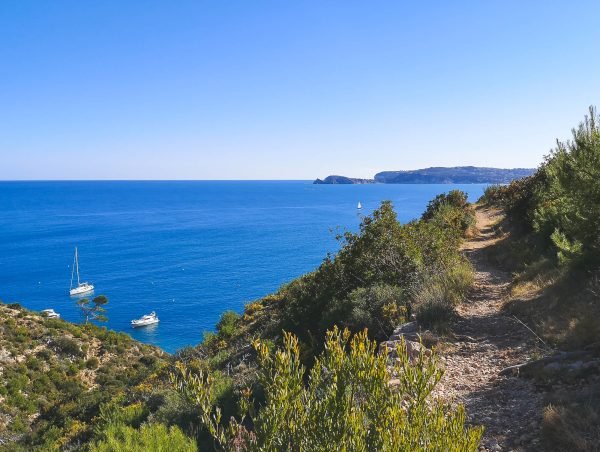
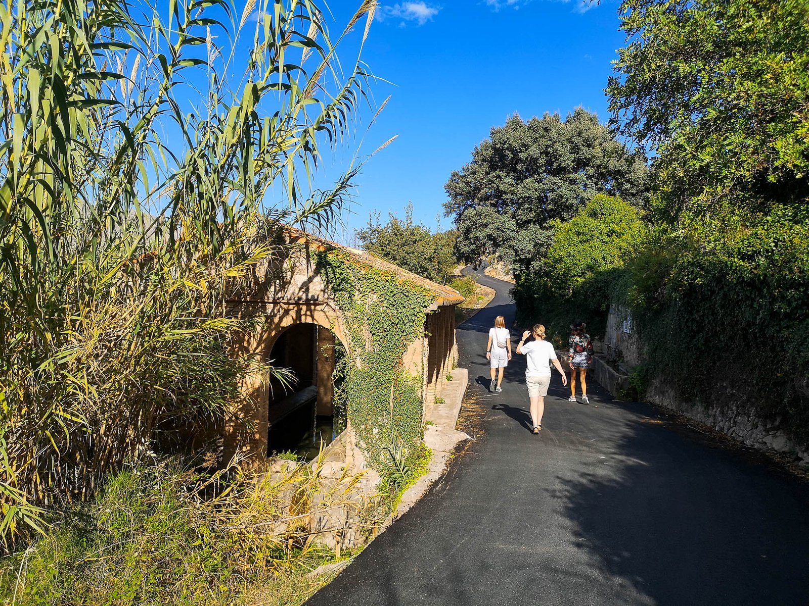
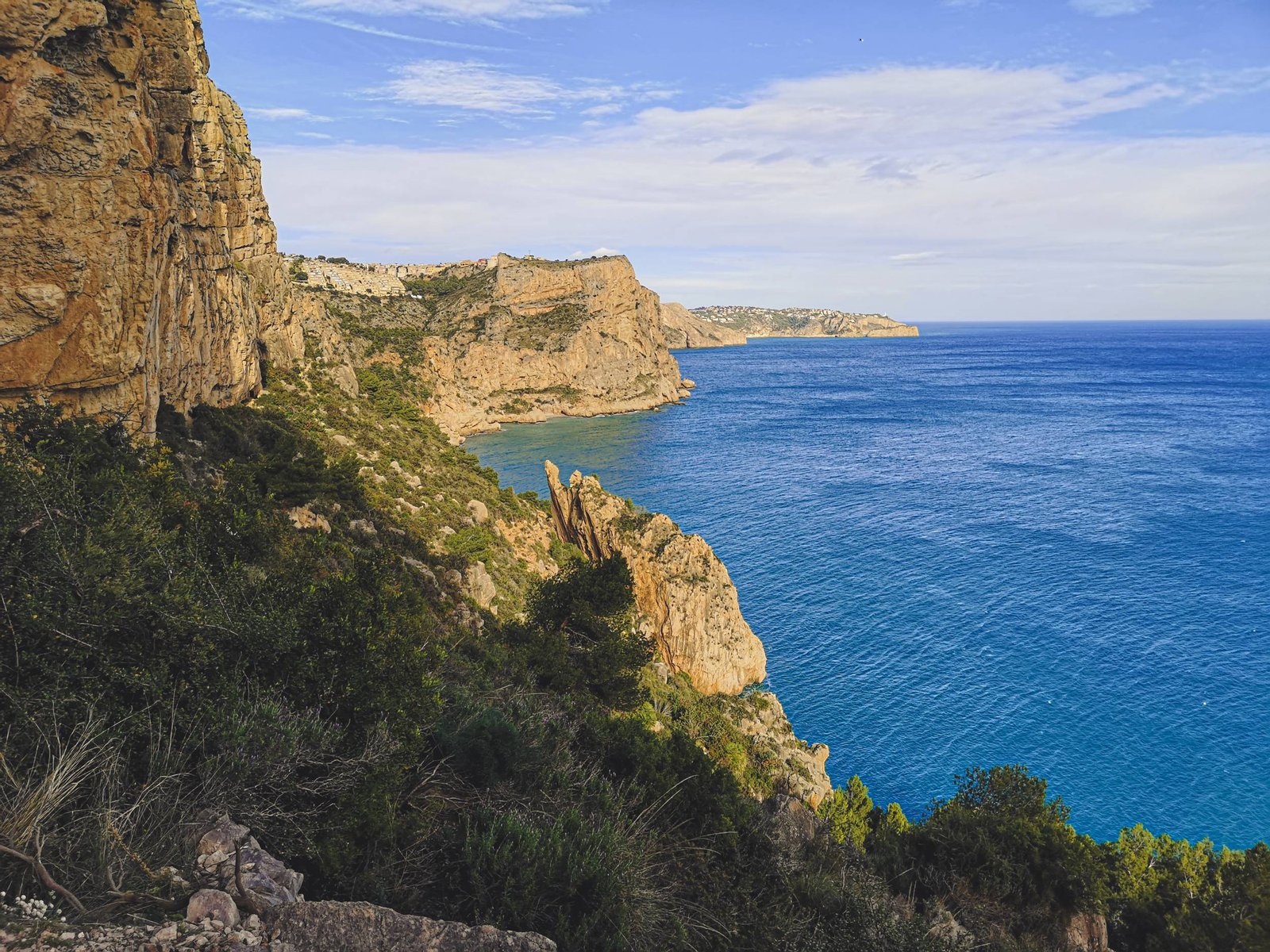
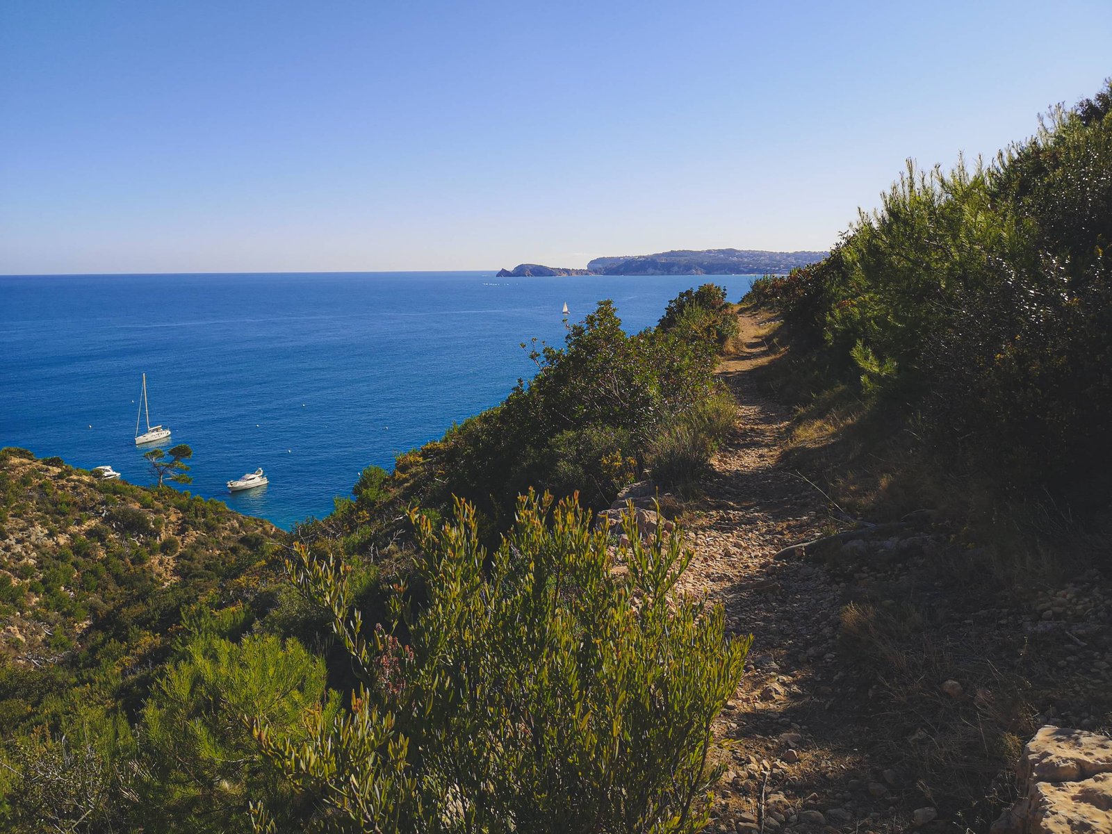
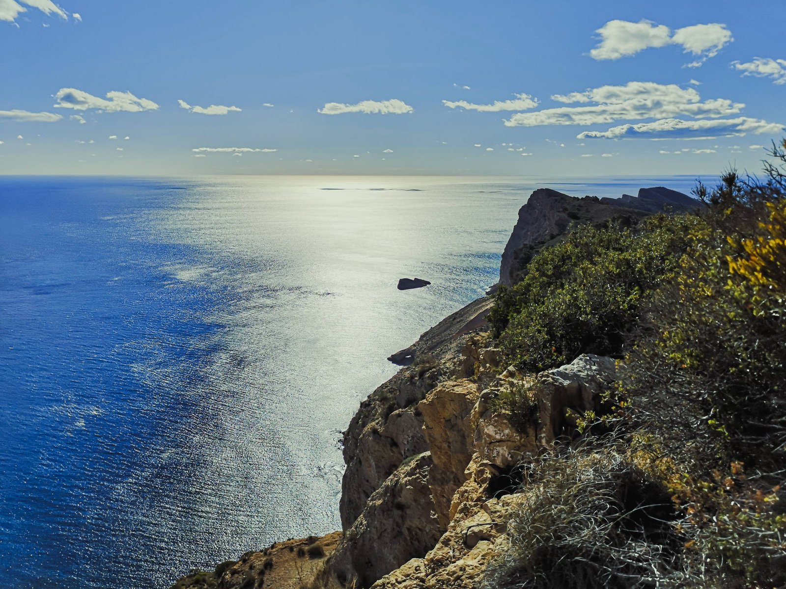
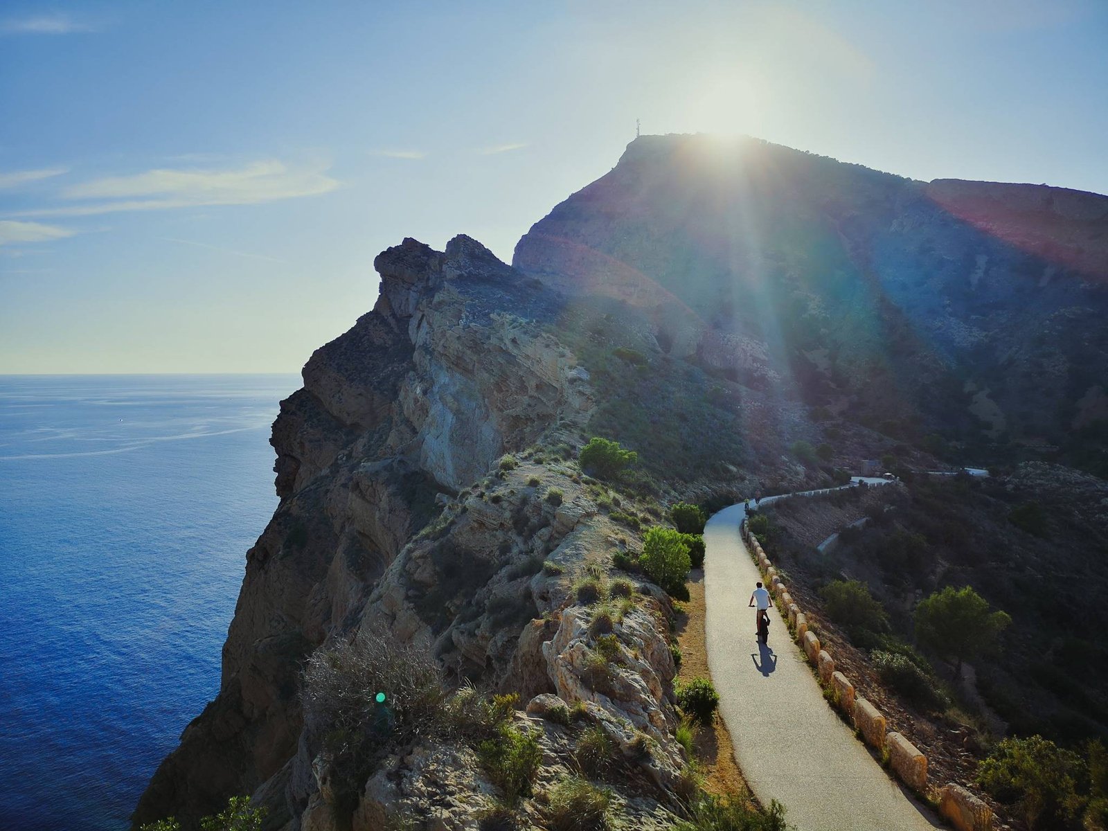
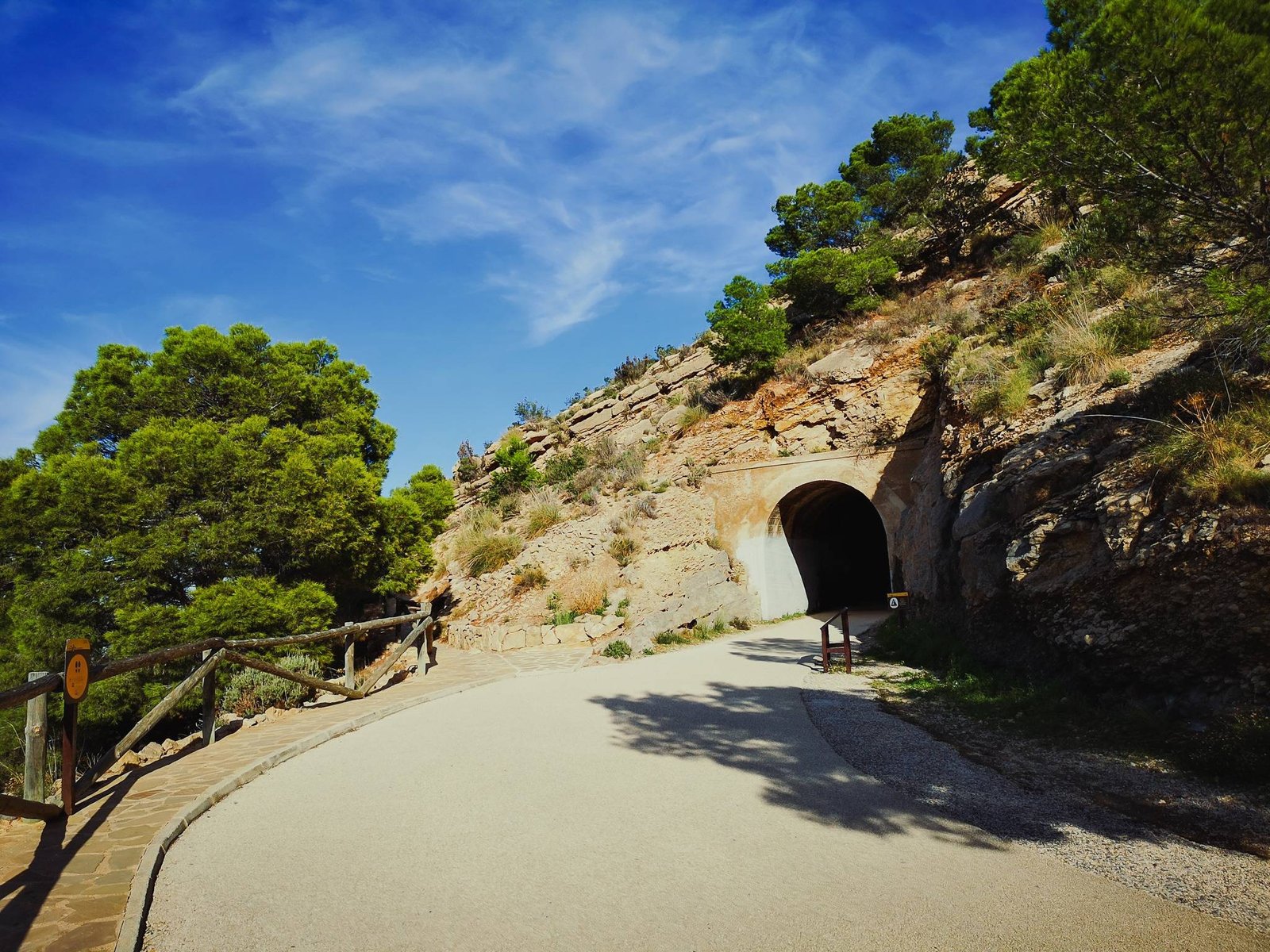
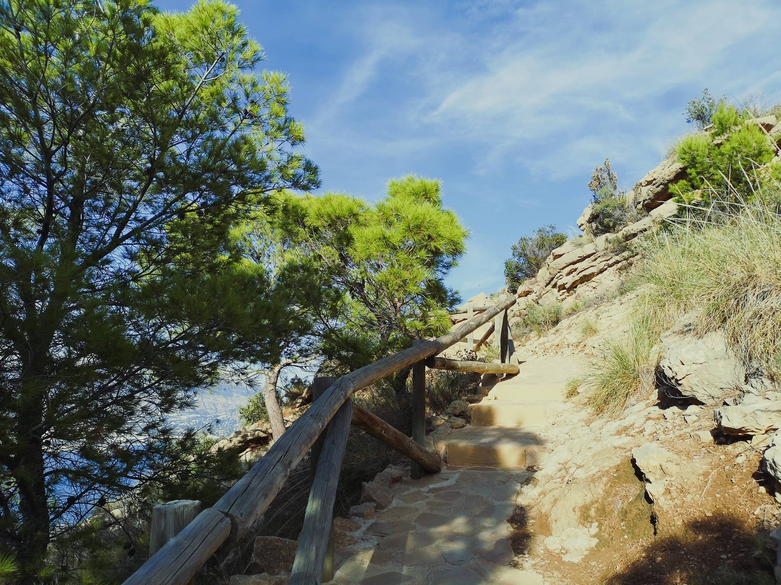
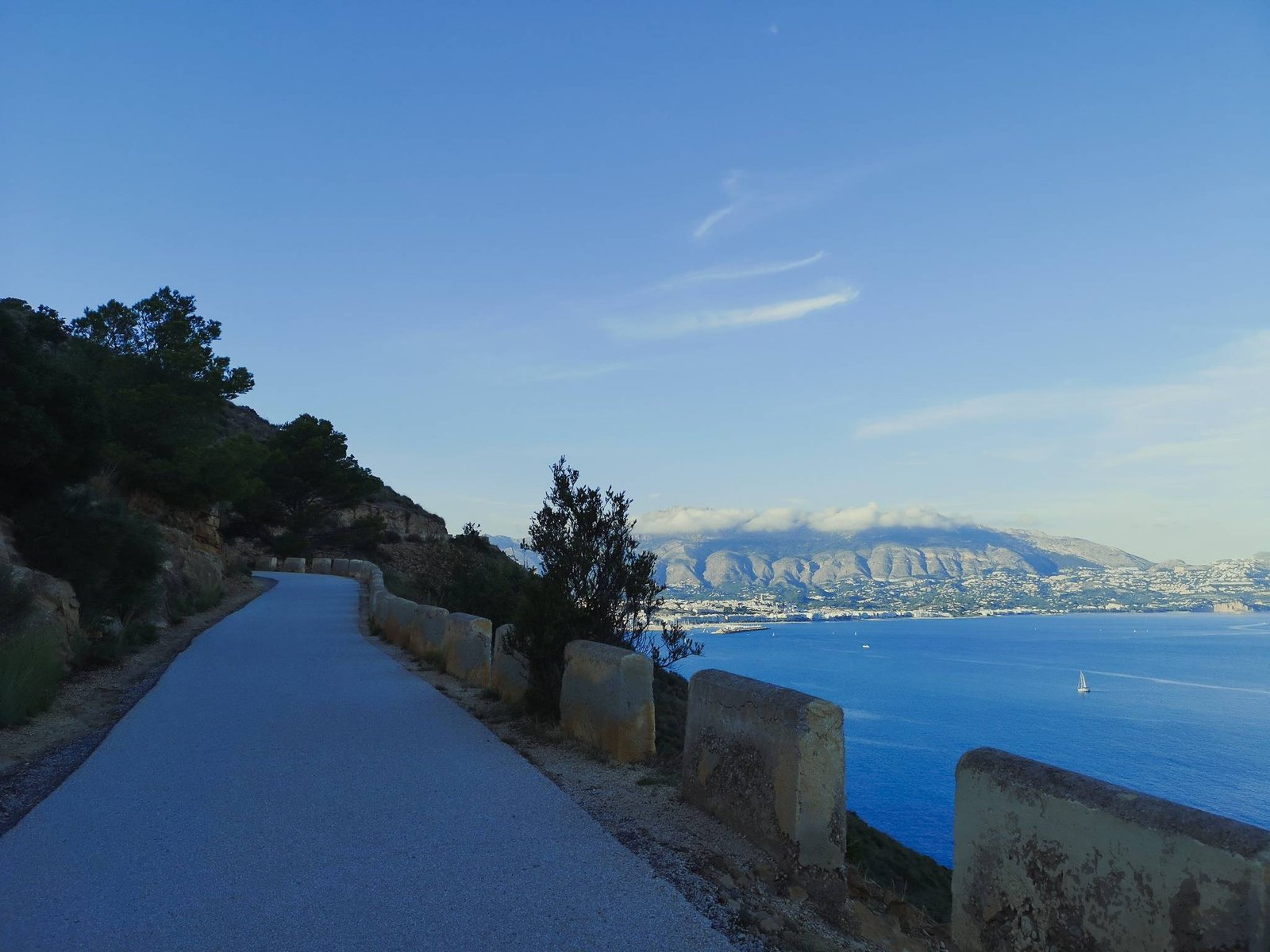
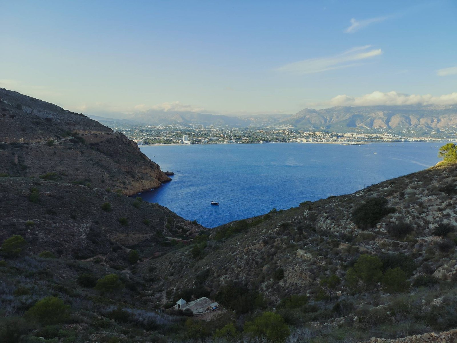
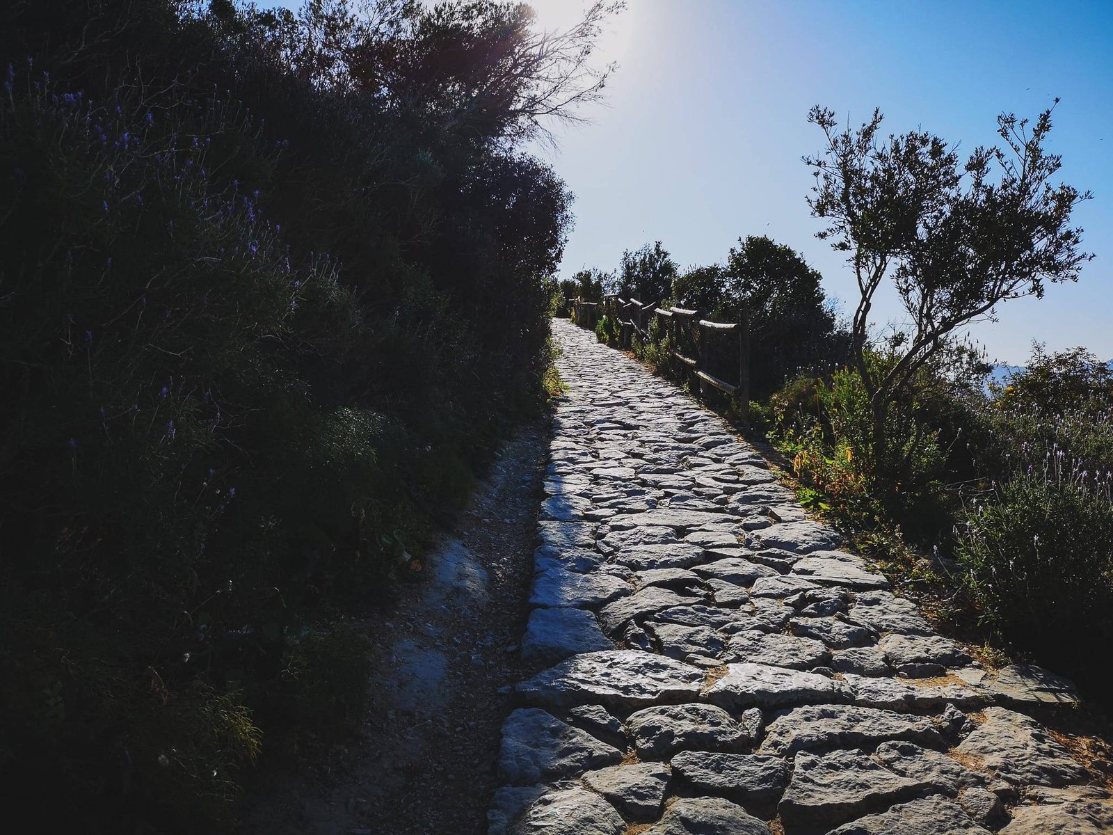
Not really a hiking trail but rather just a section of it, but arguably the best part of it. Especially if you add a little twist to it and walk off the main road to an unnamed viewpoint, which offers the best views of the tip of Cap de Sant Antoni itself I’ve managed to find so far. The quality of the road is not as good as Molins Circular Hike which could be done from the same parking, but it is flat, thus suitable for most of people. If you don’t have much time to explore, this might be the route to make a good impression of what Cap de Sant Antoni has to offer in general.
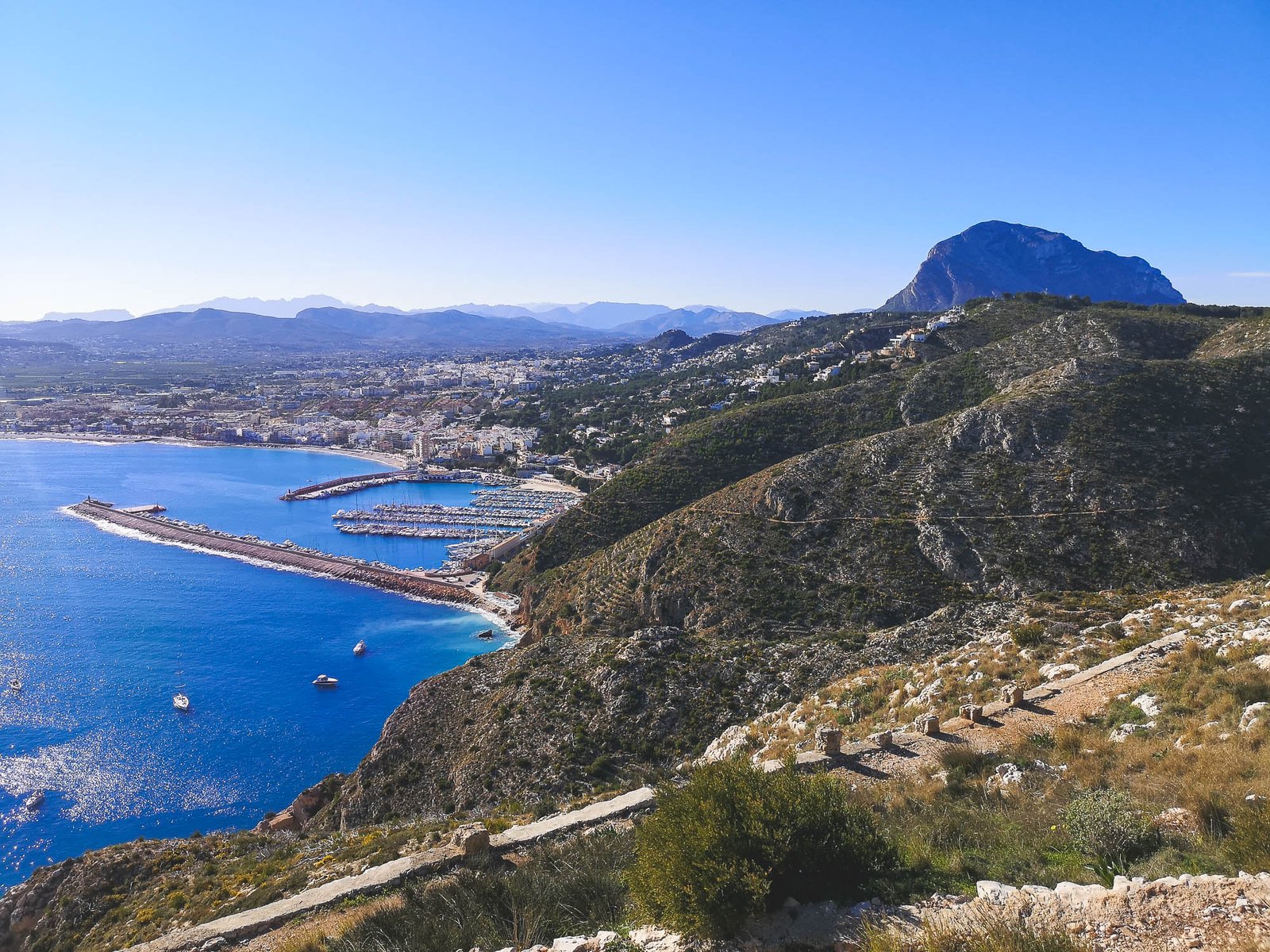
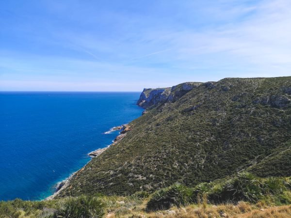
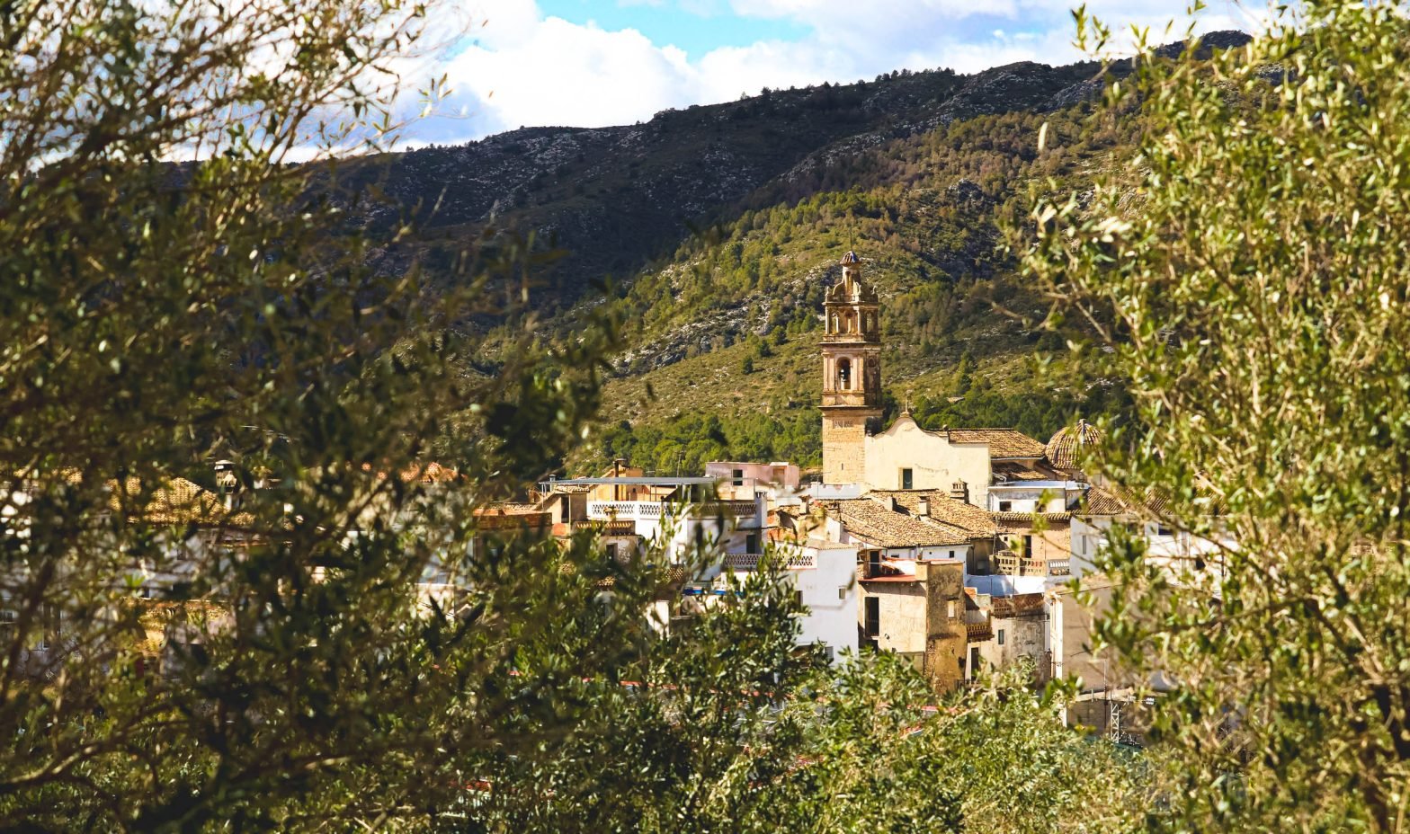
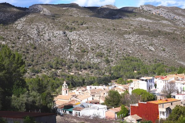
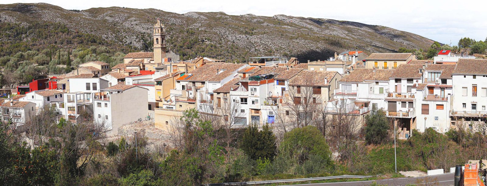
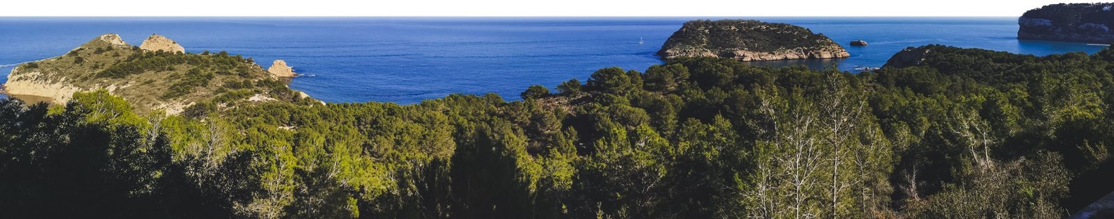
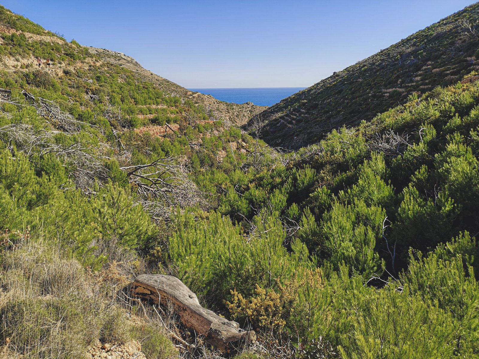
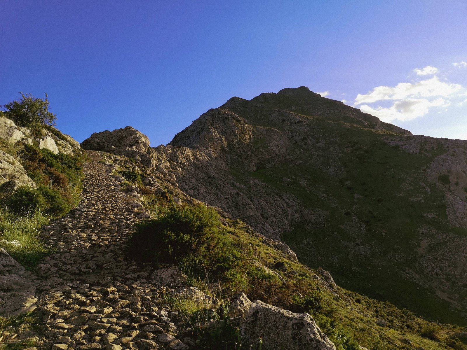
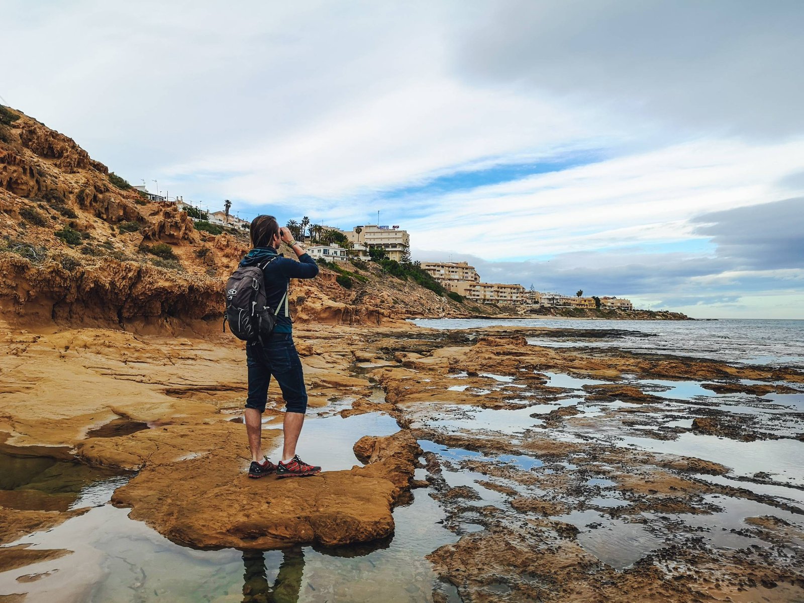
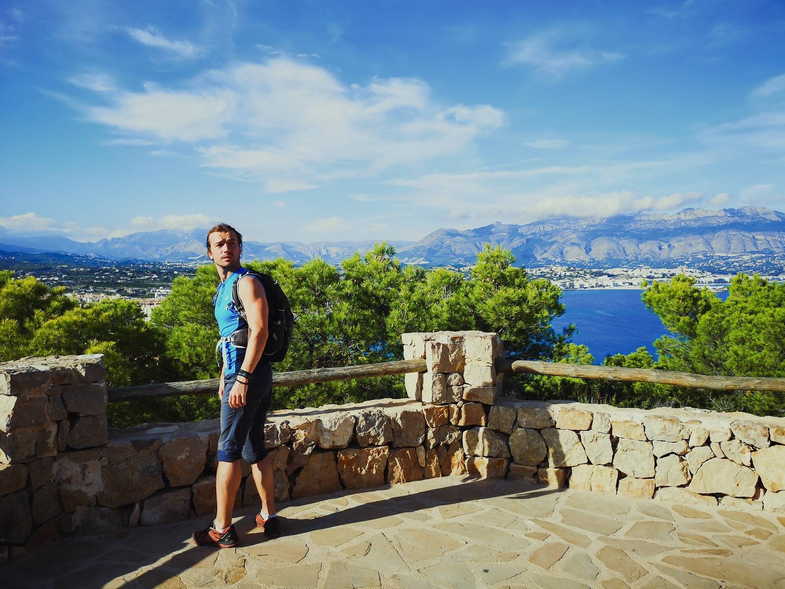
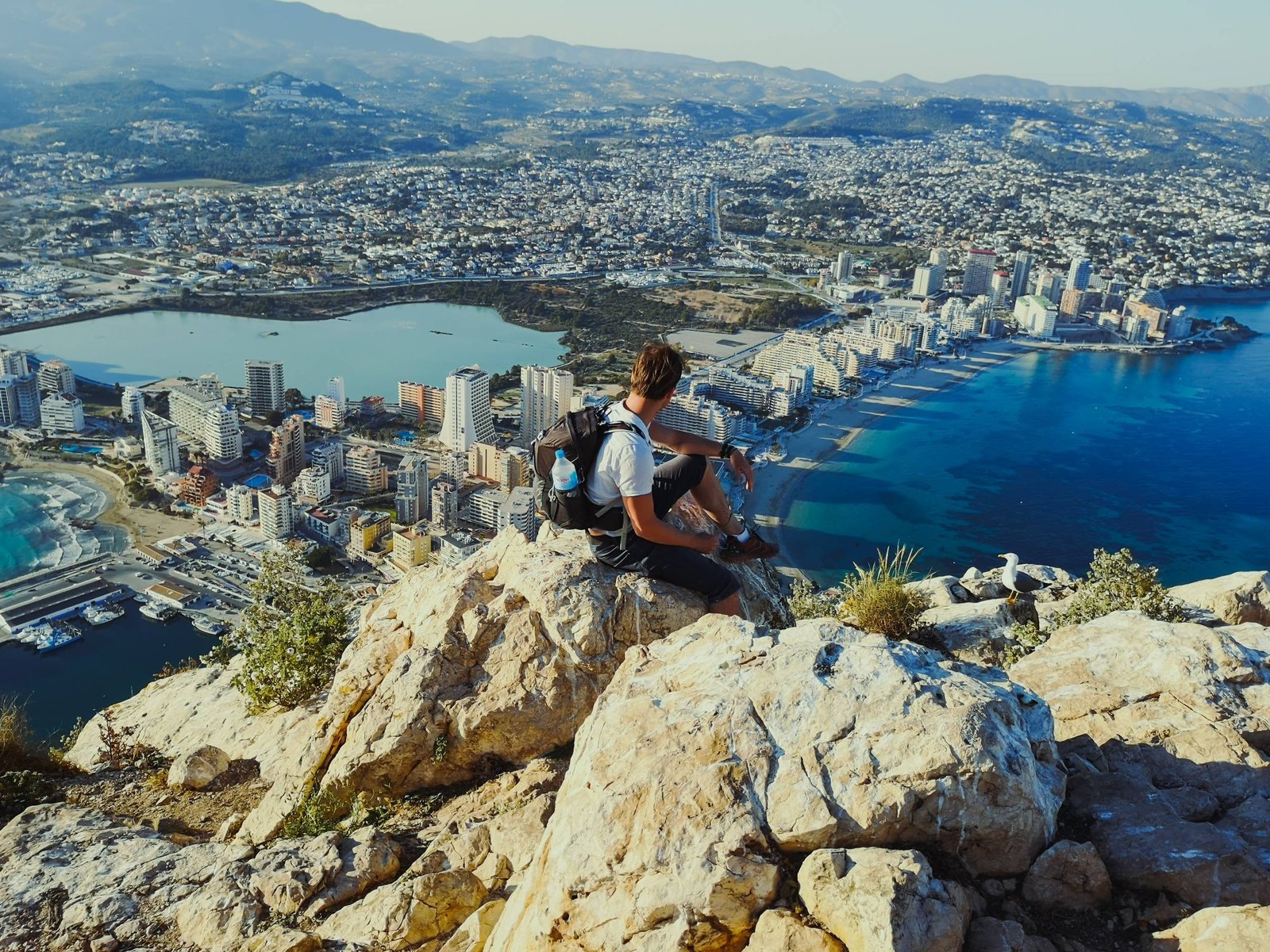
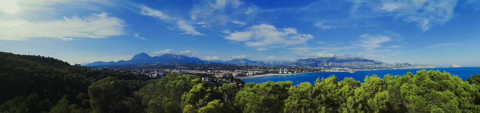
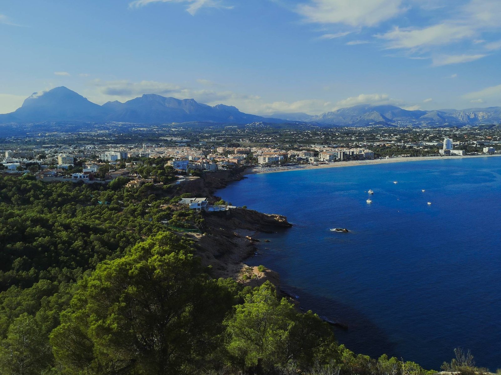
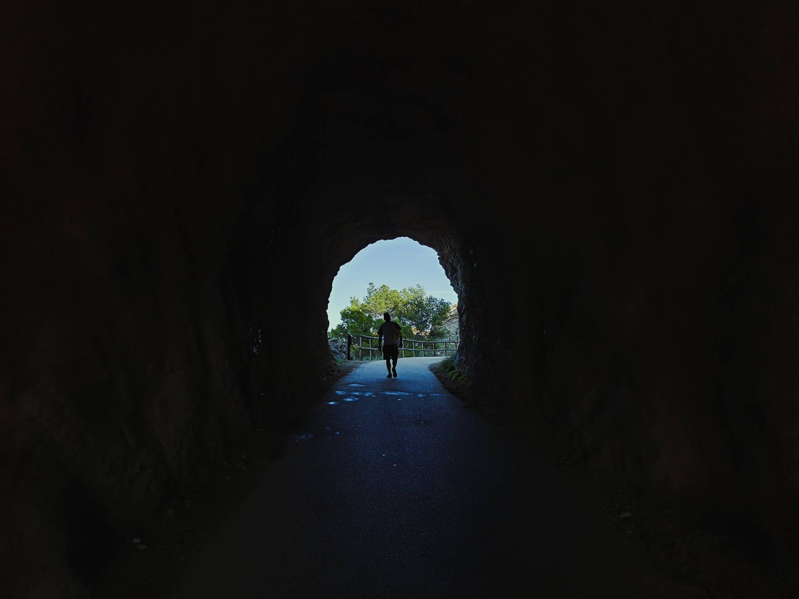
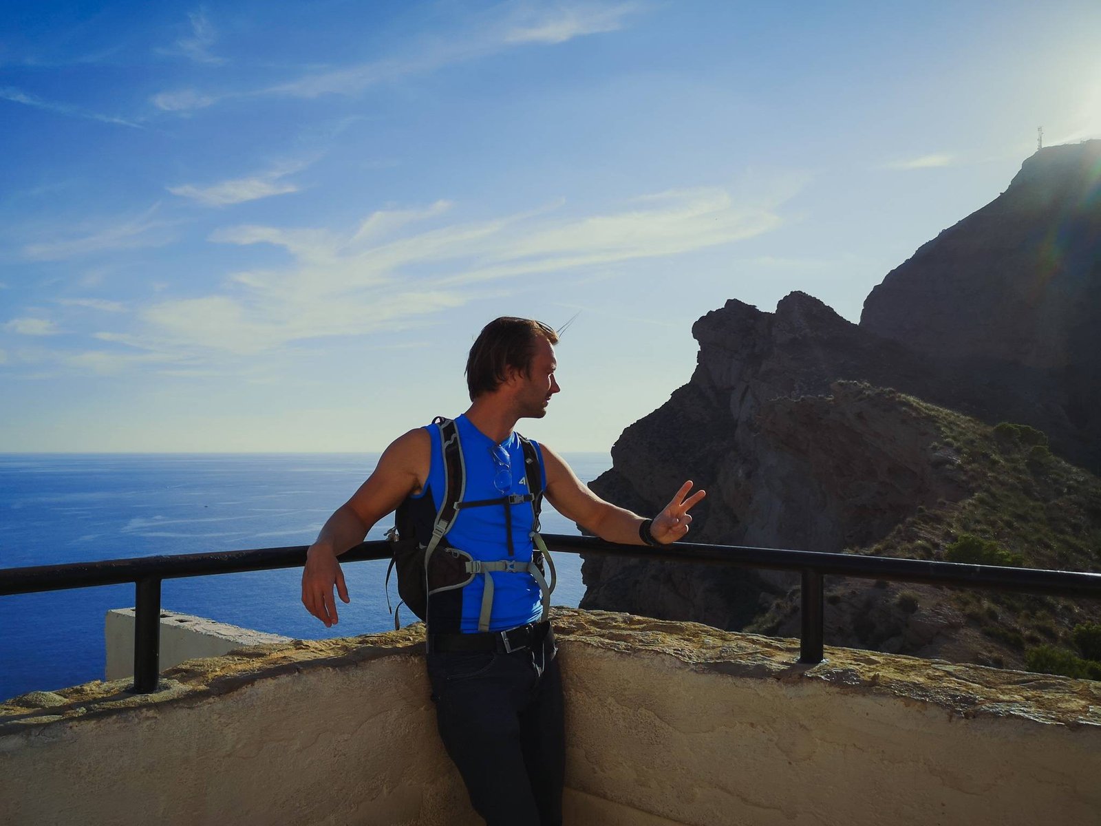
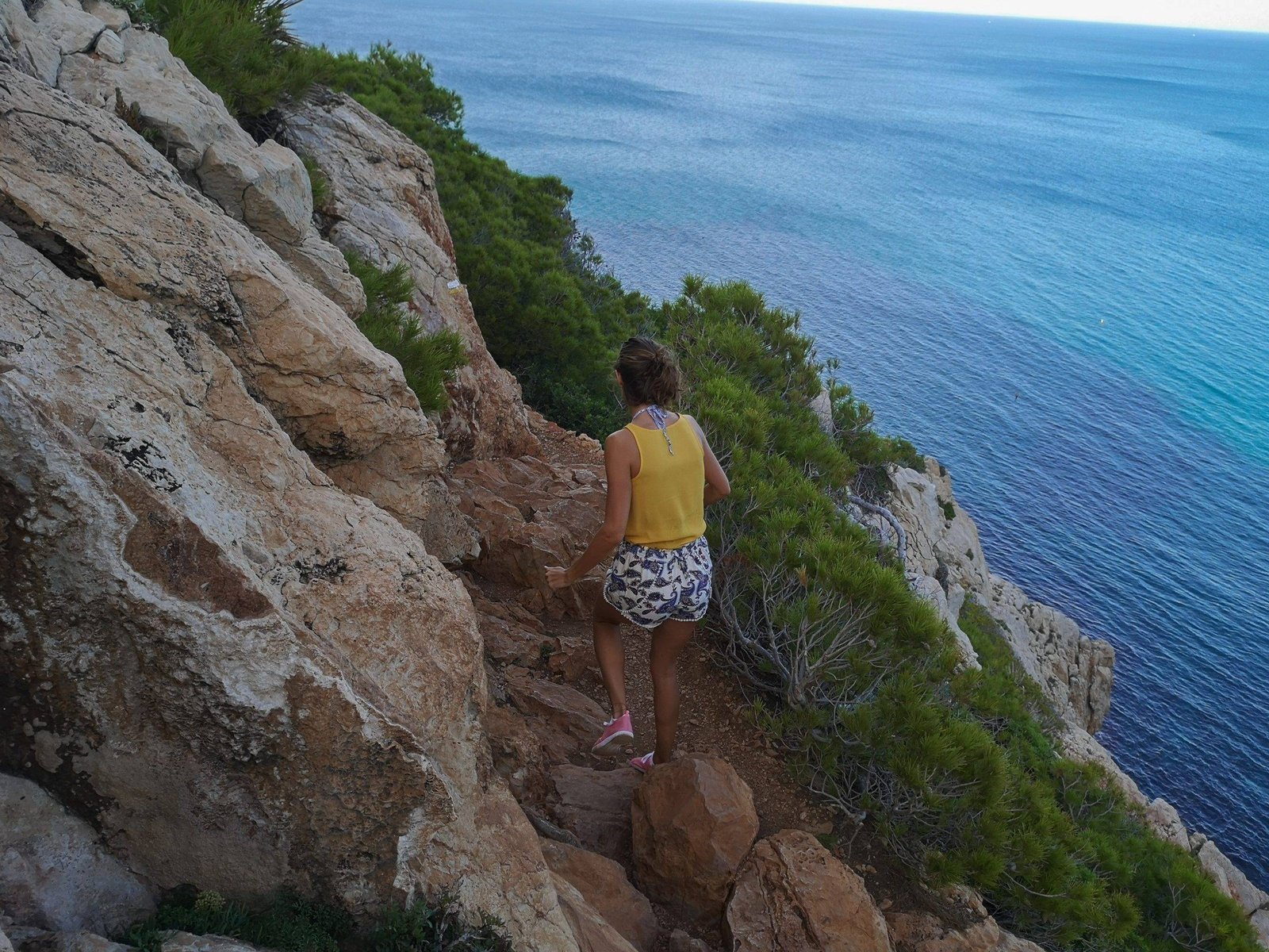
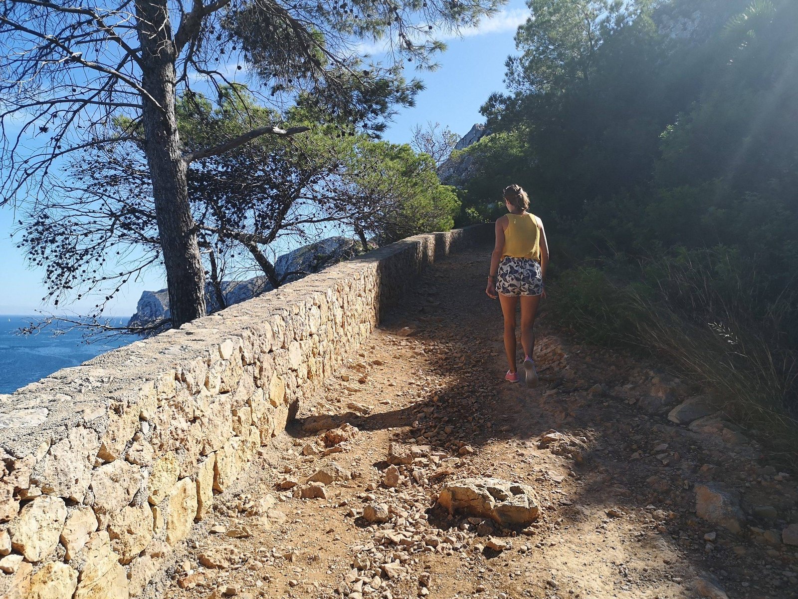
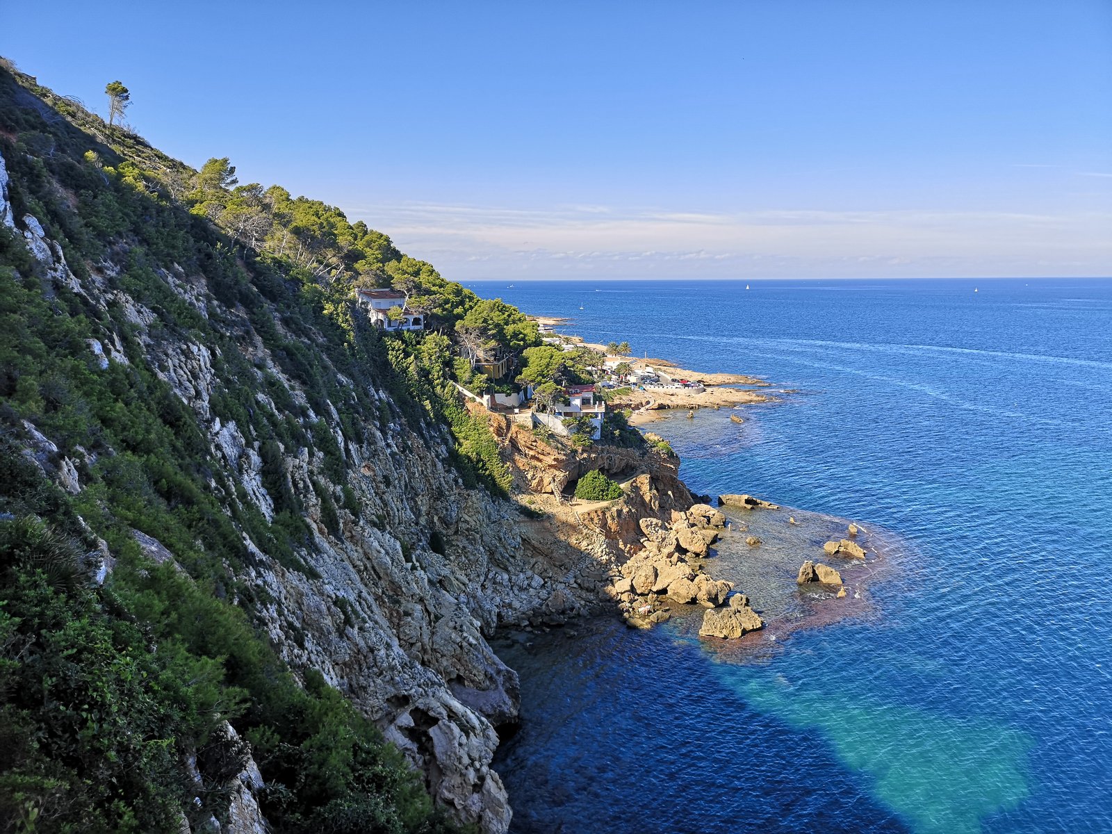
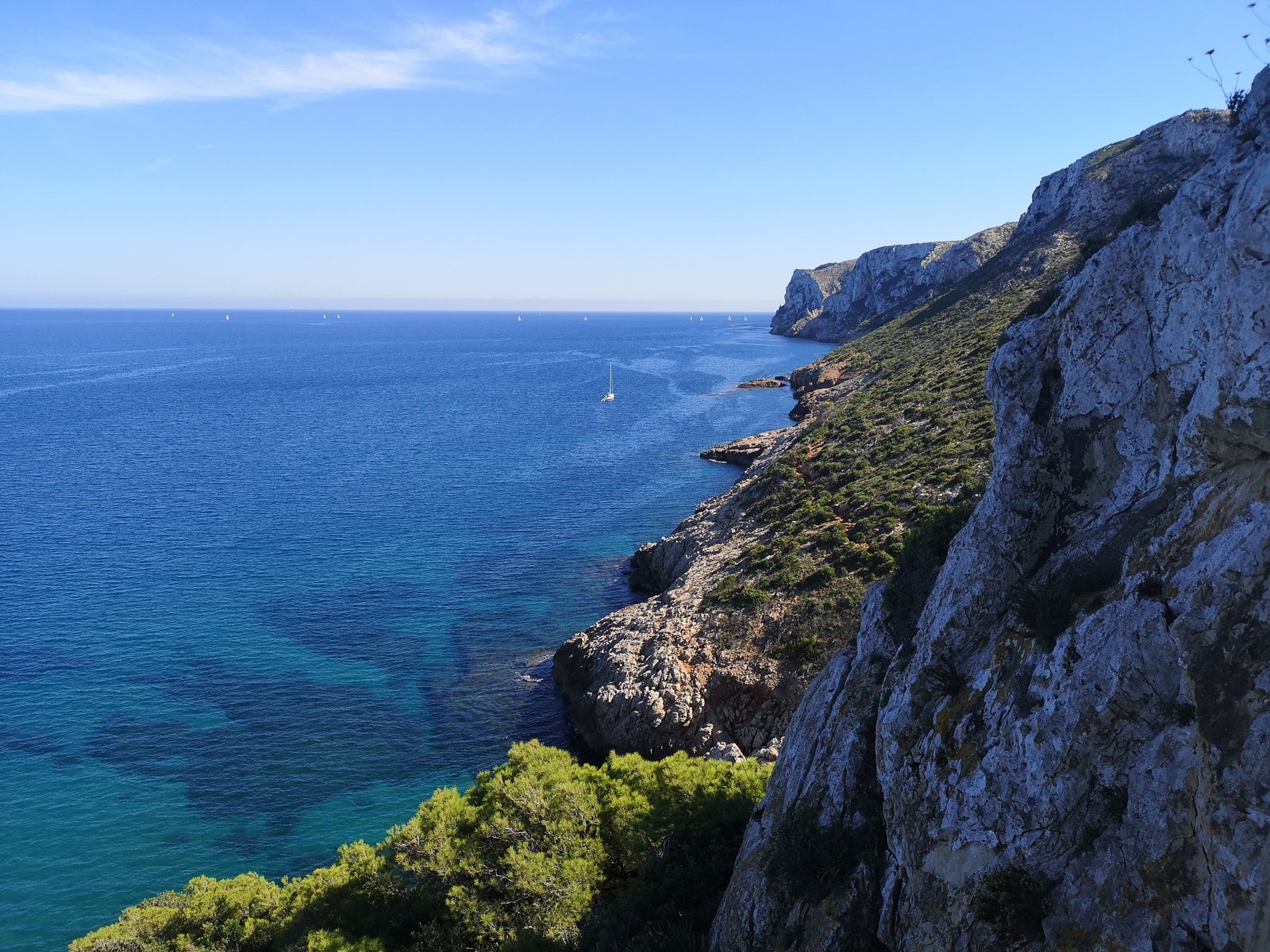
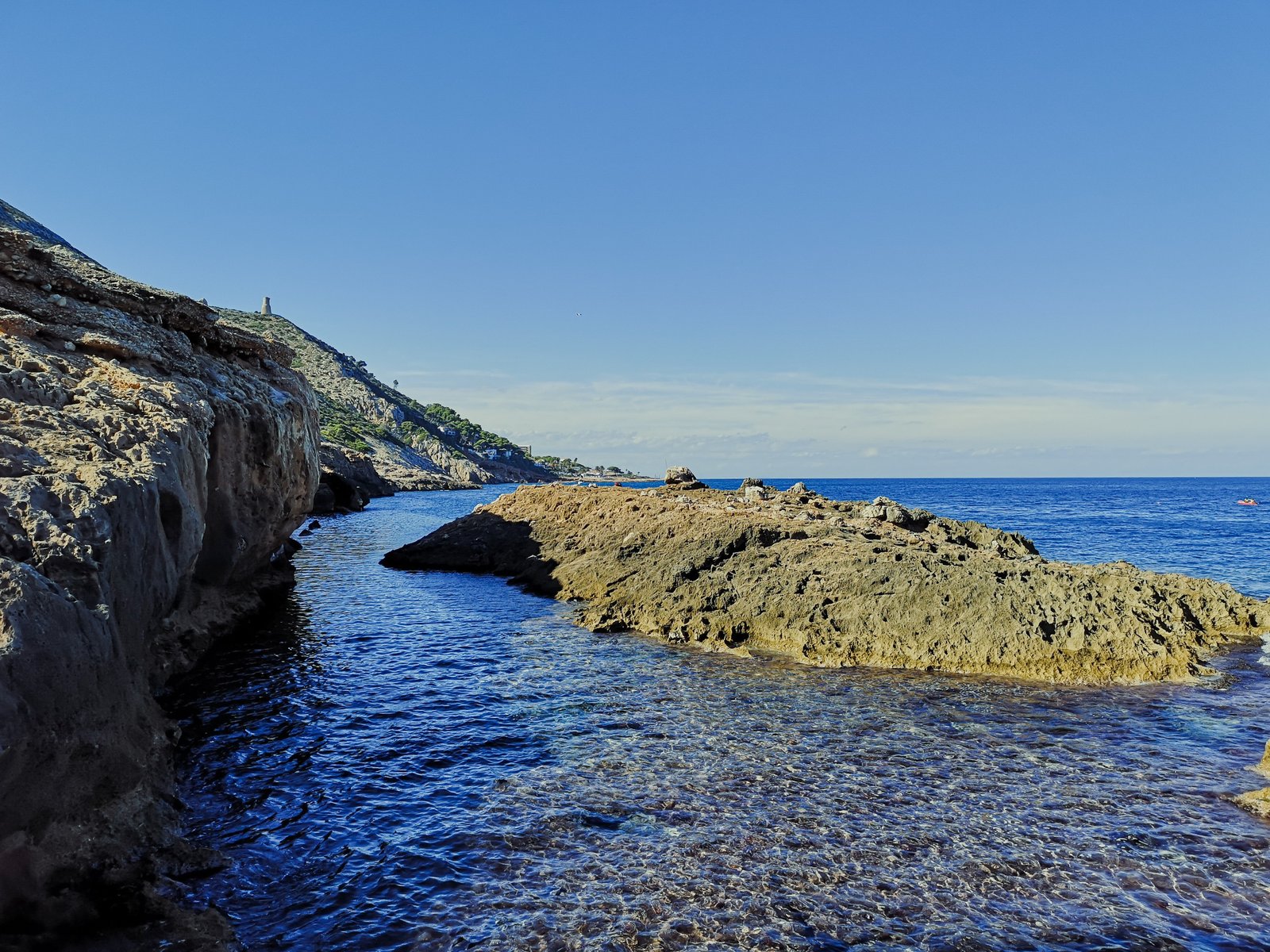
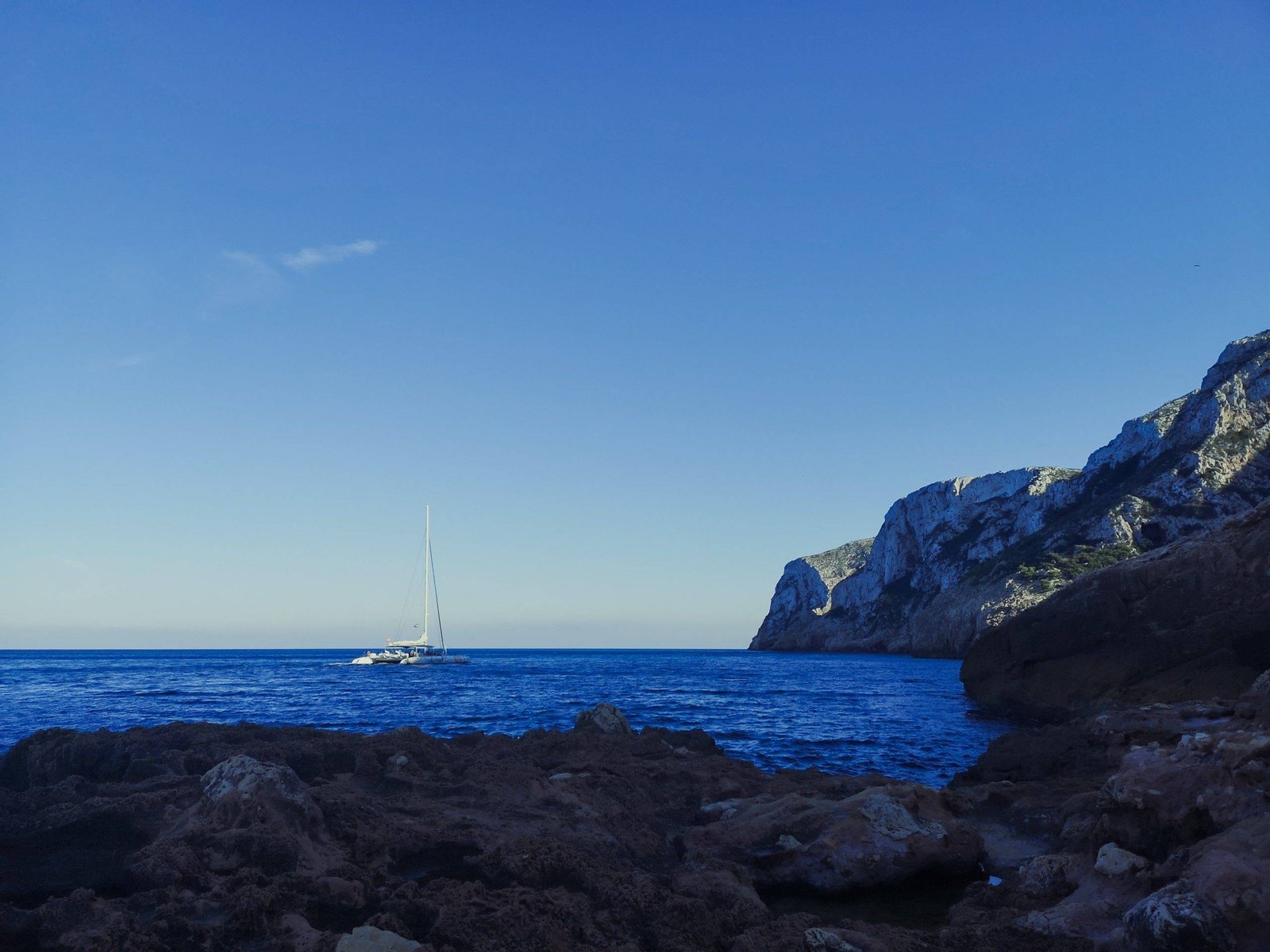
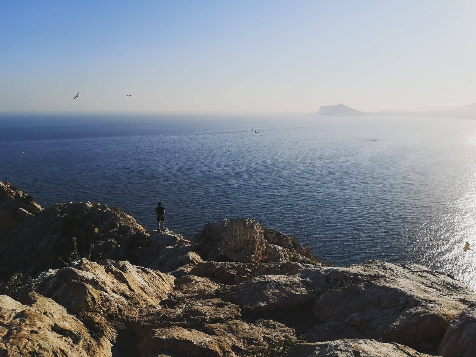
The signature hike of Javea from the port part of the town climbs Cap de Sant Antoni which is, after all, much closer to Javea than it is to Denia. Many locals and visitors of the town climb the cape each day, and so do the large houses of the super-rich living, or, at least, owning properties in otherwise protected areas. Javea missed the opportunity to preserve its side of the cape but luckily the hike goes through the remote untouched section of the last terrain of the Baetic mountains systems before it sinks into the deep sea and remerges again only in the Balearic Islands. Port Javea – Cap de Sant Antoni is a great nature getaway from an otherwise busy area.
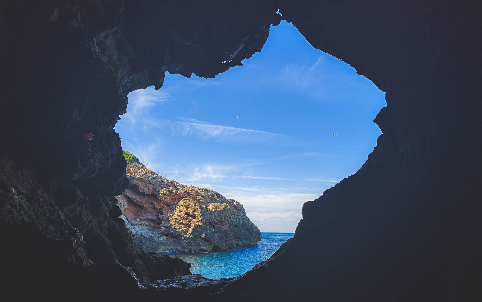
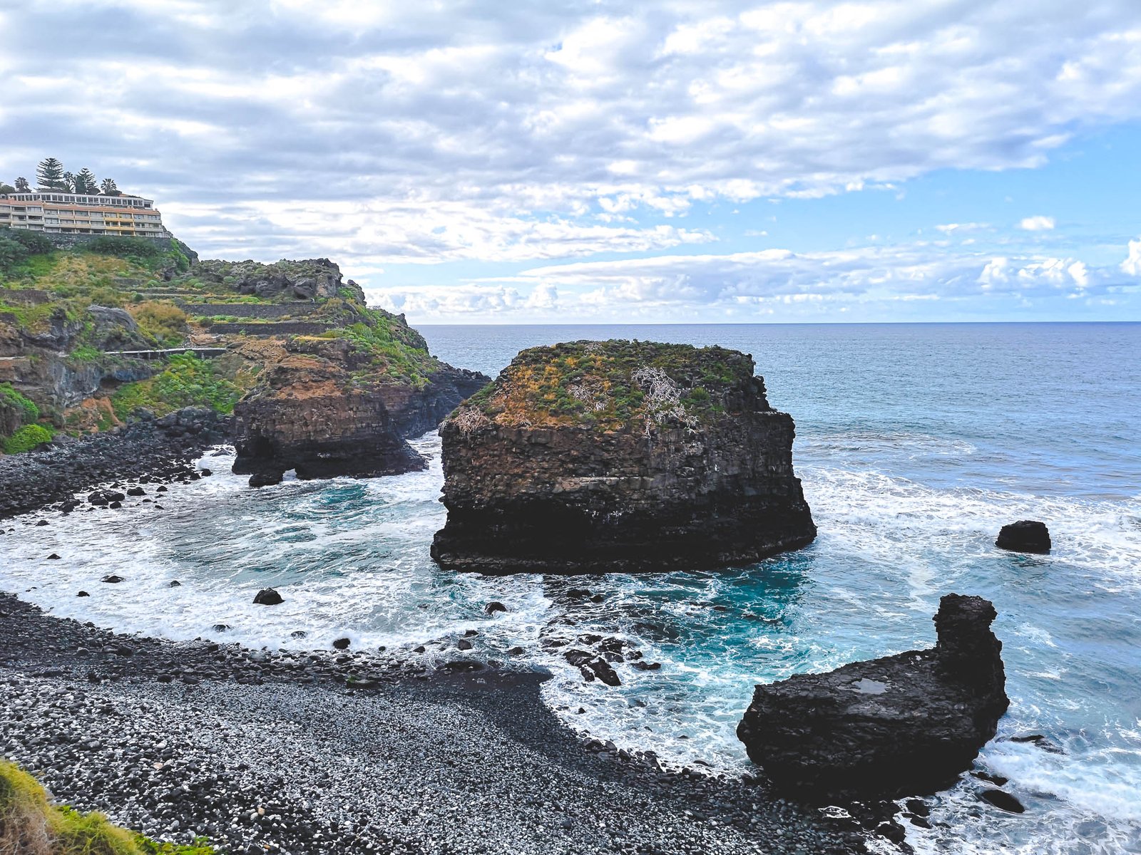
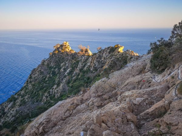
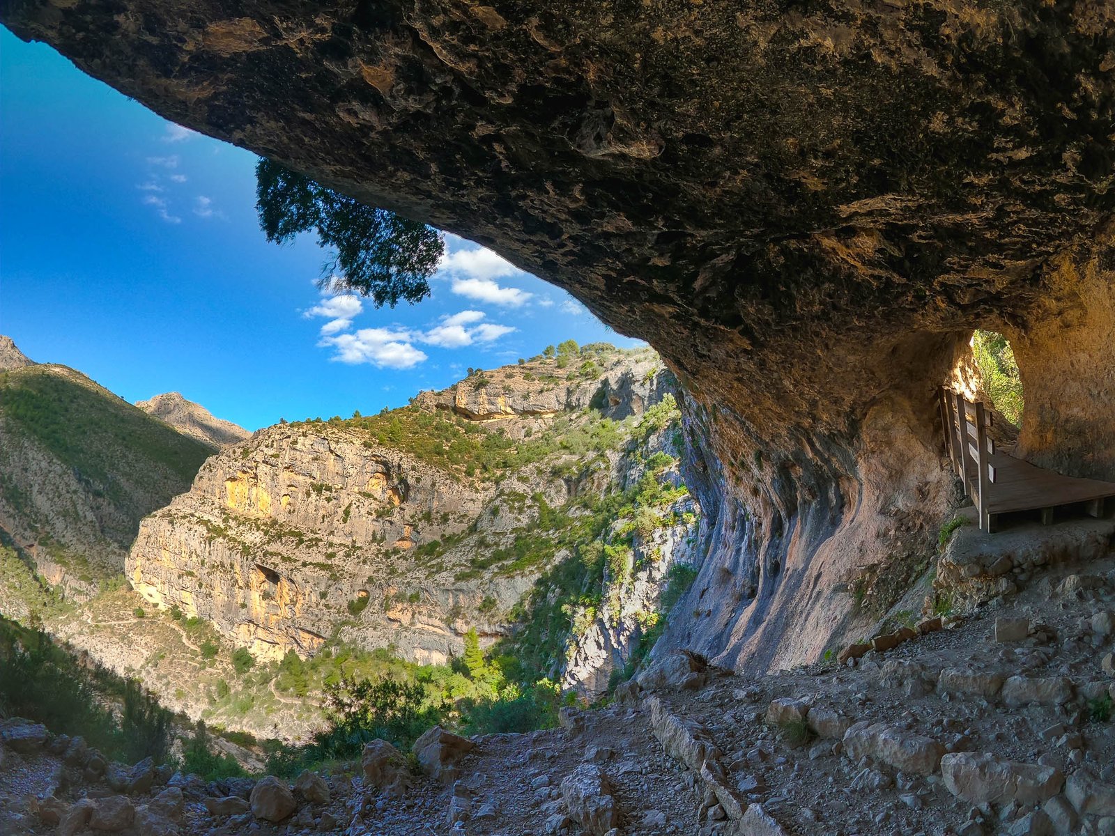
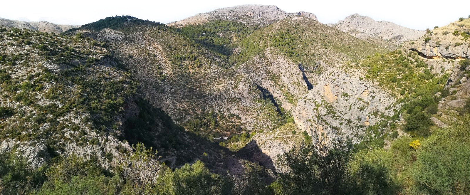
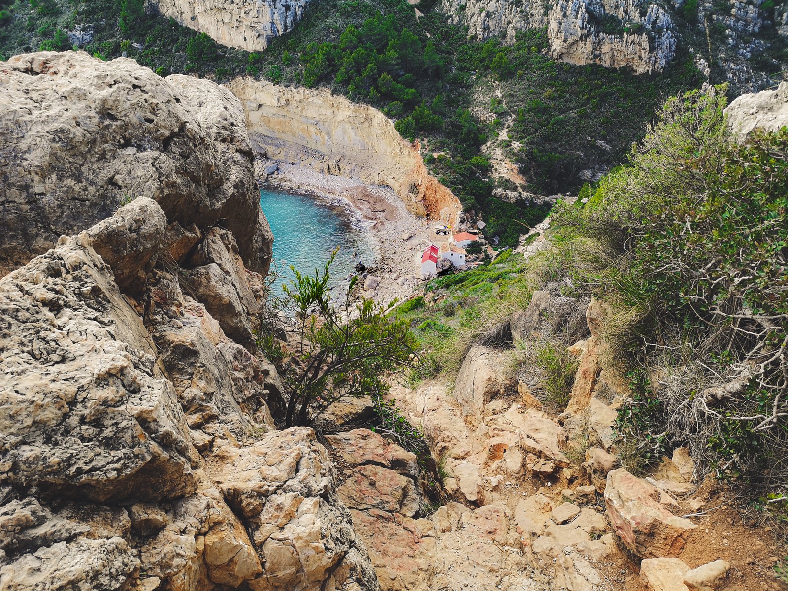
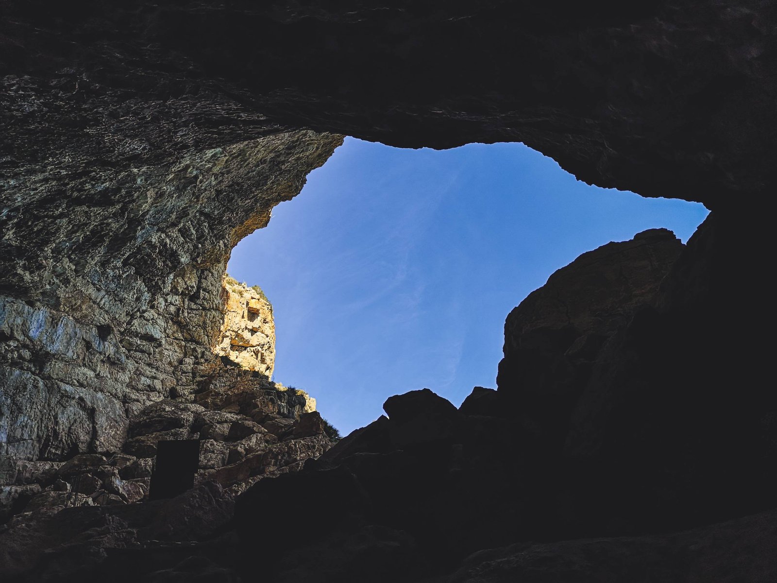
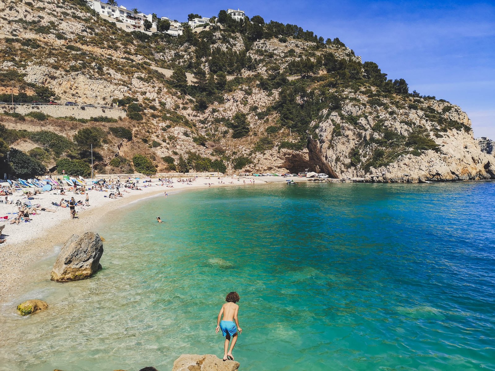
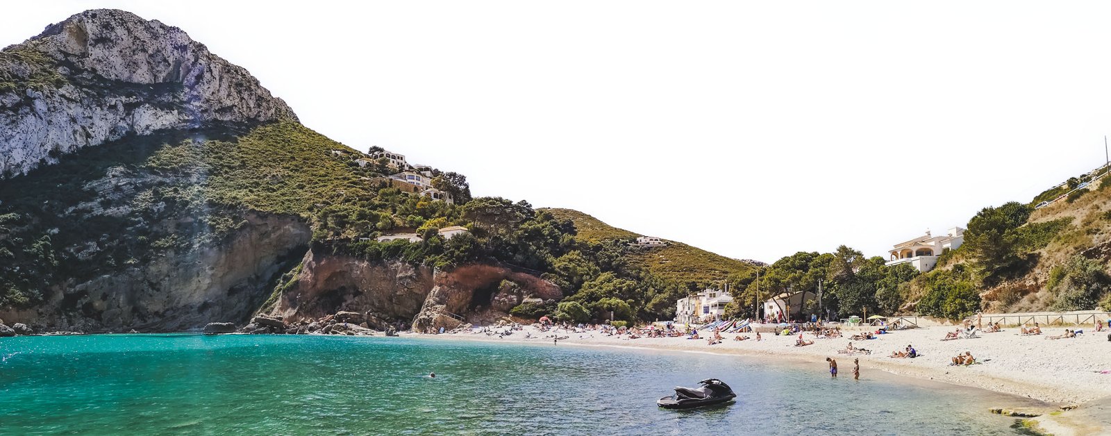
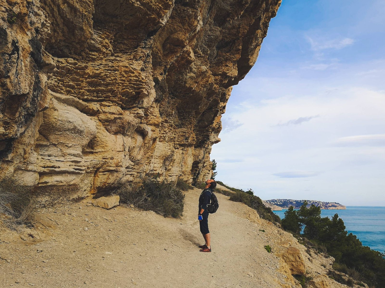
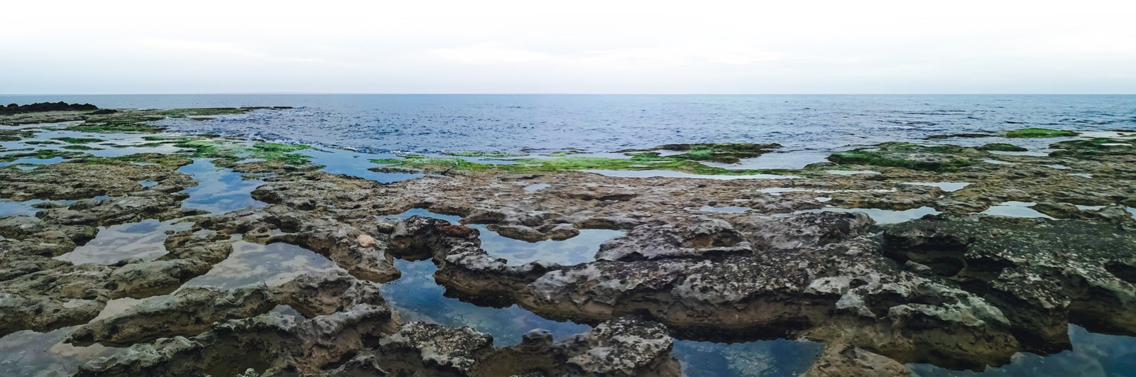
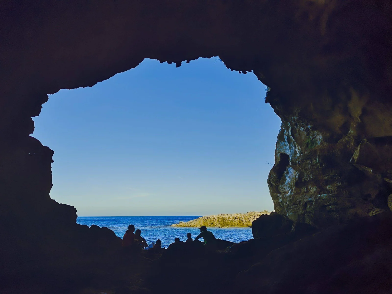
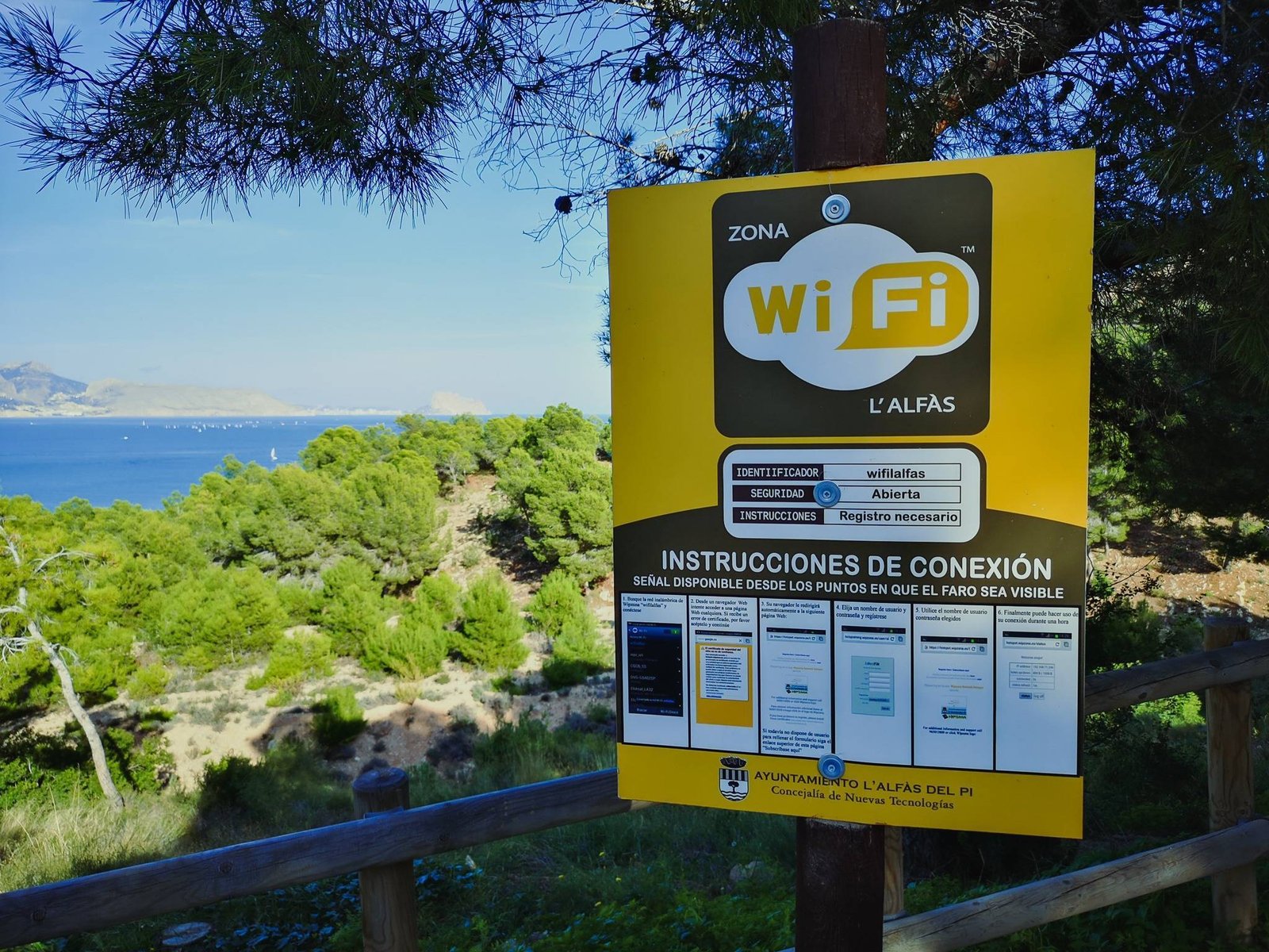
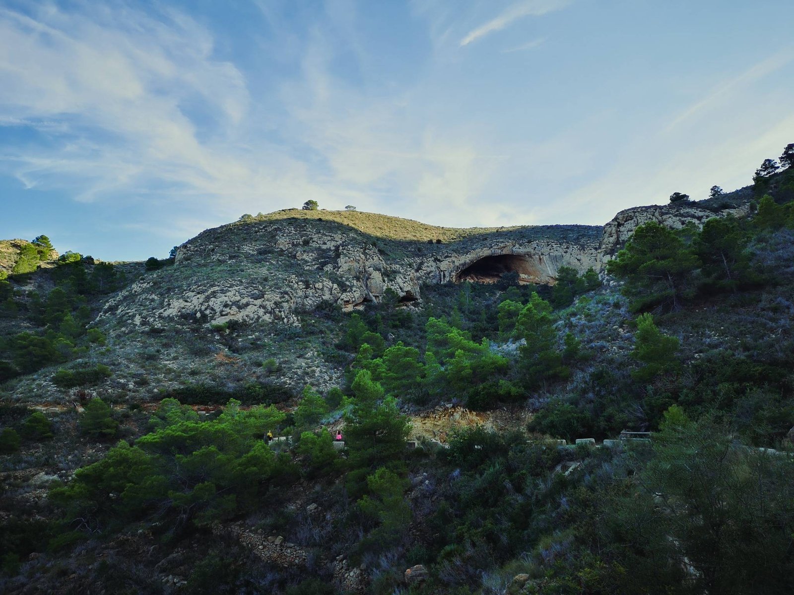
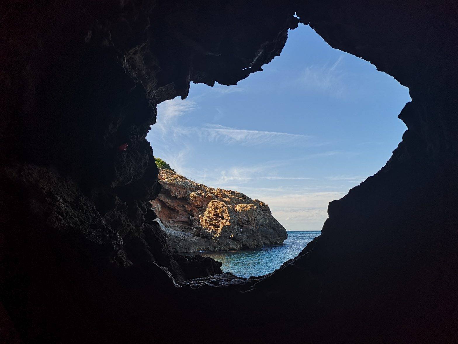
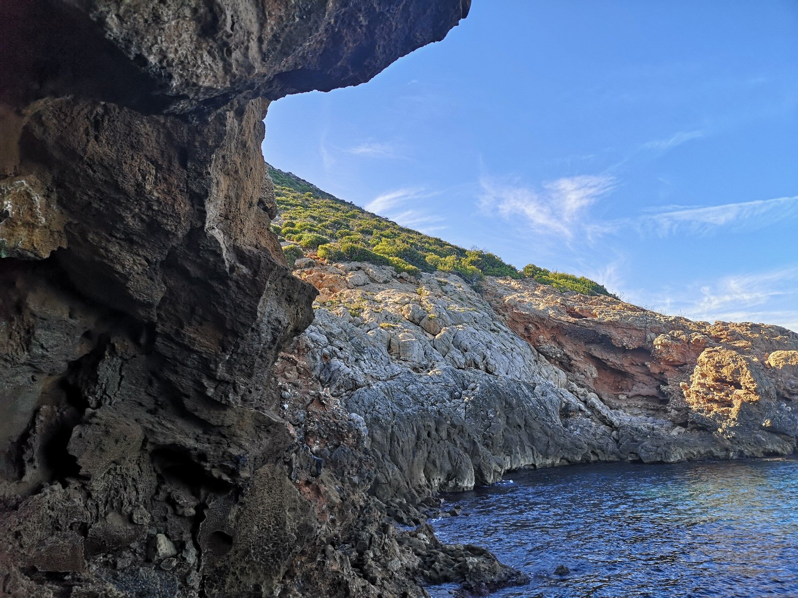
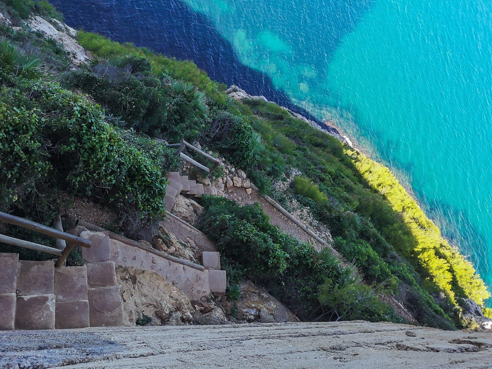
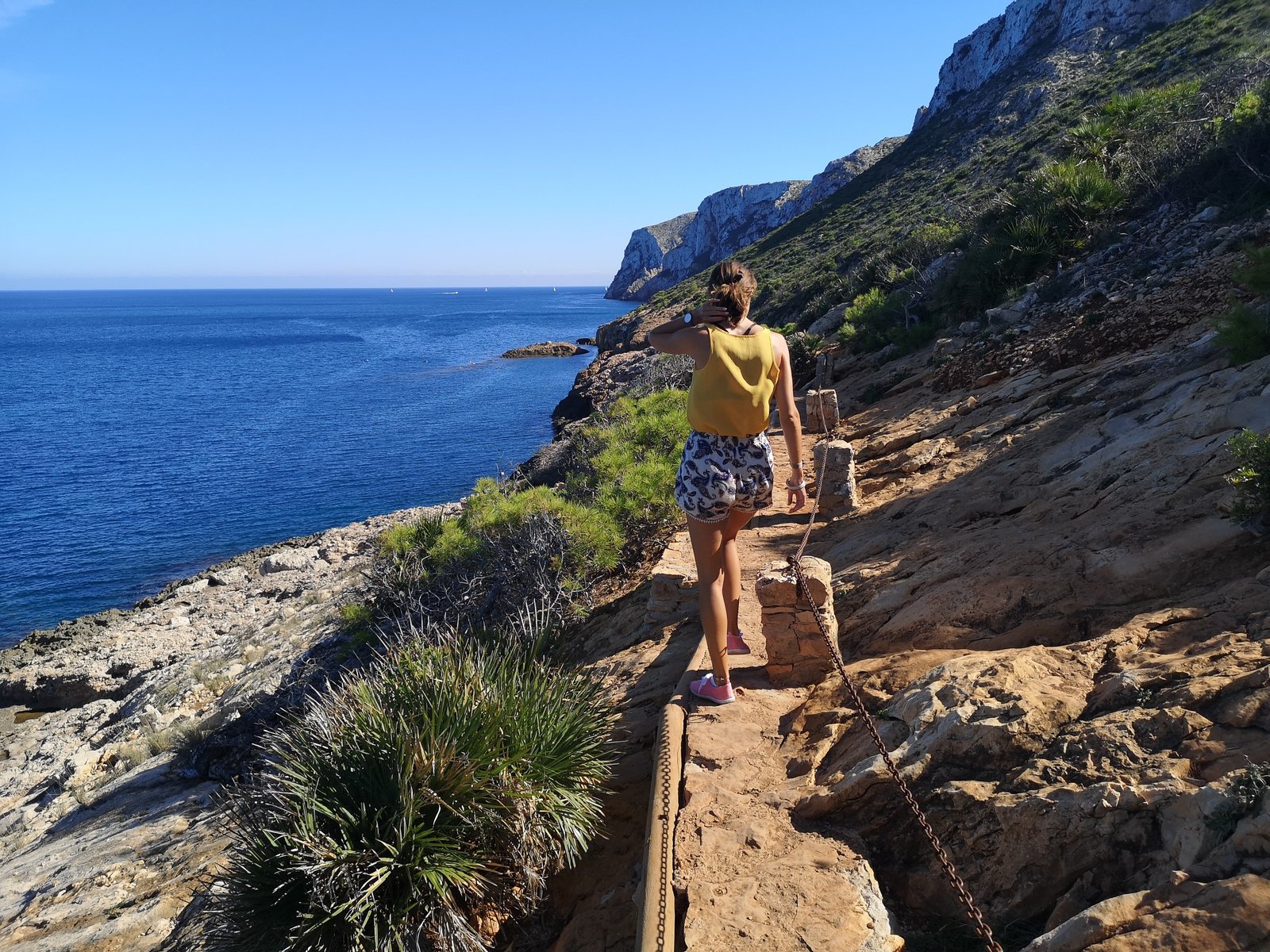
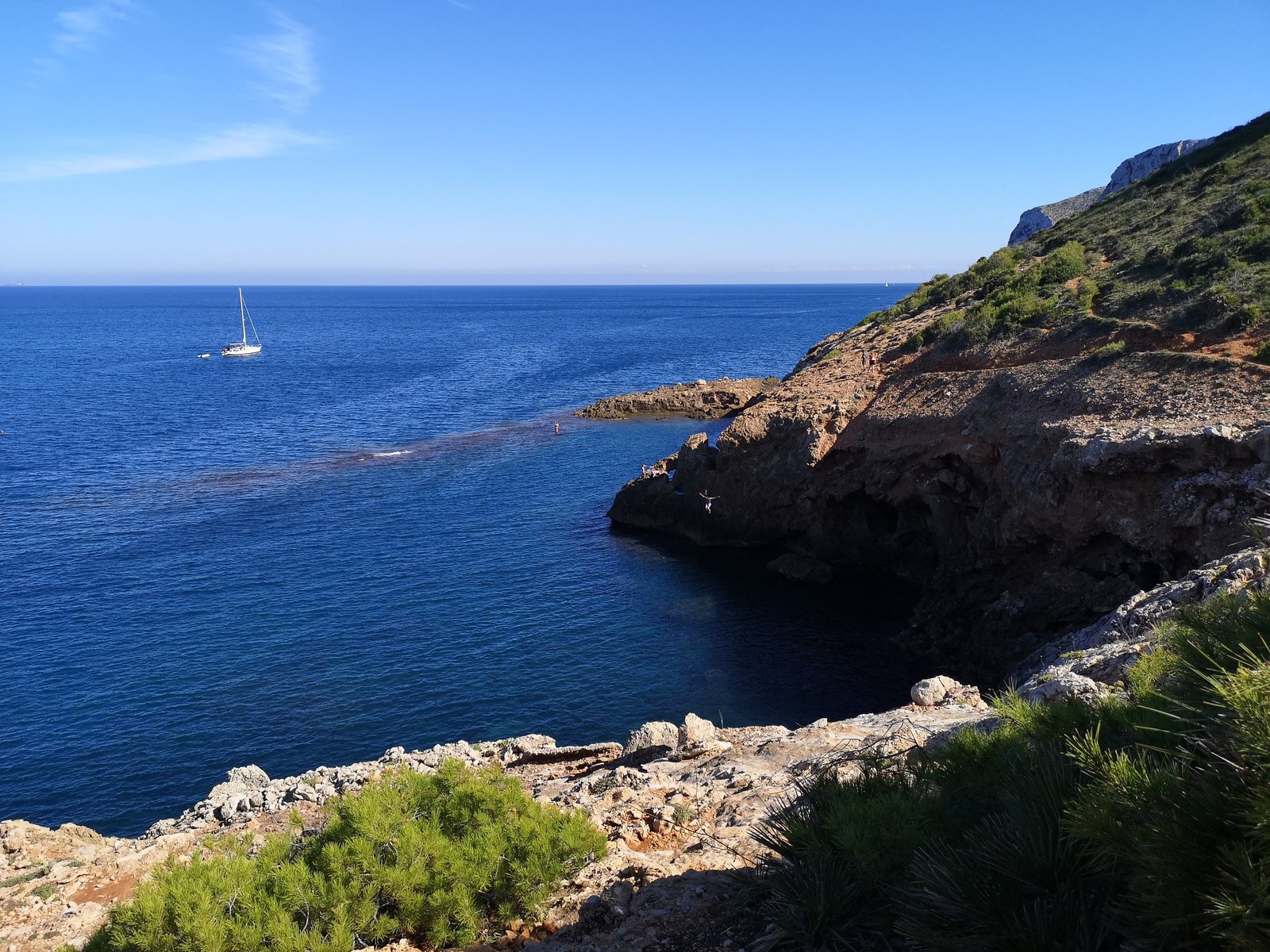
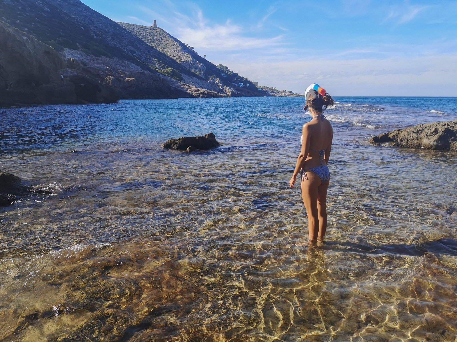
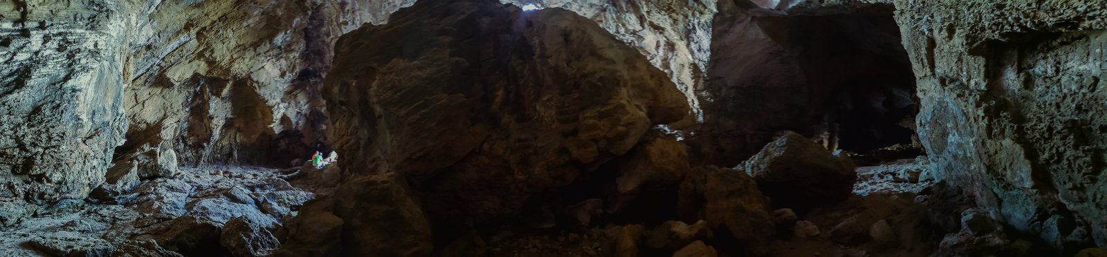
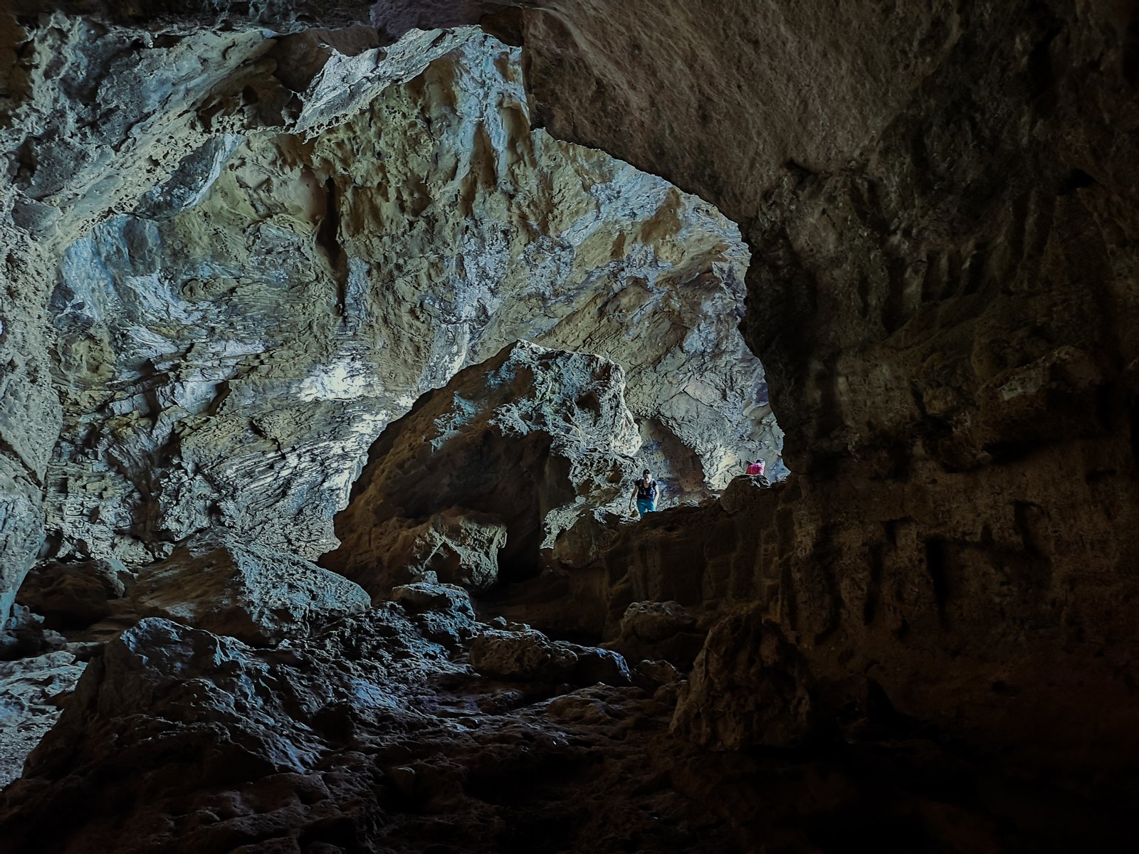
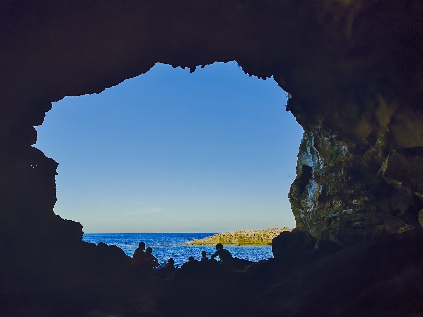
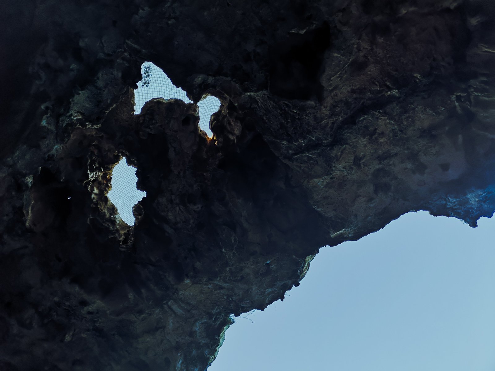
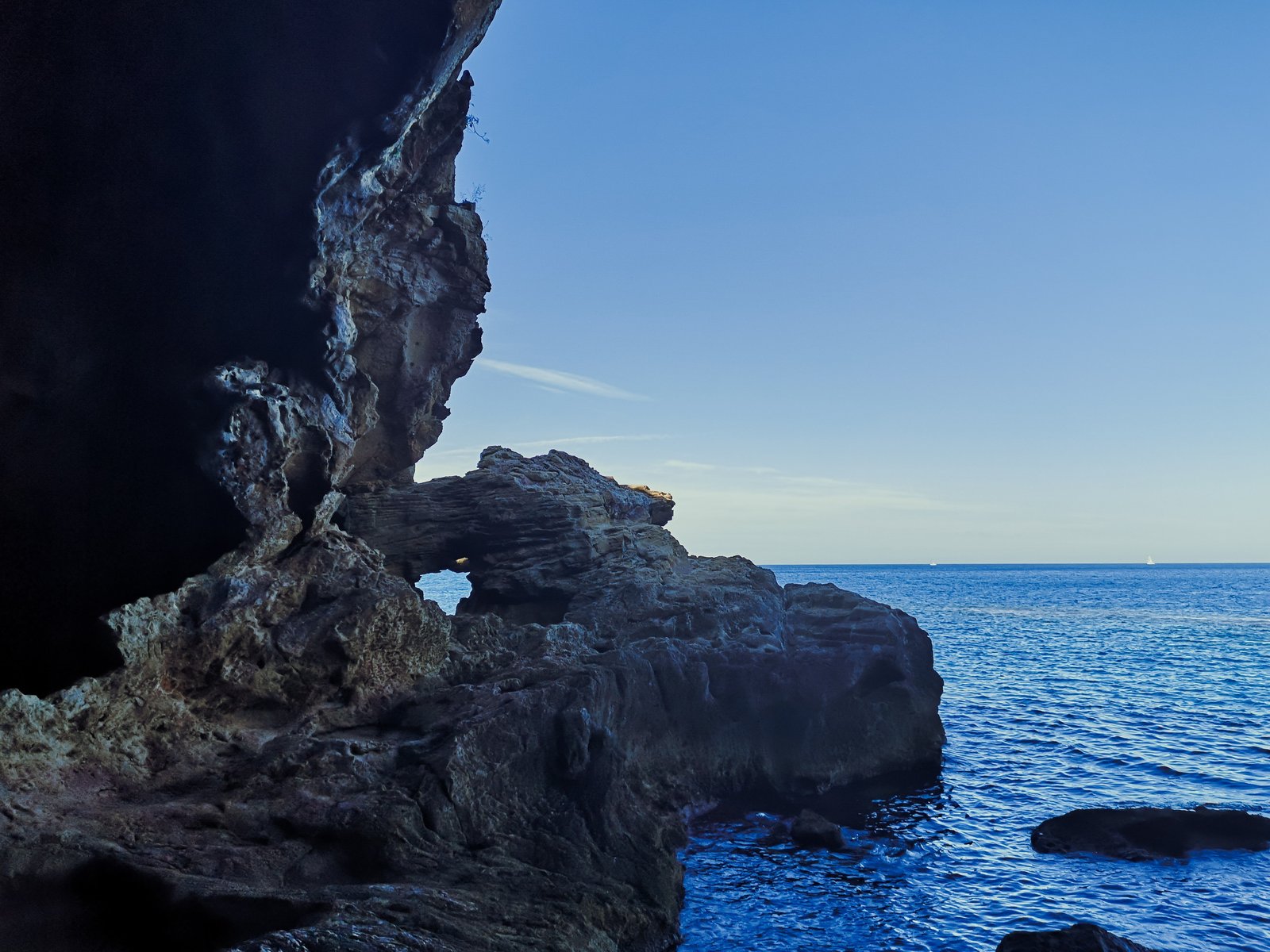
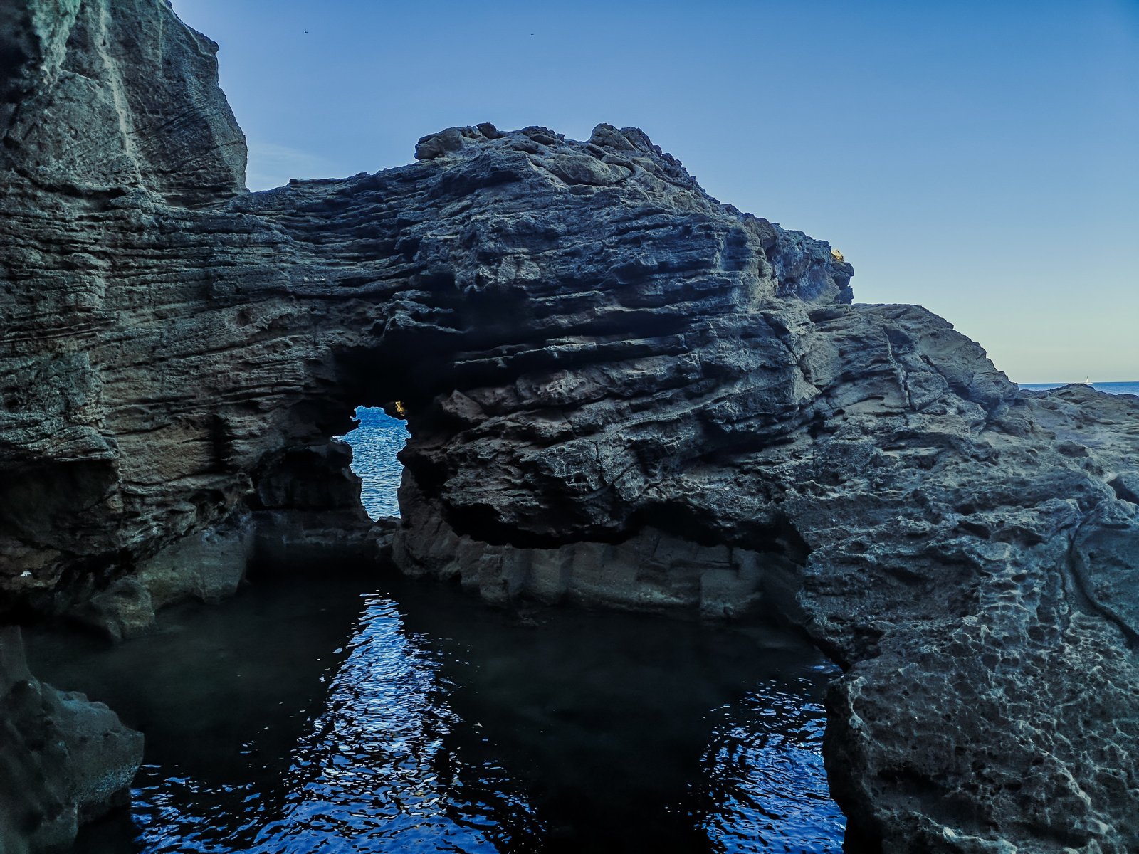
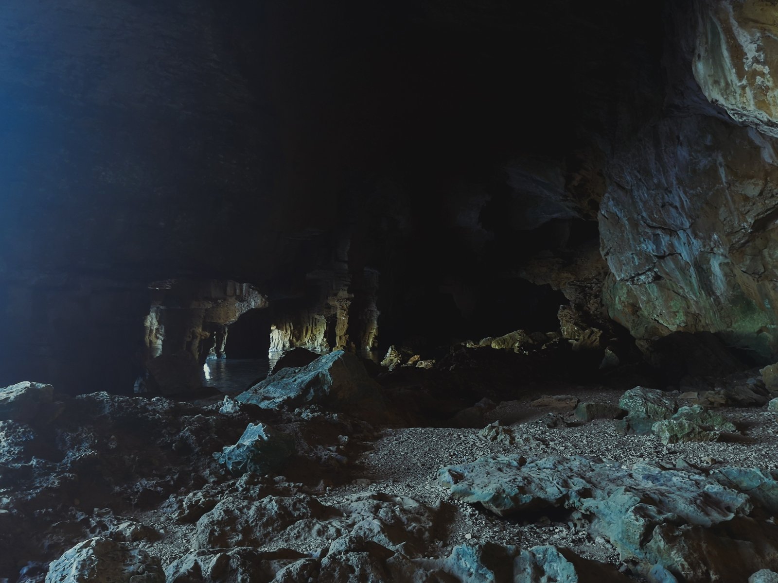
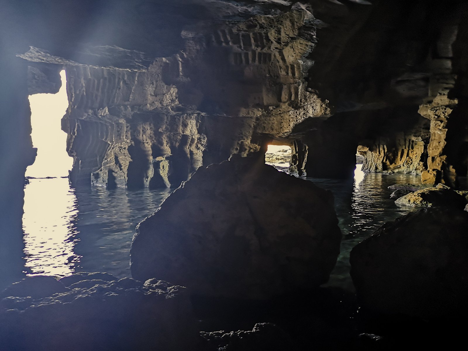
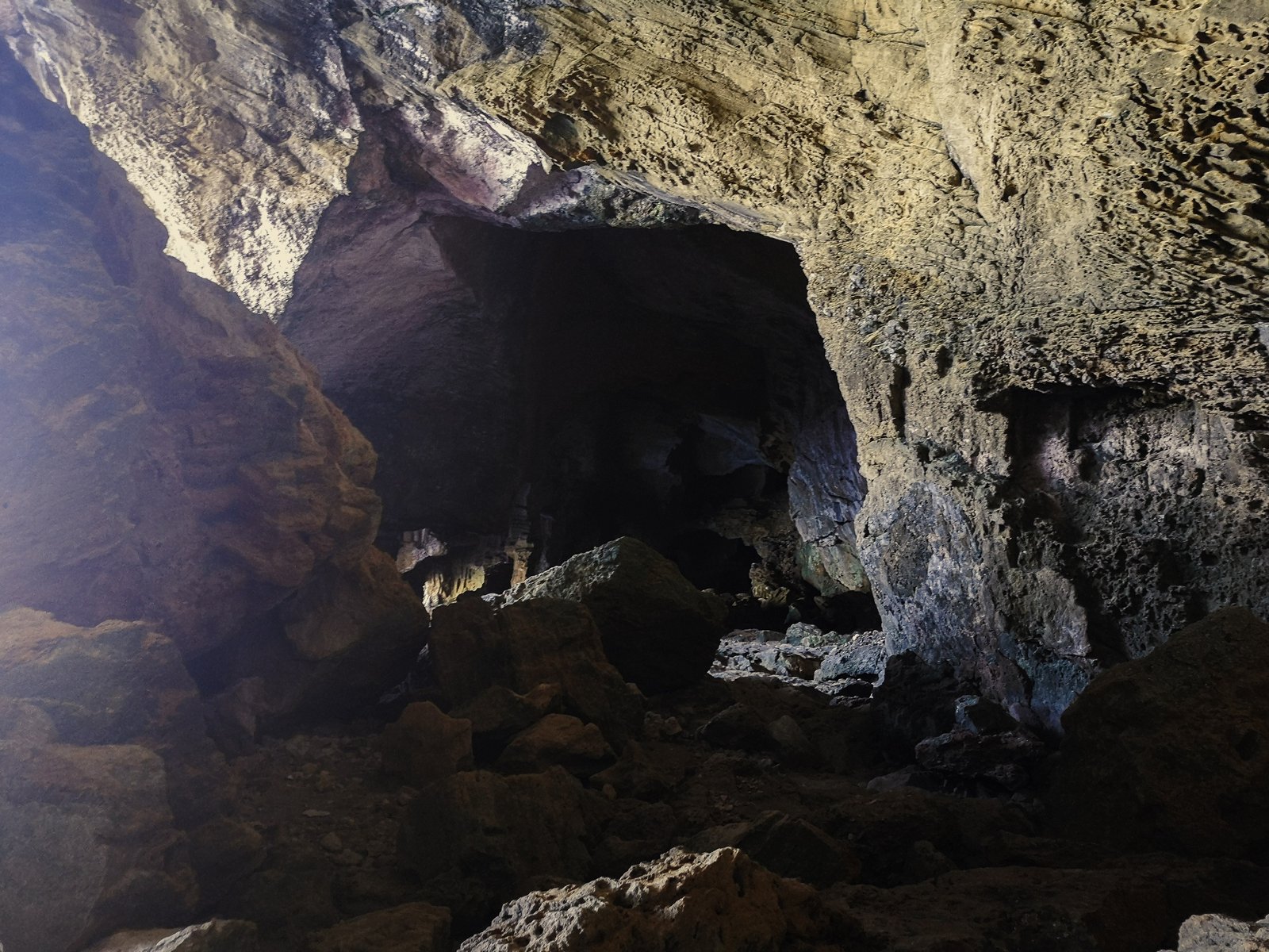
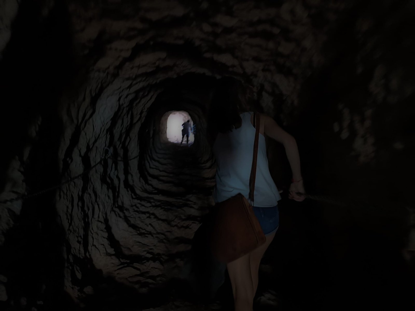
Cova Tallada is a cave system by the Mediterranean Sea below high cliffs of Cap Sant Antoni. Might be the crown jewel of the whole area, I even did this hike on my Spain road trip when I had no idea what Denia or Marina Alta is. This rather short hikes is by no means for everyone – being able to tolerate heights and good shoes is the minimum requirement. Nevertheless, the hike to Cova Tallada is a very popular among tourists and locals alike. Due to some people not being able to keep even the simplest safety rules, the access to the hike is limited during peak seasons.
Pro tip: Cova Tallada is a great snorkeling spot
Hike Details
Distance: 1km / 0.62mi
Duration: 30-40min
Difficulty: Easy/Moderate Depending on season and experience
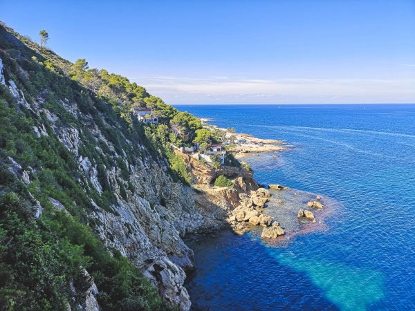
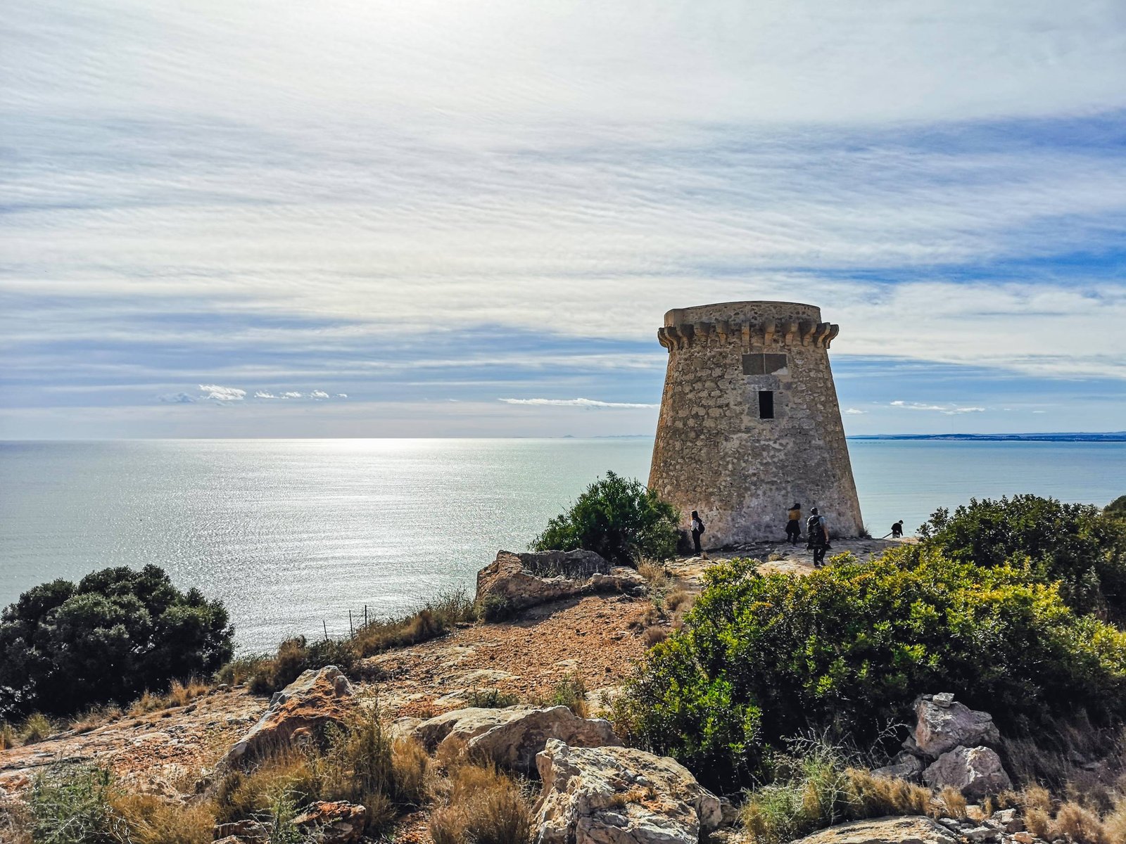
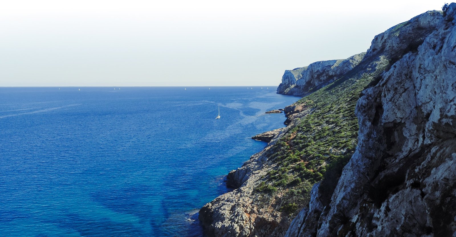
A small climb from the same location in Les Rotes as the Cova Tallada route starts. This is the shortest hike on the list, though be cautious – even given the wee distance and a relatively good road – it is a steep climb to Torre del Gerro. I wouldn’t suggest attempting the hike on a hot day unless you know what you’re doing. From Torre del Gerro beautiful vistas open towards Denia and its coast. Other hiking trails connect Torre del Gerro with Cova Tallada and Cap Sant Antoni.
Hike Details
Distance: 1km / 0.62mi
Ascend: ± 120m / 400 ft
Duration: 20-30min x2
Difficulty: Easy/Moderate Depending on season and time of date
Thank you for visiting Connecting the Dots Journal’s official website!
You got lucky! We have no ad to show for you. If you still want to support my work in a different way, please, subscribe to newsletter or become a Patron
Click on the Ad to support my work.
Thank you for visiting Connecting the Dots Journal’s official website!
You got lucky! We have no ad to show for you. If you still want to support my work in a different way, please, subscribe to newsletter or become a Patron
Click on the Ad to support my work.
Thank you for visiting Connecting the Dots Journal’s official website!
You got lucky! We have no ad to show for you. If you still want to support my work in a different way, please, subscribe to newsletter or become a Patron
Click on the Ad to support my work.
Torre del Gerro – Cap de Sant Antoni – Altomira
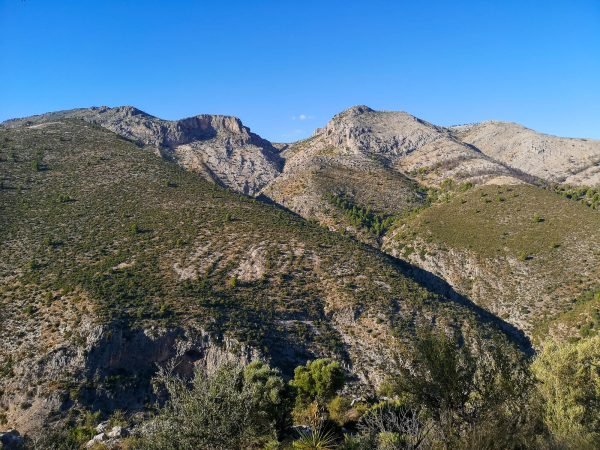
This hike leads from one area of Denia through Cap de Sant Antoni to another, to be more precise from coastal Les Rotes to the highest part of the Montgo neighborhood. Adding an extra 1 or 2 km it is possible to connect the hike into a full circle. The route includes beautiful vistas of Cap de Sant Antoni, Les Rotes, Denia, and El Montgo. This is not an official hike and runs through sections of Torre del Gerro – Molins, PR-CV 355, and Cami de Colonia in the el Montgo hiking area.
All content and photos by Alis Monte. If you want to collaborate, contact me on info@wp.connectingcosta.com Photo by Alis Monte [CC BY-SA 4.0], via Connecting the Dots
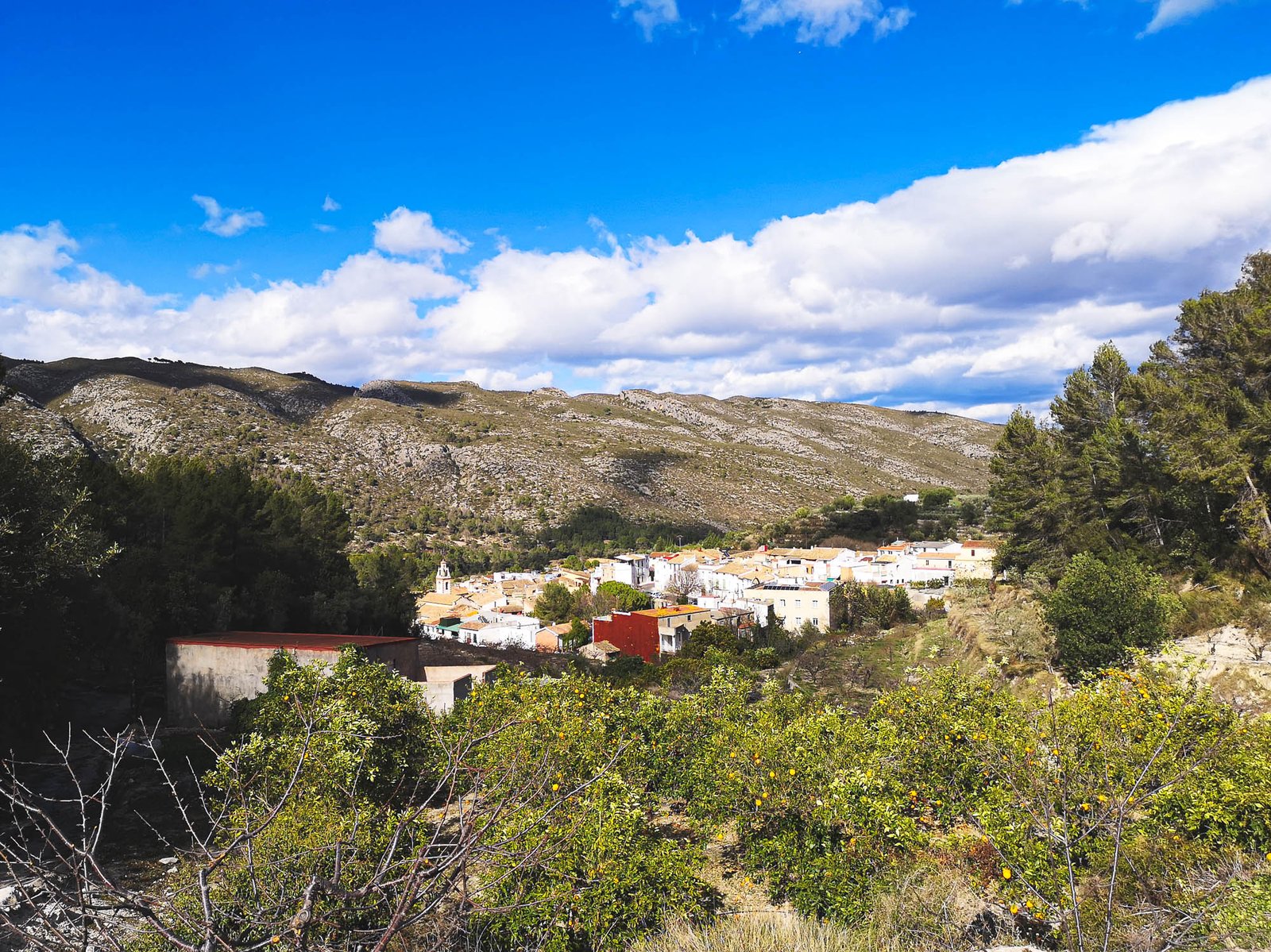
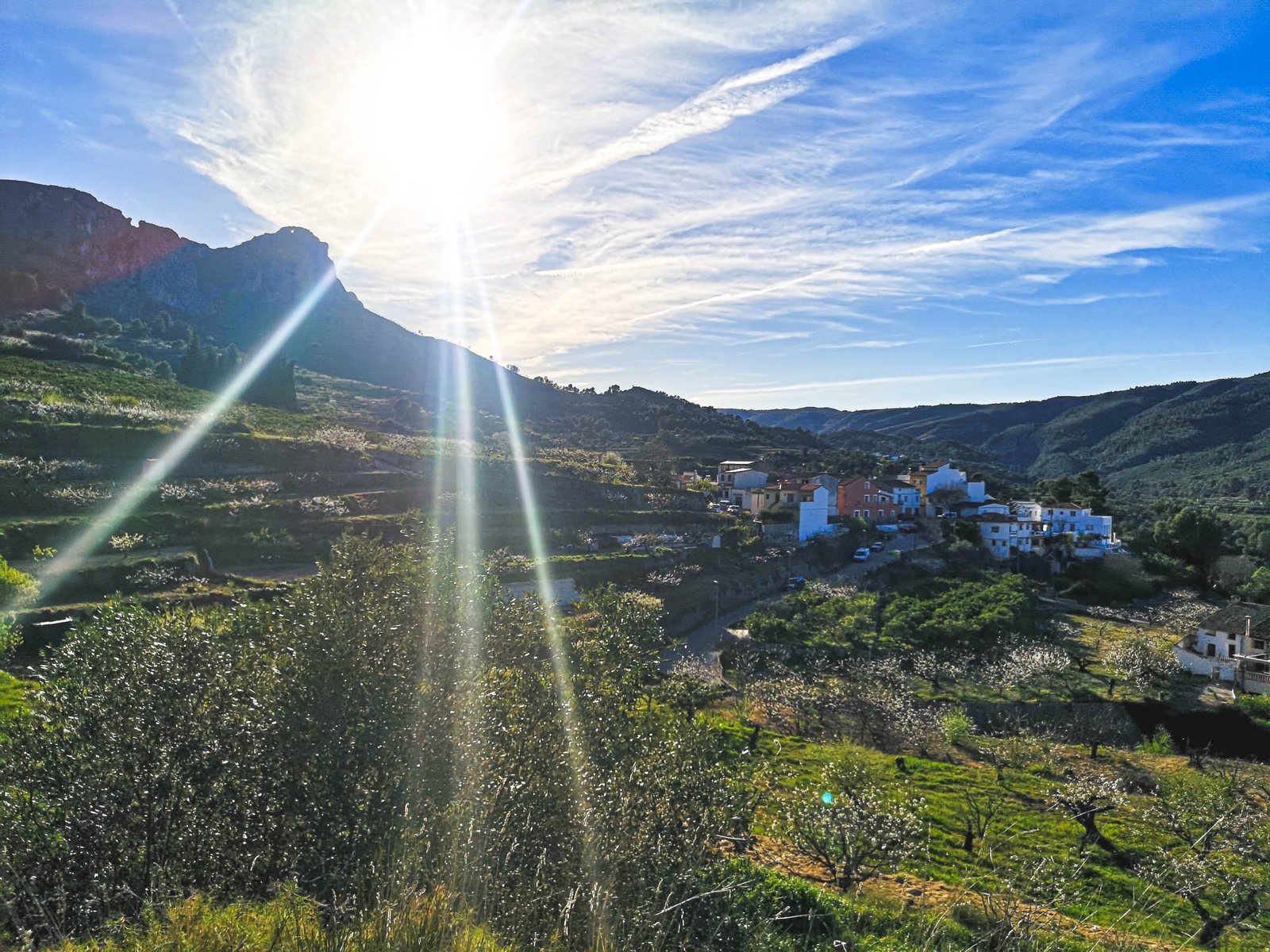
La Vall de Gallinera, nestled in the picturesque Marina Alta region of Spain, is a hidden gem waiting to be explored. Even given a tough competition, this enchanting valley, composed of eight quaint villages, Benialí, Benirrama, Benitaia, Benissivà, La Carroja, Alpatró, Llombai, and Benissili, might be the most beautiful area in all of Marina Alta’s inland. Each village, with its own distinct character and charm, paints a picture of a region rich in history and cultural heritage. From the Moorish legacy evident in the terraced agricultural landscapes to the ancient castles perched dramatically on hilltops, La Vall de Gallinera is a testament to the layers of history that have shaped this area.
Visitors are drawn to the region not only for its historical significance but also for its natural beauty. Surrounded by the soaring peaks of the Sierra de Foradada, the valley is a haven for nature enthusiasts and hikers alike, offering a plethora of trails that wind through lush cherry orchards and aromatic pine forests. The area is especially picturesque in spring when the cherry blossoms are in full bloom, casting a pink hue over the landscape and infusing the air with their delicate fragrance.
Choosing to visit La Vall de Gallinera means stepping off the beaten path to discover the authentic heart of Spain. Whether you’re interested in delving into the rich tapestry of its past, exploring the stunning natural landscape, or simply relaxing in a peaceful village setting, this valley has something for everyone. So come and experience the serene beauty and rich history of La Vall de Gallinera, where every corner holds a story waiting to be uncovered.
History of La Vall de Gallinera
Vall de Gallinera, located in the Marina Alta district of Alicante, Spain, traces its human activity back to the Neolithic period, as evidenced by archaeological discoveries such as pottery fragments and lithic tools in local caves. These early artifacts suggest that the area’s rich resources have been continuously exploited by various cultures. Notably, during the Bronze Age, the strategic location of Vall de Gallinera on elevated terrain made it an ideal settlement for defense and observation, which is reflected in the remains of fortifications found in the area.
With the arrival of the Moors in the 8th century, Vall de Gallinera entered a period of agricultural innovation and prosperity. The Moors introduced complex irrigation systems, known as “acequias,” that captured and redirected water from mountain streams to the terraced fields below, a system that significantly enhanced the agricultural output and is still visible in the landscape today. The Moors also left their mark with the construction of the “Ràfol de Salem,” a notable fortification that served as a defensive and administrative center. This period lasted until the Christian reconquest in the late 15th century, when Vall de Gallinera was integrated into the Crown of Aragon, and the Moorish population was either expelled or converted under coercive conditions, dramatically altering the demographic and cultural landscape.
In modern times, Vall de Gallinera is known not just for its historical significance but also for its cultural heritage, particularly the annual “Festes de les Danses,” which includes a series of traditional dances that are thought to have Moorish origins. The local economy, while still heavily reliant on agriculture—particularly the cultivation of cherries, olives, and almonds—has expanded to include eco-tourism, with many visitors drawn to the preserved medieval architecture, the extensive network of hiking trails, and the panoramic views of the Mediterranean landscape. This blend of deep historical layers and preserved natural beauty makes Vall de Gallinera a unique study in the continuity and change of a Mediterranean rural community through the ages.
Best time to visit: Late spring to early summer (May to June) for the cherry blossom season, and early autumn (September to October) for hiking and experiencing the harvest.
Festivals: The Cherry Blossom Festival (April); and the Moors and Christians Festival (July)
The best part of the villages found in the valley is that there are eight of them. From Benirrama to Benissili, each of them has something unique to offer. La Vall de Gallinera just seems to be created by higher forces to fit picturesque villages.
Famous for its stunning views of the surrounding mountains, Benirrama is a haven for photographers and nature lovers. The remains of an ancient Moorish castle sit atop the hill, offering a glimpse into the area’s historical strategic importance.
Benialí
This village serves as the administrative heart of the valley. Known for its well-preserved medieval architecture, Benialí boasts narrow, winding streets and traditional stone houses. The 16th-century Church of St. Michael the Archangel stands as a historical centerpiece, drawing visitors with its blend of Gothic and Baroque styles.
Thank you for visiting Connecting the Dots Journal’s official website!
You got lucky! We have no ad to show for you. If you still want to support my work in a different way, please, subscribe to newsletter or become a Patron
Click on the Ad to support my work.
Thank you for visiting Connecting the Dots Journal’s official website!
You got lucky! We have no ad to show for you. If you still want to support my work in a different way, please, subscribe to newsletter or become a Patron
Click on the Ad to support my work.
Thank you for visiting Connecting the Dots Journal’s official website!
You got lucky! We have no ad to show for you. If you still want to support my work in a different way, please, subscribe to newsletter or become a Patron
Click on the Ad to support my work.
Benissivà
As one of the valley’s smallest villages, Benissivà is renowned for its intimate atmosphere and the 17th-century Palace of the Counts of Sáfor, which now serves as a museum displaying local history and culture.
Benitaia
Benitaia is a small village known for its rustic charm and the beautiful Church of Santa Ana. The village’s layout reflects its Moorish past, with a labyrinth of alleys that evoke a sense of timelessness.
La Carroja
This village is the agricultural hub of the valley, surrounded by lush orchards and farmlands. La Carroja is particularly picturesque in the spring when the cherry trees are in bloom.
Alpatró
Known for its artisanal products, especially the local honey, Alpatró is a village where tradition and craftsmanship are alive and well. The main square and the Church of Saint James the Apostle are the focal points of village life.
Llombai
Llombai is a quiet village that offers a peaceful retreat from the more touristy spots in the valley. Its landscapes are dominated by olive groves and almond trees, reflecting the area’s agricultural heritage.
Thank you for visiting Connecting the Dots Journal’s official website!
You got lucky! We have no ad to show for you. If you still want to support my work in a different way, please, subscribe to newsletter or become a Patron
Click on the Ad to support my work.
Thank you for visiting Connecting the Dots Journal’s official website!
You got lucky! We have no ad to show for you. If you still want to support my work in a different way, please, subscribe to newsletter or become a Patron
Click on the Ad to support my work.
Thank you for visiting Connecting the Dots Journal’s official website!
You got lucky! We have no ad to show for you. If you still want to support my work in a different way, please, subscribe to newsletter or become a Patron
Click on the Ad to support my work.
Benissili
Perched on a rugged hillside, Benissili is the most dramatic of the valley’s villages. The ruins of an ancient castle loom over the village, and the area is rife with hiking trails that offer spectacular views of the valley below.
La Vall de Gallinera is a paradise for hikers, offering a variety of trails that cater to all levels of fitness and experience. Here are some of the best hiking trails in the area.
A more extensive trail that connects all eight villages of La Vall de Gallinera. This hike is perfect for those looking to explore the cultural and natural beauty of the region. It’s a longer route, about 19 km / 11.8 mi, and can take around 6 to 8 hours to complete.
Benissili Castle Trail
This short but steep trail leads to the ruins of Benissili Castle, offering panoramic views of the surrounding mountains and valleys. The trail is about 2 km / 1.2 mi round trip and takes approximately 1.5 hours to complete.
Thank you for visiting Connecting the Dots Journal’s official website!
You got lucky! We have no ad to show for you. If you still want to support my work in a different way, please, subscribe to newsletter or become a Patron
Click on the Ad to support my work.
Thank you for visiting Connecting the Dots Journal’s official website!
You got lucky! We have no ad to show for you. If you still want to support my work in a different way, please, subscribe to newsletter or become a Patron
Click on the Ad to support my work.
Thank you for visiting Connecting the Dots Journal’s official website!
You got lucky! We have no ad to show for you. If you still want to support my work in a different way, please, subscribe to newsletter or become a Patron
Click on the Ad to support my work.
La Carroja to Alpatró Circular Walk
This gentle circular walk connects the villages of La Carroja and Alpatró, winding through cherry orchards and farmlands. It’s a pleasant walk of around 8 km / 5 mi, which takes about 2 to 3 hours to complete.
Forada Peak has an iconic arc though which sun is visible at certain point of the day during equinox from the old Convent of Benitaia. Photo by Alis Monte [CC BY-SA 4.0], via Connecting the Dots
La Forada Hike
There are two options to reach the most iconic peak of Vall de Gallinera: One option is literally and figuratively straightforward, and the other includes a circular educational trail. The latter route circles around the striking Penya Forada rock formation, providing stunning views and a chance to explore the local flora and fauna. The hike is around 10 km / 6.2 mi and takes about 4 hours to complete.
The other option is a moderate hike leading straight to the iconic Forada Peak, known for its distinctive hole through the mountain. The trail offers spectacular views of the valley and is particularly beautiful during sunrise or sunset. The hike is approximately 5 km / 3.1 mi round trip and takes about 3 hours to complete.
How to Get to La Vall de Gallinera
Reaching La Vall de Gallinera is an adventure in itself, offering various modes of transportation that cater to different preferences.
By Car
Driving is the most convenient way to explore La Vall de Gallinera, providing the freedom to visit each village at your own pace. From Alicante, take the AP-7 motorway towards Valencia, then switch to the CV-700. The scenic drive through the mountains offers stunning views and the journey takes approximately 1.5 hours. Parking is available in each of the villages, though it can be limited during peak tourist seasons
Thank you for visiting Connecting the Dots Journal’s official website!
You got lucky! We have no ad to show for you. If you still want to support my work in a different way, please, subscribe to newsletter or become a Patron
Click on the Ad to support my work.
Thank you for visiting Connecting the Dots Journal’s official website!
You got lucky! We have no ad to show for you. If you still want to support my work in a different way, please, subscribe to newsletter or become a Patron
Click on the Ad to support my work.
Thank you for visiting Connecting the Dots Journal’s official website!
You got lucky! We have no ad to show for you. If you still want to support my work in a different way, please, subscribe to newsletter or become a Patron
Click on the Ad to support my work.
By Bike
For the more adventurous, cycling to La Vall de Gallinera is a rewarding experience that offers a closer connection to the landscape. The region’s winding roads and steep inclines are a challenge but offer unparalleled views and a sense of accomplishment. Be prepared for a strenuous ride, especially during the summer months, and always carry sufficient water and sun protection.
Personal Experience
Vall de Gallinera is among my favorites in the region. It beats my second top location of Marina Alta inland – Vall de Laguar, and is definitely on par with the best destinations of coastal areas of this exotic Comarca of Spain. When putting together a list of points of interest in the areas around Denia for my friends, I always include Vall de Gallinera. I don’t know if it is just me, but terraced landscapes tend to steal my heart completely. Not to mention the picturesque cherry, olive, and various citrus trees growing in the area.
In Vall de Gallinera, everything is so packed, that it really doesn’t matter if you come here for picturesque villages, vegetation blossoms, hikes, or beautiful vistas in general, you’ll get everything zipped into a pack anyway. This makes this beautiful crown jewel of Marina Alta inland a particularly attractive destination, whether you are a tourist or a local. I personally, enjoy my every visit to Vall de Gallinera, therefore I couldn’t recommend it more to anyone visiting the region.
Winter… Winter always comes and once it does, somehow it feels that it never leaves. I hardly meet a person who doesn’t want to migrate somewhere warmer during the cold season. Here in Europe, we don’t have many places to run away from the bitter cold of winter, but the Canary Islands are one of them. Yes, it lies just next to Africa in the Atlantic, but technically – it is Europe. This Spanish territory is a legacy of the empire’s illustrious past.
Today, Tenerife stands as a year-round haven for those seeking balmy weather and diverse experiences. In this guide, I’ll share a tried-and-true 7-day itinerary that showcases the best of Tenerife, from its stunning beaches to its majestic mountains.
And don’t you feel like you deserve holidays on a sunny beach too? Maybe, with a mix of one or two adventures every now and then? That would be nice, isn’t it? I think any month could be a perfect time to put your umbrellas down and head to the biggest island of all the Canary Islands – Tenerife. Whether you’re basking in the sun or embarking on an adventure, Tenerife promises a dose of vitamin D and joy for every traveler.
Day 1: Tenerife’s Beach Paradise – Begin your adventure by unwinding on some of Europe’s most beautiful beaches. Bask in the sun and soak in the picturesque views of the Atlantic.
Day 2: Marine Majesty – Dolphin and Whale Watching – Set sail on the azure waters for a chance to encounter playful dolphins and majestic whales, a highlight of Tenerife’s natural wonders.
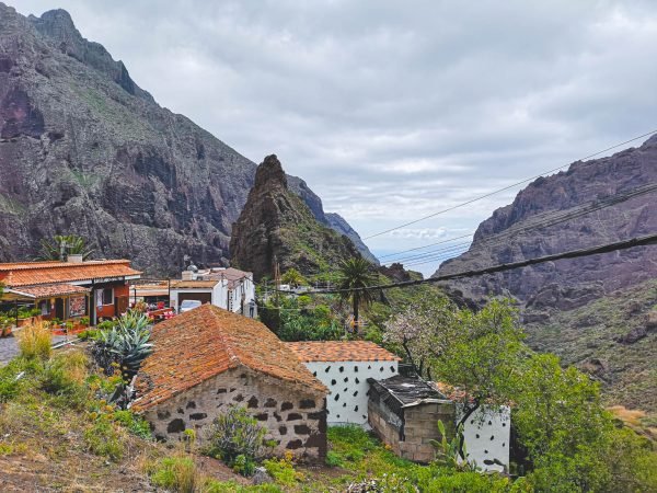
Day 3: The Enchantment of Masca Village – Step into the quaint and captivating world of Masca, a hidden gem offering breathtaking views and rich history.
Day 4: Conquering Mount Teide – Ascend Spain’s highest peak for awe-inspiring vistas and an up-close experience with Tenerife’s volcanic majesty.
Day 5: Northern Tenerife – A Journey of Discovery – Venture into the island’s northern region to explore its unique landscapes and cultural richness, from Garachico to the lush Anaga Rural Park.
Day 6: Anaga Rural Park – Nature’s Masterpiece – Immerse yourself in the lush, green heart of Tenerife, a haven for hikers and nature lovers alike.
Day 7: Santa Cruz de Tenerife – Culture and Celebration – Conclude your journey in Tenerife’s vibrant capital, where culture, history, and modernity blend
You wouldn’t guess that Anaga Rural Park is located on the same island as an active volcano. Photo by Alis Monte [CC BY-SA 4.0], via Connecting the Dots
The weather in Tenerife is just fantastic throughout the year. In winter months like February – visiting Tenerife is just surreal. Not only do you get to take out your summer outfits out of the closet but to swim outdoors in a warm sea. One thing is for sure – there are not so many places with such pleasant weather during winter. Tenerife & the rest of the Canary Islands get to enjoy one of the best climates in the world. Why won’t you enjoy it too?
Today is all about indulging in the simple pleasures of a beach holiday, setting the tone for an unforgettable week in Tenerife. To some, I imagine, this might sound a bit lame, but once you get your keys to a car and an apartment, the first thing you should do is to go out and head for the closest beach. Let’s start with a big chunk of Vitamin D, you know that it improves your mood, right? ² Good feels are what we are here for, be ready for a week of happiness as this feeling won’t leave you for the rest of the trip. A sunny beach with warm ocean water for sure is surreal once you get here on a winter out of cold Europe.
Keep in mind that due to possible big waves, some of the beaches might be closed. In that case, just head for any beach with a breakwater, I marked some on the map.
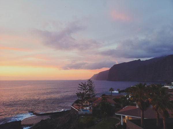
After the beach, you should walk around, and get to know your neighborhood – find those grocery shops for the morning milk runs and the pubs for the late-night drinks. Picking the best area for your base will vary based on yout personal preferences, but I highly recommend the area around Los Gigantes for its breathtaking evening views, where the sky and sea meet in a spectacular display of colors.
Day 2 – Take the Dolphin and Whale Watching Tour
Due to past experience on some other islands, I wasn’t expecting more than beautiful vistas of the island out of the tour. That was true but so was the following. From what I learned the chances of encountering these playful and intelligent creatures are exceptionally high. It might sound strange, but most of the dolphins seek out the boats themselves. They do it either for some wave-riding along the human vessels or simply just because they want to befriend you. Either way, you won’t be able to tell the difference. The dolphins will be there to cheer you up and that combined, with more sea, and more sun will guarantee some quality time. Based on my personal experience (besides the North Atlantic), Tenerife was the only island where dolphins still reach out for boats. In many places, like Mauritius and other coasts suffering from over-tourism, the opposite is true. Therefore, it is very important to take one of the eco-dolphin-friendly tours to keep these majestic creatures still interested in us.
While dolphin sightings are common, spotting a whale is a moment of serendipity, a special gift from the sea.
Alternatively, you can take a ferry or tour to La Gomera Island and spend your day there. Most of the dolphin and whale watching tours are heading for territory between Tenerife and La Gomera anyway, where these encounters are very common.
If you are afraid to get seasick, I would still recommend spending this day not too far from the sea. You just got here and there is still plenty of time to see the rest of the island. Today is the day for the sea and the further enjoyment of the beautiful beaches of Tenerife.
Day 3 – Visit Masca Village
By now you probably gotten used to warm weather and the sun (hopefully without too much of a sunburn). It is time to turn your holidays into an adventure to remember. Not like it is boring to lay down on a mattress by the sea reading a book and sipping one Gin Topic after another, but by now you probably have noticed a giant mountain overlooking the island. It kinda looks interesting, doesn’t it? We’ll get there on time, don’t worry, but for now, let’s get closer to the sea. What about getting on that big cliff called Los Gigantes?
Besides Mount Teide itself, probably the most popular natural attraction on Tenerife island is Masca village, and the so-called Masca hike. The route goes down from the village through Masca Gorge to Playa de Masca at sea level. As of 2019, it was closed down for safety upgrades because some genius decided to do the hike with slippers – don’t be that person, it is not the same as going to the closest supermarket to buy another six-pack.
Despite the hike being open or closed, Masca Village is highly recommended for any visitor to Tenerife Island. The Teno Massif surrounding the settlement is absolutely mesmerizing. In fact, the whole Teno region used to be a separate small island, which later joined forces with other islets to form what is now called Tenerife Island.
Sadly, I never had a chance to do the track but by now I hope it is open again for visitors. From what I read and from what I saw, the Masca hike is usually a one-way walk to the beach from where a water taxi will take you back to Los Gigantes but the times might have changed. What definitely has changed is that Masca village is no longer reachable by car. You’ll need to take a bus from the nearest town. Alternatively, you can do a longer and more spectacular guided hike to the ocean from Santiago del Teide. Apparently, you’ll also need a permit to access Masca Gorge Trail, but guided tours will handle this for you.
Day 4 – Get on the Top of Tenerife Island – Teide Volcano
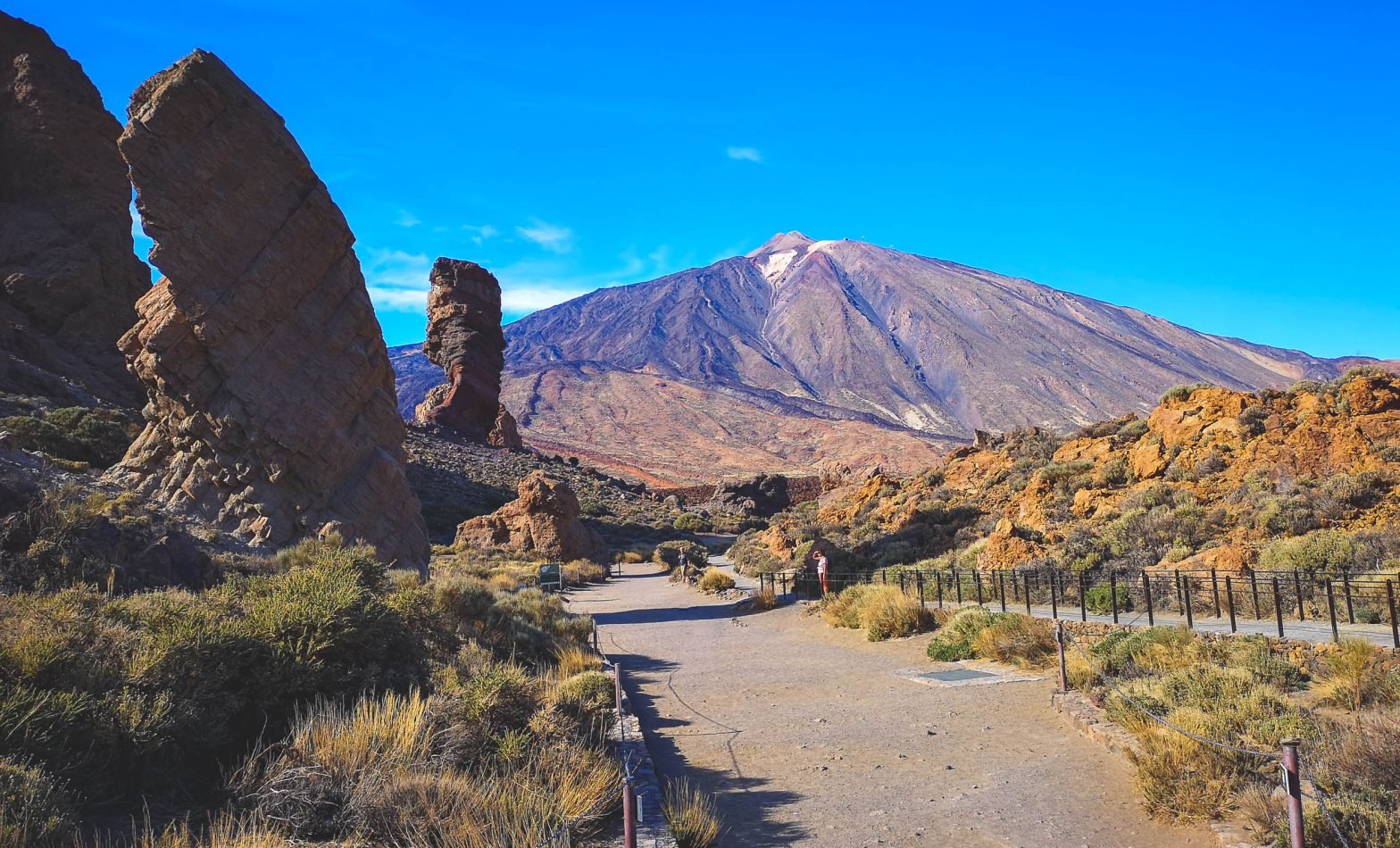
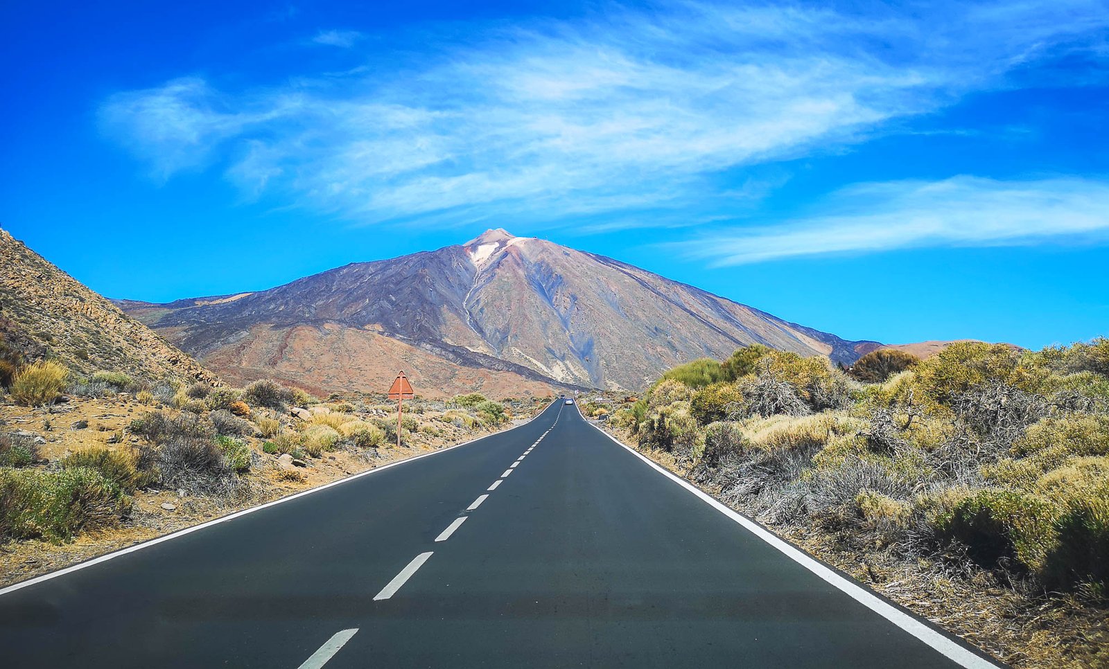
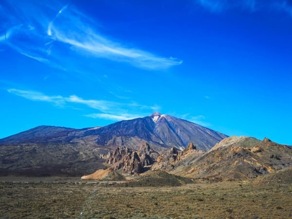
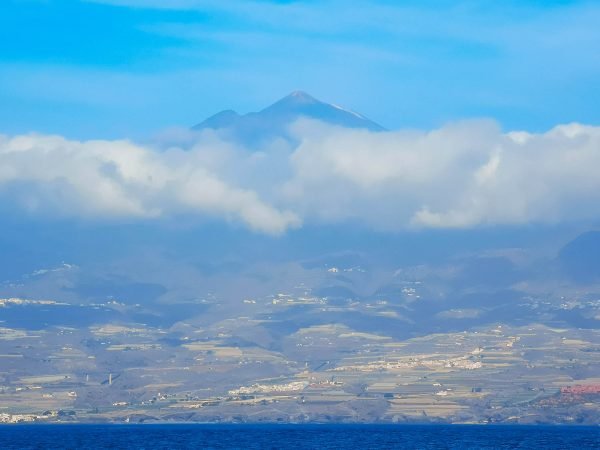
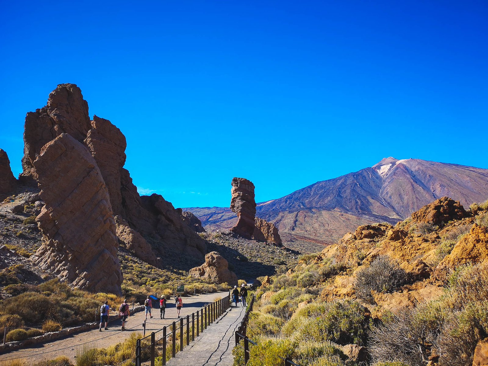
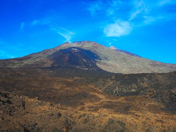
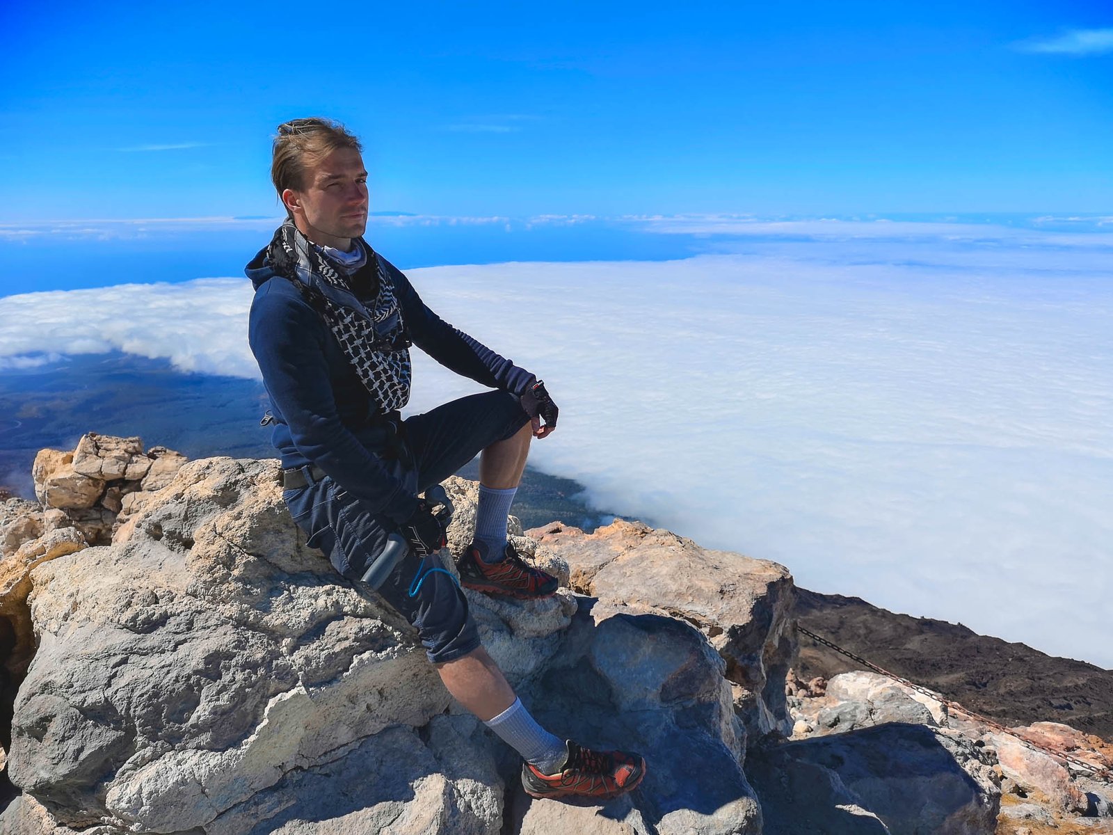
While the main reason to go to the Canary Islands is its stable climate, the main reason to pick Tenerife Island for your holidays in the Canary Islands is Mount Teide. Yes, it is the biggest island of all the archipelago and it is amazing – infrastructure and beaches are as good as it gets. Nevertheless, there is nothing similar to Mount Teide on the other islands of the Canaries, and as a matter of fact – the whole of Spain. Mount Teide is the highest mountain in the whole country and did I mention that it is an active volcano too? At the narrowest point up in the north, the sea level and the top of Mount Teide are separated only by 13km / 8 mi. That alone makes the landscape of the island truly awe-inspiring. The one you cannot mistake with anything else.
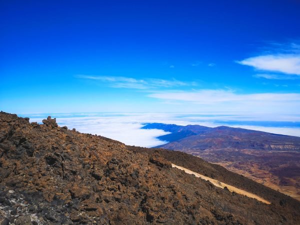
What is even better – is the various possibilities to reach the peak of Mount Teide. Most of us will reach it by the cable car running from the base station (2,356m / 7,730ft) to La Rambleta (3,555m / 11,663ft). The very peak of Mount Teide (3,718 / 12,198ft) could be only reached by foot with a special permit that you can get here from the park authorities. In the recent years, with the growth of visitors and the necessity of eco-tourism as a result, guided group tours to Teide Volcano have become very popular – no more worries about parking slots or any other organizational stuff.
If anybody wants to see more of Teide National Park, they can climb the whole mountain on foot. The hike could start almost from anywhere, including the full challenge of climbing Mount Teide from the sea level. More adventurous people might also want to try the Teide Volcano sunrise hike or sunset tour.
Day 5 – Visit the North of Tenerife Island
Many ask which side of Tenerife they should go. North or South? There is no such thing as the right answer to this question. Both faces of Tenerife Island are totally different. It is like Two-Face from the Batman series. While the south is sun-drenched, has more spaces and golden beaches, the north is totally different. This part of Tenerife is where the island’s volcanic heritage and lush landscapes come to life, offering a blend of nature, history, and culture.
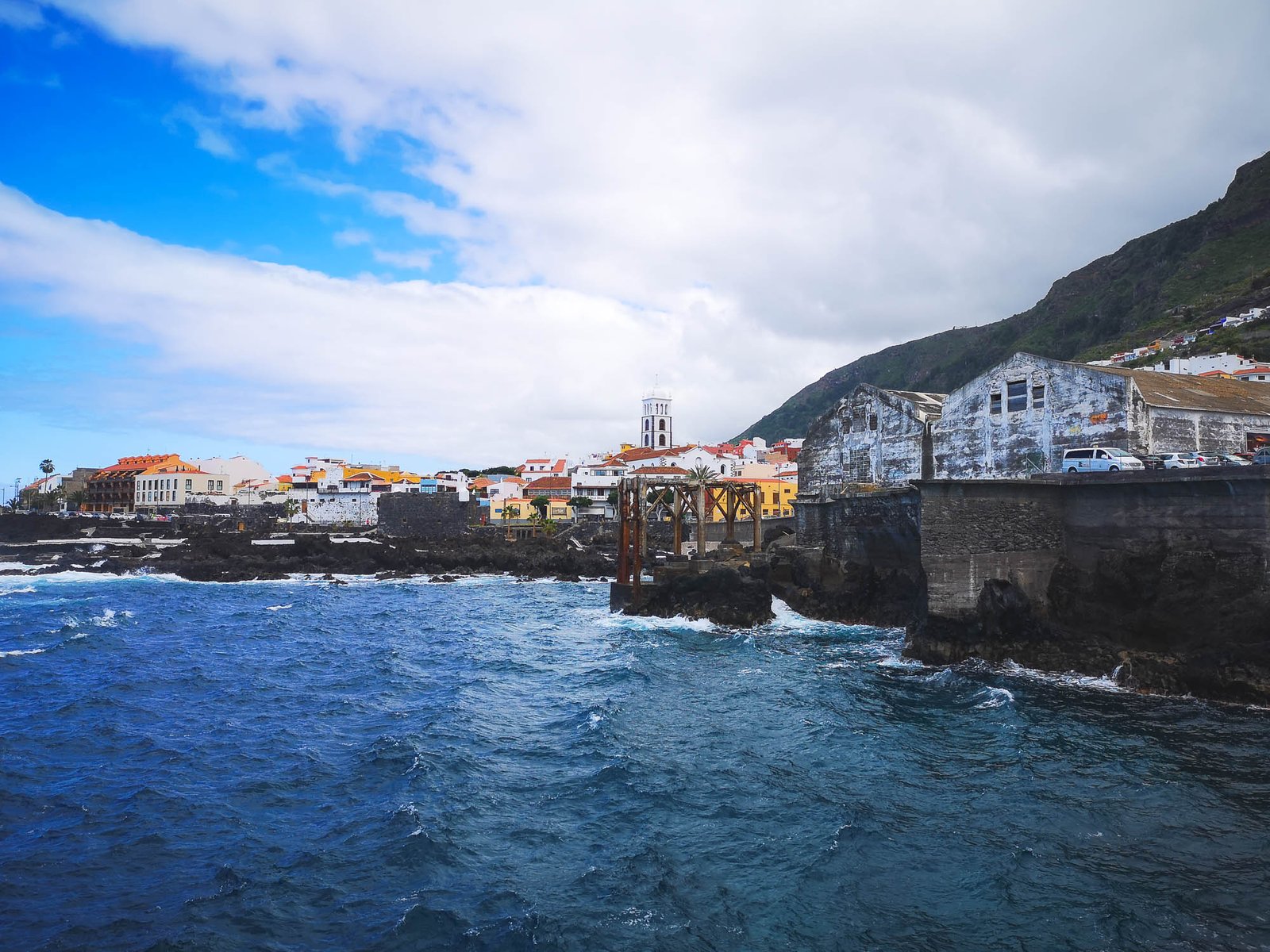
Los Gigantes is located on the edge of both sides. Today we go further to the North than we ever did before. The whole route will slowly bring you to a totally different world. First stop – Garachico – an old port founded in 1496 by a Genoese banker after Tenerife was conquered by the Crown of Castille. Its importance diminished in 1706 when a volcanic eruption destroyed part of the town. Today, Garachico is an interesting tourist destination offering informational historical walks around the city surrounded by 500m+ / 1500ft cliffs.
After visiting Garachico, drive along the coast towards Puerto de la Cruz, where you no longer have to worry about the road quality. The areas beyond the Teno region, offer smooth travel, allowing you to immerse yourself fully in the experience with everything on the table.
The rest of the day should be spent based on your preference. It is the time to visit Loro Park or walk around Puerto de la Cruz. Our choice was to have a picnic in Playa de los Roques, or you can visit La Orotova instead. Just don’t press too far – tomorrow is the time for La Laguna and Anaga Rural Park.
The northern side is not as spacious as the southern one. Eveything feels like it was molded by Teide itself. Photo by Alis Monte [CC BY-SA 4.0], via Connecting the Dots
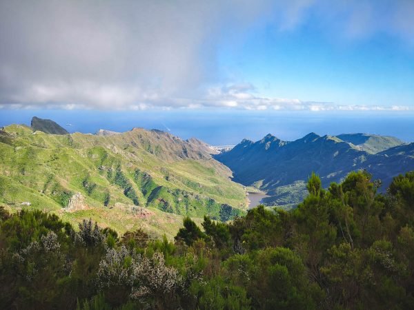
Day 6 – Enter the Hikers’ Paradise – Anaga Rural Park
Most of us associate Tenerife and the whole Canary Islands with volcanic formations. Anaga Forest is a totally different landscape. It is a true jungle from the movies: lush green with the sunlight blocked by the trees – alive & dangerous – nothing in common with desolate volcanic rocks. Well, at least, from the first sight.
The whole Anaga Forest is growing in a mountainous area formed between 7-9mya, after a volcanic eruption. Ever since life transformed this landscape to something more exotic than you’d expect from Tenerife. That is so for a reason – Anaga Rural Park has more endemic species than any other area in the whole of Europe. For that reason, it was recognized as a UNESCO World Heritage Biosphere Reserve in 2015. Actually, a pity it happened so recently.
These unique natural features attract many outdoor enthusiasts but the Anaga Forest does something way more important. The forest controls the humidity and fertility of the island. Back in the days, when wood was the most important building material, people started deforesting the area. It was noted that the microclimate of Tenerife has changed. Ever since the forest preservation took place. Unfortunately, not so many places in Spain remain with an authentic forest.
Tip: No matter where you plan to stay for the first days, you should consider relocating to Santa Cruz de Tenerife on this day as you’ll spend the rest of your time in the western part of the island.
Day 7 – Party at the Capital of Tenerife Island – Santa Cruz
After all the breathtaking variety of nature, Tenerife Island has, it is finally the time to see some of the local culture. I can hardly think of a better place to do so than the Capital of the island – Santa Cruz de Tenerife.
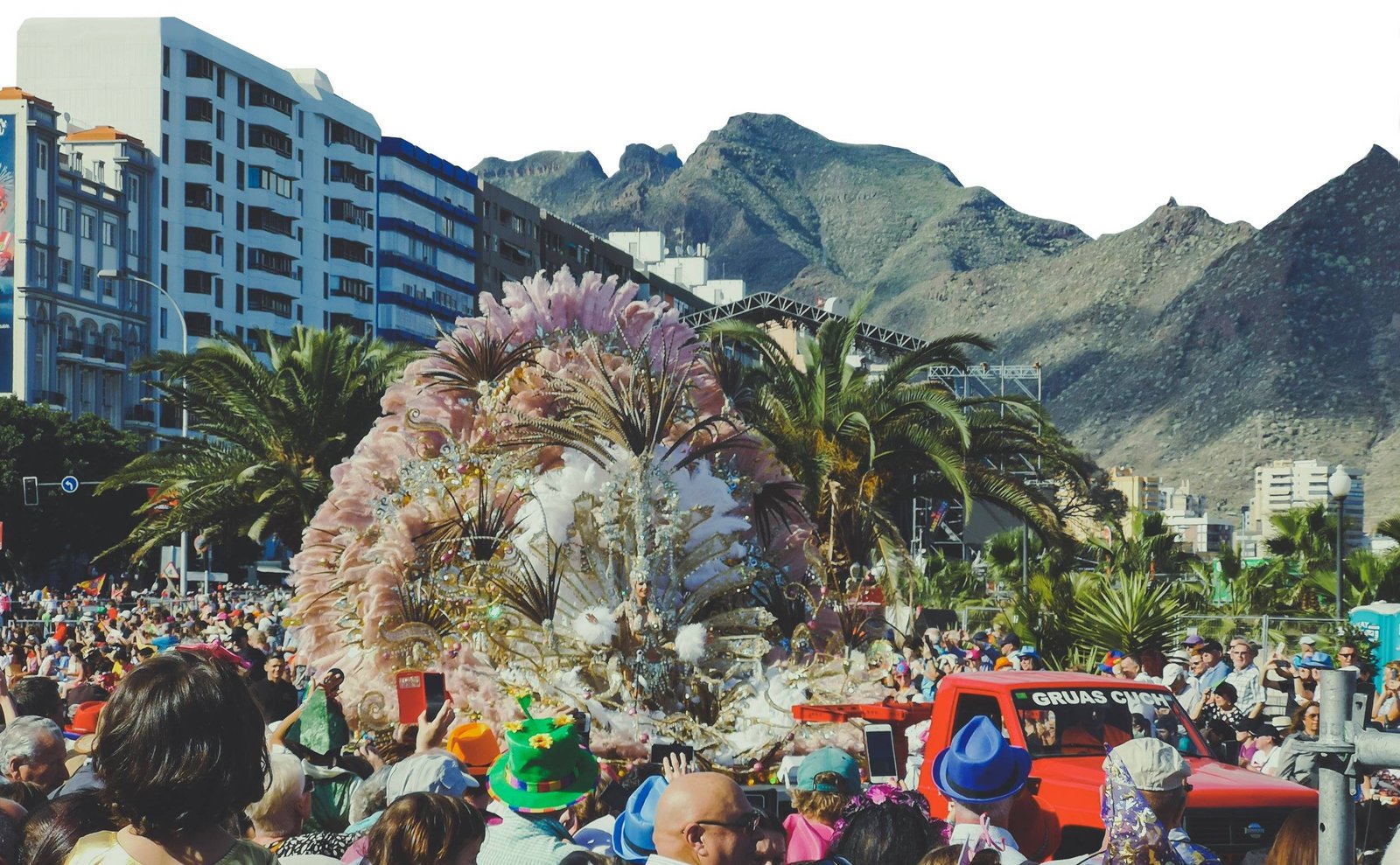
Even though Las Palmas de Gran Canaria is the most populated city in the whole archipelago, don’t underestimate Santa Cruz. After all, it does share the Capital status of the Canary Islands with Las Palmas and has that feeling of a major city. There is plenty of cultural stuff to do during the day, and more than enough things to do at night. It is especially true during the Carnival at the end of February or at the beginning of March. It is not a well-known fact that Santa Cruz de Tenerife hosts the second biggest Carnival in the whole world, bowing down only to the famous Rio de Janeiro.
The dates of the event vary from year to year but you can read more about it in my different article about the schedule of Carnival de Santa Cruz de Tenerife 2024. This is surely one hell of an event not to miss if you are around. The whole Santa Cruz de Tenerife turns into a party day after day.
The Carnival of Santa Cruz de Tenerife is the second biggest in the whole world. Photo by Alis Monte [CC BY-SA 4.0], via Connecting the Dots
Where to Stay in Tenerife?
Most of the visitors to Tenerife holidays head to resort towns located around Playa de las Americas like Costa Adeje and Los Cristianos. Unless you are visiting Tenerife for beach holidays only, I would recommend getting a bit further from the crowds instead.
From what I saw, the popular destinations feel like they were built for people seeking package holiday getaways. It was done in the most uninteresting part of Tenerife Island. All the cool stuff is somewhere else.
Los Gigantes provides the most dramatic everyday views from all the resort areas in Tenerife. Photo by Alis Monte [CC BY-SA 4.0], via Connecting the Dots
Personal Experience
There were things I expected with high expectations and they didn’t disappoint me. The Crown Jewel of Tenerife – Mount Teide exceeded even my most optimistic hopes. At the time of my visit, the whole Teide National Park was beyond my imagination. I never expected to see a new type of landscape ever again, and here it was a somewhat barren, yet rich, in both case alien and bizarre surroundings of the tallest point in all territories of Spain.
Despite its uniqueness and beauty, it was not only Mount Teide that made the whole journey across the island so exceptional. Not a single day left me disappointed. Every day it felt like a different adventure on a different island. It is not your one trick pony like paradise beach island Mahe in Seychelles, or Mauritius snorkeling heaven. Tenerife has many faces and excels to perfection in some of them. If you follow this itinerary, I’m sure you’ll experience the same. The largest islands in the Canaries have more than enough to offer to anybody.
The Cable Car will take you almost to the top of Mount Teide, but to reach the very peak you’ll need a permit. Photo by Alis Monte [CC BY-SA 4.0], via Connecting the Dots
Sources:
¹ https://www.metoffice.gov.uk/weather/travel-and-events/holiday-weather/europe/canary-islands/tenerife
² Young S. N. (2007). How to increase serotonin in the human brain without drugs. Journal of psychiatry & neuroscience : JPN, 32(6), 394–399.
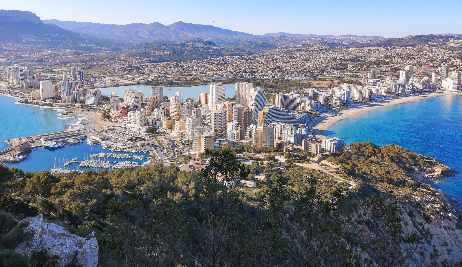
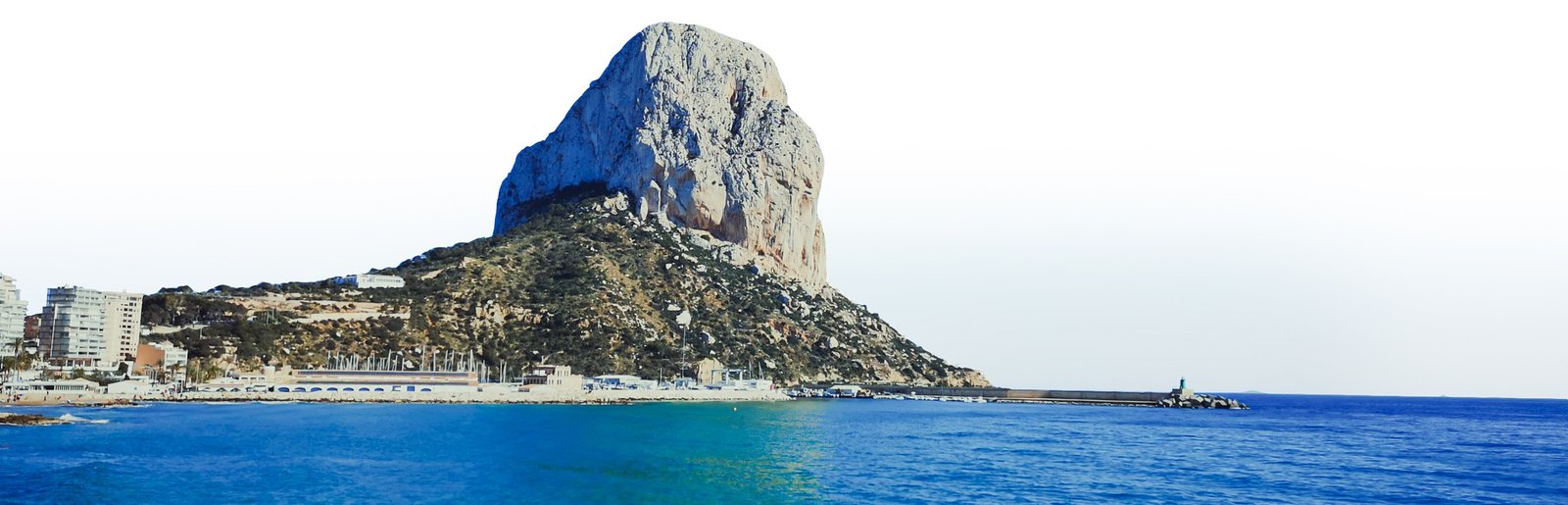
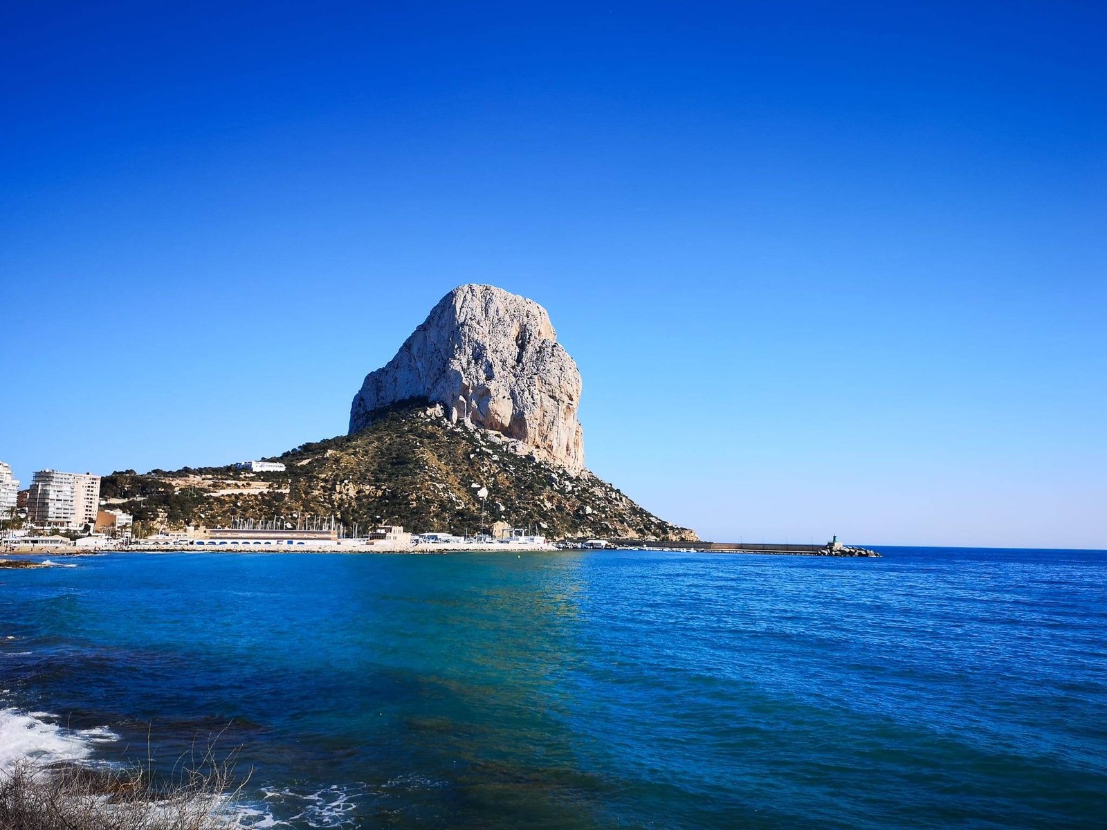
Nestled on the sun-kissed coast of Spain, Calpe beckons with its rich tapestry of history and natural beauty. This charming town, cradled by the majestic Penon de Ifach, has witnessed the ebb and flow of civilizations for over 3,000 years. The Phoenicians, known for their seafaring prowess, were among the earliest to leave their mark, drawn to this region by the same rock formation that today stands as a symbol of Calpe’s enduring allure. As they navigated the Iberian shores, they referred to the Penon de Ifach as the “rock of the north,” contrasting it with the renowned rock of Gibraltar, then known as Mons Calpe. These early settlers saw in Calpe’s rugged landscape a mirror to their other settlements across the Mediterranean, leaving behind a legacy that whispers through the town’s ancient streets.
Calpe’s story is further enriched by the footprints of the Greeks and Romans. The Greeks, in their vast explorations, recognized the unique geological formations like Penon de Ifach, terming them ‘Calpe,’ a name resonating with descriptions of large stand-alone rocks. This connection to the ancient world hints at a deeper, possibly pre-Roman, history of the town, suggesting an intriguing blend of cultures over the millennia. The Romans, captivated by Calpe’s strategic location and natural beauty, established a settlement that has grown into a treasure trove of historical wonders. Baños de la Reina, a testament to Roman ingenuity with its well-preserved mosaics and hydraulic systems, stands as a silent witness to the town’s vibrant past. These ancient ruins, now nestled between the iconic Penon de Ifach and Calpe’s bustling city center, offer a portal to a time when Romans appreciated the natural splendors of this enchanting land, a sentiment that continues to resonate with modern visitors. Today, the city enjoys a huge interest from foreigners and locals alike resulting in rapid growth in size and attractions.
Thank you for visiting Connecting the Dots Journal’s official website!
You got lucky! We have no ad to show for you. If you still want to support my work in a different way, please, subscribe to newsletter or become a Patron
Click on the Ad to support my work.
Thank you for visiting Connecting the Dots Journal’s official website!
You got lucky! We have no ad to show for you. If you still want to support my work in a different way, please, subscribe to newsletter or become a Patron
Click on the Ad to support my work.
Thank you for visiting Connecting the Dots Journal’s official website!
You got lucky! We have no ad to show for you. If you still want to support my work in a different way, please, subscribe to newsletter or become a Patron
Click on the Ad to support my work.
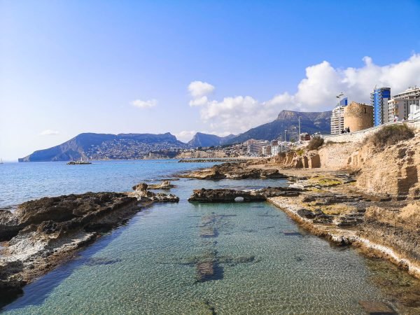
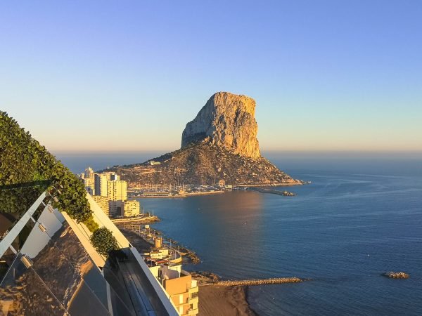
1. Visit Peñón de Ifach
Standing as a natural sentinel over Calpe, the Peñón de Ifach is an obvious number-one activity for any great outdoors enthusiast visiting the area. This towering limestone formation, soaring 332 m / 1,089 ft above the sea, is not only an iconic symbol of the region but also a haven for nature enthusiasts and hikers. The climb to the top, though steep and challenging, rewards visitors with breathtaking panoramic views of Calpe’s coastline and the vast Mediterranean Sea. Along the way, hikers are likely to encounter a rich variety of local flora and fauna, including rare bird species. The summit offers a unique opportunity to appreciate the beauty of the Costa Blanca from an unparalleled vantage point, making this experience a memorable highlight of any trip to Calpe. The views from the top of the rock of Calpe are so exceptionally beautiful that many people are trying to hit above their class by climbing the mountain. If you are not sure you are fit for the task, you can read more about it in my guide to the Penon de Ifach hike.
The central walls of the bastion in the middle of Calpe were built somewhere between the 13th and 14th centuries to protect local farmers from Muslim attacks. Photo by Alis Monte [CC BY-SA 4.0], via Connecting the Dots
2. Visit the Historic Old Town
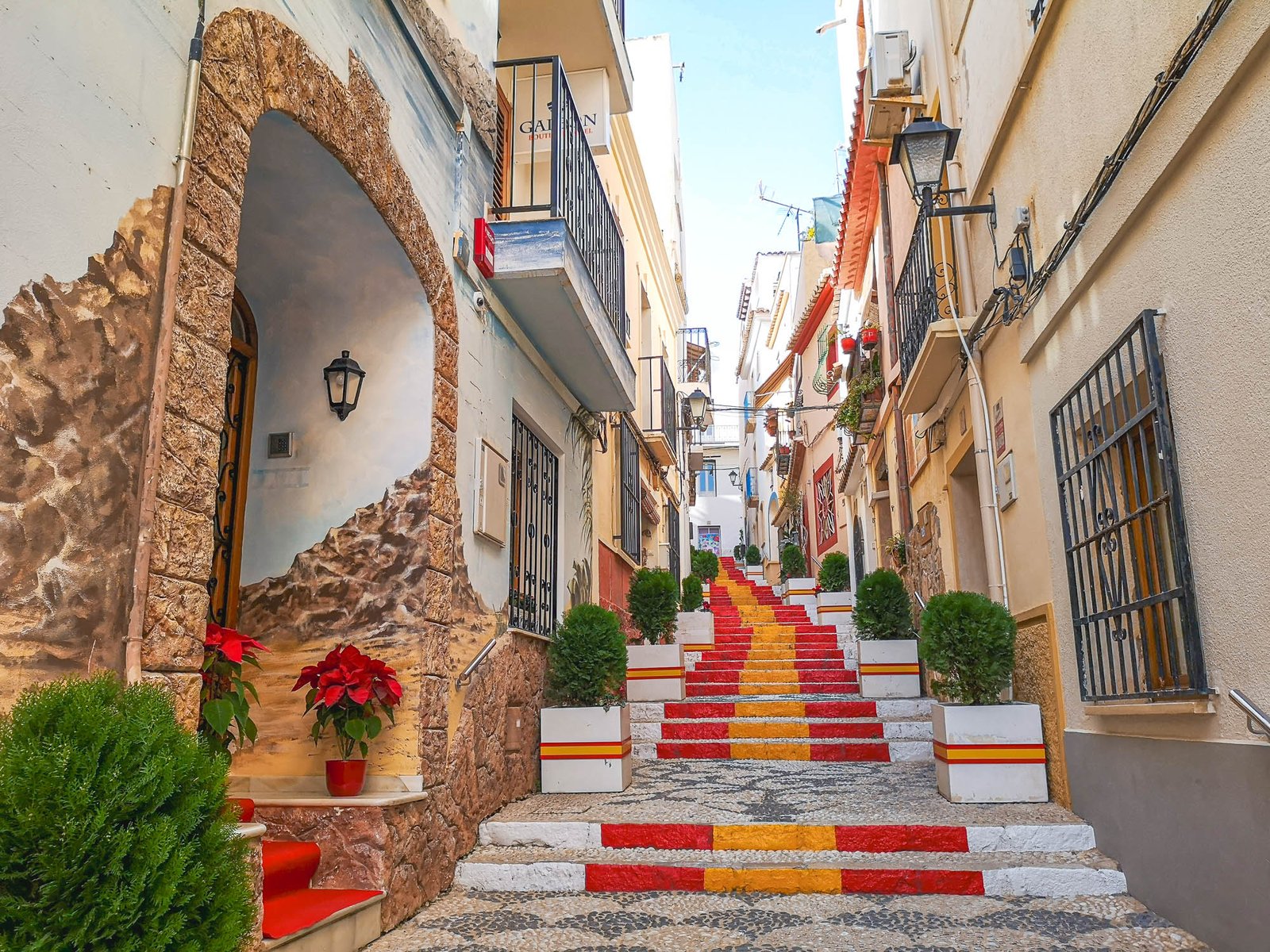
Calpe’s Historic Old Town is a vibrant tapestry of history and culture, offering a journey back in time through its narrow, winding streets. This charming quarter is a mosaic of ancient stone buildings, colorful murals, and Gothic churches, each telling its own story of the town’s rich past. As you wander through these quaint lanes, you’ll discover hidden plazas and delightful cafés, perfect for soaking in the local atmosphere. The Torreó de la Peça, an old defense tower, now serves as a cultural symbol of the town’s resilience through the ages. The blend of Moorish and Spanish architecture is a visual feast, and the artisan shops scattered throughout the area offer unique, handcrafted souvenirs. A visit to the old town is not just a walk through Calpe’s history, but an immersive experience in the living heart of this enchanting Spanish town. If you want to learn more about this topic, I have a separate article where I focus purely on the Old Town and the rich history of Calpe and the region.
3. Enjoy Sunset on a Boat Cruise
There’s no more enchanting way to end a day in Calpe than by embarking on a sunset boat cruise. As the sun dips below the horizon, painting the sky in shades of orange, pink, and purple, the Mediterranean Sea turns into a glittering canvas of colors. Aboard the cruise, you can feel the gentle sea breeze and hear the soothing sound of the waves, creating a serene and romantic atmosphere. It’s an ideal setting for photography enthusiasts, capturing the silhouette of the Peñón de Ifach against the fiery sky. Cruises include amenities like light refreshments or dinner, allowing you to savor local flavors while you float along the coast. This magical experience not only offers a different perspective of Calpe’s stunning coastline but also provides a tranquil moment to reflect on the day’s adventures.
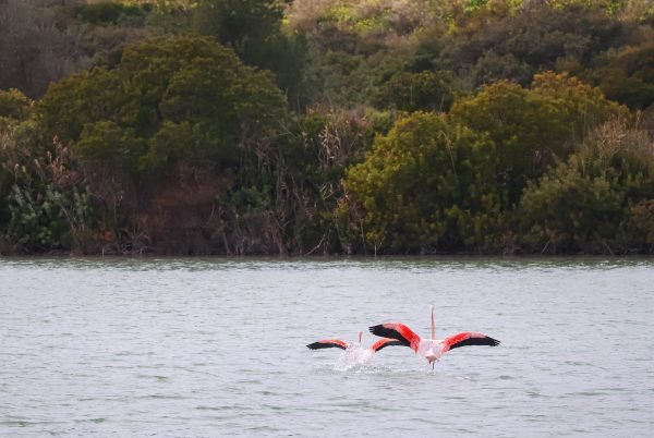
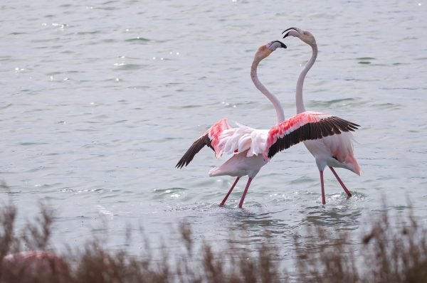
4. See Great Flamingos in Les Salinas de Calpe
A visit to Les Salinas de Calpe offers a unique wildlife experience right in the heart of the town. This natural saltwater lagoon, a remnant of ancient salt mining traditions, has become a sanctuary for a variety of bird species, most notably the elegant flamingos. These iconic birds, with their vibrant pink plumage and graceful movements, create a picturesque scene against the backdrop of the lagoon and the distant Peñón de Ifach. Bird watchers and nature lovers can stroll around the perimeter of the lagoon, enjoying the tranquility and capturing stunning photographs. The presence of informational boards along the paths provides insights into the ecology of the area and the life cycle of these fascinating birds. A visit to Les Salinas is not just a chance to witness the beauty of flamingos in their natural habitat, but also an opportunity to appreciate the delicate balance of Calpe’s unique ecosystem.
Playa de la Fossa(right) and Arenal-Bol(Far-left) from the tunnel to Penon de Ifach peak. Photo by Alis Monte [CC BY-SA 4.0], via Connecting the Dots
5. Explore the Beaches of Calpe
The beaches of Calpe are a cornerstone of its charm, offering a perfect blend of natural beauty and leisure activities. From the bustling Arenal-Bol to the more serene La Fossa, each beach has its own unique character. Arenal-Bol, with its fine golden sand and crystal-clear waters, is ideal for families, offering a safe and vibrant environment for swimming and sunbathing. La Fossa, known for its picturesque views of the Peñón de Ifach, provides a tranquil escape with its pristine shoreline and gentle waves. For those seeking a more secluded experience, the small coves dotting the coastline, like Cala del Morelló, offer peaceful retreats away from the crowds. Each beach is well-equipped with amenities like sun loungers, beach bars, and water sports facilities, ensuring a comfortable and enjoyable day by the sea. Whether you’re looking to relax under the Mediterranean sun, take a dip in the azure waters, or try your hand at windsurfing or paddleboarding, Calpe’s beaches offer something for every kind of beach-goer.
6. Take a Leisurely Stroll along the Promenade
The Paseo Marítimo in Calpe is a delightful promenade that stretches along the coastline, offering a scenic route for a leisurely walk. Lined with swaying palm trees and offering stunning views of the sea and the Peñón de Ifach, the promenade is a perfect place to experience the vibrant heartbeat of Calpe. As you stroll along, you’ll pass by a variety of charming restaurants and cafes, each offering a taste of local and international cuisine, often with al fresco dining options that allow you to enjoy your meal with a view. The walkway is also dotted with small boutiques and souvenir shops, perfect for browsing local crafts and gifts. In the evenings, the promenade comes alive with a gentle buzz of activity, making it an ideal spot for a romantic walk under the stars or an enjoyable evening out with family and friends. Whether for a morning jog, a leisurely afternoon stroll, or an evening meander, the Paseo Marítimo is a must-visit to truly embrace the coastal charm of Calpe.
7. Climb Morro de Toix
For those seeking an adventure off the beaten path, climbing Morro de Toix offers an exhilarating experience. This impressive cliff, located at the edge of Calpe, provides stunning views of the coastline and the Mediterranean Sea. As you ascend, the panoramic vistas unfold, offering breathtaking perspectives of the Calpe bays and the sprawling landscapes below. For rock climbing enthusiasts, there are various routes with different levels of difficulty, each promising an exciting and rewarding journey, but regular people can always climb Morro de Toix via urbanization roads from Calpe’s side. The summit of Morro de Toix is a peaceful spot, ideal for contemplation and taking in the natural beauty of the Costa Blanca. This activity not only tests your physical limits but also provides a unique way to connect with the rugged and raw beauty of Calpe’s natural landscape.
Thank you for visiting Connecting the Dots Journal’s official website!
You got lucky! We have no ad to show for you. If you still want to support my work in a different way, please, subscribe to newsletter or become a Patron
Click on the Ad to support my work.
Thank you for visiting Connecting the Dots Journal’s official website!
You got lucky! We have no ad to show for you. If you still want to support my work in a different way, please, subscribe to newsletter or become a Patron
Click on the Ad to support my work.
Thank you for visiting Connecting the Dots Journal’s official website!
You got lucky! We have no ad to show for you. If you still want to support my work in a different way, please, subscribe to newsletter or become a Patron
Click on the Ad to support my work.
8. Enjoy Fresh Seafood & Local Cuisine
Calpe’s culinary scene is a delightful celebration of fresh seafood and traditional Spanish flavors. The town’s close proximity to the sea ensures a constant supply of fresh fish and seafood, making it a paradise for seafood lovers. Local restaurants, ranging from cozy taverns to elegant eateries, offer a variety of dishes that showcase the best of Mediterranean cuisine. Signature dishes like paella, seafood stew, and fresh grilled fish are prepared with locally sourced ingredients, bringing the authentic taste of the region to your plate. Alongside seafood, one can also savor other regional specialties such as arroz a banda (rice cooked in fish stock), tapas, and fideuà (a noodle dish similar to paella). For a truly immersive experience, pair your meal with a glass of local wine or a refreshing sangria. Dining in Calpe is not just about the food; it’s an opportunity to indulge in the rich gastronomic culture of the region, with each meal offering a glimpse into the town’s culinary heritage and the Mediterranean lifestyle.
9. Visit Suitopia Skybar
Elevating the experience of Calpe’s vibrant nightlife is the Suitopia Skybar, a must-visit destination for those seeking a blend of luxury and stunning views. Located at the top of one of Calpe’s tallest buildings, this stylish skybar offers a 360-degree panoramic view of the town, the Mediterranean Sea, and the majestic Peñón de Ifach. As the sun sets, the skybar transforms into a picturesque setting, with the changing colors of the sky creating a mesmerizing backdrop. Guests can enjoy a variety of expertly crafted cocktails, fine wines, and a selection of gourmet snacks, all served in an elegant and contemporary atmosphere. The Suitopia Skybar is not just about the drinks; it’s an experience that combines stunning vistas, sophisticated ambiance, and exceptional service. Whether you’re looking to relax after a day of exploring or seeking a sophisticated evening out, the Suitopia Skybar promises an unforgettable experience in the heart of Calpe.
Thank you for visiting Connecting the Dots Journal’s official website!
You got lucky! We have no ad to show for you. If you still want to support my work in a different way, please, subscribe to newsletter or become a Patron
Click on the Ad to support my work.
Thank you for visiting Connecting the Dots Journal’s official website!
You got lucky! We have no ad to show for you. If you still want to support my work in a different way, please, subscribe to newsletter or become a Patron
Click on the Ad to support my work.
Thank you for visiting Connecting the Dots Journal’s official website!
You got lucky! We have no ad to show for you. If you still want to support my work in a different way, please, subscribe to newsletter or become a Patron
Click on the Ad to support my work.
Map of Calpe & Walks
All content and photos by Alis Monte. If you want to collaborate, contact me on info@wp.connectingcosta.com Photo by Alis Monte [CC BY-SA 4.0], via Connecting the Dots
Nestled within the inland of the breathtaking region of Marina Alta in Spain, La Vall de Laguar is a splendid union of three picturesque towns: Campell, Fleix, and Benimaurell, plus Fontilles – a renowned senatorium and research center for the diseases of the poor. Each of these towns boasts its unique charm, telling tales of ancient civilizations, vibrant cultures, and the rich tapestry of Spanish history.
Visitors to La Vall de Laguar are often drawn to its enchanting vistas, a blend of serene mountains and lush valleys. The landscape here paints a picture of untouched nature and promises an intimate experience with the land’s pure essence. The region offers an array of activities, from trekking along the rugged mountain trails to indulging in the tranquil beauty of its valleys. For those who seek an authentic Spanish experience, La Vall de Laguar serves as a portal to the past, all while offering modern comforts and amenities.
For the discerning traveler, a trip to La Vall de Laguar isn’t just about the sights; it’s a call to connect deeply with the soul of Spain. The allure of the towns and their heartwarming residents beckons you to immerse yourself in their way of life. As you plan your next adventure, consider the magic of La Vall de Laguar and embrace the opportunity to journey through time and beauty.
History & Legend of La Vall de Laguar
But beneath the idyllic silent landscapes lies a tale of a bloody resistance and legend, centered around the Cavall Verd Ridge (Valenciano as “Cavall Verd” and Castellano “Caballo Verde”). This area, resonating with the echoes of history, was the final bastion of the Moors, who faced their forced exile in 1609. The legend woven into these hills speaks of Ezzme de Laguart, a renowned sorceress and healer from Laguar, whose prophecy of the green horse sparked a rebellion against their expulsion.
In a valiant stand, 1500 local rebels, led by the farmer Mellini, gathered at the Cavall Verd crest, armed with mere slingshots, stones, and a crossbow, to face a formidable force of five thousand battle-hardened soldiers from Naples and Sicily. Despite their courage, the Moorish resistance met a tragic end, with many choosing to leap from the cliffs or hide in the Cavall Verd caves rather than face defeat. This tragic conflict saw the valley emptied of its original inhabitants, only to be repopulated in 1611 by settlers from Mallorca, whose descendants still carry the legacy of this historical moment in their family names today.
Campell
Steeped in history and surrounded by natural splendor, Campell stands as a testament to the timeless beauty of Marina Alta. Originally established as an Iberian settlement, the town has witnessed the ebb and flow of various cultures, from the Romans to the Moors, and then back to the Christians. These historic imprints are evident in the town’s architecture, blending Moorish designs with more modern Spanish influences.
Today, Campell is a harmonious mix of the past and present. Its narrow cobbled streets lead visitors through a maze of quaint houses, with bursts of colorful flowers adorning balconies and courtyards. The town square, buzzing with life, serves as a gathering spot for both locals and tourists alike, offering a glimpse into the daily life of the community. Modern amenities have found their place in Campell without overshadowing its historic charm. Local cafes and eateries provide a culinary journey, highlighting the region’s rich flavors and traditional recipes. As night falls, the town transforms into a peaceful haven, with the soft glow of street lamps illuminating its charming pathways.
Also known as Poble d’Enmig (“Town of In the Middle”), Fleix is not just a tranquil little town in the heart of La Vall de Laguer. It is a town with roots that trace back centuries, Fleix’s historical narrative is as captivating as its scenic beauty. I was once a strategic stronghold during the era of the Moors. Its elevated location provided both defense and a vantage point overlooking the majestic valleys below. But, after the expulsion of the Moors and repopulation in 1611, Fleix joined arms with Benimaurell and Campell to form a single unit.
Today, Fleix has maintained its quaint charm, seamlessly blending the old with the new. Its winding alleys echo tales of yesteryears, guiding visitors past beautifully preserved stone houses, remnants of ancient fortifications, and the iconic church that stands as the town’s spiritual heart. The church’s bell, with its melodious chimes, punctuates the daily rhythm of life in Fleix.
While the town may seem secluded at first glance, it’s this very seclusion that lends it its unparalleled charm. Modern conveniences, though present, take a backseat, allowing the town’s history and nature to shine. Whether it’s indulging in local delicacies at a family-owned eatery, hiking and embracing the marvelous nature of La Vall de Laguar, or simply basking in the panoramic views from a hilltop, Fleix invites you to slow down, breathe deep, and savor every moment.
Thank you for visiting Connecting the Dots Journal’s official website!
You got lucky! We have no ad to show for you. If you still want to support my work in a different way, please, subscribe to newsletter or become a Patron
Click on the Ad to support my work.
Thank you for visiting Connecting the Dots Journal’s official website!
You got lucky! We have no ad to show for you. If you still want to support my work in a different way, please, subscribe to newsletter or become a Patron
Click on the Ad to support my work.
Thank you for visiting Connecting the Dots Journal’s official website!
You got lucky! We have no ad to show for you. If you still want to support my work in a different way, please, subscribe to newsletter or become a Patron
Click on the Ad to support my work.
Benimaurell
Situated amidst the undulating landscapes of La Vall de Laguar, Benimaurell is a gem that sparkles with a rich cultural heritage. Its origins are steeped in stories of ancient civilizations, and its streets bear witness to epochs gone by. In times past, Benimaurell served as an essential crossroad for traders and travelers, a nexus where diverse cultures met, exchanged, and coexisted.
Modern-day Benimaurell is a mosaic of history and contemporary life. Its skyline is punctuated with historic towers, remnants of fortifications that once protected its residents from external threats. These architectural marvels now stand alongside newer structures, embodying the town’s evolution over time. Benimaurell’s location, cradled by mountains and overlooking lush valleys, offers a respite from the hustle and bustle, making it an ideal haven for those seeking peace and inspiration.
Best time to visit: Spring and Fall, when the weather is mild and the landscape is in full bloom.
Map of Marina Alta Activities
Best Hiking Trails in La Vall de Laguar
This region of Costa Blanca is a paradise for people who love to spend their time enjoying the bliss of the wonderful nature of Spain. Whether you choose hiking trails on the coast of Marina Alta or inland, you are on top of the game. It doesn’t mean that the best walking routes around Benidorm in Marina Baixa are worse, but Marina Alta as a region is on a totally another level, and La Vall de Laguar is not an exception but rather a rule.
One of the most famous trails, this route lets hikers witness the ‘Hell’s Gorge’ up close. The trail stretches approximately 14 km/8.7 mi and offers panoramic views of cascading waterfalls, ancient Moorish terraces, diverse local flora, and the so-called “La Catedral of Senderismo” (eng. “The Cathedral of Hiking”).
PR-CV 181 Cavall Verd
The PR-CV 181 Cavall Verd trail, often referred to as “The Watchman’s Pathway,” is a journey steeped in legend and natural beauty. This moderate-level hike stretches approximately 12 km / 7.5 mi, leading adventurers through a mosaic of landscapes that define the Marina Alta region.
The trail’s name, Cavall Verd, translates to ‘Green Horse,’ and is said to be named after the silhouette of the mountain that resembles a horse’s back. Local lore also speaks of vigilant watchmen who, during times of conflict, would use these heights to spot impending threats from afar.
Spanning roughly ±14 km/8.5 mi, this trail gives a comprehensive view of the entire valley. Hikers pass through dense forests, orchards, and traditional Spanish hamlets, soaking in the essence of La Vall de Laguar.
Thank you for visiting Connecting the Dots Journal’s official website!
You got lucky! We have no ad to show for you. If you still want to support my work in a different way, please, subscribe to newsletter or become a Patron
Click on the Ad to support my work.
Thank you for visiting Connecting the Dots Journal’s official website!
You got lucky! We have no ad to show for you. If you still want to support my work in a different way, please, subscribe to newsletter or become a Patron
Click on the Ad to support my work.
Thank you for visiting Connecting the Dots Journal’s official website!
You got lucky! We have no ad to show for you. If you still want to support my work in a different way, please, subscribe to newsletter or become a Patron
Click on the Ad to support my work.
Fontilles Viewpoint Trail
Ideal for those looking for a light trek, this 6 km/3.7 mi trail culminates at a viewpoint overlooking the Fontilles Sanatorium. The trail meanders through aromatic herb patches and provides opportunities for bird-watching.
How to Get to La Vall de Laguar
Reaching La Vall de Laguar is a journey as rewarding as the destination itself, with scenic routes offering glimpses of the Spanish countryside’s charm.
Thank you for visiting Connecting the Dots Journal’s official website!
You got lucky! We have no ad to show for you. If you still want to support my work in a different way, please, subscribe to newsletter or become a Patron
Click on the Ad to support my work.
Thank you for visiting Connecting the Dots Journal’s official website!
You got lucky! We have no ad to show for you. If you still want to support my work in a different way, please, subscribe to newsletter or become a Patron
Click on the Ad to support my work.
Thank you for visiting Connecting the Dots Journal’s official website!
You got lucky! We have no ad to show for you. If you still want to support my work in a different way, please, subscribe to newsletter or become a Patron
Click on the Ad to support my work.
By Car
Setting out from Alicante on the A-70, the cityscapes gradually give way to coastal vistas as you merge onto the AP-7 towards Valencia. Take exit 62, and the N-332 briefly teases with coastal charm before guiding you onto the CV-729 towards Orba. From there, the winding CV-721 weaves through the countryside, culminating in the welcoming embrace of La Vall de Laguar, where the heart of the town offers ample parking.
By Bike
For the more adventurous, biking to La Vall de Laguar provides an exhilarating experience. There are several bike rental shops in nearby cities like Alicante and Denia. The route, while hilly, offers cyclists a chance to immerse themselves in the region’s natural beauty. Ensure you have a map or GPS, as some trails can be less straightforward.
When I visited La Vall de Laguar for the first time it was a big surprise, and love, almost, from the first sight. Seldom do you find such a relatively easy area to access, yet so mesmerizing with its sheer beauty and the strong aura of remoteness. Of course, the inland parts of Marina Alta like La Val de la Gallinera share those feats, but it is much harder to access as it often requires a dedicated day, while La Vall de Laguar’s location in a relative proximity to the access to the A7 highway, making this area a much more flexible option for a visit.
Another great feature of La Vall de Laguar is its space planning resulting in decent facilities. Unfortunately, you won’t find a public WC but, at least, parking won’t be a problem. Furthermore, the hiking trails are marked really well, and you’ll find plenty of information in English together with the usual local languages Valencian and Castellano.
All things combined, I think La Vall de Laguar makes a perfect peaceful getaway from the ever-busy coast of Costa Blanca and Costa del Azahar. Not only it is a picturesque adventure but it offers an escape into the tranquil yet unsung nature of Spanish mountains. No matter how many friends I have brought to these areas, they were highly impressed by the pristine beauty of it. I wonder if the close proximity to the overpopulated coast gives an extra charm to the immediate pearls of the inland due to the high contrasts. One way or another, La Vall de Laguar makes a perfect destination for anyone who wants to experience Marina Alta by heart and to its fullest.
All content and photos by Alis Monte, unless stated differently. If you want to collaborate, contact me on info@wp.connectingcosta.com Photo by Alis Monte [CC BY-SA 4.0], via Connecting the Dots
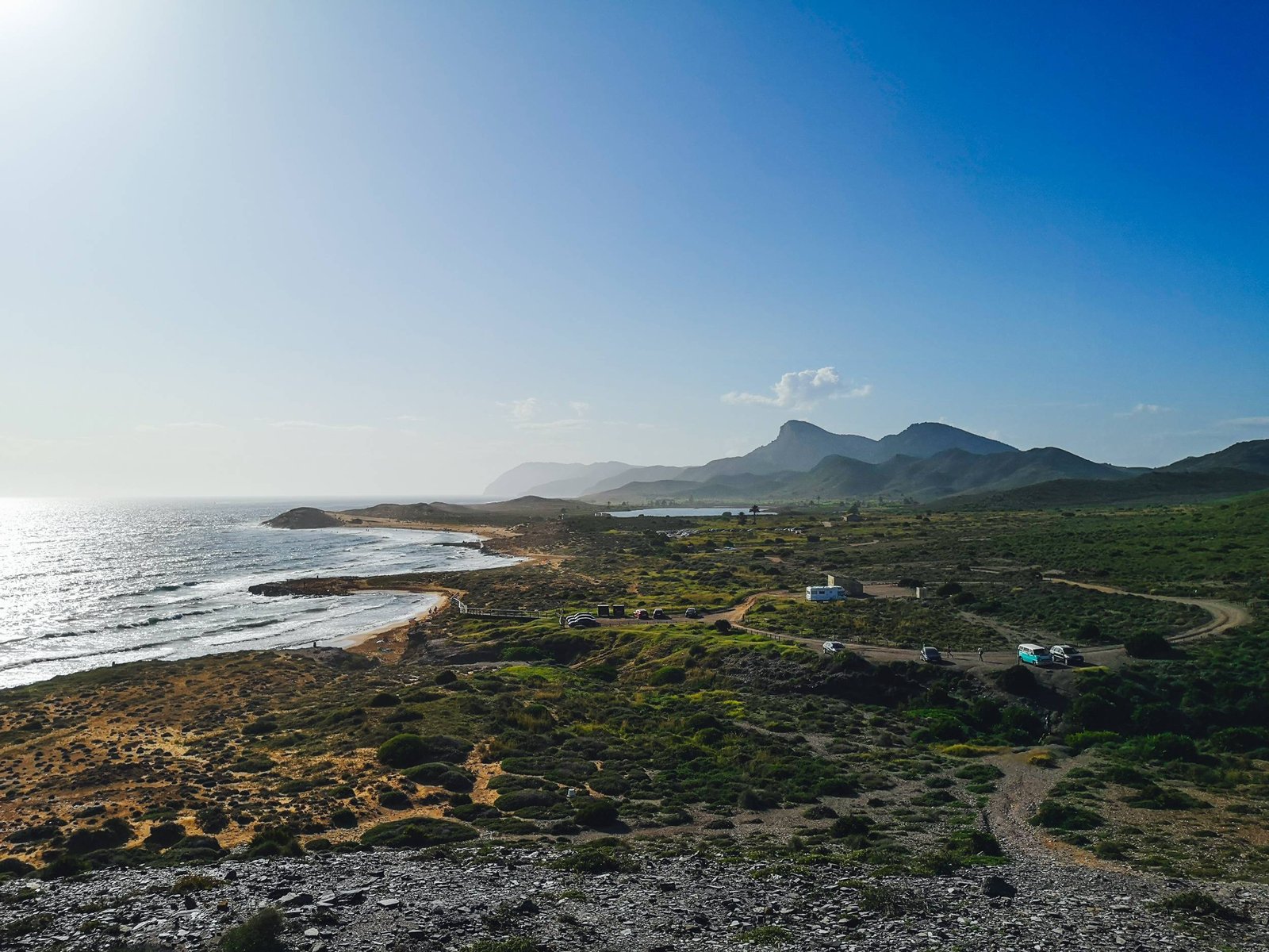
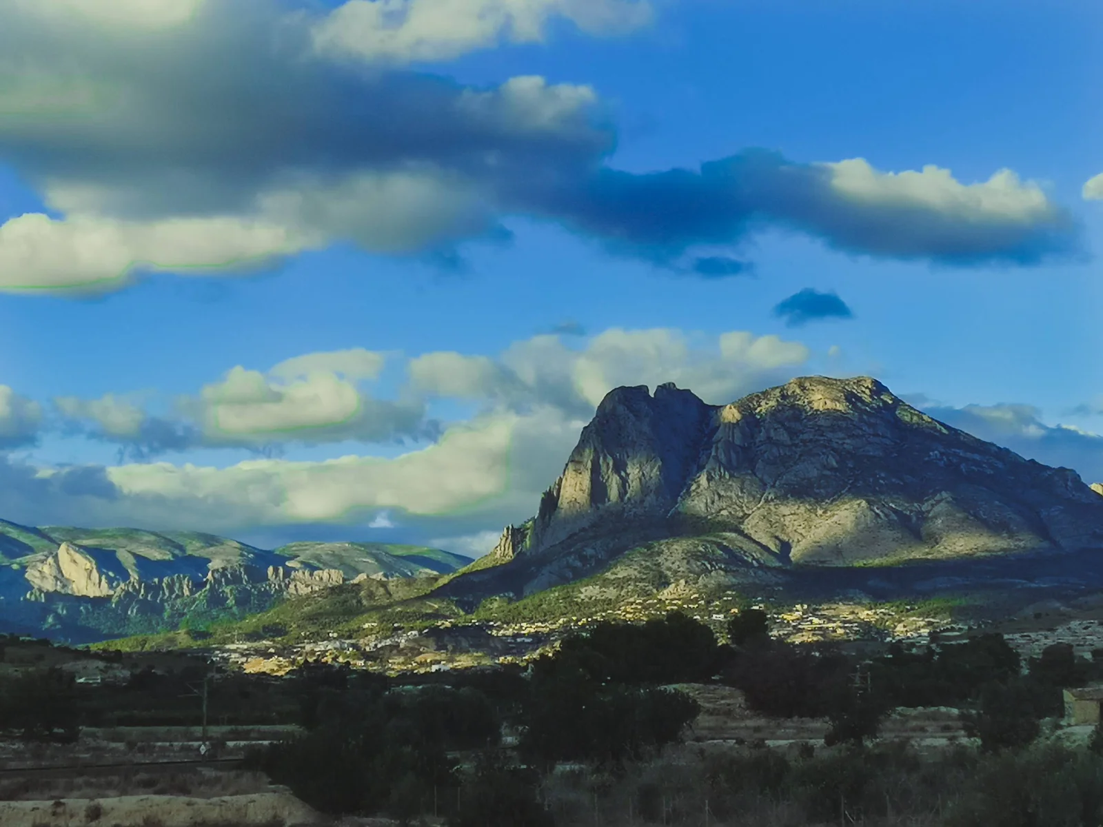
Without a doubt, Marina Alta is the most beautiful region of Costa Blanca. It wouldn’t surprise me if it was ranked right there at the top on a hypothetical factual “the most beautiful Mediterranean coastlines of mainland Europe”. There is no such list but what I’m trying to say – Marina Alta is exceptionally beautiful. You might not have heard of it but sure you have heard of Ibiza and Balearic Islands? Marina Alta is the part of Spain between the gulf of Valencia and the gulf of Alicante, which is the closest point to these iconic Spanish islands. I would argue that the cliffs and some of the beaches are just as beautiful as in the islands. One way or another, any of the best hikes in Marina Alta could be a very pleasant surprise.
Due to the beauty and magic of its landscape, Marina Alta was densely populated by Iberian Culture from about 8th century BC. Photo by Alis Monte [CC BY-SA 4.0], via Connecting the Dots
Geography & Geology
The direct translation of Marina Alta from Spanish to English is the “high port”, as an opposition to the nearby Marina Baixa, or the “low docks”, the region surrounding Benidorm. The name of Marina Alta could be easily explained by geography and geology. The region is located on the southernmost edge of mainland Spain, which has raised from the sea millions of years ago, when the Eurasian plate collided with the African one. This massive event led to the genesis of many mountains in Europe, but the closest to the point of origin are the Betic Mountains, with Marina Alta located on one end of it. The other being nothing else but famous Gibraltar and Betic Mountains dominating the scenery of the whole landscape in-between in one way or another.
As Phoenicians themselves noticed in ancient times, Betic Mountains is more or less the area between the Western Rock (Gibraltar) and the Eastern Rock (Penon de Ifach). Technically, the latter one being a part of Marina Alta but since I wrote about climbing Penon de Ifach so much, this hiking route will escape the list at least for now. Despite that, the famous Cape rock adds to the region of Marina Alta, which is simply could be called a hikers’ paradise.
Calla del Moraig – Calla del Llebeig (Los Acantilados)
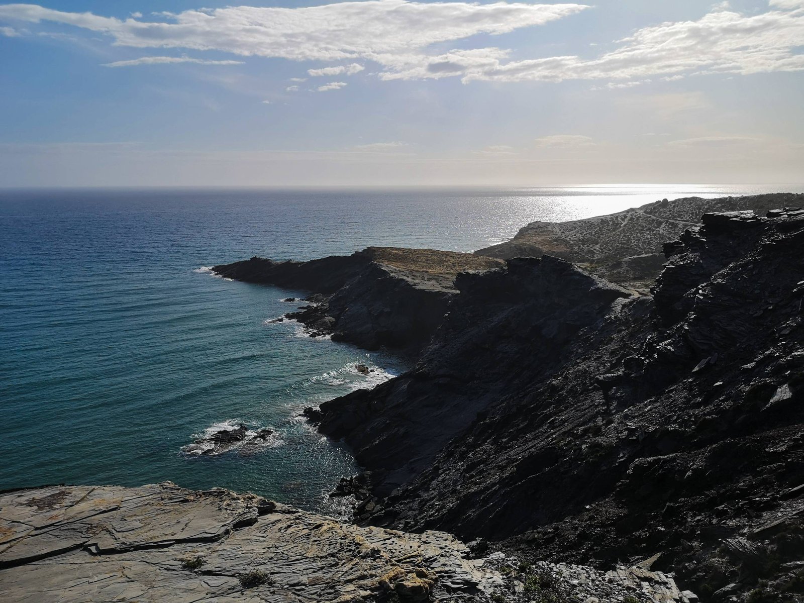
Los Acantilados hike is probably the most popular outdoor destination in the area for the high and exceptionally beautiful beaches: Cala del Moraig and Cala Llebeig. The first one is a very popular attraction on its own, offering very unique geological formations, and the latter one is a pristine remote fishing beach, straight out from a postcard. They are connected via the Los Acantilados hike, which a semi-easy walk amid very high cliffs. The route offers majestic views all the way. If you can deal with some steps, the heights, and the crowds, this could be easily the hike to pursue in Marina Alta.
From left to right: Cap de la Nao, La Granadella, Morro Falqui & Falla del Moraig. Photo by Alis Monte [CC BY-SA 4.0], via Connecting the Dots
Though the official hiking trail of Los Acantilados goes past Cala Llebeig back upwards the mountain, there is no reasonable option to make it a circle route. I did not find it to be a major problem as the views are equally stunning in both directions. The hiking trail goes along the cliffs, somewhere in a midst of it. This gives an illusion of being somewhere remote in nature, though in reality the cliff is heavily urbanized just above your head. Along Los Acantilados you’ll find a few remote hermit houses, used to shelter animals by shepherds almost 100 years ago.
While the hiking trail between the two beaches is relatively short, it is not possible to quickly cruise through the whole route. Parts of the hike require extra attention due to the narrow passages by the steep cliffs. The final section of the hike gives breath-taking views of Cala Llebeig, but descending to the beach might be not for everybody. Climbing back up will literally going to take your breath away.
The descend to Calla Llebeig might be not for everybody, but the viewpoint itself is worth the hike. Photo by Alis Monte [CC BY-SA 4.0], via Connecting the Dots
Cova dels Arcs
Los Acantilados might be the most sought hiking trail in Marina Alta, but it doesn’t define everything this gorgeous corner has to offer. At the edge of Cala dėl Moraig lies a beautiful cave – Cova dels Arcs. It has a few entrances forming a spider-like rock sculpture Cova dels Arcs is a perfect example of what happens when a continental karst system goes underwater. Today, this exceptional geological formation is a symbol of the Valencian coastline and challenges Los Acantilados for the top tourist destination in Benitachell.
Another interesting geological formation found right next to Cala del Moraig and Cova dels Arcs is Falla del Moraig. You can access it on a short 15-min walking trail (marked pink) right from Cala del Moraig. Many people mistake this hiking route with Los Acantilados, thus be sure to check the hiking map, I provided above.
Though Falla del Moraig resembles a phallus, the word “falla” stands for a fault, because this geological formation is a good example of a normal fault line. This creative term describes a crack within the earth, where the upper block slides down relative to the block below. These kinds of slides are possible causation of earthquakes. The gap between geological blocks formed because waves of the Mediterranean eroded the lower part of the upper block and the rock have collapsed. It is possible to see the continuation of this fault line on the other side of Cala del Moraig.
Los Acantilados hikign trail begins at the parking of Cala Moraig not the beach itself. Photo by Alis Monte [CC BY-SA 4.0], via Connecting the Dots
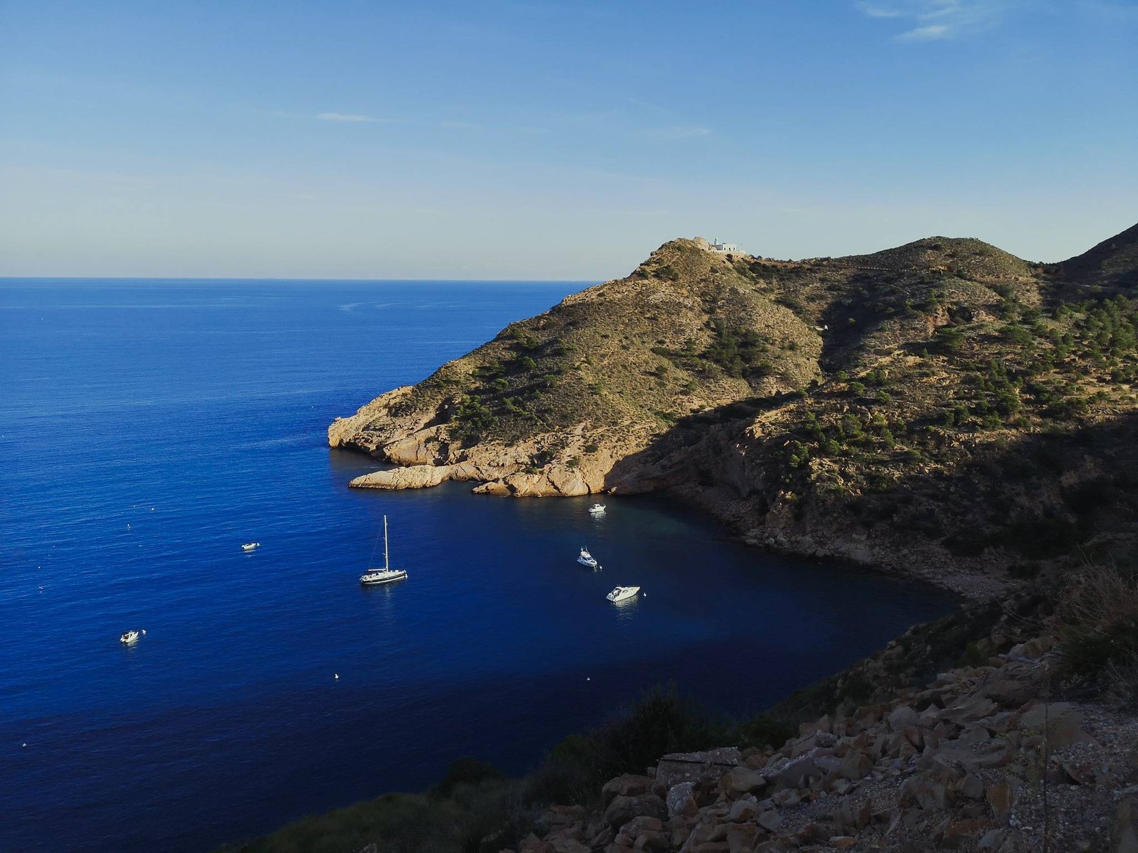
Cala Barraca – Cap Prim Hike
A hike to an exceptionally beautiful narrow piece of nature pressed to the very edge of high cliffs by countless fancy mansions. Cap Prim (eng. Prim Cape) is a very tip of a larger peninsula of mainland Spain – the closest point to the Balearic islands. That explains both the reason why it attracts so many rich people and the awe-inspiring views of a landscape, which is more similar to a south Asian than a European one. The people are not the only inhabitants of Cap Prim. Many bird species find this narrow piece of land as their home, which is still dwarfed by the colonies living on the Island of Portixol that dominates the scenery throughout most of the time during this wonderful hike.
Thank you for visiting Connecting the Dots Journal’s official website!
You got lucky! We have no ad to show for you. If you still want to support my work in a different way, please, subscribe to newsletter or become a Patron
Click on the Ad to support my work.
Thank you for visiting Connecting the Dots Journal’s official website!
You got lucky! We have no ad to show for you. If you still want to support my work in a different way, please, subscribe to newsletter or become a Patron
Click on the Ad to support my work.
Thank you for visiting Connecting the Dots Journal’s official website!
You got lucky! We have no ad to show for you. If you still want to support my work in a different way, please, subscribe to newsletter or become a Patron
The Cap Prim is a real paradise on the edge of the Betic Mountains, whose high cliffs dip into the Mediterranean. The close encounter of mountains and sea sculpted out this majestic landscape throughout the endless years and today – to put it bluntly – it is absolutely stunning. Cap Prim is a true hidden secret as there not much information on the Internet but once you are in the area, something naturally draws you there. As my experience has shown me, this is that kind of hike, which literally sucks you in. A real step-turner, if you pardon the pun. It doesn’t matter, where you’d start the route, you’ll end up in Cap Prim.
Though accidentally I walked to Cap Prim from Cala Blanca (3.94 km / 2.45 mi), I intended and recommend doing so via the official route. You could either start at Cala Barraca (3.67 km / 2.28 mi) or Creu de Portixol (2.14 km / 1.33 mi). Though have in mind that the latter one has very limited parking options, and getting to Cala Barraca might be not an option for less experienced drivers. If you have time, hiking from Cala Blanca is still a very viable option.
Torre de Vigia Walking Trail (El Portet Beach – Cap d’Or)
The climb up to the watchtower of Cap d’Or (eng. d’Or Cape) is an hour-long hike, beginning at El Portet Beach in Moraira, which is an outstanding travel destination on its own. The first part of the hike leads through some fancy estates, facing the Mediterranean but soon the road leads into the protected areas of micro-reserve. From there on, the rich history of this small area unveils itself. Besides the expected watchtower, Cap d’Or houses an ancient Iberian settlement and a prehistoric cave. Thanks to a recent infrastructure investment all these places could be reached on foot. At the end of the day, the climb to the Watchtower of Cap d’Or is a magical experience. Let alone the views of the Mediterranean or El Portet beach, but the cape has a positive aura attached to it.
Thank you for visiting Connecting the Dots Journal’s official website!
You got lucky! We have no ad to show for you. If you still want to support my work in a different way, please, subscribe to newsletter or become a Patron
Click on the Ad to support my work.
Thank you for visiting Connecting the Dots Journal’s official website!
You got lucky! We have no ad to show for you. If you still want to support my work in a different way, please, subscribe to newsletter or become a Patron
Click on the Ad to support my work.
Thank you for visiting Connecting the Dots Journal’s official website!
You got lucky! We have no ad to show for you. If you still want to support my work in a different way, please, subscribe to newsletter or become a Patron
La Cova de les Cendres (eng. Cendra Cave) is considered to be one of the most important archeological sites in the Iberian Peninsula. The cave was inhabited since the prehistoric times some 20,000 years ago to the Neolithic period 8,000 years ago (The final stage of the Stone Age, characterized by domesticated animals and crops).
The trail down to the Cendra Cave a recent addition as a part of the renewal project of Torre de Vigia walking trail. Making it a good choice for either history fans or off-beaten path adventurers. The trail has a few but very steep steps. It leaves me wondering about the toughness of the prehistoric people – one thing is to descend to or ascend from the cave, but keeping cattle over there?
Caves facing the Mediterranean with an evidence of the prehistoric people are found across the coastline of Marina Alta. Photo by Alis Monte [CC BY-SA 4.0], via Connecting the Dots
Cap d’Or
The name of d’Or Cap translates into the Golden Cape, which is associated with the Sun Cult of the Iberian Culture. It is the same word from the infamous “matador”, or “atoreador” from bullfighting, which possibly derived from some ancient Iberian ritual of sacrificing a bull to the Golden Sun.
At the foot of the 16th watchtower of Cap d’Or, lies the ruins of ancient Iberian town. It is not the first such archeological site in the Province of Alicante that gives this energized feeling. Like many ancient cultures, Iberians chose magic places for their settlements or sacred places, based on the movements of the Sun or constellations. Given the rich scenery visible from the top of Cap d’Or: Penon de Ifach, Sierra de Bernia, Sierra de Gelada, and even Puig Campana, I imagine the whole calendar could be laid-out on the horizon.
From left to right: Penon de Ifach, Sierra Gelada, Sierra Bernia & Puig Campana. Photo by Alis Monte [CC BY-SA 4.0], via Connecting the Dots
Hiking Granadella
Luckily for us, the Granadella Forest Park area for some reason was left uninhabited, making it one of only two such areas by the coast of Marina Alta. (The other one is, of course, the natural park of El Montgo). Though this park is labeled as a forest, almost no trees are here today. The reason behind this is the terrible wildfires in 2016 that completely devastated vast areas between Javea and Granadella. Remember that most such wildfires are caused by people, so if you chose to hike during a dry season, be extra careful with fire.
Today, despite being nothing exceptional compared to the famous Park in Marina Alta – El Montgo, being uninhabited alone makes the area around Granadella special. The reason is the possibility to find traces of the original flora and fauna here, which is very rare on the coastline in Marina Alta. To be honest, across the whole country. Among the interesting fauna that you might encounter are hedgehogs, dormice and beetles. You might be not lucky enough to spot these but I’m sure that across the hike you’ll encounter various species of plants and birds like larks, serins, and swallows.
Tip: Note that this area lacks shade, so it is better to come early or in the evening.
Granadella beach hike is going to unveil most of this unique green space has to offer. The hike will start from urbanización located by the foot of Mount Llorenca and will lead you through a plateau with some ravines. The road will slowly take you towards the cliffs with beautiful vistas of the Mediterranean and Granadella Beach itself. Though the descent to the sea level is relatively steep it is not dangerous at all like in some other hikes on the list. Unfortunately, the beach could be reached by car as well, so it won’t feel as remote as some other places. The upside of this is a couple of cozy restaurants and water sports gear rent. The hike should be perceived as a semi-circular trail in a green area by the sea anyway. Access to Granadella Beach on the midway is just a bonus. It is a perfect option if you are not sure if you want to spend a day in nature or by the beach.
Mount Montgo Massif homes the largest natural park in Marina Alta. Located between the two most populous towns in the region – Denia and Javea – Montgo Nature Park is a naturally popular location for hiking. It has the biggest variety of different difficult routes, and probably is the best destination for a decent outdoors challenge.
Key features
High cliffs
Large green areas
Variety of hikes
Mount Montgo massive faces the Mediterranean forming giant cliffs along the coast. Photo by Alis Monte [CC BY-SA 4.0], via Connecting the Dots
Denia – Cova Tallada Hike
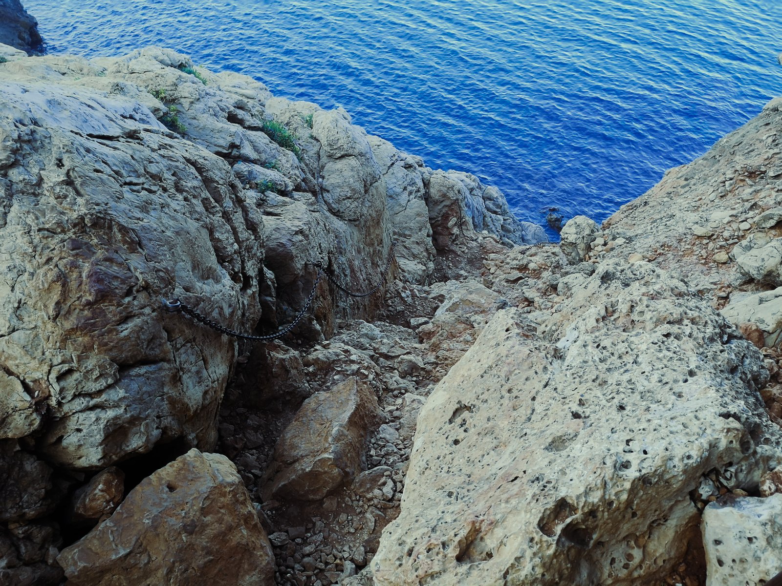
This is a very rewarding, semi-short but a bit difficult hike for inexperienced outdoors people. To most of us, it would be an easy walk in a park without a need for a map but due to the high traffic of visitors, the route becomes a bit more dangerous than it should, so you must be careful of other people’s actions. Otherwise, it is an enjoyable walk along the cliffs, facing the Mediterranean with a few steps and narrow passages with chains.
Key features
Cova Tallada cave system
Mount Montgo high cliffs
Good snorkeling
Cliff diving
Kayaking alternative
The entrance to Cova Talada is hidden down a small cliff, just above the Mediterranean. Photo by Alis Monte [CC BY-SA 4.0], via Connecting the Dots
Hike details
Location: Montgo Natural Park
Starting Location: Denia
Target Location: La Cova Tallada
Distance: 1km / 0.62mi x2
Ascend: Flat (~80 m / 260 ft)
Type: Linear
Duration: 30-40min x2
Difficulty: Intermediate
Color: Yellow
Despite all the obstacles, the hike to Cova Tallada is a wonderful destination to an inland rocky island paradise. Though the red route itself won’t take a lot of your time – be prepared to spend a better half of a day there. Cova Tallada is a beautiful cave system surrounded by pristine Mediterranean water, small islets, and giant cliffs. This spectacular landscape is a great place for a picnic, snorkeling, cliff diving, reading a book, or simply contemplating your thoughts. Just be sure to wear a good pair of hiking boots, take water shoes, and pick up all your trash.
Have in mind that the described Cova Tallada hiking route starts from the Denia side of Mount Montgo Natural Park. Though it is possible to hike to the cave from the Javea side, this is the easiest way to do so. If you want more information on this particular route, you can read my detailed guide of hiking from Denia to Cova Tallada.
The name of Playa de Pope comes after a Russian Orthodox priest, who used to come to bathe in this beach. Photo by Alis Monte [CC BY-SA 4.0], via Connecting the Dots
Sant Antoni Cape Hike
This short hike from the port of Javea to Cap Sant Antoni (eng. Saint Anthony Cape) is just the first steps of the longer hiking trail all the way up to Mount Montgo – PR-CV 355 Port Xàbia-Montgo. Regardless of it, the hiking route stands out on its own as a worthy walk. The climb up to the lighthouse of Cap Sant Antoni is not that challenging but rewarding in different ways. To be more precise, the hiking route has spectacular views of the beaches of Javea, Mount Montgo, Portixol Island, and Cap Prim. Possibly the most impressive part of the hike is the local vegetation, which just seems to be greener than everywhere else. All things considered, the Cap Sant Antoni hike is an easily accessible and rewarding hiking destination.
Thank you for visiting Connecting the Dots Journal’s official website!
You got lucky! We have no ad to show for you. If you still want to support my work in a different way, please, subscribe to newsletter or become a Patron
Click on the Ad to support my work.
Thank you for visiting Connecting the Dots Journal’s official website!
You got lucky! We have no ad to show for you. If you still want to support my work in a different way, please, subscribe to newsletter or become a Patron
Click on the Ad to support my work.
Thank you for visiting Connecting the Dots Journal’s official website!
You got lucky! We have no ad to show for you. If you still want to support my work in a different way, please, subscribe to newsletter or become a Patron
From my own experience of hiking in Marina Alta, I would consider Port Javea – Cap Sant Antoni hiking trail to be the least demanding one. The whole route is a gradual climb up the cliff without any major obstacles ensuring maximum pleasure. Even more so, this straight-up-forward hike doesn’t have any really dangerous passages, thus it is a viable option for more experienced families. I’ve seen many people walking their dogs on this hiking route and I can’t blame them. If I was living in Javea and had a dog – I would probably do the same.
Once you get on top of Cap Sant Antoni don’t forget to visit all viewpoints to enjoy the beautiful scenery of Javea Bay and beyond while doing so. I wouldn’t recommend going off the official route as things might get ugly rather quickly. Along with Sant Antoni lighthouse, you’ll find remains of the past eras. Though I haven’t found any information on this, I’m sure Cap Sant Antoni was inhabited by humans since the deep stone age.
There is not much to say – getting on the top of Mount Montgo is the ultimate challenge in Marina Alta. The only question is how you want to do it. The route I chose is not the shortest, but still doable within a day, and the upside is that the climb from Jesus Pobre is not as steep as the alternative options. Neither route is recommended for less experienced hikers. Climbing mountains is very rewarding but the hike itself might be tough and not as interesting as the amazing alternatives in Marina Alta I mentioned before. Nevertheless, Mount Montgo will open breath-taking views to those who dare to challenge it.
During the hike, be sure to appreciate the walls of an ancient Iberian town – La Penya de l’Àguila, which dates as far as to the 5th century BC.
Thank you for visiting Connecting the Dots Journal’s official website!
You got lucky! We have no ad to show for you. If you still want to support my work in a different way, please, subscribe to newsletter or become a Patron
Click on the Ad to support my work.
Thank you for visiting Connecting the Dots Journal’s official website!
You got lucky! We have no ad to show for you. If you still want to support my work in a different way, please, subscribe to newsletter or become a Patron
Click on the Ad to support my work.
Thank you for visiting Connecting the Dots Journal’s official website!
You got lucky! We have no ad to show for you. If you still want to support my work in a different way, please, subscribe to newsletter or become a Patron
Since Marina Alta is the easternmost part of mainland Spain, the main roads tend to cut this beautiful “corner”. While most of the region could be easily accessed, getting to the coastline of Marina Alta is not as simple as anywhere else in the Province of Alicante. Given that, the quality of the local roads is very good compared to the other regions due to the richness of the area.
You can reach Marina Alta by either AP-7 Autopista Mediterraneo (eng the Mediterranean Motorway), or the lesser N-332, which will get you just a bit closer to the heartland of Marina Alta. Either way, you need to look for Benissa or Teulada (CV-740) – the main gateways to the rest of the region. Both can only be accessed from N-332, thus you’ll need to enter it from AP-7 first to get any further.
Pro tip: From 2021, most of AP-7 in Marina Alta is free.
Without a doubt, Marina Alta is the most beautiful part of a really attractive Costa Blanca. The same case could be made not only for the Valencian Community but for the whole coastline of the Spanish mainland of the Mediterranean. Having that in mind, I must admit that it was not a love from first sight for me. Most of Costa Blanca is massively urbanized and almost exclusively for ex-pats and tourists. As a result, it is even hard to find that desired temperament of Spanish culture in the area. Of course, there is one upside to that – you’ll find communicating in English around these areas much easier than in most of Spain.
Having all that in mind, it took me a while to learn to see all the prettiness of the region through the crowds of tourists and ex-pat houses. What did I find? Exceptionally beautiful landscape, where mountains meet the sea. Marina Alta has everything a true nature lover desires. Traveling through Marina Alta’s inland and coastal areas made me wonder what the whole landscape looked like without all the urbanization, especially during the magic times of the Iberian Culture. These people chose Marina Alta and the surrounding landscape as their home for a reason and so do thousands of people today.
All content and photos by Alis Monte. If you want to collaborate, contact me on info@wp.connectingcosta.com Photo by Alis Monte [CC BY-SA 4.0], via Connecting the Dots
El Torcal is a natural UNESCO World Heritage Site within the Betic Mountains, known for its unusual finger-like pillar stone formations and other distinctive geological features. It is widely regarded as one of the most unique karst landscapes in the whole of Europe. Located right next to Antequera, just 48.1 km / 29.89 mi from Malaga, El Torcal is often left out off the tourists’ radars. While it is probably better for the preservation of the area, it doesn’t do justice to the beauty of this awe-inspiring mountain range. After all, there has to be a reason why it was added to the natural UNESCO World Heritage Site list. For sure, it has something to show off for it, especially, for nature enthusiasts like me.
Situated in-between the countless pieces of Betic Mountains, El Torcal could be easily mistaken for being just another fish in a pond. Having that in mind, a keen eye will notice a difference of range’s formations, whose rounded-shaped rocks give out that something unusual had happened here. Ultimately, the finger-like pillars need certain conditions to form.
Rock formations of El Torcal are reminiscent of the Great Pillars of the Gondor Kings. Photo by Alis Monte [CC BY-SA 4.0], via Connecting the Dots
Formation of Sierra del Torcal
Betic Mountains stretch throughout the southeastern part of Spain along the Mediterranean coast. Its location is no coincidence. The genesis of these mountains rose large parts of the Iberian Peninsula from the depths of the ocean millions of years ago. This gradual action shaped the iconic peninsula to its current form we all know and appreciate today. Geologists can tell that the rocks across the area, started to form at the bottom of the ocean about 200 million years ago during the Jurassic era.
El Torcal is a great example of this geological process, the whole mountain range is like a ‘living fossil’ and speaks for itself of what had happened here throughout all that time. The incarnation of these mountains is a very interesting and unique case in the peninsula. For this reason, in 1929 El Torcal de Antequera became the first object to be recognized as “Andalusian Protected Natural Area”. In the coming years, the mountain range was declared and added to many other conservation lists, including the UNESCO World Heritage Site list, I mentioned before.
El Torcal, together with La Peña de los Enamorados (human head shaped mountain) and three neolithic megalithic monuments form Antequera Dolmens UNESCO Site. Photo by Alis Monte [CC BY-SA 4.0], via Connecting the Dots
Despite being located right next to a regional center – Antequera, due to its nature, El Torcal offers a very limited variety of access.
Thank you for visiting Connecting the Dots Journal’s official website!
You got lucky! We have no ad to show for you. If you still want to support my work in a different way, please, subscribe to newsletter or become a Patron
Click on the Ad to support my work.
Thank you for visiting Connecting the Dots Journal’s official website!
You got lucky! We have no ad to show for you. If you still want to support my work in a different way, please, subscribe to newsletter or become a Patron
Click on the Ad to support my work.
Thank you for visiting Connecting the Dots Journal’s official website!
You got lucky! We have no ad to show for you. If you still want to support my work in a different way, please, subscribe to newsletter or become a Patron
Click on the Ad to support my work.
By public transport
There is no public transport running to El Torcal.
By car
Car is the only way to get up to El Torcal visitors center. You can reach it from 42nd km of road A-7075, between Antequera and Villanueva de la conception.
Parking at Centro de Visitantes Torcal Alto on the mountain range is limited and the road leading to it is closed after the slots are filled. Alternative parking is next to A-7075 Road. There will be a bus running between parking lots after the upper one is closed, which costs 2.00Eur for a round trip. Alternatively, you can climb up to El Torcal Alto visitors center on a 3.6 km / 2.24 ft long orange-marked hiking route, with 263 m / 863 ft vertical ascension. It is considered intermediate difficulty.
Another option is to take a tour from Antequera. There are quite a few options, but personally, I prefer taking tours via third parties, like GetYourGuide, so I get better guarantees for quality service and proper cancelation policies. Enjoy one of the most famous natural landscapes in Andalucia.
Transfer from Antequera with a guided hiking tour (4h00 | from € 25/person) The price covers a transfer from Antequera and a guided tour in either English, French or Spanish. Up to 8 people groups are accepted.*
Transfer from Malaga with a guided hiking tour (5h00 | from € 49/person) The price covers a transfer from Antequera and a 3-hour long guided hiking tour in either English or Spanish. Up to 8 people groups are accepted.*
* All of these tours are curated by GetYourGuide, therefore you can cancel up to 24 hours in advance to receive a full refund.
Visiting El Torcal de Antequera is free of charge and you don’t need a special permit on any of the three marked routes. Entering other hiking trails is your own risk and responsibility. If you want to explore beyond the official trails, I recommend getting one of the guided tours in the mountain range. Note that these don’t include a transfer from Antequera as GetYourGuide El Torcal Tours.
Thank you for visiting Connecting the Dots Journal’s official website!
You got lucky! We have no ad to show for you. If you still want to support my work in a different way, please, subscribe to newsletter or become a Patron
Click on the Ad to support my work.
Thank you for visiting Connecting the Dots Journal’s official website!
You got lucky! We have no ad to show for you. If you still want to support my work in a different way, please, subscribe to newsletter or become a Patron
Click on the Ad to support my work.
Thank you for visiting Connecting the Dots Journal’s official website!
You got lucky! We have no ad to show for you. If you still want to support my work in a different way, please, subscribe to newsletter or become a Patron
Click on the Ad to support my work.
Green route
Most of El Torcal’s visitors are probably going to choose this hiking route, and most of them going to regret not taking the yellow one. On the map, the green route basically looks like a mini version of it. Nevertheless, this short trail is not shy of El Torcal’s beauty. The 45 min walk is relatively easy compared to what the yellow route has to offer, and for sure it is more than enough to get the feeling of what this exceptional mountain range is all about. The unique rock-pillar formations will please throughout the route, the hike includes famous figures like “Sphinx”, “the Indian” and “the Cathedral”.
Trail details
Distance: 1,50 km / 0.93 mi
Type: Circular
Ascend: +40 m / 131 ft
Duration: 45 minutes
Difficulty: Easy
These narrow passages between the rocks have opened-up following a karst collapse. Photo by Alis Monte [CC BY-SA 4.0], via Connecting the Dots
Yellow route
More of the “same” El Torcal natural beauty, which is hard to get enough of. The yellow route goes deeper into El Torcal Alto mountains throughout narrower shady paths. The non-green part of the hike is dominated by vegetation and it is not that hard to get lost if you walk off the marked trail. In addition to the rock formations mention before, the yellow route includes “the Finger (not that one)”, “Camel”, “Jug” and “Bottle”.
The orange route is somewhat different compared to the other two marked paths. This hike is one of the ways to get to the top of El Torcal after the road MA-9016 to the visitors center gets closed due to reaching its limits. The path begins at the lower parking of the mountain range and leads up to El Torcal Alto visitors center. Despite its functional description, the orange route offers spectacular views and vistas like “Mirador de Manuel Grajales”. Other interesting objects along the road are An old shepherds’ refuge “Majada del Fraile” and the Natural Monument “El Tornillo”.
Trail details
Distance: 3.6 km / 2.24 mi
Type: Linear
Ascend: +263 m / 863 ft
Duration: 3 hours and 45 minutes
Difficulty: Intermediate
There are obvious traces of an attempt to make Camorro Alto climbing trail more accessible. Photo by Alis Monte [CC BY-SA 4.0], via Connecting the Dots
Climbing Camorro Alto
This is the only unofficial hiking route I can recommend with confidence. Climbing the highest peak of El Torcal de Antequera sounds more dangerous than it actually is. Generally, given good weather conditions, a good pair of shoes should be enough to ensure your safety while climbing Camorro Alto from the northern side. Nevertheless, don’t forget that this is a nature reserve, thus if you chose to climb the mountain, maintain a “leave no trace” approach and respect the inhabitants of the area.
Finger-shaped rock pillars might be more common in other parts of the world, but here, in the Iberian Peninsula, they are unique geological formations. This, of course, requires specific conditions to emerge. The limestone sediments, from which Sierra del Torcal is shaped, originated in the deep past, when dinosaurs used to roam the Earth. Back then, the current area of El Torcal was submerged underwater in the Tethys Sea, located between the Iberian and African tectonic plates. As you might already know, most of the limestone rocks form throughout millions of years in the shallows sea waters, wherever it is due to biological process like oyster shells, or simply by evaporation of water, leaving Calcium Carbonate (precursor to limestone) to sink to the bottom of the ocean, where it was pressured into limestone. This process lasted for about 175 million years and resulted in strata thousands of meters thick.
Limestone rocks are a good place to look for ancient fossils. El Torcal is no exception to that. Photo by Alis Monte [CC BY-SA 4.0], via Connecting the Dots
Of course, limestone alone was not enough for such awe-inspiring rock formations like in El Torcal to take shape. These sedimentary rocks were only a mold for the forces, which sculpted the area during the last millions of years. The process, which started somewhere in the middle Miocene after the region has surfaced from the depths of the ocean, thanks to the Alpine orogeny. In fact, it is still happening today, as the Iberian plates to the north and African plates to the south continue its almost timeless showdown of collision in an attempt to form another supercontinent. Still, these uniformitarian forces were only the catalyst for the genesis of the current day form of El Torcal de Antequera.
A photo of El Torcal de Antequera is the thumbnail of the limestone page on Wikipedia. Photo by Alis Monte [CC BY-SA 4.0], via Connecting the Dots
As you might now understand – being exposed to the atmosphere are not natural conditions for limestone. Like almost anything else, it is vulnerable to all kinds of erosion: driven mainly by either wind or water cycles.
First and foremost, El Torcal is best known as a karst landscape, but what does it mean? Yes, there are some caves and holes in the area but that alone is so impressive, and more importantly unique? Definitely, no. This puzzled me for a while until I dug in a bit deeper into the mechanics behind the formation of this exceptional mountain range. Caves and karst sinkholes are typical for limestone strata exposed to rain and other water cycles. All thanks to the same physical feature of Calcium Carbonate – for which we can thank for having beautiful stalagmites and stalactites as well – its solubility in water. Here in El Torcal, it has saluted entire layers of Calcite, forming wide passages between the rocks and exposing them to further erosion caused by rain, ice, and wind. Finally, these meteorological agents shaped the uncovered layers of limestone to these remarkable stone pillars. Only by understanding these slow and gradual mechanics, one can really learn to appreciate the uniqueness of El Torcal.
Having traveled the old continent in and out, very few natural landmarks still manage to surprise me. El Torcal proved to be that kind of a place. Needless to say that I loved it, or that I highly recommend visiting it. Instead, once again, I want to emphasize the out-of-place feeling the mountain range gives. The natural UNESCO World Heritage Site could hardly be compared to any wonder of nature I know. The picturesque rock columns are reminiscent of a somewhat mythical aura from a deep past. The only good match I can think of is the Great Pillars of Gondor Kings from Lord of the Rings. Of course, the main difference between the two is that you can actually visit El Torcal de Antequera and see it with your own eyes. Therefore, why hesitate? Let El Torcal speak for itself.
All content and photos by Alis Monte. If you want to collaborate, contact me on info@wp.connectingcosta.com Photo by Alis Monte [CC BY-SA 4.0], via Connecting the Dots
Unless you are an ex-pat or looking for a warm place by the Mediterranean to become one, the only reason you’d know the name of Torrevieja is its Salty lagoons, locally known as “Salinas”. Technically, it only concludes of two large water bodies: Laguna Salada de Torrevieja and Laguna Salada de La Mata, but I see many bloggers including the salt lagoons of Santa Pola, Elche, and even San Pedro del Pinatar, which is located in a totally different region – Murcia.
Though they don’t add up as the local Torrevieja lagoons, it defines the area in which the fifth largest city in Valenciana Community is located. The area might not be as straight-out beautiful as it is when hiking in the north of Costa Blanca, but nature around Torrevieja has its own flavor of experience and tranquility.
The southern part of Costa Blanca might not have as many advertisement as the northern counterpart, but for sure it has its own pearls. Photo by Alis Monte [CC BY-SA 4.0], via Connecting the Dots
Best time to visit: April, June, September & October
Map of Hiking Routes
Hiking Torrevieja and La Mata Salt Lagoons
Despite what people might say, neither Torrevieja Salt Lagoon nor La Mata Salt Lagoon has flamingos walking around, with the minor exceptions in the first one. Despite that, the Park of Natural Salt Lagoons is a true refuge for the wildlife, especially birds. Many birdwatching is definitely among the top hobbies of the local communities. I have to admit, with such a big variety it is hard not to fall for it, which I did. You can learn more on my guide for birding around Torrevieja.
Sometimes it is possible to see one or two flamingos, near the salt mine in Salt Lagoon of Torrevieja but getting near them is virtually impossible because that part of the lagoon is private property. There are holes to enter the area but I haven’t seen anybody trying to approach the spots. Generally, people come in to get to the nearest spot of the Lagoon to get awe-inspiring sunsets shots on the glassy surface of Torrevieja Salt Lagoon. Due to exploitation, it is much saltier than the counterpart in La Mata.
One could be forgiven for mistaking this view with a sunset on Titan Moon of Saturn. Photo by Alis Monte [CC BY-SA 4.0], via Connecting the Dots
Generally, there are no official hikes around this Lagoon and all of the official hiking is done around the wild neighbor.
Thank you for visiting Connecting the Dots Journal’s official website!
You got lucky! We have no ad to show for you. If you still want to support my work in a different way, please, subscribe to newsletter or become a Patron
Click on the Ad to support my work.
Thank you for visiting Connecting the Dots Journal’s official website!
You got lucky! We have no ad to show for you. If you still want to support my work in a different way, please, subscribe to newsletter or become a Patron
Click on the Ad to support my work.
Thank you for visiting Connecting the Dots Journal’s official website!
You got lucky! We have no ad to show for you. If you still want to support my work in a different way, please, subscribe to newsletter or become a Patron
Click on the Ad to support my work.
La Mata Salt Lagoon
Though most of the hiking and bird-watching is done on the side of La Mata salt Lagoon, facing the sea, it is possible to walk around the whole water body if you’d like. Officially, there are three hiking routes in the park, offering great diversity among them – if you prefer a minimal dose of this natural bird haven – these hikes are just for you. If you feel more adventurous – there are things to see beyond the routes and even some bird watching towers.
I highly recommend taking the yellow route to explore most of the natural ecosystems typically found in wetlands. That includes a wide variety of plants and the protagonists of this type of areas – birds. During the bird nesting season between April and July, you might consider taking the cycling (red) or wine (green) hiking route. Overall, the Salt Lagoon of La Mata is a great example of the natural salty wetlands of Costa Blanca. The park is a great place for bird-watching, but most importantly – the lagoon offers a peaceful area to hike further away from the noisy coastline.
This is where you can see flamingos – at the salt lagoons of Santa Pola. They are so abundant that it is hard to miss them even when simply driving-by. Despite the high numbers, getting close to these majestic birds is not simple. I’ve marked several parking lots on the map along the road throughout the salt lagoons, but have in mind that flamingos prefer privacy. Most of them feed in the ponds further away from the road, where people cannot disturb them. It is almost impossible to make a good shot of the pink birds without professional gear. Personally, I’ve simply learned to enjoy the fact of being surrounded by these beautiful birds without trying to make the moment last forever.
The 2470 ha area of the salt lagoons is an exemplary coexistence between traditional human cultivation and the conservation of nature. These old salty ponds look like they have an entire series of bird species, specialized in these unique natural conditions. This is because some parts of the salt lagoons are no longer in use for the salt extraction, but the whole salination mechanism is still in place. Apparently, birds really like that, thus countless species could be found within the salty ponds including flamingos, egrets, avocets, and many other bird species.
The flamingos are not the only pink things in the area. Thanks to the salt, a wide variety of plants and the ground itself have some amount of pink coloration, which grants the park some exceptional beauty. There is probably no better place to learn about the flora of the park than the hiking route in the Salt Lagoons of del Pinet. This 4 km / 2.48 mi hiking route will uncover all the secrets of this landscape: from the practical use of local herbs in ancient medicine to the mechanics of producing salt in these ponds.
Hiking route of del Pinet goes through old salt lagoons and sand dunes next to the Mediterranean. Photo by Alis Monte [CC BY-SA 4.0], via Connecting the Dots
If you want to learn more about salt cultivation in these areas, consider taking either red or green hiking route in the Nature Park of Salt Lagoons of Santa Pola.
Thank you for visiting Connecting the Dots Journal’s official website!
You got lucky! We have no ad to show for you. If you still want to support my work in a different way, please, subscribe to newsletter or become a Patron
Click on the Ad to support my work.
Thank you for visiting Connecting the Dots Journal’s official website!
You got lucky! We have no ad to show for you. If you still want to support my work in a different way, please, subscribe to newsletter or become a Patron
Click on the Ad to support my work.
Thank you for visiting Connecting the Dots Journal’s official website!
You got lucky! We have no ad to show for you. If you still want to support my work in a different way, please, subscribe to newsletter or become a Patron
Click on the Ad to support my work.
Sierra de Santa Pola – Santa Pola Lighthouse
From the first sight, the lighthouse of Santa Pola and the cliff on which it stands might seem mediocre, but in fact, there is much more hidden beneath the surface. First of all, Santa Pola Lighthouse is actually a medieval watchtower – Talaiola Tower. It was used to observe Tabarca or the Mediterranean for pirate ships and signal it to the people inside the fortress of Santa Pola. Such towers could be found across Costa Blanca. In fact, Torrevieja is named after one of such towers: Torre (eng. Tower) and Vieja (eng. Old). The actual tower is located on a hill, close to Cabo Cervera.
Escaletes Watch Tower could be easily reached on a short hike from the northern part of Santa Pola. Photo by Alis Monte [CC BY-SA 4.0], via Connecting the Dots
Second, the whole Sierra de Santa Pola is actually a fossil of approx. 5-million-year-old coral reef atoll. Taller than any of its surroundings, the 5 km diameter rock has slowly risen from the sea like a newly formed iceberg in slow motion due to the continuing collision between African and Eurasian plates. The evidence of this is so apparent that on the parts of the rocks, where erosion has opened the atoll, a good geologist could feel like diving in a sea. If you consider wandering off the road to explore the atoll and look for fossils, be sure to wear a good pair of sturdy hiking shoes. Sierra de Santa Pola is the closest you can get in the area to the popular hiking destination in Costa Blanca – Marina Alta.
There are quite a few hiking routes in Sierra de Santa Pola but the trail Connecting Escaletes Watch Tower to Talaiola Tower (Santa Pola Lighthouse) is the best way to experience everything this ancient place has to offer. The 3 km / 1.86 mi one-way hike will provide some glimpses of the local history, great views of the Mediterranean and New Tabarca island, and some insight into the park itself, which will unveil the distant past to any keen eye.
One doesn’t need a PhD in geology to tell that these rocks are somewhat different. Photo by Alis Monte [CC BY-SA 4.0], via Connecting the Dots
The main reward of Santa Pola Lighthouse hike is a skywalk, facing Tabarca island. Photo by Alis Monte [CC BY-SA 4.0], via Connecting the Dots
Salt Lagoons of San Pedro del Pinatar
That is right, more salt lagoons. Though it is located in a different region – Murcia – San Pedro del Pinatar is about the same distance from Torrevieja as Santa Pola. The salt lagoons are situated just next to the largest salt Lagoon in Europe – Mar Menor (Eng. Minor Sea). Regardless of that this large body of water feels like freshwater, compared to the salt lagoons of San Pedro del Pinatar.
Though flamingos are also present in these salt lagoons, to me the most distinctive feature of the place is the mud baths. Thanks to the high salinity and fairly large amount of sunlight in the region, Mar Menor muds are suitable for therapeutical treatments. In fact, the salt lagoons of San Pedro del Pinatar are the biggest open-air mud therapy area in whole Europe. They might be too shallow to be drifted upon like in the Dead Sea but it is enough to get the same SPA procedure the famous sea provides, just for free.
In a fairly short distance, Los Encanizadas has plenty of different terrains to offer. Photo by Alis Monte [CC BY-SA 4.0], via Connecting the Dots
Once you look at the map, the uniqueness of this area is obvious. The narrow passage between Mar Menor and the Mediterranean catches the eye. Thanks to the unique traits and no urbanization, this is where most of the hiking is done. The obvious hiking trail to beat is the round route along the coast of the peninsula, though due to its length it might be wise to pick up a by cycle for the task.
Thank you for visiting Connecting the Dots Journal’s official website!
You got lucky! We have no ad to show for you. If you still want to support my work in a different way, please, subscribe to newsletter or become a Patron
Click on the Ad to support my work.
Thank you for visiting Connecting the Dots Journal’s official website!
You got lucky! We have no ad to show for you. If you still want to support my work in a different way, please, subscribe to newsletter or become a Patron
Click on the Ad to support my work.
Thank you for visiting Connecting the Dots Journal’s official website!
You got lucky! We have no ad to show for you. If you still want to support my work in a different way, please, subscribe to newsletter or become a Patron
Click on the Ad to support my work.
To sum things up, the salt lagoons of San Pedro del Pinatar have flamingos, sand dunes, the sea, dead-sea-like SPA mud, and the largest salt lagoon in Europe. Sounds impressive, right? Just have in mind that these are also the most urbanized salt lagoons on the list as well.
Located beyond even the large Mar large in Murcia, the hike to Playa de Calblanque (eng. White Street beach) starts at Cala Reona on the edge of Cabo de Palos. Though the route is located a bit further from Torrevieja, Playa de Calblanque is a good alternative destination to expand your exploration of the gorgeous Spanish Mediterranean coast. Situated in a regional park with the same name, the pristine beach and its surroundings is a wonderful quiet getaway to nature, undisturbed by the noisy urbanized coasts of Costa Blanca.
What I love about the coast of Calblanque Park is the impression of being alien in this part of Spain. The dark stones of mountains and cliffs give an impression of being of volcanic origin. As a matter of fact, these dark rocks are ancient relics from the pre-dinosaur times, formed due to certain extreme conditions, close to the melting point. These types of natural stones are called metamorphic rocks. To my experience, they are much rarer at the surface than sedimentary or volcanic counterparts. They were unearthed for the same reason as all Betic Mountains in southeast Spain – the collision of African and Eurasian plates. One can really learn to appreciate the topography of scenery with the help of geology.
The cliffs between Cala Reona & Playa de Calblanque unveils ancient metamorphic rocks. Photo by Alis Monte [CC BY-SA 4.0], via Connecting the Dots
Because of the very old nature of this landscape, many mining shafts could be found along the hiking route. If it was not for the formation of Calblanque Regional Park in 1992, these magnificent lands would be exploited to this day. Thankfully, the reality is quite opposite. Calblanque Regional Park offers a great refuge not only to many plant and bird species but helps nature lovers to escape from the otherwise noisy neighborhood. It is considered to be among the best-preserved such geological coastlines in the whole Mediterranean. If nothing, hiking along it is a pure joy.
It is a popular notion that the Southern part of Costa Blanca is not as pretty as the northern one. While I agree with the statement due to personal liking of the mountains, not everybody might have the same opinion. The matter of fact is that the areas, surrounding Torrevieja in South Costa Blanca have a different type of landscape. Instead of mountains, cliffs, and rocky beaches of the northern part of the region, the south has sandy beaches, much smaller cliffs, and wetlands. On top of everything, the region around Torrevieja has its own unique climate zone compared to the rest of the Iberian peninsula. The hot semi-arid climate might sound a bit extreme in summer but in turn, it makes every winter trully pleasant not only to humans but birds as well. As the result, the southern part of Costa Blanca doesn’t look like semi-deadlands at all.
..and then again – the sunsets and sunrises on the salty lagoons are just mesmerizing. Photo by Alis Monte [CC BY-SA 4.0], via Connecting the Dots
Given all of that, hiking in the area around Torrevieja is just different from hiking in the upper part of Costa Blanca. To some, it will provide a more desirable and accessible landscape than the mountainous one, to the others – at least some unique variety in Spain. One thing is for sure, if you learn to appreciate the wonder, the regions around Torrevieja are, the rewards are going to be immense.
All content and photos by Alis Monte. If you want to collaborate, contact me on info@wp.connectingcosta.com Photo by Alis Monte [CC BY-SA 4.0], via Connecting the Dots
Benidorm is the leader of sunny-beach-style tourism in Spain. The city has such a big branding for it, that the entire TV show was created about British holidaymakers, spending their money by the Mediterranean coast. Actually, Benidorm was featured in more than 300 movies or series and it was the host of many festivals including its own like “Song Festival”.
History
The city might seem a bit too pompous, or too one-dimensional, but becoming a tourism megapolis was the only way to prosperity for the city. Regardless of what it might look like, the roots of Benidorm might be ancient, outdating both Muslims and Romans. What is known for a fact is that Benidorm was first mentioned in 1325, and it came to the brink of extinction between 1502 and 1666, when the back-then-settlement became a part of Polop Parish.
The city marks the beginning of the tourism era in the city in 1893, but Benidorm got its current shape only in the early 1950s. Just after ten years, Benidorm became the first city in Spain to allow bikinis, which at first were demonstrated only by the French girls. Soon after – the tourists followed.
At first, Benidorm was covered by horizontal hotels and villas, but during the 70s the demand grew and so did the size of hotels. They became so enormous that they started to resemble skyscrapers. It was the beginning of the modern tourism era of Benidorm.
For the longest time the only resource of Benidorm – the sunny beaches – was more than enough to fulfill the needs of its holidaymakers, but today the demand is changing. The town got surrounded by various theme parks, sports, golf, and other activity venues. These places are so dense that sometimes it is easy to forget, where Benidorm is located at. There are plenty of things to see and to visit around the famous holidays destination. You can learn more about it in my guide to the best day trips from Benidorm.
Best time to visit: April, June, September & October
Benidorm and most of the natural beauty around it are located in Marina Baixa region. Photo by Alis Monte [CC BY-SA 4.0], via Connecting the Dots
Hiking Around Benidorm
Benidorm might not be the first destination to come into mind for hiking, but it is actually located in a very beautiful part of Spain – Costa Blanca. The terrain around the city is exceptionally beautiful, thus the option to stretch the legs for a change is always there. Also, Benidorm is located right next to a hiking paradise – Marina Alta.
What applies in Alicante region applies to Benidorm as well. This region is very mountainous, thus there are plenty of hiking opportunities. Given the long stretches of the Mediterranean Sea, most of the hikes have awe-inspiring views, which undoubtedly going to leave a mark in your memory. Despite the depth of the wonderful natural wonders to visit in Alicante region, in this article I’m going to focus only on the hikes within close reach of Benidorm. Though, one could argue that this is in a matter of fact the most beautiful part not only of the region of Alicante, but the whole Valenciana Community.
Hiking in Serra Gelada Natural Park
The most obvious place to hike near Benidorm is the giant rock cliff right next to the city – Serra Gelada Natural Park (Parque Natural de la Serra Gelada). Due to its close proximity, the park might look like a boring place to go, but it couldn’t be further from the truth. Benidorm arose in Costa Blanca not without a reason. This area is stunningly beautiful. The mountains seem to be hand-in-hand with the Mediterranean Sea and Serra Gelada Natural Park is one of those places.
1. Alt del Governador – Climbing the Roof of Serra Gelada
If you want to rise above the skyscrapers of Benidorm, there is no better place to do so than climbing Alt del Governador. Rising 438 m / 1,437 ft above the sea level, which is right next to the peak, Alt del Governador is the highest point of Serra Gelada Natural Park. Though the peak is situated closer to L’Albir on the other side of the mountain range, the yellow route through Serra Gelada connects both towns. Therefore, technically, it is possible to climb Alt del Governador from either side, though walking straight from Benidorm will add about 2-3h of walking in one direction.
Starting Location: Serra Gelada tourist information center
Target Location: Alt del Governador
Distance: ~2 km / 4.34 mi x2
Ascend: 438 m / 1,437 ft
Type: Linear
Duration: 1h x2
Difficulty: Intermediate
The detour route to the peak has the same yellow marking as the rest of the hiking trail, thus be aware of signs showing directions. Alt del Governador rises clearly above all the terrain of Serra Gelada therefore it shouldn’t be possible to miss it. In case you want to be sure, Alt del Governador is the peak with all the antennas on it, The very same one, which gives the precise weather forecast for the beaches of Benidorm.
Thank you for visiting Connecting the Dots Journal’s official website!
You got lucky! We have no ad to show for you. If you still want to support my work in a different way, please, subscribe to newsletter or become a Patron
Click on the Ad to support my work.
Thank you for visiting Connecting the Dots Journal’s official website!
You got lucky! We have no ad to show for you. If you still want to support my work in a different way, please, subscribe to newsletter or become a Patron
Click on the Ad to support my work.
Thank you for visiting Connecting the Dots Journal’s official website!
You got lucky! We have no ad to show for you. If you still want to support my work in a different way, please, subscribe to newsletter or become a Patron
Click on the Ad to support my work.
Serra Gelada is a very popular hiking destination, but the yellow-marked hiking route is much less crowded than its red counterpart. Both hikes from L’Albir side starts from the tourist information center of Serra Gelada and has dedicated parking lot right next to the entrance. There is no possibility to refill your water tanks along the route except the tourist information center, thus being enough. Though parts of the hike are covered by a forest, during the hot parts of the season, the weather will be scorching even in the shadows.
Climbing Alt del Governador will reward with the amazing views at all directions. Photo by Alis Monte [CC BY-SA 4.0], via Connecting the Dots
2. Camino del Faro – The Hike to Albir Lighthouse
The other official hiking route in Serra Gelada Natural Park connects the tourist information center to L’Albir lighthouse via the red-marked track. Way more people come to the park to do this hike than the yellow route and for a good reason. Camino del Faro follows the northeast edge of the Serra Gelada cliff ridge. Needless to say, the views of Penon de Ifach, Altea, L’Albir beach & Puig Campana are just jaw-dropping.
Having in mind the wonderful scenery of the hike, and the accessibility, Camino del Faro is somewhat a paradise for all kinds of nature lovers. Photo by A.L. [CC BY-SA 4.0], via Connecting the Dots
Having said that, the vistas are just top-notch across Serra Gelada. The real reason for the popularity of the hike is the quality of the road itself. Though similar in length, the red route is not as steep as the yellow one. Also, Camino del Faro has a paved wheelchair friendly road, which attracts many cyclists, scooters, and even Segway enthusiasts. In short – anybody can do this hike and it even has WiFi. Given the awe-inspiring vistas along the route, Camino del Faro is a perfect hiking route for easily accessed spots for beautiful Instagram pictures to everybody. You can read more about hiking to Albir lighthouse in this guide.
3. Cova Tallada – Perfect Combination of Walking & Sea
Located on the edge of Costa Blanca, Cova Tallada is a cave system by the sea next to the giant cliffs of Mount Montgó Natural Park. The cave is a very popular destination not only among hikers but kayakers as well. People come here to spend their day on the rocky beaches near Cova Tallada to enjoy the views, snorkeling, and even cliff diving. Because of the crowds, the hike tends to get worse press than it should. Sure the route is dangerous but if you act carefully and follow all the common hiking rules – you’ll be fine. Just be sure to take a pair of good hiking shoes because the rocks are slippery due to the overuse of the route.
There are 6 official hiking routes in Mount Montgó Natural Park but I’ve picked Cova Tallada due to its uniqueness in the list. If you are considering looking for another hike in the park, have in mind that all of them are linear and require taking water supplies with you.
The hallway is connected to the main room which covers most of the total area. Acoustics are perfect here as the ceiling is astonishingly high. The dining room is combined with the room but due to ever-changing trends of design it is hard to notice where exactly the kitchen is. Photo by Alis Monte [CC BY-SA 4.0], via Connecting the Dots
Cova Tallada hike is a very short walk from Denia by the beautiful cliffs of Mount Montgó, facing the ever-blue Mediterranean Sea. The route starts at the eastern edge of Denia facing Mount Montgó Natural Park. There is no dedicated parking lot for the amounts of visitors Cova Tallada receives, therefore you’ll have to drop your car somewhere in the outer streets of the city. The hike itself will take just above half an hour to complete. That includes some stairs and narrow ferrata roads by the cliffs, thus some mountain hiking experience is recommended.
You can read the details of hiking to Cova Tallada in this guide, but if the hiking route looks too difficult for you – don’t worry – you can always rent a kayak in Denia and row it to Cova Tallada.
4. Penon de Ifach – Climbing the Gibraltar of Costa Blanca
The real crown jewel of the Costa Blanca for challenging hiking and exceptional views is Penon de Ifach. Situated behind Calpe city, on a tip of the region, this rock was used for navigation from ancient times. The great sea culture – Phoenicians – used to call Penon de Ifach the North Rock, with the south one being famous Gibraltar itself.
Rising 332m / 1089 ft above the sea level, Penon de Ifach might not be as tall as Alt del Governador of Serra Gellada but the vistas are superb probably to everything I’ve seen so far in the Iberian Peninsula. Because of that, the popularity of the hike is much higher than it is supposed to be. Many people try to hit above their category by attempting this difficult climb but I can hardly blame them. If anywhere, the risks are worth taking. Though I highly suggest this hike only to the people, who have some rock climbing experience and good sturdy hiking boots.
The hike to the top of Penon de Ifach could be easily divided into two parts: The first one is a good quality road, which traverses up like a snake to a tunnel and could be done by anybody; The second part starts just after the tunnel through rocks to the very peak of the Calpe rock. It might sound easier than I insist the route is, but have in mind the high crowds, which make the rocks more slippery every day. Without a guide to climbing Penon de Ifach should be carefully considered, but it is probably the hike to do in the whole of Costa Blanca. Even though the Calpe rock provides superb views, the other hikes could be much easier but still very mesmerizing.
5. Puig Campana – In Search of Benidorm Island Origins
Puig Campana hike is the hiking route to beat not only around Benidorm but in the whole of Costa Blanca. At 1,406m / 4,613ft is the highest point in the region and one of the tallest mountains in the Valencian Community, therefore getting on the very top of it is the ultimate challenge. Climbing Puig Campana will test not only your skills but endurance and physical preparation as well. Despite all the odds, it will reward with incomparable awe, only possible such peaks as Puig Campana is – the highest mountain in proximity.
Thank you for visiting Connecting the Dots Journal’s official website!
You got lucky! We have no ad to show for you. If you still want to support my work in a different way, please, subscribe to newsletter or become a Patron
Click on the Ad to support my work.
Thank you for visiting Connecting the Dots Journal’s official website!
You got lucky! We have no ad to show for you. If you still want to support my work in a different way, please, subscribe to newsletter or become a Patron
Click on the Ad to support my work.
Thank you for visiting Connecting the Dots Journal’s official website!
You got lucky! We have no ad to show for you. If you still want to support my work in a different way, please, subscribe to newsletter or become a Patron
Click on the Ad to support my work.
Due to the Puig Campana’s dramatic appearance, the climb to the top of it seems to start from the arrival to Costa Blanca. With the right weather conditions, Puig Campana dominates the landscape in the region. The most extinguishing feature of the mountain is Roland’s cut, which as the legend of Puig Campana tells was cut out by the famous Knight himself to prolong the life of his loved one by a few moments. The remnants of that mountain slice are supposed to be the giant rock at the coast by Benidorm. Whatever there is any truth in this, the legend animates the romance in the already lovely region.
The hiking route to the very top of Costa Blanca begins at Font Moliin Finestrat town. There are two options to climb Puig Campana: The first one is shorted but very unpleasant and a hard one – the so-called “vertical kilometer”, which is actually 1,100m / 3,609ft of steep upright climbing; The second one is easier but longer and requires just as much endurance. The route via Col de Pouet might require a whole day to complete, but it is just as I said before – climbing Puig Campana is the hike to beat in Costa Blanca.
Hiking in the area around Benidorm of Costa Blanca at first might look like a cheap shot but in reality, it is a blessing in disguise. It took me four visits to the area to start truly appreciate the uniqueness of this landscape. The region is filled with artificial towns for tourists and ex-pats but beyond them lies the reason why they were built in this area in the first place. Costa Blanca combines the best of nature into one region and exploring it will be an unforgettable adventure.
On the top of everything, Costa Blanca is not all the same all the way. Benidorm is located at the central part of it and has a good mixture of everything. If you want more cliffs, you should head north to Marina Alta, and if you want a flat landscape, you should try hiking in Torrevieja wetlands. I hope that my personal experience of exploring Costa Blanca will help you to learn to appreciate the region, just as they taught me to do so.
All content and photos by Alis Monte. If you want to collaborate, contact me on info@wp.connectingcosta.com Photo by Alis Monte [CC BY-SA 4.0], via Connecting the Dots
Because of a similar name to the most popular trail in the world, to some “Camino del Faro” might sound like a long and hard walk. The reality couldn’t be more opposite. From the starting point to the very end, the whole 2.5km of road is wheelchair-friendly. The route is relatively flat; thus, elderly people can do it as well. Having in mind the wonderful scenery of the hike, and the accessibility, Camino del Faro is somewhat a paradise for all kinds of nature lovers.
Being one of them, and also into science, the relaxing walk made my mind to drift away thinking of the hiking as an activity. We all know that it is good for you, but why? Having in mind all the features of the route I mentioned before, was like a perfect storm to try deconstructing the whole hiking thing to the very bits. It is then, what I saw was really upsetting. Observing some people exploiting the good conditions of the road left me with somewhat mixed feelings. It looked to me like they miss the entire point of hiking.
Thank you for visiting Connecting the Dots Journal’s official website!
You got lucky! We have no ad to show for you. If you still want to support my work in a different way, please, subscribe to newsletter or become a Patron
Click on the Ad to support my work.
Thank you for visiting Connecting the Dots Journal’s official website!
You got lucky! We have no ad to show for you. If you still want to support my work in a different way, please, subscribe to newsletter or become a Patron
Click on the Ad to support my work.
Thank you for visiting Connecting the Dots Journal’s official website!
You got lucky! We have no ad to show for you. If you still want to support my work in a different way, please, subscribe to newsletter or become a Patron
Due to its accessibility and gorgeousness, Camino del Faro might be the most popular hike if not in the whole of Costa Blanca, then definitely in the area near Benidorm. It is a perfect place to start uncovering the beauty of Costa Blanca, but there is much more to see. These are some of the best hikes around Benidorm in Costa Blanca.
Is it Hard to Hike Camino del Faro?
Well, like any hike, it depends on your preparation. To some people it might look hard, even a segway is required to do the “walking“. On the other hand, I bet the blind people could do the hike. Jokes aside, if you can walk 5km with as many breaks as you want – you can do the hike. I‘ve seen people from all age groups doing Camino del Faro: from those who can barely walk to those who just learned to do so. After all, Camino del Faro is as easy as a walk in a park and it is the beauty of it. We all can enjoy this walk despite our conditions.
Electric Bike Guided Tour
In case it is hard physically for you to reach Albir’s lighthouse on foot, it is possible to rent e-bike to do the hike. It is even possible to get a guided e-bike tour to reveal more than just the beautiful nature of Serra Gelada. Unfortunately, I could only find such a guided tour from Benidorm.
From Benidorm: Electric Bike Guided Tour (3h00 | € 35/person) The price covers e-bike with all the gear required, and a professional guide in either English or Spanish.
Recommended Gear
Whatever is comfortable. I’ve seen people doing the hike with proper mountain hiking gear but if you prefer flip-flops – don’t worry – this is THE HIKE. You’ll do just fine.
Serra Gelada is located between Albir and Benidorm – popular tourist getaway – which guarantees a good connection to the area. It could be reached by Autopista de Mediterraneo, a toll road Ap-7, or N-332 – slower and busier free alternative. Whichever road you pick, I’ll guarantee you – you’ll feel like you could drive straight to the Albir lighthouse.
Just next to the entrance to Serra Gelada park there is a huge parking lot built there for visitors of Parc Natural de la Serra Gelada. Despite its size, I expect it to be full in the evening, during the high season. Just have in mind that the same would apply even more for the rest of Albir town.
The key feature of the park is the large cliffs, rising above 400 meters above the sea level providing some of the most dramatic landscapes of Costa Blanca. Heights of the most prominent point, Alt del Governador (438m), are enough to rank them among the tallest cliffs in the whole Iberian Peninsula. Other interesting features of the park are: hanging fossilized dunes among the coast; the underwater area with all of its flora and fauna, including the presence of cetaceans. All of this is enough to make it one of the most unique protected spaces in the entire Valencian Community.
Camino del Faro (Albir – Albir Lighthouse Yellow Route)
Camino del Faro starts straight at the entrance to Parc Natural de la Serra Gelada, sharing the starting point with several other hikes, which you can find on the edge of a popular beach resort town, Albir. A tourist information center is located at the spot with drinkable water and public WC. It is the only one on the whole route, with no possibility to do your nasty work somewhere off-route. Camino del Faro contains twelve designated stops across the 2.5km route. That alone will be enough to help you take more from the hike than just beautiful pictures.
Camino del Faro leads to the left toward a picnic area with another access to water. Photo by Alis Monte [CC BY-SA 4.0], via Connecting the Dots
Thank you for visiting Connecting the Dots Journal’s official website!
You got lucky! We have no ad to show for you. If you still want to support my work in a different way, please, subscribe to newsletter or become a Patron
Click on the Ad to support my work.
Thank you for visiting Connecting the Dots Journal’s official website!
You got lucky! We have no ad to show for you. If you still want to support my work in a different way, please, subscribe to newsletter or become a Patron
Click on the Ad to support my work.
Thank you for visiting Connecting the Dots Journal’s official website!
You got lucky! We have no ad to show for you. If you still want to support my work in a different way, please, subscribe to newsletter or become a Patron
Click on the Ad to support my work.
To my surprise, the area of the park even includes free wi-fi. Ironically, the routes, which need a connection for navigation the least, are the only ones to have it. Photo by Alis Monte [CC BY-SA 4.0], via Connecting the DotsFlora in Camino del Faro, Serra Gelada, Spain. [CC BY-SA 4.0], via Connecting the Dots
The first information stand will direct your attention to the surrounding flora in the shadowed parts of the park. If there is one thing people should learn here is that Serra Gelada is the home to some endemic (found only in this area) plant species to this area of the Mediterranean. Respecting their habitat could be a life and death question to the survival of whole species.
It won’t take long until the road will roll out of the vegetation layer to give the first glimpse of what is to come. Photo by Alis Monte [CC BY-SA 4.0], via Connecting the Dots
Thank you for visiting Connecting the Dots Journal’s official website!
You got lucky! We have no ad to show for you. If you still want to support my work in a different way, please, subscribe to newsletter or become a Patron
Click on the Ad to support my work.
Thank you for visiting Connecting the Dots Journal’s official website!
You got lucky! We have no ad to show for you. If you still want to support my work in a different way, please, subscribe to newsletter or become a Patron
Click on the Ad to support my work.
Thank you for visiting Connecting the Dots Journal’s official website!
You got lucky! We have no ad to show for you. If you still want to support my work in a different way, please, subscribe to newsletter or become a Patron
Click on the Ad to support my work.
It is the best distance/view ratio I‘ve ever experienced in any hike. Seriously, anywhere else I would walk 10km for this. Photo by Alis Monte [CC BY-SA 4.0], via Connecting the Dots
Puig Campana
In this area, a 10km hike will get you to the top of this mountain – Puig Campana. Elevated 1,406m above the sea level it is the second-highest mountain in the Province of Alicante. The key feature of this giant mountain is a small gash, just next to the peak of it. Curious how it got there? There are several legends which you can read here.
The next thing to catch your attention, undoubtedly, is going to be a tunnel, built here 60 years ago to make the access to 156-year old Albir lighthouse less dangerous. Photo by Alis Monte [CC BY-SA 4.0], via Connecting the DotsBe sure not to miss the road on the left to the tunnel, where hides the second viewpoint of the route. Photo by Alis Monte [CC BY-SA 4.0], via Connecting the Dots
Thank you for visiting Connecting the Dots Journal’s official website!
You got lucky! We have no ad to show for you. If you still want to support my work in a different way, please, subscribe to newsletter or become a Patron
Click on the Ad to support my work.
Thank you for visiting Connecting the Dots Journal’s official website!
You got lucky! We have no ad to show for you. If you still want to support my work in a different way, please, subscribe to newsletter or become a Patron
Click on the Ad to support my work.
Thank you for visiting Connecting the Dots Journal’s official website!
You got lucky! We have no ad to show for you. If you still want to support my work in a different way, please, subscribe to newsletter or become a Patron
From now on you’ll be constantly followed by this scenery. See that rock? That is Penon de Ifach, a Gibraltar-type rock of Costa Blanca in Calpe. If you want to climb that one instead – I highly recommend reading the pieces of advice written in climbing Penon de Ifach guide. This hike falls into the category – high risk, high reward.
After the second viewpoint, head back to the tunnel. Just don’t think too much about its dynamite origins. Photo by Alis Monte [CC BY-SA 4.0], via Connecting the Dots
These are fossils of extinct bivalve mollusks – Condrodontos. While the shape of it might not impress you, the fact that they are here proves that at least this part of Serra Gelada was at the seabed 100 mya.
After the tunnel, the path goes to the sunny side of the park (not today). For that reason, the vegetation is totally different, including more endemic plant species. Photo by Alis Monte [CC BY-SA 4.0], via Connecting the Dots
Thank you for visiting Connecting the Dots Journal’s official website!
You got lucky! We have no ad to show for you. If you still want to support my work in a different way, please, subscribe to newsletter or become a Patron
Click on the Ad to support my work.
Thank you for visiting Connecting the Dots Journal’s official website!
You got lucky! We have no ad to show for you. If you still want to support my work in a different way, please, subscribe to newsletter or become a Patron
Click on the Ad to support my work.
Thank you for visiting Connecting the Dots Journal’s official website!
You got lucky! We have no ad to show for you. If you still want to support my work in a different way, please, subscribe to newsletter or become a Patron
Click on the Ad to support my work.
The road goes deep into Serra Gelada, around La Mina Cove. Photo by Alis Monte [CC BY-SA 4.0], via Connecting the DotsThe next point of interest is Boca de Ballena, which could look like an ordinary cave, but its name actually translates to Mount of Whale. Hope this will spark your imagination. Photo by Alis Monte [CC BY-SA 4.0], via Connecting the Dots
Down the road, Cala de la Mina is accessible to anyone willing to do the climbing back. I imagine this beach would be appreciated more by snorkeling enthusiasts rather than usual swimmers.
After a few couples of hundred meters, deep in the cove, iron-rich red stones of La Mina (eng. Mine) appear right into your face. This ochre mine was run by a single family from the mid-19th to early 20th century. Photo by Alis Monte [CC BY-SA 4.0], via Connecting the Dots
The last viewpoint before the Grande Finale of the hike is named after mining engineer and geologist, Alfonso Yebenes Simon, who’s scientific work and publications were very important understanding the stone formations of Serra Gelada. Photo by Alis Monte [CC BY-SA 4.0], via Connecting the Dots
Thank you for visiting Connecting the Dots Journal’s official website!
You got lucky! We have no ad to show for you. If you still want to support my work in a different way, please, subscribe to newsletter or become a Patron
Click on the Ad to support my work.
Thank you for visiting Connecting the Dots Journal’s official website!
You got lucky! We have no ad to show for you. If you still want to support my work in a different way, please, subscribe to newsletter or become a Patron
Click on the Ad to support my work.
Thank you for visiting Connecting the Dots Journal’s official website!
You got lucky! We have no ad to show for you. If you still want to support my work in a different way, please, subscribe to newsletter or become a Patron
Click on the Ad to support my work.
Albir lighthouse was built in 1863. Photo by Alis Monte [CC BY-SA 4.0], via Connecting the DotsThe old alternative to Camino del Faro went along the coast to the very end, where the steps led right to the lighthouse. Photo by Alis Monte [CC BY-SA 4.0], via Connecting the DotsOnce you reach the lighthouse, it feels like the whole Mediterranean Sea opens in front of your eyes. Photo by Alis Monte [CC BY-SA 4.0], via Connecting the Dots
Spotting Cetaceans
The Albir lighthouse area is great for spotting cetaceans, especially, the bottlenose dolphins. The Serra Gelada Natural Park is home to one of the few schools of these wonderful creatures, found around the waters of the Iberian Peninsula.
These dramatic cliffs formed 70 mya when Africa shifted northwards and collided with the Iberian Peninsula. This resulted in many mountains and similar cliffs across Spain and Europe. The gap between these two peaks is about 170m, formed as a result of an erosion caused by the water.
Camino del Faro is a linear walk, but, at least, it is a pleasant walk in a park. Photo by Alis Monte [CC BY-SA 4.0], via Connecting the Dots
Thank you for visiting Connecting the Dots Journal’s official website!
You got lucky! We have no ad to show for you. If you still want to support my work in a different way, please, subscribe to newsletter or become a Patron
Click on the Ad to support my work.
Thank you for visiting Connecting the Dots Journal’s official website!
You got lucky! We have no ad to show for you. If you still want to support my work in a different way, please, subscribe to newsletter or become a Patron
Click on the Ad to support my work.
Thank you for visiting Connecting the Dots Journal’s official website!
You got lucky! We have no ad to show for you. If you still want to support my work in a different way, please, subscribe to newsletter or become a Patron
Click on the Ad to support my work.
The coves of Serra Gelada and Benidorm Island were regular hideouts for pirates between the 16th and 18th centuries. Photo by Alis Monte [CC BY-SA 4.0], via Connecting the DotsCamino del Faro is highly recommended for anybody happen to be in the area. Photo by Alis Monte [CC BY-SA 4.0], via Connecting the Dots
My Impressions of Camino del Faro
As a European country, Spain is one of the larger ones, and it is no secret that it has a lot to show-of. For that reason, it is expected for some places to have better infrastructure, and some places to lag behind it. Camino del Faro is an example of excellence not only in Spain but in the rest of Europe. Not that every hiking route should be paved (and I’m strongly against it) but that it is possible to have some of these top-notch scenery areas made accessible to everyone.
The views might look like the main reward here, but the actual motivation for hiking is rather different. Getting direct sun and exercising increases the levels of serotonin in the brain¹. Nowadays, it is a well-known fact that serotonin reduces anxiety of the people vulnerable to depression and increase the mood for all of us². Thus, I cannot stress myself enough to express how it is sad for me to see “like vampires” missing the entire point of outdoor activities.
Just because this beautiful route is paved, that doesn’t mean that people should grab a segway, or electric scooter, and ride along. It is hard to explain my thoughts once I saw a young woman getting off her Segway and trying to climb a rock by a cliff. All this risk just to get a beautiful picture. She couldn’t do more things wrong here.
The reason why I’m stressing about this is, that she risked her safety for a short-term behavior reinforcing dopamine boost obtained from the likes on social network for a cool picture³, while totally ignoring the main benefits of hiking. As I mentioned before, exercising would have similar effects due to increased levels of serotonin, minus the addictive part, plus all the other benefits of active lifestyle, which we all can equally enjoy on Camino del Faro.
¹ Young S. N. (2007). How to increase serotonin in the human brain without drugs. Journal of psychiatry & neuroscience : JPN, 32(6), 394–399.
² Jenkins, T. A., Nguyen, J. C., Polglaze, K. E., & Bertrand, P. P. (2016). Influence of Tryptophan and Serotonin on Mood and Cognition with a Possible Role of the Gut-Brain Axis. Nutrients, 8(1), 56. doi:10.3390/nu8010056
³ Trevor Haynes (2018). Dopamine, Smartphones & You: A battle for your time. http://sitn.hms.harvard.edu/flash/2018/dopamine-smartphones-battle-time
Everything is written in its name – Cova Tallada – translated from Valenciana language that would be the Carved Cave. This makes the cave not just another cave – sculpted out of a rock by water waves as it was some kind of bad-tasted contemporary art sculpture – the cave is man-made. This naturally raises a question why would somebody carve a cave not too far but not too close to the settlement nearby – Denia – to which Cova Tallada’s destiny was bounded from the very beginning and still holds to this day.
Despite Cova Tallada origins, its beauty is sought by lots of tourists and adventurers. So many that during the high season access to the cave had to be limited due to safety reasons. You see, from time to time some people tend to fall into Cova Tallada as they get ‘creative’ trying to take a selfie on the hole above the cave.
Difficulty: Easy/Moderate Depending on season and experience
Permit: Required between June 15 – September 30
Map of Costa Blanca Hikes
Despite all odds, I would easily rank hike to Cova Tallada among the best hikes in Costa Blanca. The route simply has so much to offer in such a short distance. If you can avoid the crowds, hiking to Cova Tallada is an absolutely must!
The Official Rules of Cova Tallada Hike
Stay in the cave no longer than 2 hours
Bring water in abundance
Proper footwear
Do not bring bulky and cumbersome objects
Do not run or shout
It is forbidden to:
Spending the night at the cave
Fishing and extracting any kind of species from the sea
The main thing everybody needs to understand before going to Cova Tallada is that all the warnings of danger are here due to the popularity of the hike. The route is nowhere close to being somehow exceptionally unsafe. All the fuss is just because the cave is not only popular among hikers but tourists as well thus the whole area gets really crowded. It is not a secret that the number of incidents increases with the number of visitors. The authorities are simply left with no other options once the tragic news get to the papers. Everything combined, my general advice – like during any other hike including steep slopes – the correct pace is always the safe pace. If you stick to this rule you will be all right. Let the idiots alone increase the incident roll.
The route itself is hard to describe, it doesn’t fit into any basic category. Physically – the walk is not difficult because it is very short but technically – the story is a bit different. With good shoes and some experience, many would mark the hike as easy though that totally doesn‘t do the justice to actually easy hikes. The best way to prepare for the hike would be to follow me through this article and decide it yourself because it really depends on your own skills and equipment.
My Recommended Gear
Water shoes
Good hiking shoes for steep Rock climbing
Extra: If you like snorkeling, be sure to take your gear along
Denia – Cova Tallada Yellow Route
The first challenge of the hike is to find the beginning of the route. It should not be a problem if you are reading this article because I have already linked the coordinations on Google Maps.
From the start of the yellow route to Cova Tallada to Mirador las Rotas the road is relatively civilized and the only way to get hurt is to get ‘creative’. Photo by Alis Monte [CC BY-SA 4.0], via Connecting the DotsSome people tend to miss it but just before Mirador Las Rotas there are small steps down to continue the road toward Cova Tallada. When in doubt – always look for yellow route markings. Photo by Alis Monte [CC BY-SA 4.0], via Connecting the DotsThe view from Mirador Las Rotas, Denia. Photo by Alis Monte [CC BY-SA 4.0], via Connecting the Dots
Thank you for visiting Connecting the Dots Journal’s official website!
You got lucky! We have no ad to show for you. If you still want to support my work in a different way, please, subscribe to newsletter or become a Patron
Click on the Ad to support my work.
Thank you for visiting Connecting the Dots Journal’s official website!
You got lucky! We have no ad to show for you. If you still want to support my work in a different way, please, subscribe to newsletter or become a Patron
Click on the Ad to support my work.
Thank you for visiting Connecting the Dots Journal’s official website!
You got lucky! We have no ad to show for you. If you still want to support my work in a different way, please, subscribe to newsletter or become a Patron
Click on the Ad to support my work.
This is where the walk might get a bit tricky from time to time but if sightseeing and walking are not done at the same time everybody should be just fine. Photo by Alis Monte [CC BY-SA 4.0], via Connecting the Dots
Formation of Montgo Massif – Precursor to Cova Tallada
Cova Tallada is located at the edge of Montgo Massif, which arose from the depths some 70 million years ago when continent plates of Europe and Africa were making love pretty hard. No surprise, passing through this place is not easy; but without it there would be no places like this beautiful cave.
From here on Cova Tallada is just behind two passages across hill cliffs, which I suggest walking extra-carefully. The basic rule is to let everybody from in front to pass the difficult part first because you never know, which passer-by might be a hot-headed idiot, who will use any given possibility to push you off the cliff.
Pro tip: In case somebody enters a difficult range while you are on it, just stop on the safe side and let them pass on the outside. They chose to put you in a dangerous situation so let them do the walking.
The valley between the passages is less stressful but since the path is very popular – most of the rocks are ground almost as if it was done by a jeweler – thus might get a bit slippery with the wrong footwear. Photo by Alis Monte [CC BY-SA 4.0], via Connecting the DotsThe second passage doesn‘t include steps but it is quite narrow, just stick to the rules I posted above and you’ll be fine. Photo by Alis Monte [CC BY-SA 4.0], via Connecting the Dots
Thank you for visiting Connecting the Dots Journal’s official website!
You got lucky! We have no ad to show for you. If you still want to support my work in a different way, please, subscribe to newsletter or become a Patron
Click on the Ad to support my work.
Thank you for visiting Connecting the Dots Journal’s official website!
You got lucky! We have no ad to show for you. If you still want to support my work in a different way, please, subscribe to newsletter or become a Patron
Click on the Ad to support my work.
Thank you for visiting Connecting the Dots Journal’s official website!
You got lucky! We have no ad to show for you. If you still want to support my work in a different way, please, subscribe to newsletter or become a Patron
Click on the Ad to support my work.
Just before the hike turns into a rock climbing session, the road goes around a small gulf with Cova Tallada almost visible behind the next corner. Photo by Alis Monte [CC BY-SA 4.0], via Connecting the Dots
Getting Into Cova Tallada
Once you get to this sign ‘the walk in a park’ is over. To access the cave you have two options with neither of them being very simple. Photo by Alis Monte [CC BY-SA 4.0], via Connecting the DotsThe official route goes down this road where you’ll have to take out your hands out of your pockets or if you are cool – take the risk of falling somewhere, hurting something. Photo by Alis Monte [CC BY-SA 4.0], via Connecting the Dots
At this point, some of you might be already thinking – ‘I’m taking the second route’ but don’t be so quick to judge. The second option does not include the rock climbing session but instead requires hiking a bit further, descending from a way gentler cliff on unofficial route, fording to an islet nearby, crossing the islet (which is a total pain without water shoes) and swimming to the cave.
Needless to say which route I took. After walking through the razor-sharp surface of the islet, cursing my flip-flops without stopping, I found myself only dozen meters away from Cova Tallada with the only obstacle being the sea.
Cautiously I took my steps forward, getting deeper and deeper, toward the uncharted underworld. The same moment my eyes got below the surface of salty seawater, that world revealed itself to me. Everything changed instantly – like midday to midnight. For a moment, I forgot everything that I left above and swam deeper into this alien planet. Escorted by flocks of fish, I was navigating between giant rocks. They were like huge houses to other lifeforms, who were all carefully observing this unseen explorer tirelessly trying to reach his goal. Avoiding jellyfishes, somehow I reached the shallow waters, where crabs took the race for their lives just before I ascended above them to enter Cova Tallada.
Thank you for visiting Connecting the Dots Journal’s official website!
You got lucky! We have no ad to show for you. If you still want to support my work in a different way, please, subscribe to newsletter or become a Patron
Click on the Ad to support my work.
Thank you for visiting Connecting the Dots Journal’s official website!
You got lucky! We have no ad to show for you. If you still want to support my work in a different way, please, subscribe to newsletter or become a Patron
Click on the Ad to support my work.
Thank you for visiting Connecting the Dots Journal’s official website!
You got lucky! We have no ad to show for you. If you still want to support my work in a different way, please, subscribe to newsletter or become a Patron
Click on the Ad to support my work.
Even though there was no thought process behind the decision, I don’t regret taking the second option. I had no idea about the first one until I swam to the cave just to find the entrance from the surface. I was quite surprised how all of these people got to the cave with all this gear and food, and pets, while I was there barefoot only with a phone and a snorkel in my hands. Don’t take this as an encouragement to skip the water shoes part, this venture cost me five cuts on my toes and it could have been way worse if not for my thick skin.
LCova Tallada stretches from 15 meters in height to 75 meters in length but I imagine these numbers might not give the correct impression of the cave. An easier way to characterize the Carved Cave would be to compare it to a medium-sized flat, somewhere in the countryside near a sea.
There is an entrance at the end of a hallway which leads to the stairs you need to climb before getting out of here. The flat is on the base floor after all. Photo by Alis Monte [CC BY-SA 4.0], via Connecting the DotsThe hallway is connected to the main room which covers most of the total area. Acoustics are perfect here as the ceiling is astonishingly high. The dining room is combined with the room but due to ever-changing trends of design it is hard to notice where exactly the kitchen is. Photo by Alis Monte [CC BY-SA 4.0], via Connecting the Dots
Thank you for visiting Connecting the Dots Journal’s official website!
You got lucky! We have no ad to show for you. If you still want to support my work in a different way, please, subscribe to newsletter or become a Patron
Click on the Ad to support my work.
Thank you for visiting Connecting the Dots Journal’s official website!
You got lucky! We have no ad to show for you. If you still want to support my work in a different way, please, subscribe to newsletter or become a Patron
Click on the Ad to support my work.
Thank you for visiting Connecting the Dots Journal’s official website!
You got lucky! We have no ad to show for you. If you still want to support my work in a different way, please, subscribe to newsletter or become a Patron
Click on the Ad to support my work.
Few windows on the roof will keep the main room enlightened for most of the day. Photo by Alis Monte [CC BY-SA 4.0], via Connecting the DotsThere is a terrace in the main room with a top-notch view. Photo by Alis Monte [CC BY-SA 4.0], via Connecting the DotsThe main problem with the flat is that the bathroom is located outside. Yes it includes a huge bath but when the weather is bad it might get annoying. Photo by Alis Monte [CC BY-SA 4.0], via Connecting the Dots
Thank you for visiting Connecting the Dots Journal’s official website!
You got lucky! We have no ad to show for you. If you still want to support my work in a different way, please, subscribe to newsletter or become a Patron
Click on the Ad to support my work.
Thank you for visiting Connecting the Dots Journal’s official website!
You got lucky! We have no ad to show for you. If you still want to support my work in a different way, please, subscribe to newsletter or become a Patron
Click on the Ad to support my work.
Thank you for visiting Connecting the Dots Journal’s official website!
You got lucky! We have no ad to show for you. If you still want to support my work in a different way, please, subscribe to newsletter or become a Patron
Click on the Ad to support my work.
…and last but not least is the beautiful sleeping room which is darker than other spaces of the flat – perfect for sleeping and other stuff. Photo by Alis Monte [CC BY-SA 4.0], via Connecting the DotsThe only illumination of the room is coming through several arches that are leading straight to the backyard where you’ll find plenty of space for your daily exercise. Photo by Alis Monte [CC BY-SA 4.0], via Connecting the DotsOverall the flat could maintain over a couple of hundred people though I wouldn’t signup for such a commune thus recommend visiting it off-season. Photo by Alis Monte [CC BY-SA 4.0], via Connecting the Dots
Cova Tallada Secrets
The beautiful arches of the interior withstand all the bad weather for a reason. Apparently, the rocks are more robust at this location and the whole cave was carved out by the people from Denia. They used these rocks to build important buildings in the city, including the Castle of Denia. So if you still think this hike is dangerous or hard – imagine the people carrying these rocks the same distance – which is untrue, since it is way easier to do it by the sea. I’ll leave you with that.
From everything I’ve ever seen, there is only one place like legendary Gibraltar. Take away the strategic importance with its historical significance from Gibraltar, and add the remote beauty of the wild nature, you get Penon de Ifach. Located on the tip of Calpe City, it is separating the urban area’s beaches into two. Having in mind the Les Salines, a salt lagoon located in the middle of the city, the beauty of views from the top of Penon de Ifach is somewhat iconic on Instagram. This is certainly among the best things to do in Calpe and one of the best hikes near Benidorm, Costa Blanca overall.
Rising 332m above the sea level, which is right next to it, Penon de Ifach is a hard-to-miss wonder of nature of Costa Blanca. With a size of approx. 45 hectares or 62 soccer fields, the Natural Park of Penon de Ifach is the smallest regional park in Spain and one of the smallest in the whole of Europe. Nevertheless, it attracts more than 100,000 visitors each year. Due to its uniqueness, the rock creates many microhabitats perfect for rare specialized plants. If it is safe, be sure to smell various flowers growing around the path.
Penon de Ifach is also a nesting site for many birds and for that reason it has some path restrictions from 1st April to 30th June. Even though you can meet some of the semi-domesticated cats in the park, during the mating season, it is the sea birds which will drive you crazy with their catlike sounds for seducing a partner. No matter how many tourists come here, there are more seagulls than anybody else. It is their rock, respect that. Birds are not the only ones to appreciate Penon de Ifach, humans used the rock to navigate since prehistoric times. Today, Penon de Ifach marks the entrance to Marina Alta – the hikers’s paradise.
It is not surprising that I’m not the first to notice the similarity between Penon de Ifach and Gibraltar. Around 4.000 years ago, Phoenicians, the best sailors in the World at that time, called Gibraltar and Penon de Ifach – the Southern Rock and the Northern Rock, respectively. It served as a landmark for mariners ever since.
Thank you for visiting Connecting the Dots Journal’s official website!
You got lucky! We have no ad to show for you. If you still want to support my work in a different way, please, subscribe to newsletter or become a Patron
Click on the Ad to support my work.
Thank you for visiting Connecting the Dots Journal’s official website!
You got lucky! We have no ad to show for you. If you still want to support my work in a different way, please, subscribe to newsletter or become a Patron
Click on the Ad to support my work.
Thank you for visiting Connecting the Dots Journal’s official website!
You got lucky! We have no ad to show for you. If you still want to support my work in a different way, please, subscribe to newsletter or become a Patron
Click on the Ad to support my work.
From 4th to 3rd century BC, the rock was a place for Iberian settlement as it proved to be an outstanding strategic place to observe the shores of the surrounding areas and spot approaching pirates. But as technology advanced, the attacks from the sea became unbearable. Villagers had to move deeper into the land, somewhere where the modern Calp is.
For more than a century, the area of Penon de Ifach has been privately owned and only in 1987 it was declared a public regional park after the Generalitat Valenciana Authority bought it.
Calp is connected to any major city around. ALSA buses come and go from Valencia, Denia, Altea, Benidorm, and Alicante every day. You can find more information here: https://www.busbud.com/en/bus-calpe/c/snb5c5
By car – N-332 or AP-7 roads
Like most other coastal cities in the region, the easiest way to reach Calp by N-332 road. The main problem with this road is traffic. The road goes through every town where it runs into the traffic lights, roundabouts and all the other stuff you can imagine to find in urban areas.
Calp can be also reached by the Autopista del Mediterráneo, also known as AP-7, a tolled motorway running along the Mediterranean coast of Spain. If you approaching Calp from the South, exit AP-7 road to N-332 near Altea, or to Bonaire if you are coming from the North.
Parking at the Natural Park of Penon de Ifach
There are some parking spaces just next to the information center of the Natural Park of Penon de Ifach, but it seems to be closed. Instead use the parking down below, at the entrance to the park, or simply put the car anywhere in Calp and walk your way the information center of the Natural Park of Penon de Ifach, where the hike starts.
The hike could be divided into two parts: the First one being really easy and recommended for everyone passing by; And the second should be attempted only by those who are fit, know what they are doing and have a good pair of hiking boots.
The road quality, from the information center of the park to the rock, won’t change a bit. It is easy to walk and has plenty of places to take your breath and enjoy the amazing views. There are no steps just an uphill stone-grounded path.
Both parts of the hike are separated by a tunnel, which gives you a good taste of what is ahead in a safe manner. You’ll get to taste how good are your shoes for slippery stones and how comfortable you are holding onto the chains. Please note that there is no light in the tunnel. If you are afraid of the dark, I am sorry, but if you are afraid of the heights, enjoy while you can. Once you reach the light at the end of the tunnel, the steep cliffs down to the ocean won’t leave your sight for a second. From here on, the road up to Penon de Ifach will turn into a tough challenge for any regular person without any major experience in rock hiking.
The second half of the hike couldn’t be more different from the first one. Instead of a man-made path, the hike will continue on slippery rocks with some chains to hold on. The road is marked with red paint, but sometimes you should consider a safer option next to the main path. There are way fewer people after the tunnel on the road, but with time, the long-lasting rocks have seen a lot of them. The hikers had grinded the surface of the stone like it has spent most of its life in the ocean. The main tips for hiking to the top of Penon de Ifach goes as it follows:
High hiking shoes with a deep sole are really useful here;
Always look where to put your feet;
Enjoy the views only when standing still;
Leave enough time to climb down before it gets dark or take a headlight.
Where the road is narrow, let incoming people pass it first;
If you will continue walking with a hope that the road will get any easier – DON’T. The hike to the top of Penon de Ifach will remain challenging right up to the peak. And it won’t be a pleasant walk. You have to remain conscious of the high probability that any miss-step might result in bye-bye-your-life all the time.
I might be exaggerating a lot, but I’ve seen plenty of people on this hike who shouldn’t be there, and they didn’t look very happy. If you are one, I want to scare you away and save you some nerves. These days it is a common thing that people die trying to take a cool selfie or simply doing a hard hike trying to get to a beautiful vista. Some places are just simply not for everyone, but the motivation behind the possibility of rewarded attention on social media pushes some people beyond their capabilities. Personally, I enjoyed the hike a lot, I love climbing and hiking on rocks and it is really sad that after some misfortune incidents wonderful hikes like this gets closed.
Of course, the real tragedy is the loss of life which could be avoided if the people get informed correctly in front. Instead, there is not much official information to be found in English, which is substituted by some random comments on TripAdvisor. Something like “The hike was challenging but totally worth it”, could mean many things, one of them is that somebody after reading a comment like this won’t get home. Better safe than sorry, right? That is the reason for my description being so harsh. In short – be smart, take that Instagram selfie before the tunnel, and get back home in one piece.
This hike leads to the top of the rock 3xx meters above the sea level, which is next to it. Obviously, there is not much of a space for cafes or bathrooms. The last bathroom is at the start of a hike, in the information center of the Natural Park of Penon de Ifach.
Thank you for visiting Connecting the Dots Journal’s official website!
You got lucky! We have no ad to show for you. If you still want to support my work in a different way, please, subscribe to newsletter or become a Patron
Click on the Ad to support my work.
Thank you for visiting Connecting the Dots Journal’s official website!
You got lucky! We have no ad to show for you. If you still want to support my work in a different way, please, subscribe to newsletter or become a Patron
Click on the Ad to support my work.
Thank you for visiting Connecting the Dots Journal’s official website!
You got lucky! We have no ad to show for you. If you still want to support my work in a different way, please, subscribe to newsletter or become a Patron
Click on the Ad to support my work.
There is a tap for water at the start of the hike, but I don’t recommend drinking from it. It is mainly to clean your hands after the walk, as you’ll definitely get your hands dirty during this one. If you are reading a guide for the hike, you’ll probably going to take at least 3 hours to complete it. Be sure to take your own water and snacks as the hike up will be exhausting and energy consuming.
It is definitely worth to visit Penon de Ifach, but climbing it to the top is a totally different topic. The views are amazing and worth seeing, but you can see almost the same from the area just before the tunnel without any unnecessary misery. If you are going for beautiful views and shots, getting to the tunnel is enough for you. If you are interested in a difficult and dangerous hike with rewarding views at the end of it, take a shot. With some luck on a beautiful day, you might get even to see the Balearic Islands from the top of Penon de Ifach.
In Costa Blanca, one thing is for sure, you can hardly find any refuge from the noise and the crowds. Even in the off-season, late in the day, the hike was really crowded. Penon de Ifach literally stands out as an obvious thing to do if you are in a region. Many inexperienced hikers might misunderstand the challenge. Never-ever I heard so few “Thank you” when you let somebody coming from the opposing direction to cross a difficult part. Of course, I’m not complaining about the people being not polite, the problem here is a lack of understanding of the cooperation on a dangerous road.
Nevertheless, I really enjoyed the hike, the views are amazing, and the road is very interesting. Attached chains will help you to keep safe, but the rocks are really easy to hold on as well. Rock climbing enthusiasts will be as pleased just as I was. Overall, if you’ll stay careful with the tourists wandering around, tolerate the birds who occupy the rock, you will appreciate what this unsung hike has to offer.