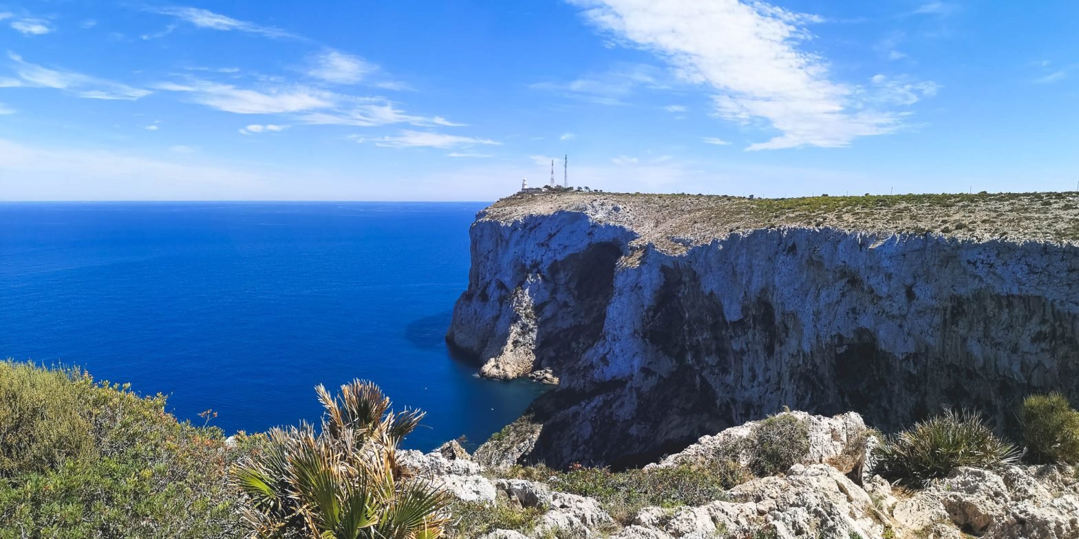
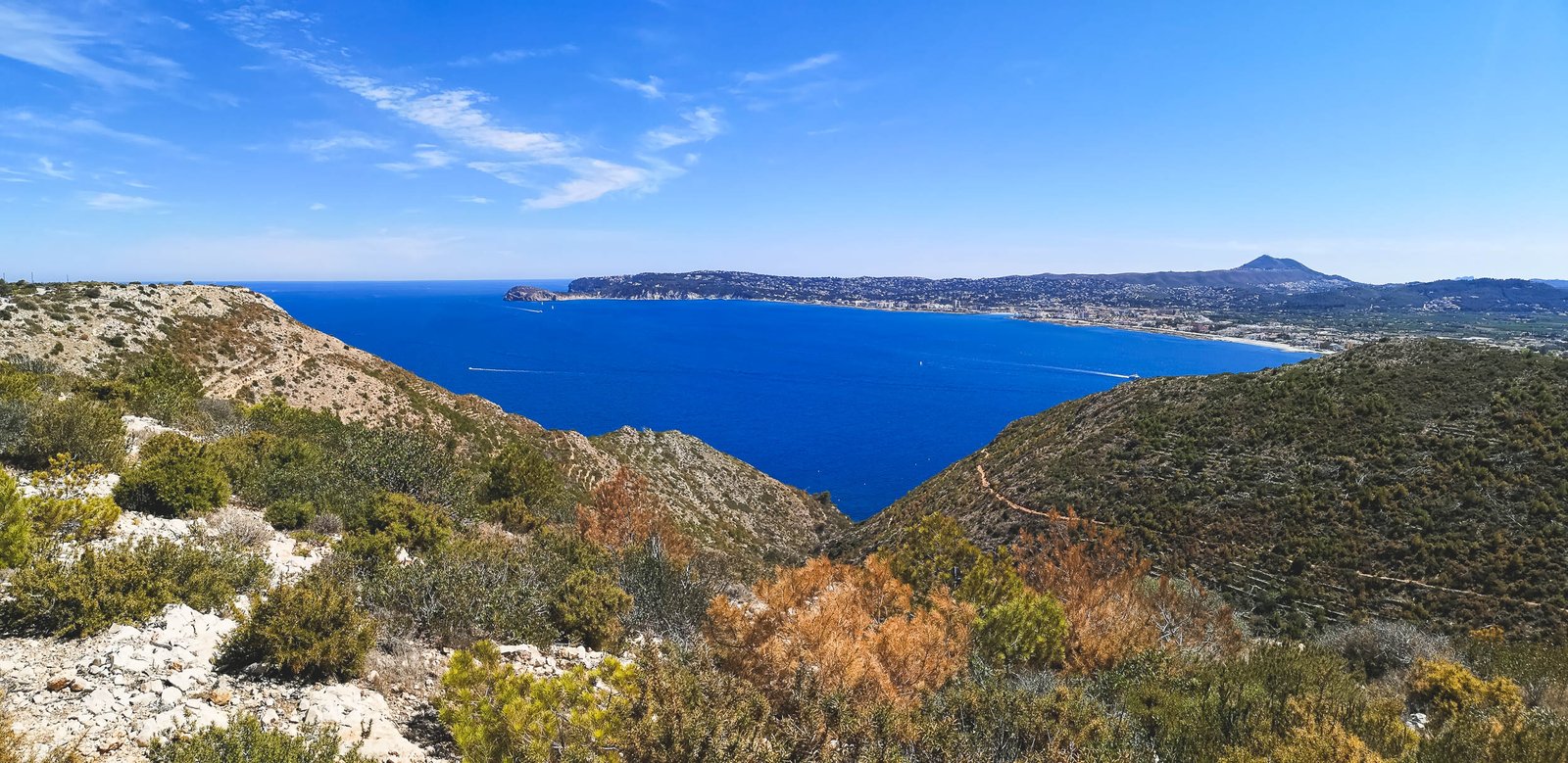
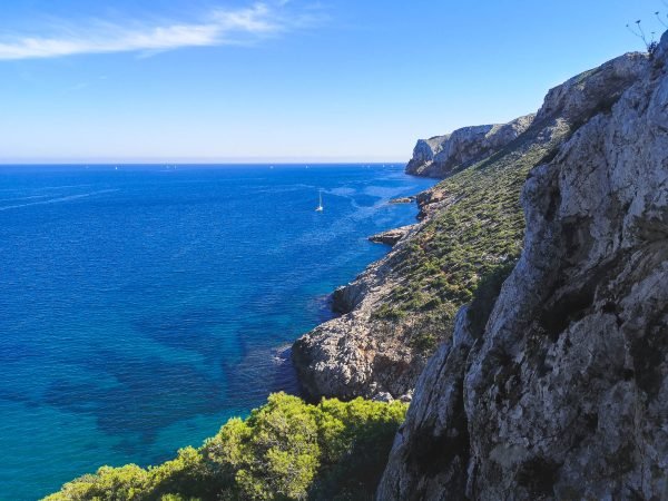
Most of the hiking routes listed in this article are just sections of the PR-CV 355 hiking trail between Port Javea and El Montgo Peak. You might as well just do it, but for those less fitted, or not being able to spare a day for such a trail, there are more accessible options. Actually, everything except getting the names right is easy Cap de Sant Antoni.
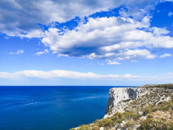
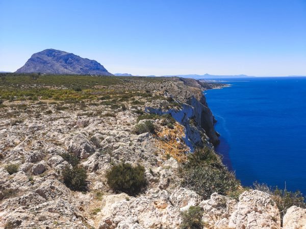
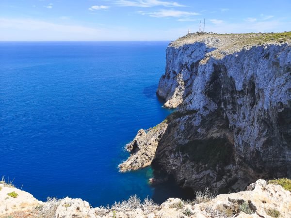
This natural marvel is named after the same saint as a famous city in Texas San Antonio, which is the Spanish name. The most common name – Cap Sant Antoni – is in the local Valenciano language, but it is also known in English as Saint Anthony’s Cape or Cape San Antonio, and in Spanish: Cabo San Antonio). In case you get confused it is all the same thing. The good part, as I said, everything else is simple, especially, getting good vistas with little to no effort. Though some cliffs of the Cape rise about 150 m / 500 ft above the sea level, the Cape is very flat. Walking here is a breeze, especially if you start hiking from one of the parking spaces on top of Cap de Sant Antoni.
Cap de Sant Antoni Details
Location: Spain
Region: Valencia
Main hub: Javea & Denia
Distance from Alicante: 90km / 55.92mi
Distance from Valencia: 105km / 65.24mi
Distance from Benidorm: 55km / 34.18mi
Area: 1.1 km² / 0.42 mi²
Lat/Lon: 38°47’30″N 0°11’41”E
Highest point: Cap de Sant Antoni (170 m / 557 ft)
Situated on the plateau of Cap de San Antoni, this circular hike suits almost everyone. Given the easy access via Denia-Javea CV-736, it offers almost free exceptional vistas that would otherwise require a steep climb. Molins Circular Hike offers amazing views towards both sides of the cape, with its crown jewel being the mesmerizing view towards Javea from the windmill area.
Pro tip: Make a small detour on Denia’s side to a beautiful viewpoint: Mirador del Cuni.
Hike Details
Distance: 5.5km / 3.4mi
Duration: 1h30-2h00
Difficulty: Easy
Color: Yellow
Type: Circular
Route: Aparcamiento Merendero – Mirador del Cuni – Els Molins – Santuario de Nuestra Señora de los Ángeles
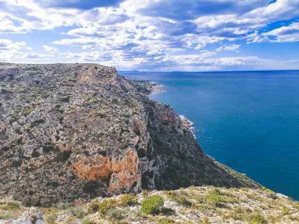
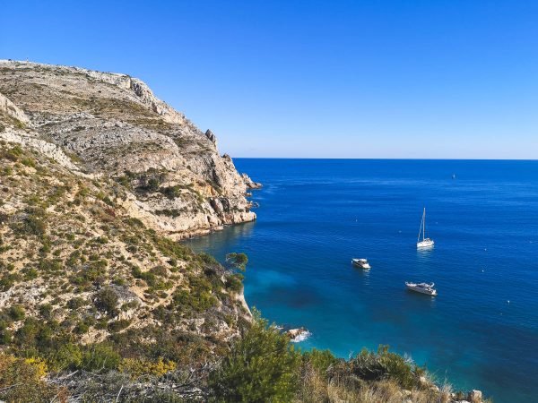
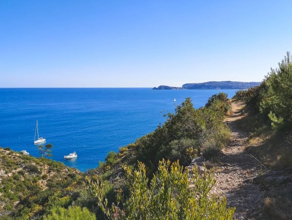
Not really a hiking trail but rather just a section of it, but arguably the best part of it. Especially if you add a little twist to it and walk off the main road to an unnamed viewpoint, which offers the best views of the tip of Cap de Sant Antoni itself I’ve managed to find so far. The quality of the road is not as good as Molins Circular Hike which could be done from the same parking, but it is flat, thus suitable for most of people. If you don’t have much time to explore, this might be the route to make a good impression of what Cap de Sant Antoni has to offer in general.
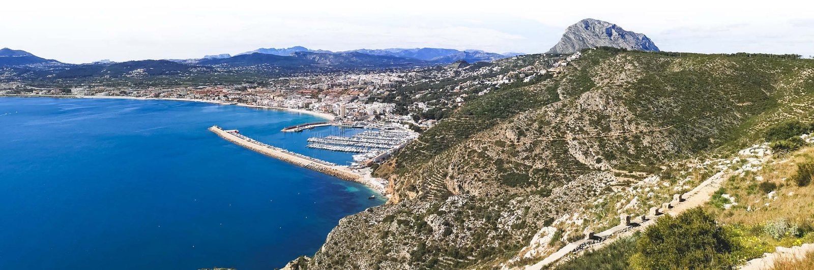
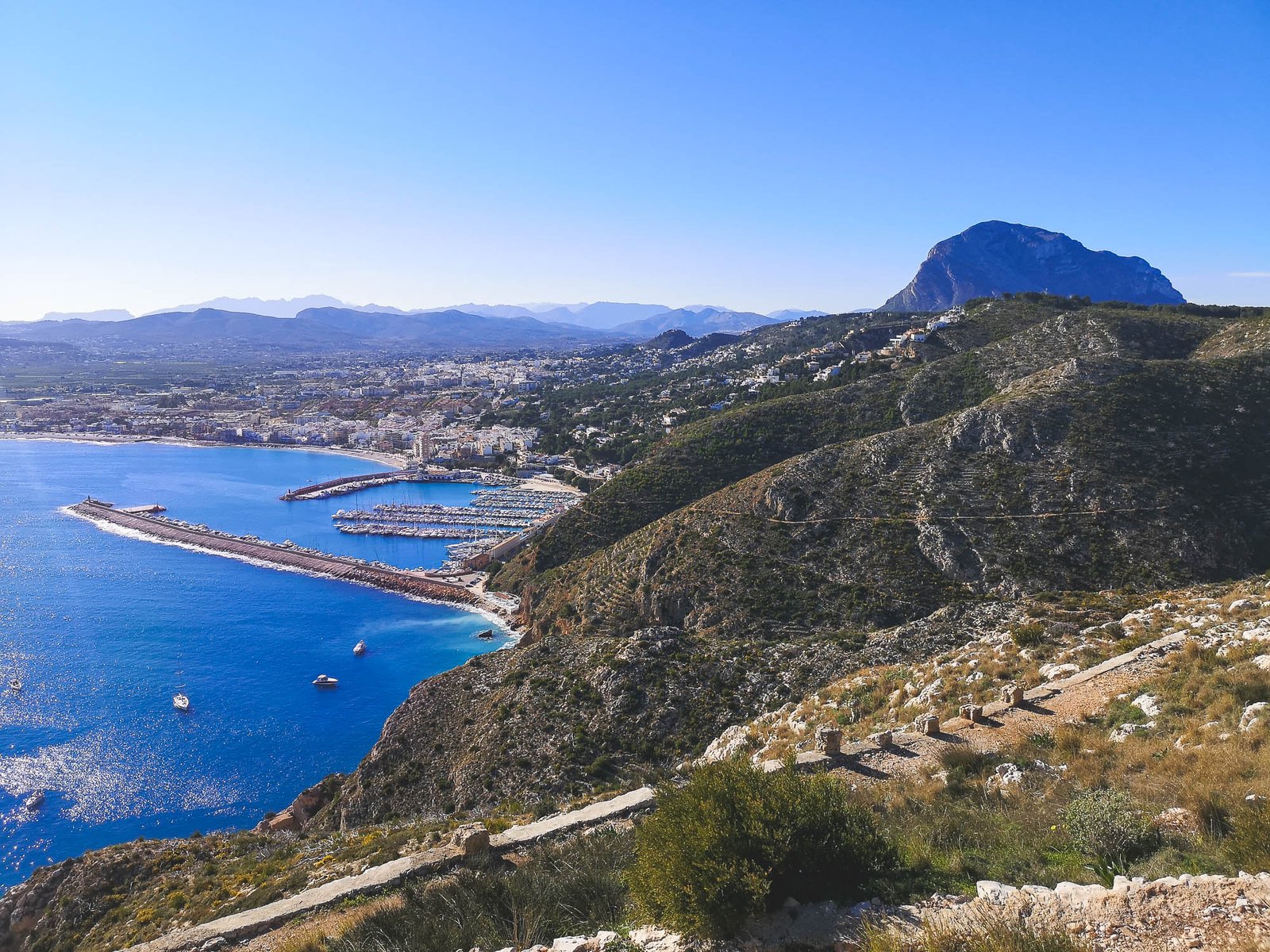
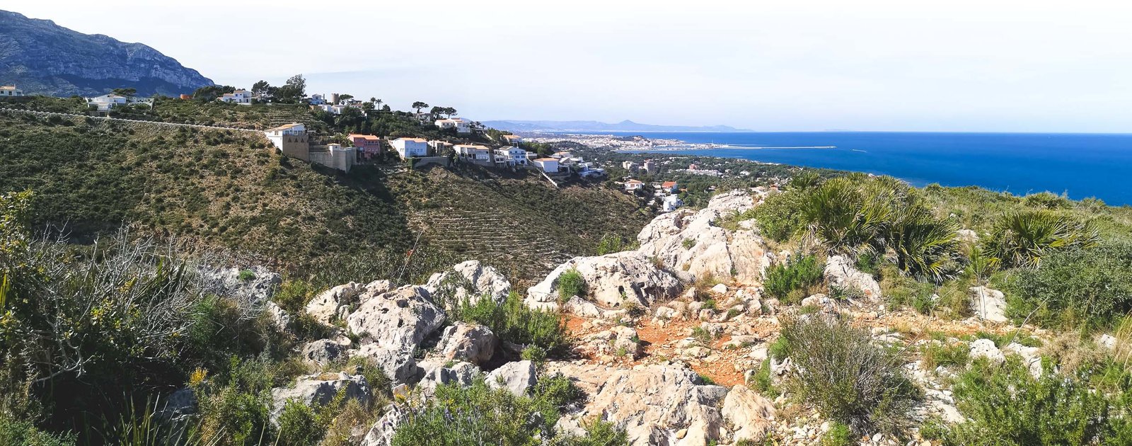
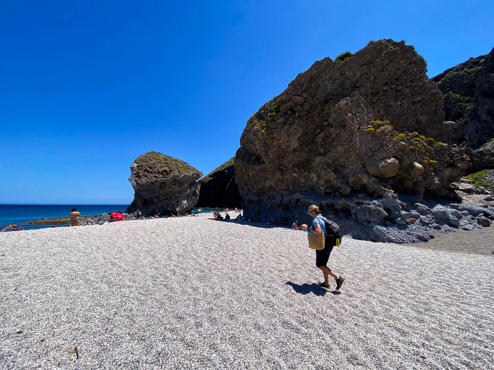
The signature hike of Javea from the port part of the town climbs Cap de Sant Antoni which is, after all, much closer to Javea than it is to Denia. Many locals and visitors of the town climb the cape each day, and so do the large houses of the super-rich living, or, at least, owning properties in otherwise protected areas. Javea missed the opportunity to preserve its side of the cape but luckily the hike goes through the remote untouched section of the last terrain of the Baetic mountains systems before it sinks into the deep sea and remerges again only in the Balearic Islands. Port Javea – Cap de Sant Antoni is a great nature getaway from an otherwise busy area.
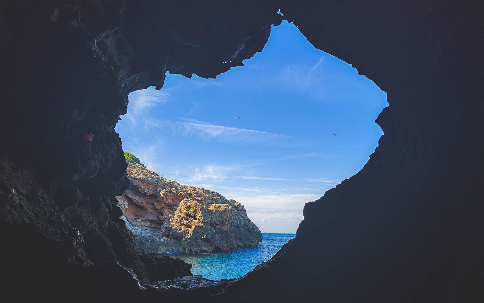
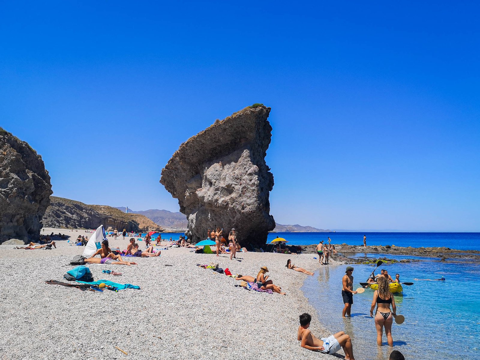
Cova Tallada is a cave system by the Mediterranean Sea below high cliffs of Cap Sant Antoni. Might be the crown jewel of the whole area, I even did this hike on my Spain road trip when I had no idea what Denia or Marina Alta is. This rather short hikes is by no means for everyone – being able to tolerate heights and good shoes is the minimum requirement. Nevertheless, the hike to Cova Tallada is a very popular among tourists and locals alike. Due to some people not being able to keep even the simplest safety rules, the access to the hike is limited during peak seasons.
Pro tip: Cova Tallada is a great snorkeling spot
Hike Details
Distance: 1km / 0.62mi
Duration: 30-40min
Difficulty: Easy/Moderate Depending on season and experience
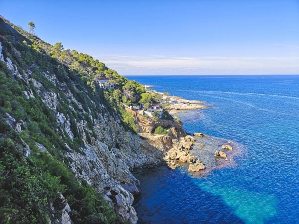
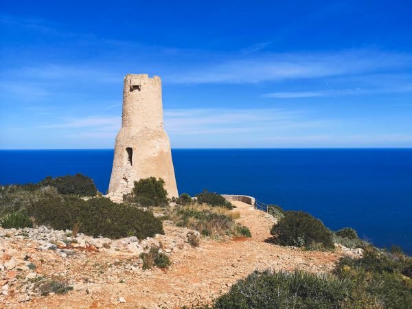
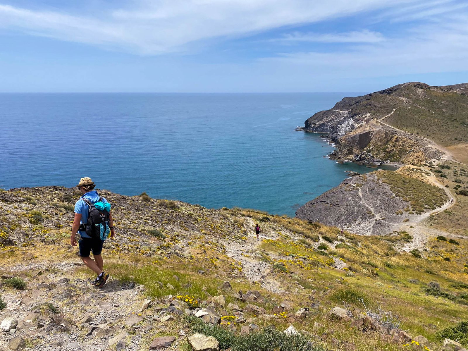
A small climb from the same location in Les Rotes as the Cova Tallada route starts. This is the shortest hike on the list, though be cautious – even given the wee distance and a relatively good road – it is a steep climb to Torre del Gerro. I wouldn’t suggest attempting the hike on a hot day unless you know what you’re doing. From Torre del Gerro beautiful vistas open towards Denia and its coast. Other hiking trails connect Torre del Gerro with Cova Tallada and Cap Sant Antoni.
Hike Details
Distance: 1km / 0.62mi
Ascend: ± 120m / 400 ft
Duration: 20-30min x2
Difficulty: Easy/Moderate Depending on season and time of date
Thank you for visiting Connecting the Dots Journal’s official website!
You got lucky! We have no ad to show for you. If you still want to support my work in a different way, please, subscribe to newsletter or become a Patron
Click on the Ad to support my work.
Thank you for visiting Connecting the Dots Journal’s official website!
You got lucky! We have no ad to show for you. If you still want to support my work in a different way, please, subscribe to newsletter or become a Patron
Click on the Ad to support my work.
Thank you for visiting Connecting the Dots Journal’s official website!
You got lucky! We have no ad to show for you. If you still want to support my work in a different way, please, subscribe to newsletter or become a Patron
Click on the Ad to support my work.
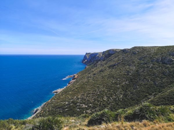
Torre del Gerro – Cap de Sant Antoni – Altomira
This hike leads from one area of Denia through Cap de Sant Antoni to another, to be more precise from coastal Les Rotes to the highest part of the Montgo neighborhood. Adding an extra 1 or 2 km it is possible to connect the hike into a full circle. The route includes beautiful vistas of Cap de Sant Antoni, Les Rotes, Denia, and El Montgo. This is not an official hike and runs through sections of Torre del Gerro – Molins, PR-CV 355, and Cami de Colonia in the el Montgo hiking area.
All content and photos by Alis Monte. If you want to collaborate, contact me on info@wp.connectingcosta.com Photo by Alis Monte [CC BY-SA 4.0], via Connecting the Dots
There are many majestic, yet unspoiled, corners of the world. Relatively few of them could be found in Europe and even fewer by the coast of the Mediterranean Sea. Often, the coastlines are pushed to their capacities by the vast demand and over-tourism. As a result, the beautiful areas by the Mediterranean Sea often remind of an old whore after a high season. Sadly, there are very few places remaining unaffected by the overuse of the land.
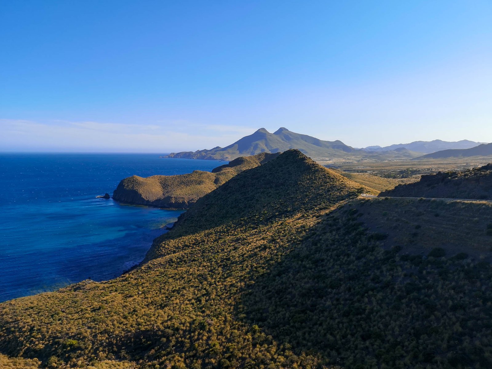
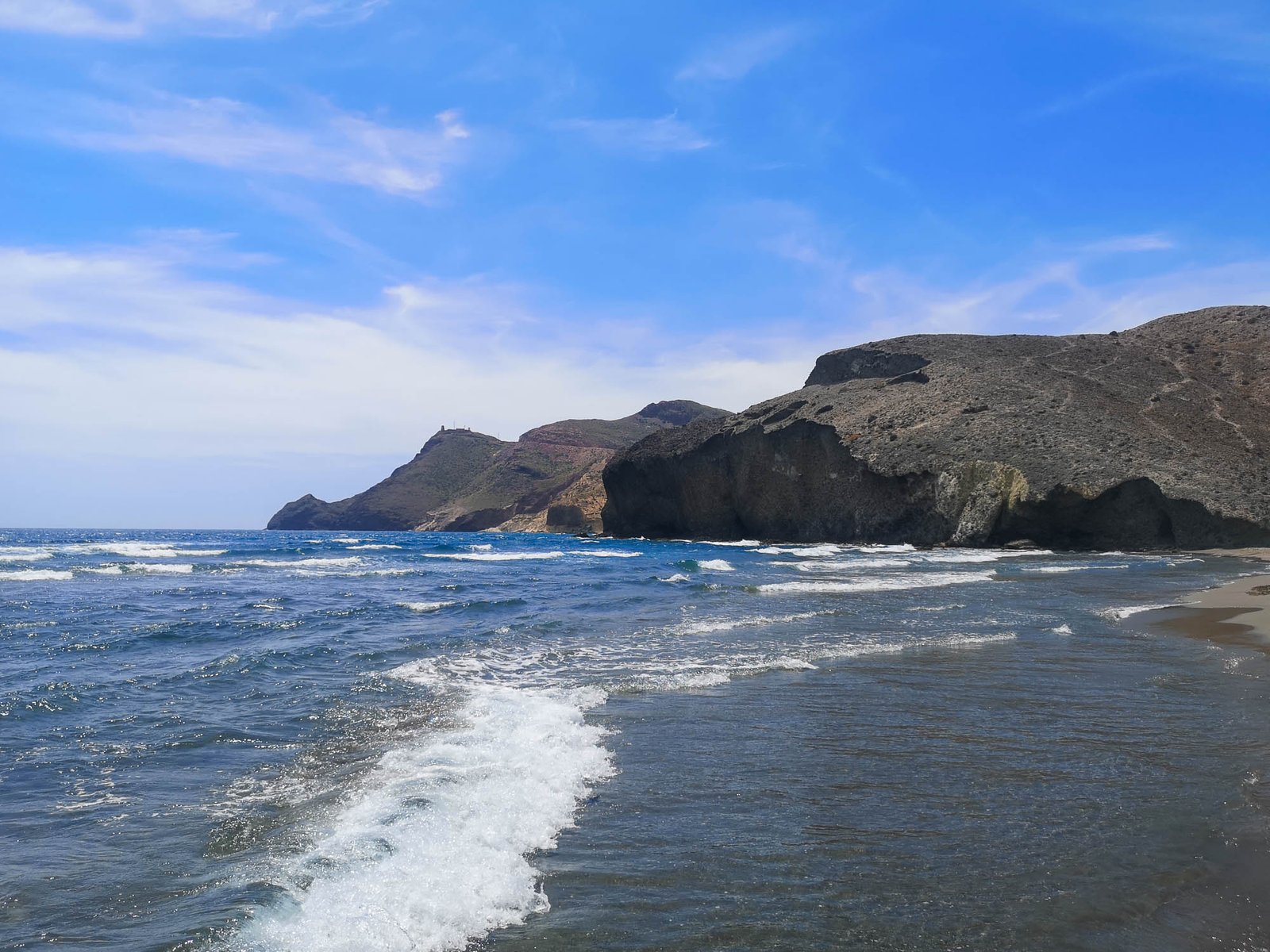
The coastline of the Natural Park of Cabo de Gata-Nijar is one of those places, where one could still imagine how the Iberian Peninsula might have looked like centuries ago. This Nature Reserve has managed not only to avoid the overpopulation of the Spanish coastline but to preserve its pristine and natural beauty.
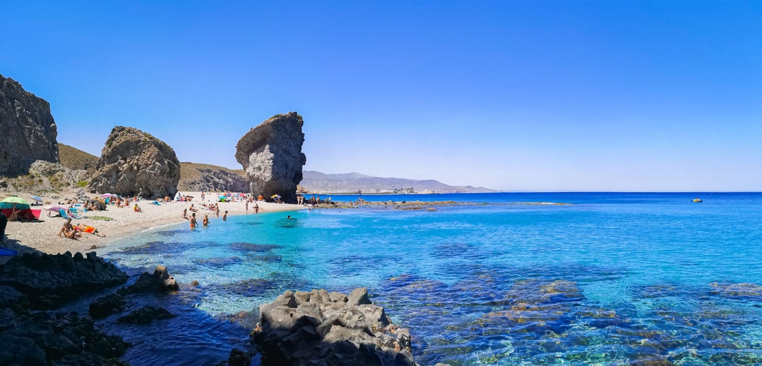
Cabo de Gata is a protected natural area in the southeast of the province of Almería in Andalusia, Spain. The area includes about 100 km / 62 mi of coastline, making it one of the largest marine reserves in the Mediterranean Sea. The coastal area includes cliffs, coves, stacks, and arches. There are also three volcanic islands, Isleta del Moro, Isla de San Pedro and Isla Mágica.
Thank you for visiting Connecting the Dots Journal’s official website!
You got lucky! We have no ad to show for you. If you still want to support my work in a different way, please, subscribe to newsletter or become a Patron
Click on the Ad to support my work.
Thank you for visiting Connecting the Dots Journal’s official website!
You got lucky! We have no ad to show for you. If you still want to support my work in a different way, please, subscribe to newsletter or become a Patron
Click on the Ad to support my work.
Thank you for visiting Connecting the Dots Journal’s official website!
You got lucky! We have no ad to show for you. If you still want to support my work in a different way, please, subscribe to newsletter or become a Patron
Click on the Ad to support my work.
UNESCO Protected Area
The area was declared a natural park on January 24, 1987, the first in the province of Almería. In 1997, the European Commission included Cabo de Gata among the Natura 2000 network. Most of the area is included in the Cabo de Gata-Níjar Natural Park and is a Biosphere Reserve. In 2015, together with the Tabernas Desert and the Sierra de Gata mountain range, Cabo de Gata was listed in the Global Geoparks Network of UNESCO.
The Geopark is known for its wide variety of geological features, including karst landscapes, fossil-rich marine deposits, and lava flows. There are also a number of archaeological sites, including the Cave of the Treasures, which contains cave art from the Neolithic period. The Cabo de Gata UNESCO Global Geopark is also home to a number of protected species, including the Iberian lynx, the Spanish imperial eagle, and the European mouflon.
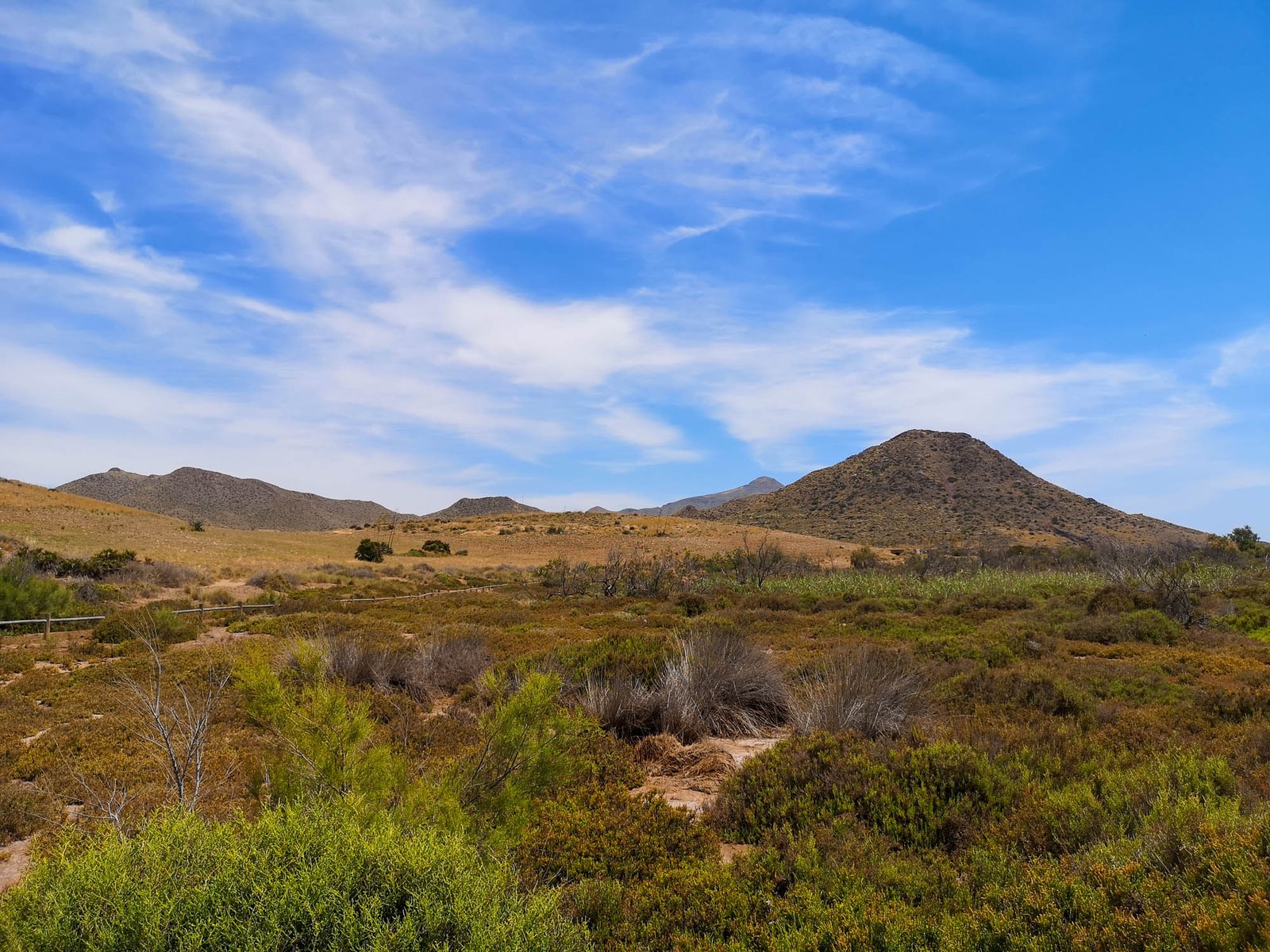
Cabo de Gata is one of the driest and warmest areas in Spain. The average rainfall is only 200 mm per year and temperatures often exceed 30 °C in summer. The lack of rainfall and the aridity of the soil is due to the rain shadow effect caused by the nearby Sierra Nevada.
Thank you for visiting Connecting the Dots Journal’s official website!
You got lucky! We have no ad to show for you. If you still want to support my work in a different way, please, subscribe to newsletter or become a Patron
Click on the Ad to support my work.
Thank you for visiting Connecting the Dots Journal’s official website!
You got lucky! We have no ad to show for you. If you still want to support my work in a different way, please, subscribe to newsletter or become a Patron
Click on the Ad to support my work.
Thank you for visiting Connecting the Dots Journal’s official website!
You got lucky! We have no ad to show for you. If you still want to support my work in a different way, please, subscribe to newsletter or become a Patron
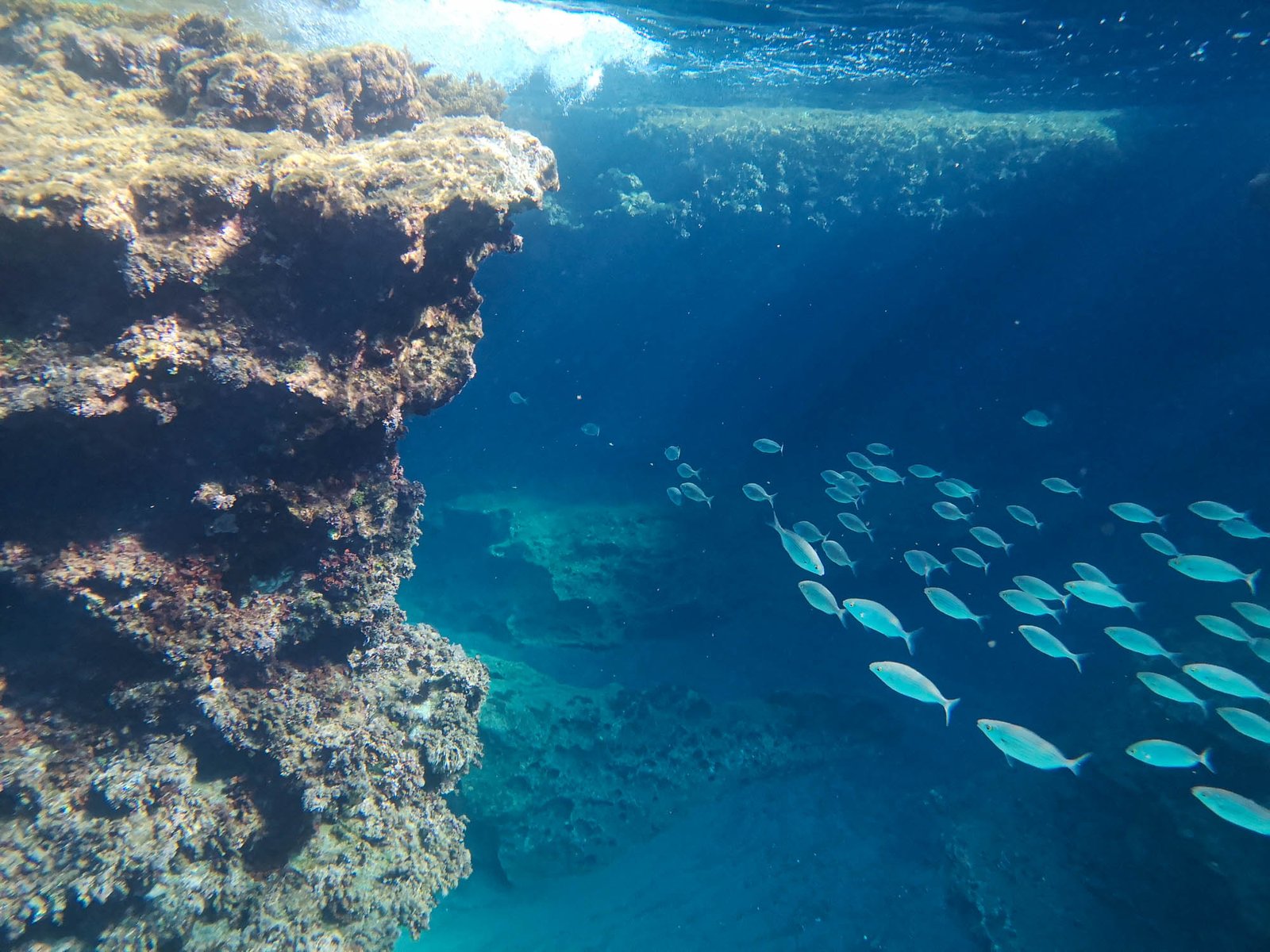
Cabo de Gata is a popular destination for kayaking, scuba diving, snorkeling, and fishing. There are many dive sites around the islands and along the coast. The best time for diving is from May to October when the water is warmest.
Cabo de Gata is also popular with birdwatchers. The islands and coastal areas are home to a variety of bird species including Audouin’s gull, flamingos, and ospreys.
The area is also known for being a great place to go hiking. There are many trails that lead through the beautiful mountains and the exceptional coastline. Probably the best hikes are Loma Pelada, Sendero La Molata, Caldera de Majada Redonda and the one to Cala de San Pedro.
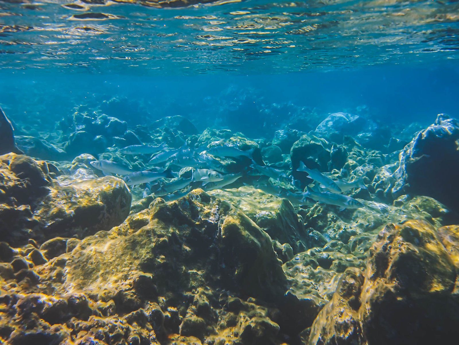
The waters around Cabo de Gata are exceptionally clear even by the Mediterranean standards. Photo by Alis Monte [CC BY-SA 4.0], via Connecting the Dots
How to get to Cabo de Gata from Almeria
There is a reason for the unspoiled beauty of the shores in Cabo de Gata, the area is situated at the very corner of the Iberian Peninsula. It almost feels like the volcanoes formed this exceptional landscape after everyone has already settled in on one or another part of Spain and nobody really bothered about Cabo de Gata. This comes with a price – it is not that easy to reach the natural park nowadays. Luckily, there is one exception, the easiest way to get to Cabo de Gata is from Almeria.
By Car
The most convenient way to reach Cabo de Gata-Níjar Natural Park is by car if you have one. You’ll have to take a detour from the A-7 motorway, connecting Almeria to Murcia cities, on either road AL-3106 or AL-3112. It is also possible to reach the area by AL-3115 from N-344, or AL-5106 from N-341, or use the latter to reach Carboneras and continue your journey by the coast from there. Generally, there are many small roads leading to Cabo de Gata depending on your final destination.
By Public Transport
The only major city connecting Cabo de Gata to the rest of the world is Almeria. There are few buses depending on your needs:
M-202 – Almería – Retamar – Cabo de Gata – La Fabriquilla
M-212 – Almería – San José – La Isleta del Moro
M-213 – Almería – Hospital El Toyo – Venta del Pobre – Carboneras – Agua Amarga
By Guided Bus Tour
Getting to Cabo de Gata-Níjar Natural Park might be a real pain in the butt. A dedicated private transport might save you a lot of hassle and it is not necessarily expensive. Especially, if you count in the guide services and insurances. A day trip from Almeria to Cabo de Gata Natural Park costs just from €48 and that also includes hotel pickup. If you want to save your time and simply enjoy the transcendent beauty of Cabo de Gata, this might be the best option for you.
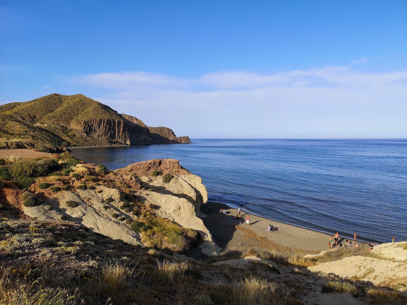
The coastline of Cabo de Gata is very rugged and there are many small coves and beaches. In this article you’ll find the most popular beaches in Cabo de Gata, but, of course, there are even more pristine paradise beaches in remote coves across the Natural Park like Cala Puente, Cala Sorbas, Cala Castillo and Cala de Enmedio. Naturally, it is much more difficult to reach them. You’ll either have to make an intermediate to hard hike or simply book a water taxi.
Thank you for visiting Connecting the Dots Journal’s official website!
You got lucky! We have no ad to show for you. If you still want to support my work in a different way, please, subscribe to newsletter or become a Patron
Click on the Ad to support my work.
Thank you for visiting Connecting the Dots Journal’s official website!
You got lucky! We have no ad to show for you. If you still want to support my work in a different way, please, subscribe to newsletter or become a Patron
Click on the Ad to support my work.
Thank you for visiting Connecting the Dots Journal’s official website!
You got lucky! We have no ad to show for you. If you still want to support my work in a different way, please, subscribe to newsletter or become a Patron
Click on the Ad to support my work.
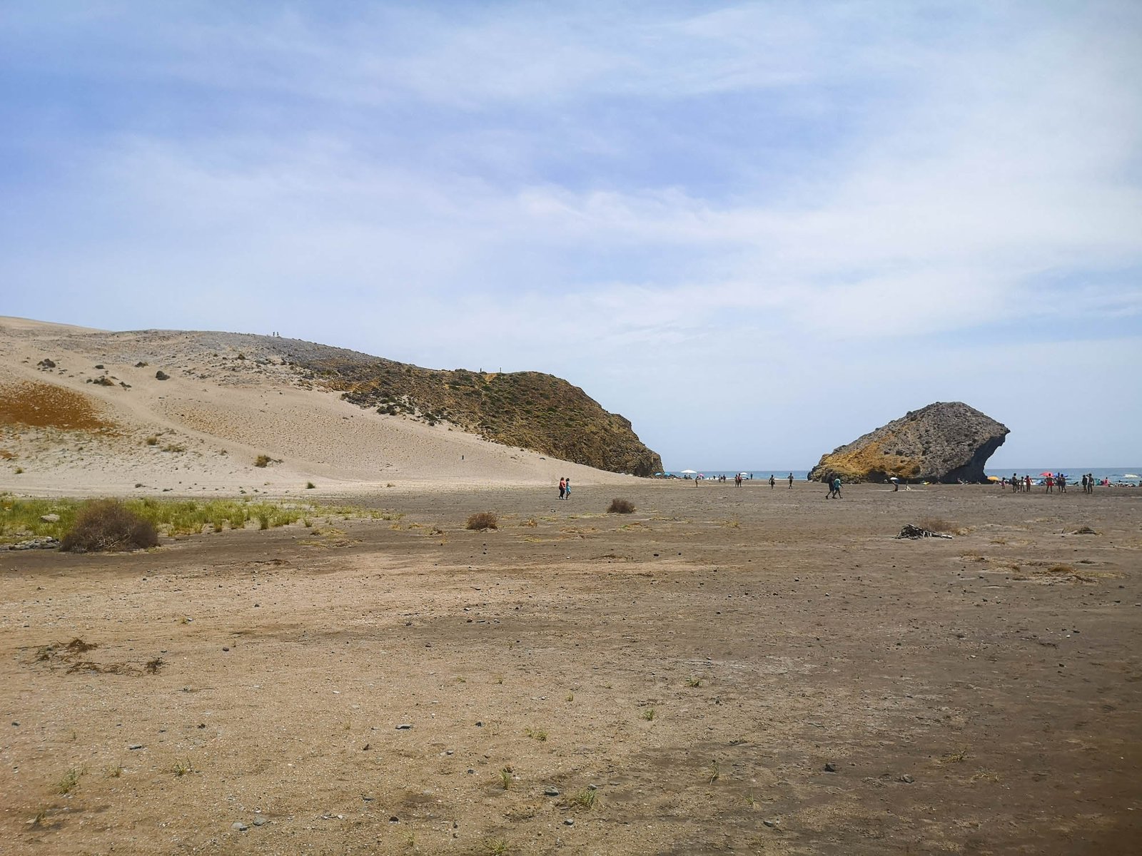
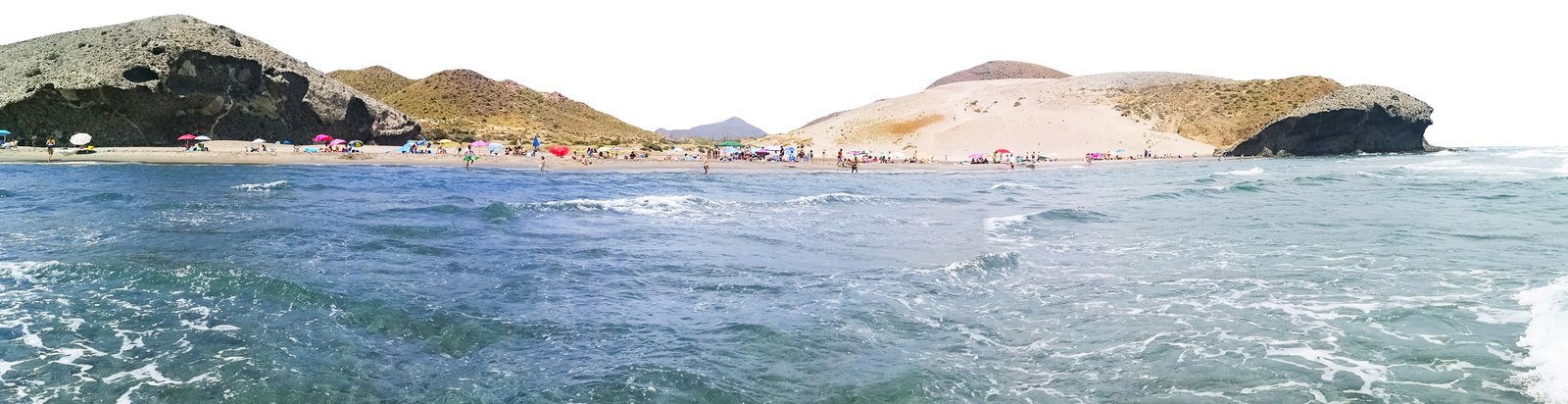
Playa de los Genoveses
Thanks to the 1 180 m / 3 871 ft length of the beach, Playa de Genoveses doesn’t feel that crowded despite being one of, if not, the most popular beaches in the Natural Park along with Playa de Monsul and Playa de los Muertos. Among them, Playa de Genoveses is undoubtedly the best beach for families on the coastline of Natural Park Cabo de Gata-Nijar. The beach is situated just 3 km / 1.64 mi from San Jose and its dedicated car parking lot is relatively close to the sea, therefore the access to Playa de Genoveses is gentle for all family members.
Despite being situated between beautiful and colorful hills, dunes, and cliffs, the most famous geological feature of the beach is, undoubtedly, the fossilized dune. It is located approximately in the middle of Playa de Genoveses and reminds of a giant lava tongue, turned into stone upon reaching the sea, and it actually is. The fact that the fossilized dune is still visible today indicates that the beach is between 180 000 and 250 000 years old – old enough for the Neathertals to see it. The relatively dark sand of the beach also indicates the volcanic origins of Playa de Genoveses.
The origins of the name of the beach are from the Genoes Navy landing on this beach in 1147 to assist the Christians in reconquering the region of Almeria.
Thank you for visiting Connecting the Dots Journal’s official website!
You got lucky! We have no ad to show for you. If you still want to support my work in a different way, please, subscribe to newsletter or become a Patron
Click on the Ad to support my work.
Thank you for visiting Connecting the Dots Journal’s official website!
You got lucky! We have no ad to show for you. If you still want to support my work in a different way, please, subscribe to newsletter or become a Patron
Click on the Ad to support my work.
Thank you for visiting Connecting the Dots Journal’s official website!
You got lucky! We have no ad to show for you. If you still want to support my work in a different way, please, subscribe to newsletter or become a Patron
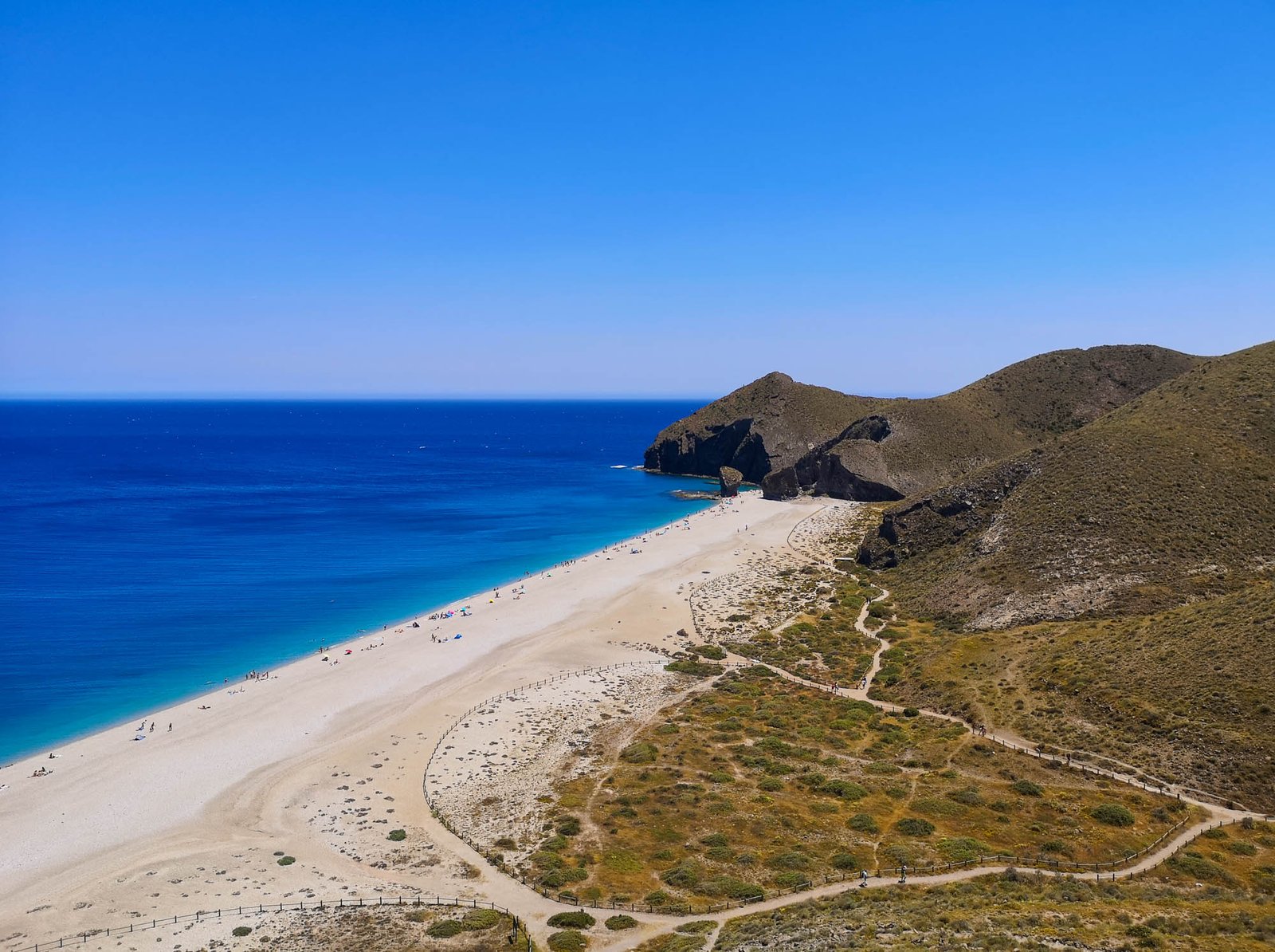
Though Playa de Monsul is a relatively small beach, but of great beauty. The beach is a must-visit for any cinema fan. Playa de Monsul is located in a protected area, even further down the unpaved road from San Jose than Playa de los Genoveses, therefore its access is restricted. The beach is about 300 m / 1000 ft long and 20-30m / 65-100 ft wide and is backed by imposing cliffs. Playa de Monsul is quiet and ideal for swimming, sunbathing, snorkeling, and scuba diving. It offers a rich underwater fauna that includes large examples of the species of fish called barbudo (grouper), and moray eels. Undoubtedly, it is one of the most beautiful beaches in Cabo de Gata-Nijar Natural Park.
The most famous geological features of Playa de Monsul are the Petrified Wave in the middle of the beach and the Monsul Dune. Together they form a mini Holywood park of geological structures. As a matter of fact, Playa de Monsul is also known for being the filming location of many movies, including Lawrence of Arabia, Indiana Jones and the Last Crusade, and the Spanish movie La mujer de mi hermano (My Brother’s Wife), by Juan Antonio Bayona.
Thank you for visiting Connecting the Dots Journal’s official website!
You got lucky! We have no ad to show for you. If you still want to support my work in a different way, please, subscribe to newsletter or become a Patron
Click on the Ad to support my work.
Thank you for visiting Connecting the Dots Journal’s official website!
You got lucky! We have no ad to show for you. If you still want to support my work in a different way, please, subscribe to newsletter or become a Patron
Click on the Ad to support my work.
Thank you for visiting Connecting the Dots Journal’s official website!
You got lucky! We have no ad to show for you. If you still want to support my work in a different way, please, subscribe to newsletter or become a Patron
Click on the Ad to support my work.
Playa de Rodalquilar
Playa de Rodalquilar is approximately 1,200 m / 3,937 ft long and 50 m / 164ft wide natural beach with golden sand and crystal clear water. Unsurprisingly, it is a Blue Flag beach. Playa de Rodalquilar is a very well-equipped beach including showers, toilets, and a lifeguard service in the summer. There is a possibility to access Playa de Rodalquilar by car and park it right next to the sea but have in mind that the road leading there is not for everyone. In case you feel like there is not enough time to enjoy this exceptional beach, you can stay in the nearby hotel for another day. It is situated in very close proximity to the beach in the 18th century Castillo de San Ramón.
Sofía Cos, CC BY-SA 3.0 <https://creativecommons.org/licenses/by-sa/3.0>, via Wikimedia Commons
Beaches of La Isleta del Moro
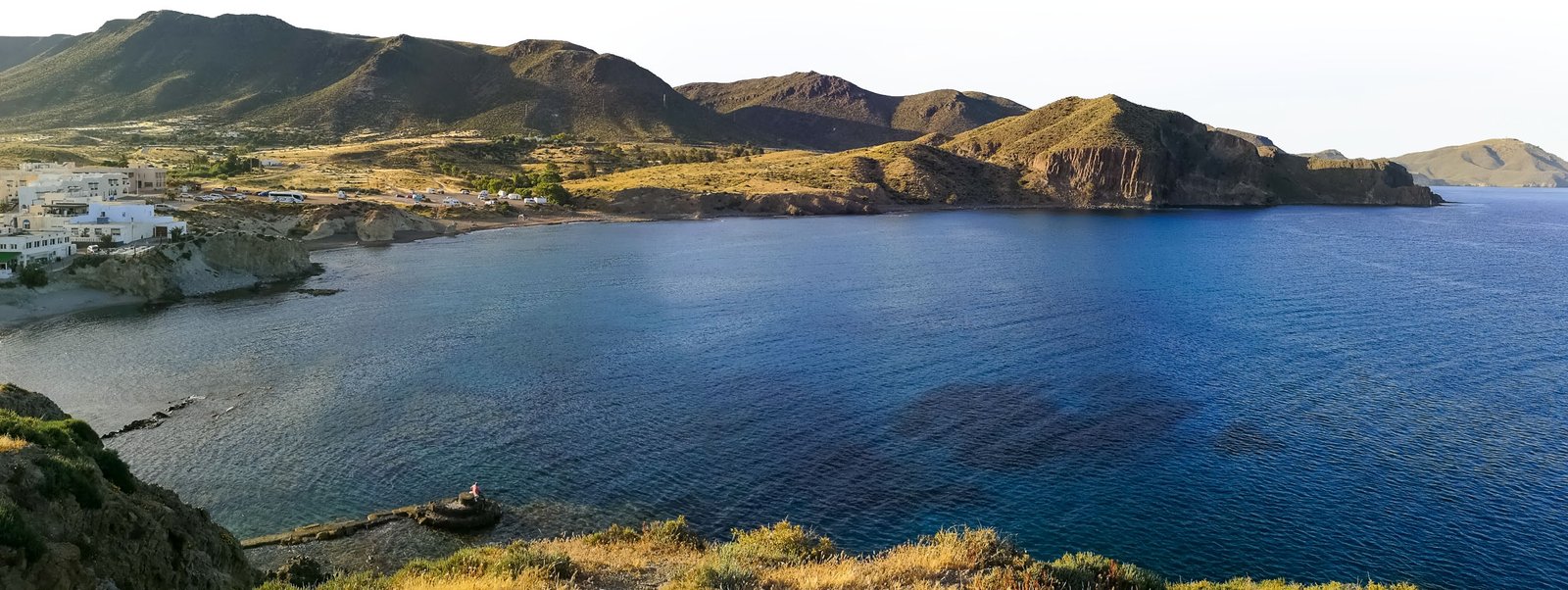
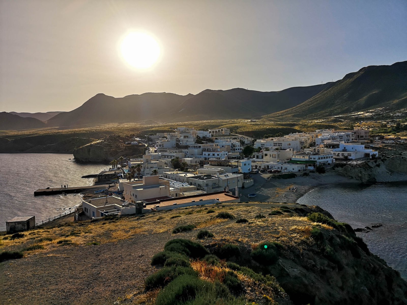
La Isleta del Moro is a small fisher village settled on a tiny cape facing an island. It is a hidden corner rich in natural beauty and known as an excellent place to discover the underwater world of the Mediterranean. The cliffs of La Isleta del Moro has an average height of 20 m / 65 ft. They are a unique natural place full of sea caves and gullies that make the shores of cliffs excellent for diving. The steep decline into the depths of the sea makes it a perfect spot to encounter a great variety of fish and other marine life. Thanks to the shape of a small peninsula, La Isleta del Moro has at least one side without wind and waves all the time, pushing its label of a perfect snorkeling place even more.
The list of beaches in La Isleta del Moro includes Cala Higuera, Playa del Peñón Blanco and Playa del Muelle de La Isleta.
Despite all the qualities for snorkeling and diving, these are not the only activities worth mentioning in La Isleta del Moro. Bird-watchers should keep an eye for various sea birds in the area but gastronomy is probably the second-most prominent feature of La Isleta del Moro. The people who live in here have basically two sources of income: fishing and tourism. Both combine perfectly into a decent amount of good restaurants offering the day’s catch on the plate. The location of the village makes La Isleta del Moro a perfect place for a romantic dinner during sunset.
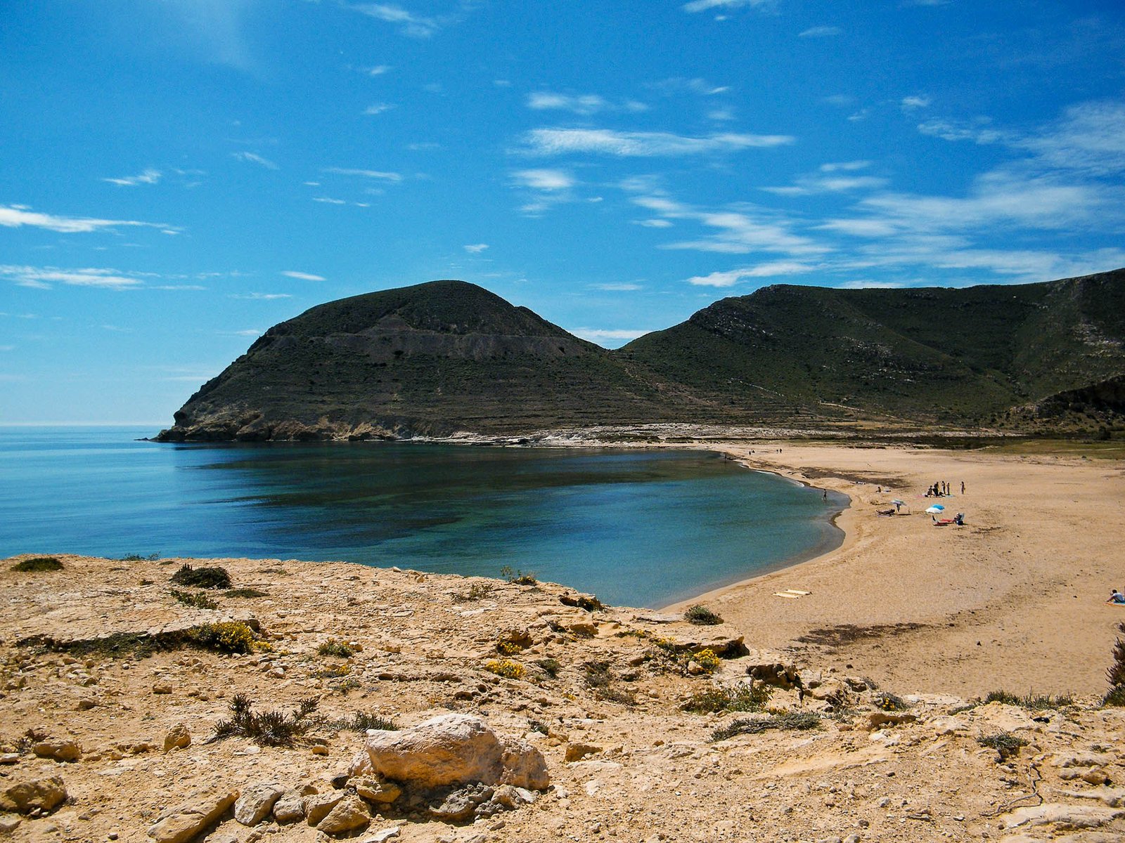
Playa Los Escullos is a secluded beach situated between two volcanic rocks in the middle of a protected area. The beach is a sheltered cove that is ideal for shorter visits to the sea. The landscape around the beach is rocky and there are a few restaurants and bars close by.
Thank you for visiting Connecting the Dots Journal’s official website!
You got lucky! We have no ad to show for you. If you still want to support my work in a different way, please, subscribe to newsletter or become a Patron
Click on the Ad to support my work.
Thank you for visiting Connecting the Dots Journal’s official website!
You got lucky! We have no ad to show for you. If you still want to support my work in a different way, please, subscribe to newsletter or become a Patron
Click on the Ad to support my work.
Thank you for visiting Connecting the Dots Journal’s official website!
You got lucky! We have no ad to show for you. If you still want to support my work in a different way, please, subscribe to newsletter or become a Patron
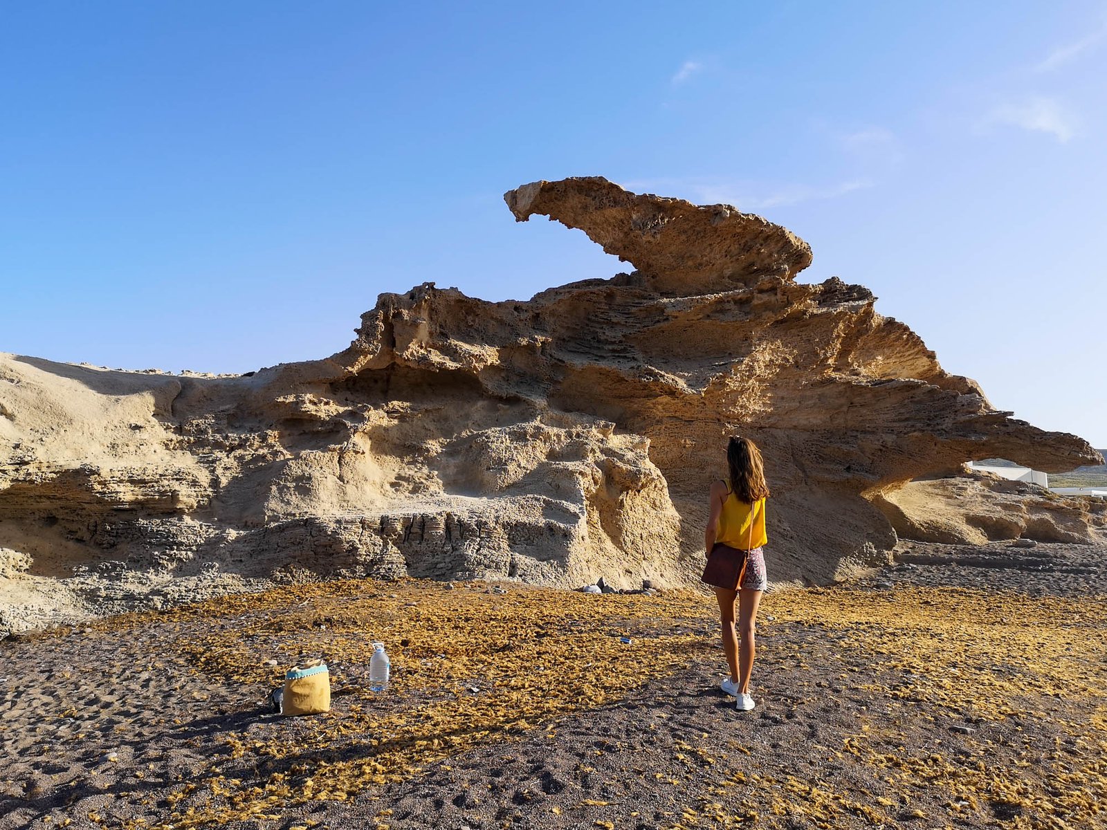
Compared to the best beaches in the area, it wouldn’t be anything special if it was not for the fossil dune with its arc formations. Despite being a true wonder on its own, the fossil dune offers great panoramic views of Los Frailes – the ancient volcanoes. Nevertheless, for the most, it is the arc that steals the show in this area. This unique formation eventually is going to be destroyed by one of the plenty of idiots who take pictures hanging or standing on it. Sooner or later, the arc will not hold and will collapse, likely taking the life of the last perpetrator. Don’t be that person.
Playa de los Muertos is, probably, the most famous and iconic beach in the Natural Park of Cabo de Gata-Nijar. The name of the beach translates to “the Beach of the Dead” in English. You might wonder why such a dreadful name for such a beautiful beach? Its origins of it are unclear, but it is believed to be named after numerous dead bodies from shipwrecks that occurred near the beach many years ago with a relative frequency. All thanks to the sea currents, converging in the area surrounding Playa de los Muertos.
It is a beautiful sandy-small pebble beach with crystal clear waters – perfect for swimming, snorkeling, and diving. Despite its close location to the coal plant of Almeria, Playa de los Muertos is situated in a natural park and is therefore unspoiled and very quiet. Playa de los Muertos was named the most beautiful beach in Spain for numerous times.
Possibly the most famous feature of Playa de los Muertos is the pillar rock formation, which has been carved from the cliffs by years of wave erosion. Nevertheless, it is not the only geological reason for the unquestionable popularity of the beach among the people and magazines in Spain. Various rocks and cliffs from different geological eras could be observed from the beach. The ancient sedimentary deposits filled with various fossils is a common feature found across Playa de los Muertos. On top of it lies the volcanic layer and relatively recent deposits from the Miocene Epoch.
Down south from Playa de los Muertos lies secret hidden coves, which could only be accessed by a water taxi. They could be booked in advance with a free cancelation up to čė hours before the tour date.
Having traveled most of the Spanish coastline, the area of Cabo de Gata-Nijar Nature Park ignites very positive emotions in me. There are very few corners by the Mediterranean Sea in the country with such a low level of urbanization. Cabo de Gata animates my imagination wondering what Costa Blanca or Costa del Sol might have looked like before being swarmed by tourist villas and skyscrapers. Despite all its qualities and interests, the lack of urban development is what amazes me the most about Cabo de Gata.
Ignoring that, Cabo de Gata has many great qualities that would make this unique volcanic area worth visiting even if there wasn’t a single house in Spain. It is the only corner in the Iberian Peninsula of volcanic origins. This could be observed across the coastline even by an untrained eye. Not only that it makes Cabo de Gata exceptionally beautiful and colorful, but creates unique conditions for unique flora and fauna above and underwater.
I recommend Cabo de Gata-Nijar Nature Park for a day trip or more to anybody who can find any reason to leave the urbanized areas or cities. Mother Nature is still flourishing in Cabo de Gata.
What Can I Do to Protect the Pristine Cabo de Gata?
Take care of your own trash, or even better pick up the trash in general. Avoid using the trash cans located in the area of the park, instead, throw them away in one of the settlements located within Cabo de Gata, or near your accommodation. Trash is often dispersed by the winds or animals and in natural areas that can cause immediate damage.
Follow all boating regulations – never anchor your boat on the top of lively local ecosystems such as Poseidonia meadows.
Respect local flora & fauna – don’t touch any underwater organisms, or pick up local plants.
All content and photos by Alis Monte, unless stated differently. If you want to collaborate, contact me on info@wp.connectingcosta.com Photo by Alis Monte [CC BY-SA 4.0], via Connecting the Dots
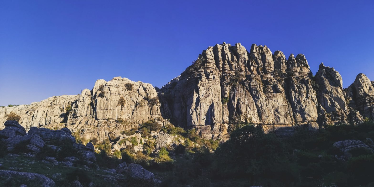
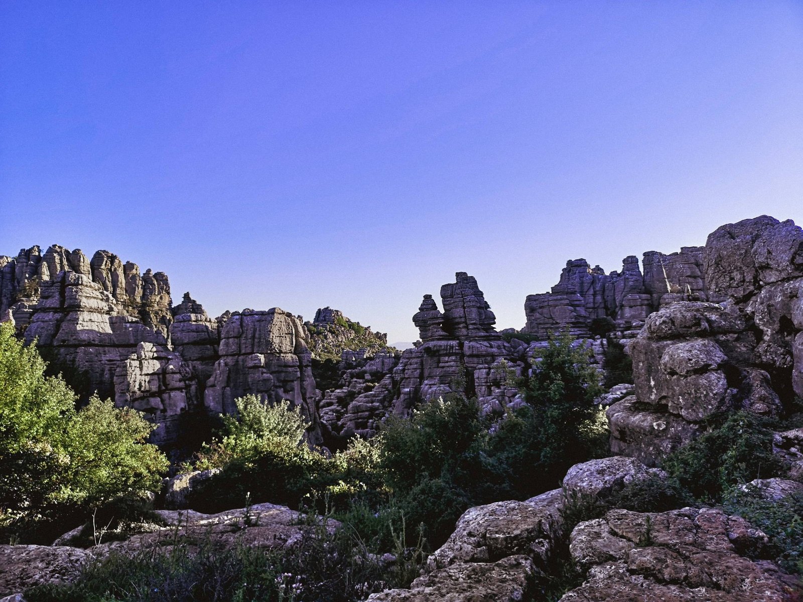
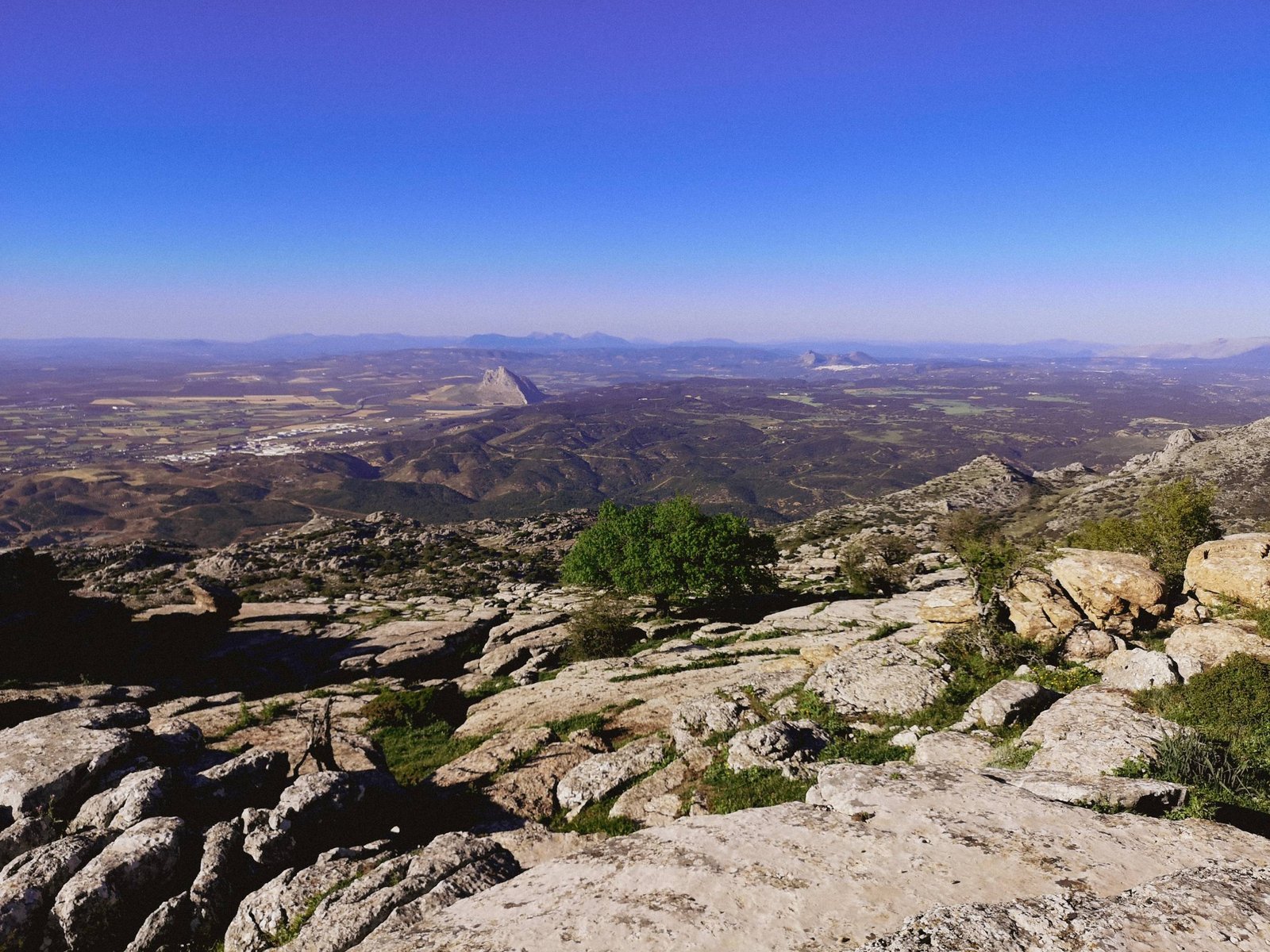
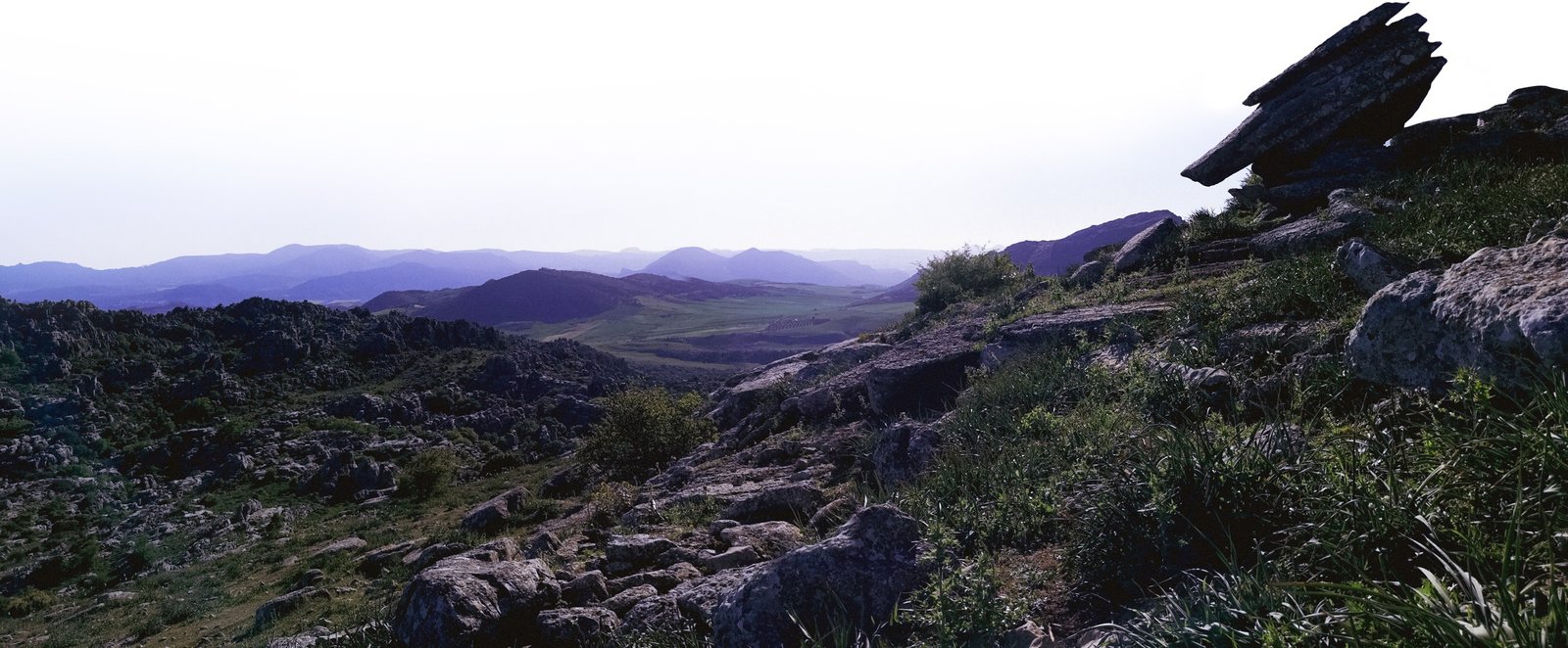
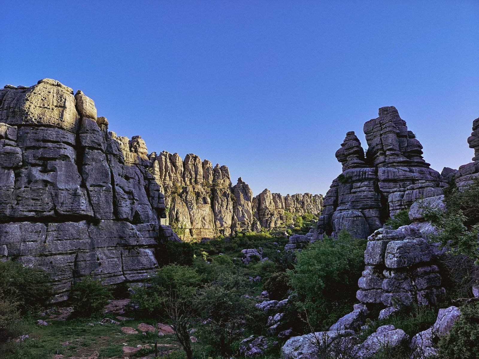
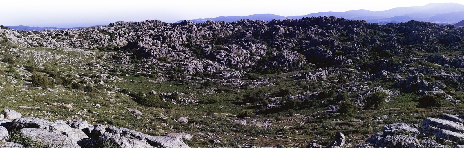
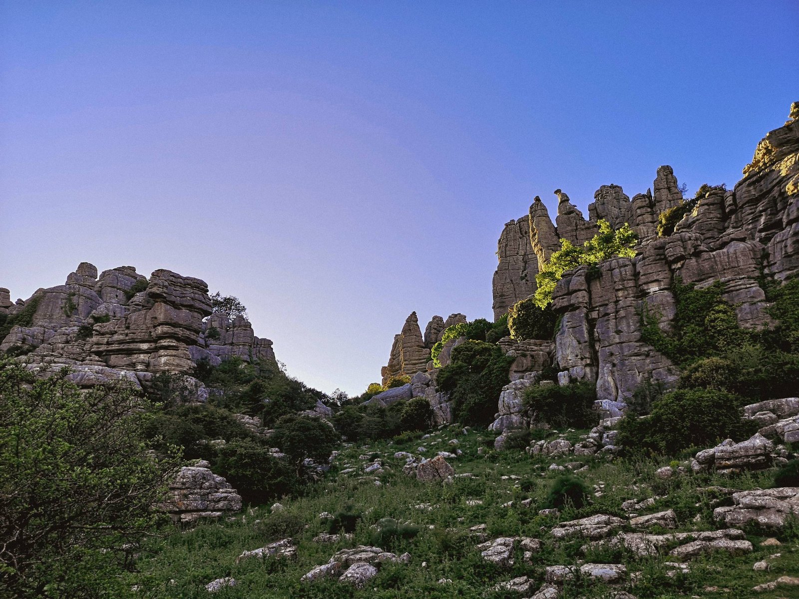
El Torcal is a natural UNESCO World Heritage Site within the Betic Mountains, known for its unusual finger-like pillar stone formations and other distinctive geological features. It is widely regarded as one of the most unique karst landscapes in the whole of Europe. Located right next to Antequera, just 48.1 km / 29.89 mi from Malaga, El Torcal is often left out off the tourists’ radars. While it is probably better for the preservation of the area, it doesn’t do justice to the beauty of this awe-inspiring mountain range. After all, there has to be a reason why it was added to the natural UNESCO World Heritage Site list. For sure, it has something to show off for it, especially, for nature enthusiasts like me.
Situated in-between the countless pieces of Betic Mountains, El Torcal could be easily mistaken for being just another fish in a pond. Having that in mind, a keen eye will notice a difference of range’s formations, whose rounded-shaped rocks give out that something unusual had happened here. Ultimately, the finger-like pillars need certain conditions to form.
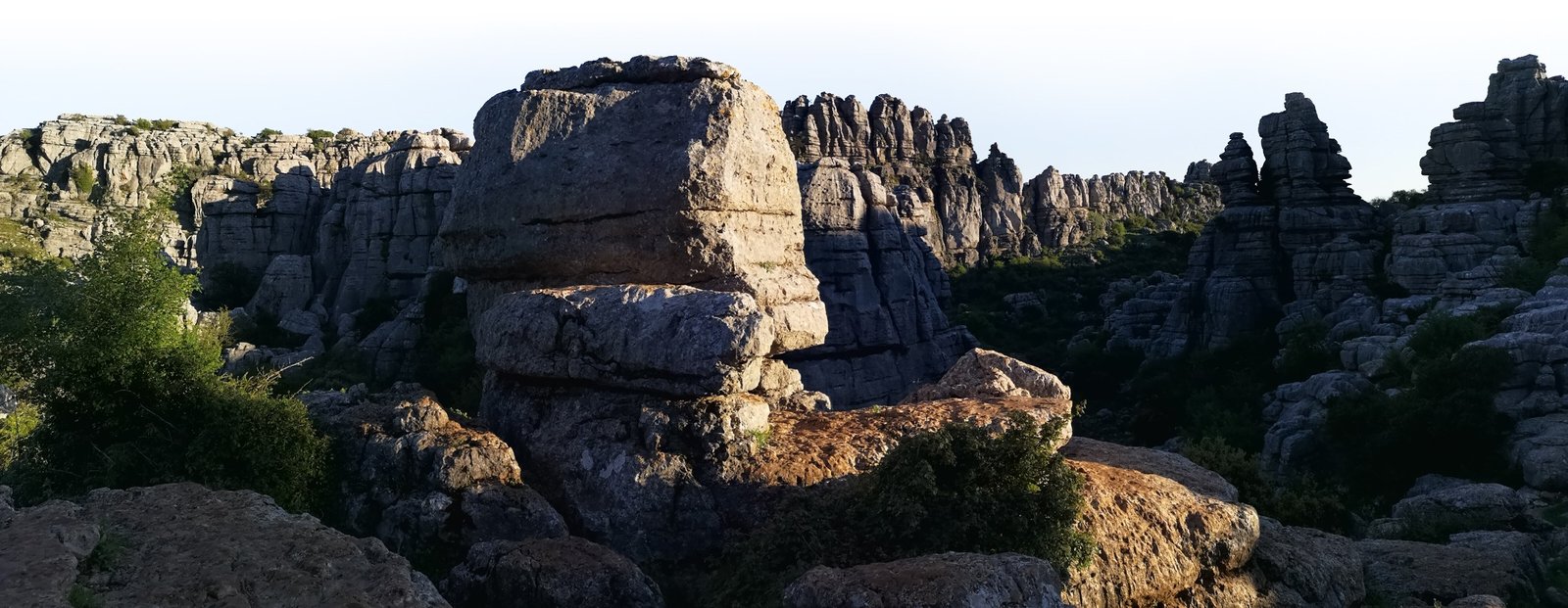
Rock formations of El Torcal are reminiscent of the Great Pillars of the Gondor Kings. Photo by Alis Monte [CC BY-SA 4.0], via Connecting the Dots
Formation of Sierra del Torcal
Betic Mountains stretch throughout the southeastern part of Spain along the Mediterranean coast. Its location is no coincidence. The genesis of these mountains rose large parts of the Iberian Peninsula from the depths of the ocean millions of years ago. This gradual action shaped the iconic peninsula to its current form we all know and appreciate today. Geologists can tell that the rocks across the area, started to form at the bottom of the ocean about 200 million years ago during the Jurassic era.
El Torcal is a great example of this geological process, the whole mountain range is like a ‘living fossil’ and speaks for itself of what had happened here throughout all that time. The incarnation of these mountains is a very interesting and unique case in the peninsula. For this reason, in 1929 El Torcal de Antequera became the first object to be recognized as “Andalusian Protected Natural Area”. In the coming years, the mountain range was declared and added to many other conservation lists, including the UNESCO World Heritage Site list, I mentioned before.
El Torcal, together with La Peña de los Enamorados (human head shaped mountain) and three neolithic megalithic monuments form Antequera Dolmens UNESCO Site. Photo by Alis Monte [CC BY-SA 4.0], via Connecting the Dots
Despite being located right next to a regional center – Antequera, due to its nature, El Torcal offers a very limited variety of access.
Thank you for visiting Connecting the Dots Journal’s official website!
You got lucky! We have no ad to show for you. If you still want to support my work in a different way, please, subscribe to newsletter or become a Patron
Click on the Ad to support my work.
Thank you for visiting Connecting the Dots Journal’s official website!
You got lucky! We have no ad to show for you. If you still want to support my work in a different way, please, subscribe to newsletter or become a Patron
Click on the Ad to support my work.
Thank you for visiting Connecting the Dots Journal’s official website!
You got lucky! We have no ad to show for you. If you still want to support my work in a different way, please, subscribe to newsletter or become a Patron
Click on the Ad to support my work.
By public transport
There is no public transport running to El Torcal.
By car
Car is the only way to get up to El Torcal visitors center. You can reach it from 42nd km of road A-7075, between Antequera and Villanueva de la conception.
Parking at Centro de Visitantes Torcal Alto on the mountain range is limited and the road leading to it is closed after the slots are filled. Alternative parking is next to A-7075 Road. There will be a bus running between parking lots after the upper one is closed, which costs 2.00Eur for a round trip. Alternatively, you can climb up to El Torcal Alto visitors center on a 3.6 km / 2.24 ft long orange-marked hiking route, with 263 m / 863 ft vertical ascension. It is considered intermediate difficulty.
Another option is to take a tour from Antequera. There are quite a few options, but personally, I prefer taking tours via third parties, like GetYourGuide, so I get better guarantees for quality service and proper cancelation policies. Enjoy one of the most famous natural landscapes in Andalucia.
Transfer from Antequera with a guided hiking tour (4h00 | from € 25/person) The price covers a transfer from Antequera and a guided tour in either English, French or Spanish. Up to 8 people groups are accepted.*
Transfer from Malaga with a guided hiking tour (5h00 | from € 49/person) The price covers a transfer from Antequera and a 3-hour long guided hiking tour in either English or Spanish. Up to 8 people groups are accepted.*
* All of these tours are curated by GetYourGuide, therefore you can cancel up to 24 hours in advance to receive a full refund.
Visiting El Torcal de Antequera is free of charge and you don’t need a special permit on any of the three marked routes. Entering other hiking trails is your own risk and responsibility. If you want to explore beyond the official trails, I recommend getting one of the guided tours in the mountain range. Note that these don’t include a transfer from Antequera as GetYourGuide El Torcal Tours.
Thank you for visiting Connecting the Dots Journal’s official website!
You got lucky! We have no ad to show for you. If you still want to support my work in a different way, please, subscribe to newsletter or become a Patron
Click on the Ad to support my work.
Thank you for visiting Connecting the Dots Journal’s official website!
You got lucky! We have no ad to show for you. If you still want to support my work in a different way, please, subscribe to newsletter or become a Patron
Click on the Ad to support my work.
Thank you for visiting Connecting the Dots Journal’s official website!
You got lucky! We have no ad to show for you. If you still want to support my work in a different way, please, subscribe to newsletter or become a Patron
Click on the Ad to support my work.
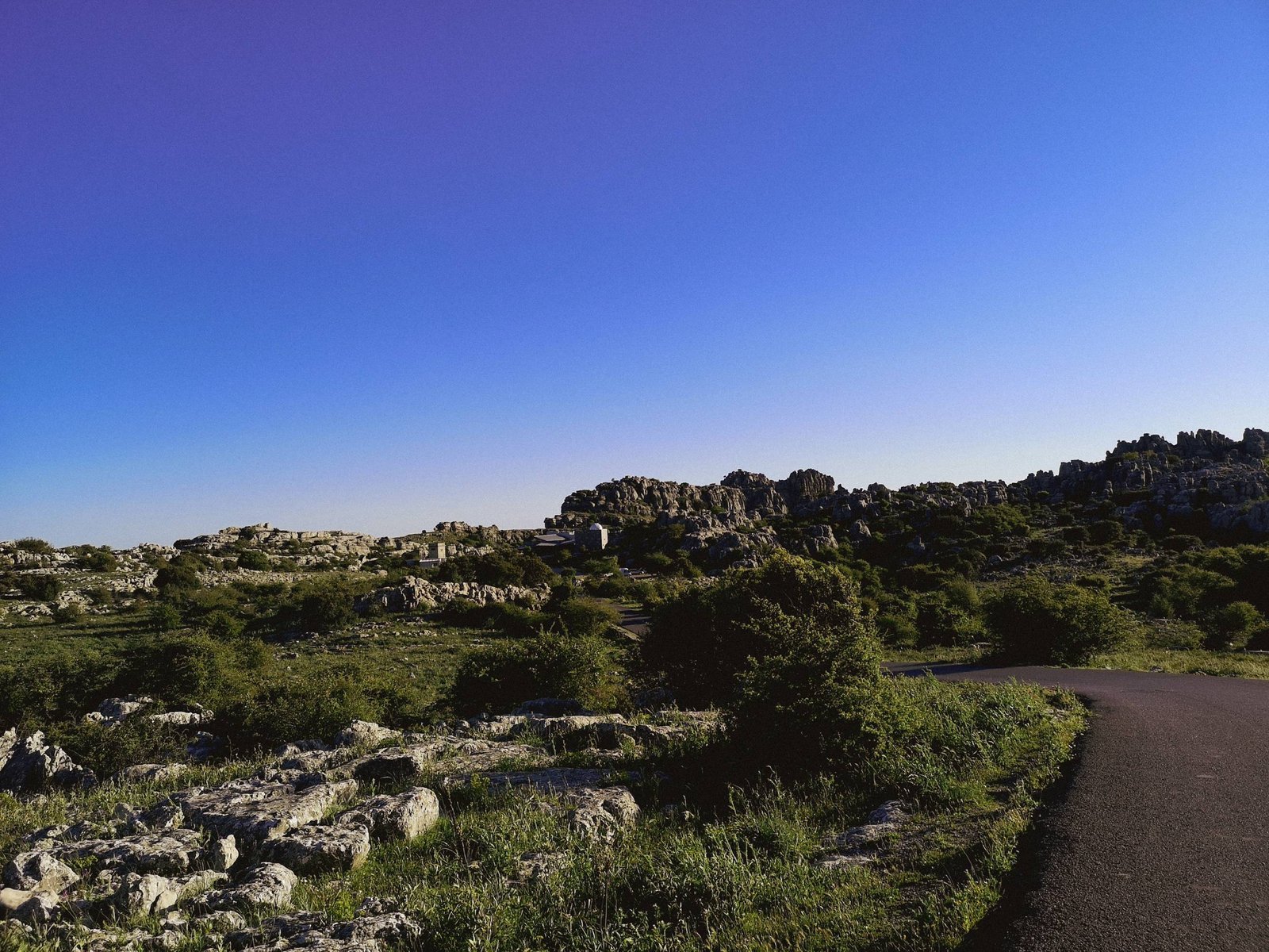
Green route
Most of El Torcal’s visitors are probably going to choose this hiking route, and most of them going to regret not taking the yellow one. On the map, the green route basically looks like a mini version of it. Nevertheless, this short trail is not shy of El Torcal’s beauty. The 45 min walk is relatively easy compared to what the yellow route has to offer, and for sure it is more than enough to get the feeling of what this exceptional mountain range is all about. The unique rock-pillar formations will please throughout the route, the hike includes famous figures like “Sphinx”, “the Indian” and “the Cathedral”.
Trail details
Distance: 1,50 km / 0.93 mi
Type: Circular
Ascend: +40 m / 131 ft
Duration: 45 minutes
Difficulty: Easy
These narrow passages between the rocks have opened-up following a karst collapse. Photo by Alis Monte [CC BY-SA 4.0], via Connecting the Dots
Yellow route
More of the “same” El Torcal natural beauty, which is hard to get enough of. The yellow route goes deeper into El Torcal Alto mountains throughout narrower shady paths. The non-green part of the hike is dominated by vegetation and it is not that hard to get lost if you walk off the marked trail. In addition to the rock formations mention before, the yellow route includes “the Finger (not that one)”, “Camel”, “Jug” and “Bottle”.
The orange route is somewhat different compared to the other two marked paths. This hike is one of the ways to get to the top of El Torcal after the road MA-9016 to the visitors center gets closed due to reaching its limits. The path begins at the lower parking of the mountain range and leads up to El Torcal Alto visitors center. Despite its functional description, the orange route offers spectacular views and vistas like “Mirador de Manuel Grajales”. Other interesting objects along the road are An old shepherds’ refuge “Majada del Fraile” and the Natural Monument “El Tornillo”.
Trail details
Distance: 3.6 km / 2.24 mi
Type: Linear
Ascend: +263 m / 863 ft
Duration: 3 hours and 45 minutes
Difficulty: Intermediate
There are obvious traces of an attempt to make Camorro Alto climbing trail more accessible. Photo by Alis Monte [CC BY-SA 4.0], via Connecting the Dots
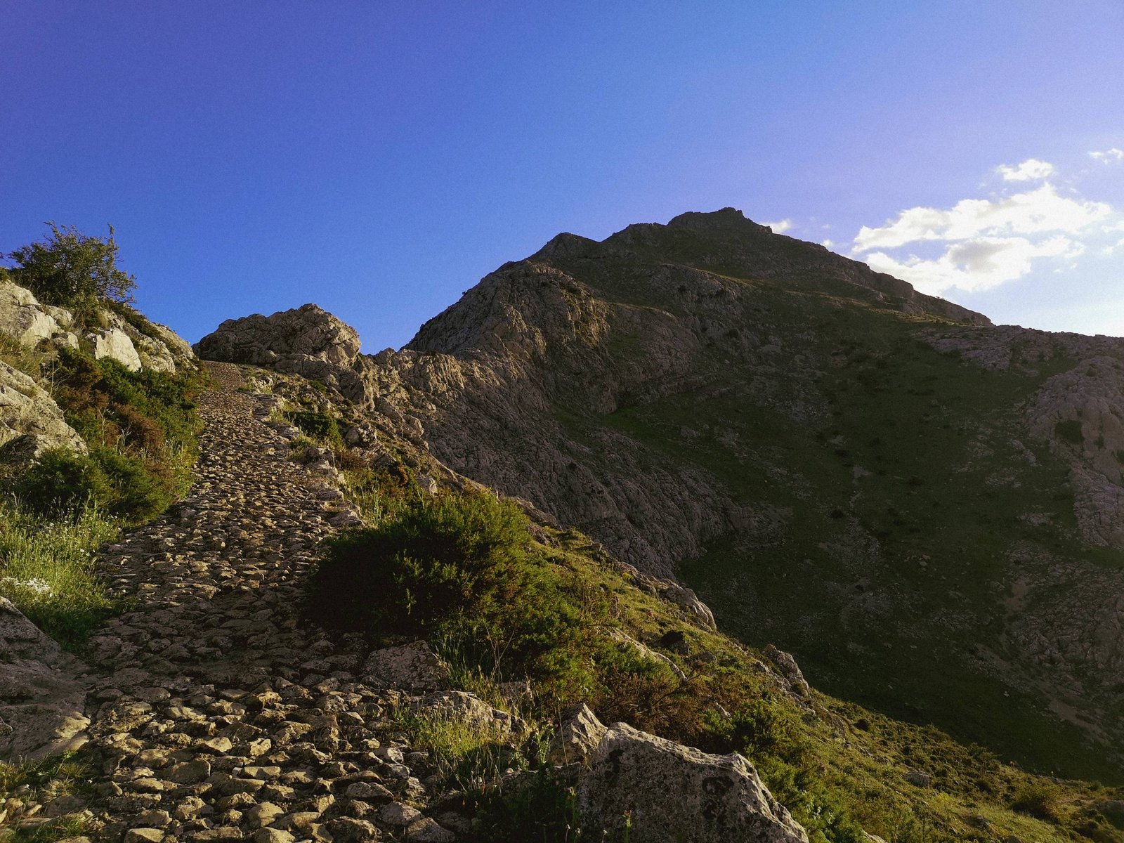
Climbing Camorro Alto
This is the only unofficial hiking route I can recommend with confidence. Climbing the highest peak of El Torcal de Antequera sounds more dangerous than it actually is. Generally, given good weather conditions, a good pair of shoes should be enough to ensure your safety while climbing Camorro Alto from the northern side. Nevertheless, don’t forget that this is a nature reserve, thus if you chose to climb the mountain, maintain a “leave no trace” approach and respect the inhabitants of the area.
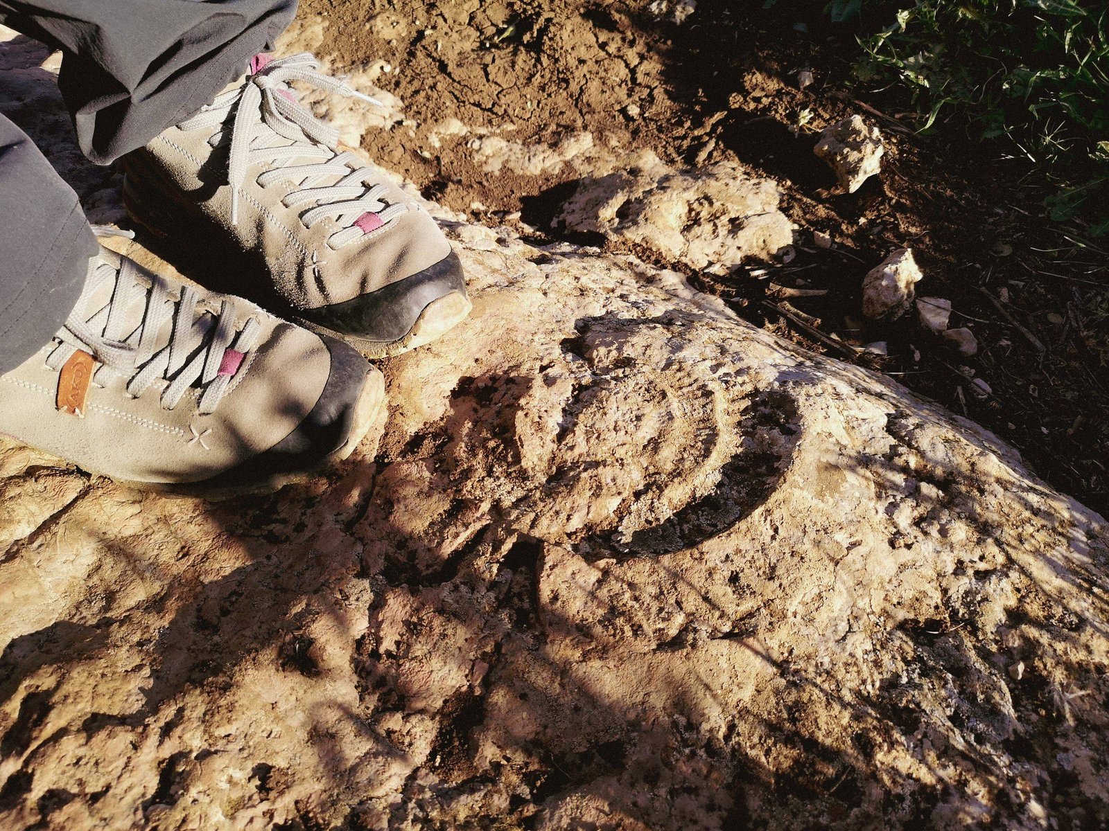
Finger-shaped rock pillars might be more common in other parts of the world, but here, in the Iberian Peninsula, they are unique geological formations. This, of course, requires specific conditions to emerge. The limestone sediments, from which Sierra del Torcal is shaped, originated in the deep past, when dinosaurs used to roam the Earth. Back then, the current area of El Torcal was submerged underwater in the Tethys Sea, located between the Iberian and African tectonic plates. As you might already know, most of the limestone rocks form throughout millions of years in the shallows sea waters, wherever it is due to biological process like oyster shells, or simply by evaporation of water, leaving Calcium Carbonate (precursor to limestone) to sink to the bottom of the ocean, where it was pressured into limestone. This process lasted for about 175 million years and resulted in strata thousands of meters thick.
Limestone rocks are a good place to look for ancient fossils. El Torcal is no exception to that. Photo by Alis Monte [CC BY-SA 4.0], via Connecting the Dots
Of course, limestone alone was not enough for such awe-inspiring rock formations like in El Torcal to take shape. These sedimentary rocks were only a mold for the forces, which sculpted the area during the last millions of years. The process, which started somewhere in the middle Miocene after the region has surfaced from the depths of the ocean, thanks to the Alpine orogeny. In fact, it is still happening today, as the Iberian plates to the north and African plates to the south continue its almost timeless showdown of collision in an attempt to form another supercontinent. Still, these uniformitarian forces were only the catalyst for the genesis of the current day form of El Torcal de Antequera.
A photo of El Torcal de Antequera is the thumbnail of the limestone page on Wikipedia. Photo by Alis Monte [CC BY-SA 4.0], via Connecting the Dots
As you might now understand – being exposed to the atmosphere are not natural conditions for limestone. Like almost anything else, it is vulnerable to all kinds of erosion: driven mainly by either wind or water cycles.
First and foremost, El Torcal is best known as a karst landscape, but what does it mean? Yes, there are some caves and holes in the area but that alone is so impressive, and more importantly unique? Definitely, no. This puzzled me for a while until I dug in a bit deeper into the mechanics behind the formation of this exceptional mountain range. Caves and karst sinkholes are typical for limestone strata exposed to rain and other water cycles. All thanks to the same physical feature of Calcium Carbonate – for which we can thank for having beautiful stalagmites and stalactites as well – its solubility in water. Here in El Torcal, it has saluted entire layers of Calcite, forming wide passages between the rocks and exposing them to further erosion caused by rain, ice, and wind. Finally, these meteorological agents shaped the uncovered layers of limestone to these remarkable stone pillars. Only by understanding these slow and gradual mechanics, one can really learn to appreciate the uniqueness of El Torcal.
Having traveled the old continent in and out, very few natural landmarks still manage to surprise me. El Torcal proved to be that kind of a place. Needless to say that I loved it, or that I highly recommend visiting it. Instead, once again, I want to emphasize the out-of-place feeling the mountain range gives. The natural UNESCO World Heritage Site could hardly be compared to any wonder of nature I know. The picturesque rock columns are reminiscent of a somewhat mythical aura from a deep past. The only good match I can think of is the Great Pillars of Gondor Kings from Lord of the Rings. Of course, the main difference between the two is that you can actually visit El Torcal de Antequera and see it with your own eyes. Therefore, why hesitate? Let El Torcal speak for itself.
All content and photos by Alis Monte. If you want to collaborate, contact me on info@wp.connectingcosta.com Photo by Alis Monte [CC BY-SA 4.0], via Connecting the Dots