Tag: Travel

Various travel destinations based on personal Experience.

  • Hiking Penon de Ifach – Calpe Rock, Costa Blanca

    Hiking Penon de Ifach – Calpe Rock, Costa Blanca

    The Gibraltar of Costa Blanca

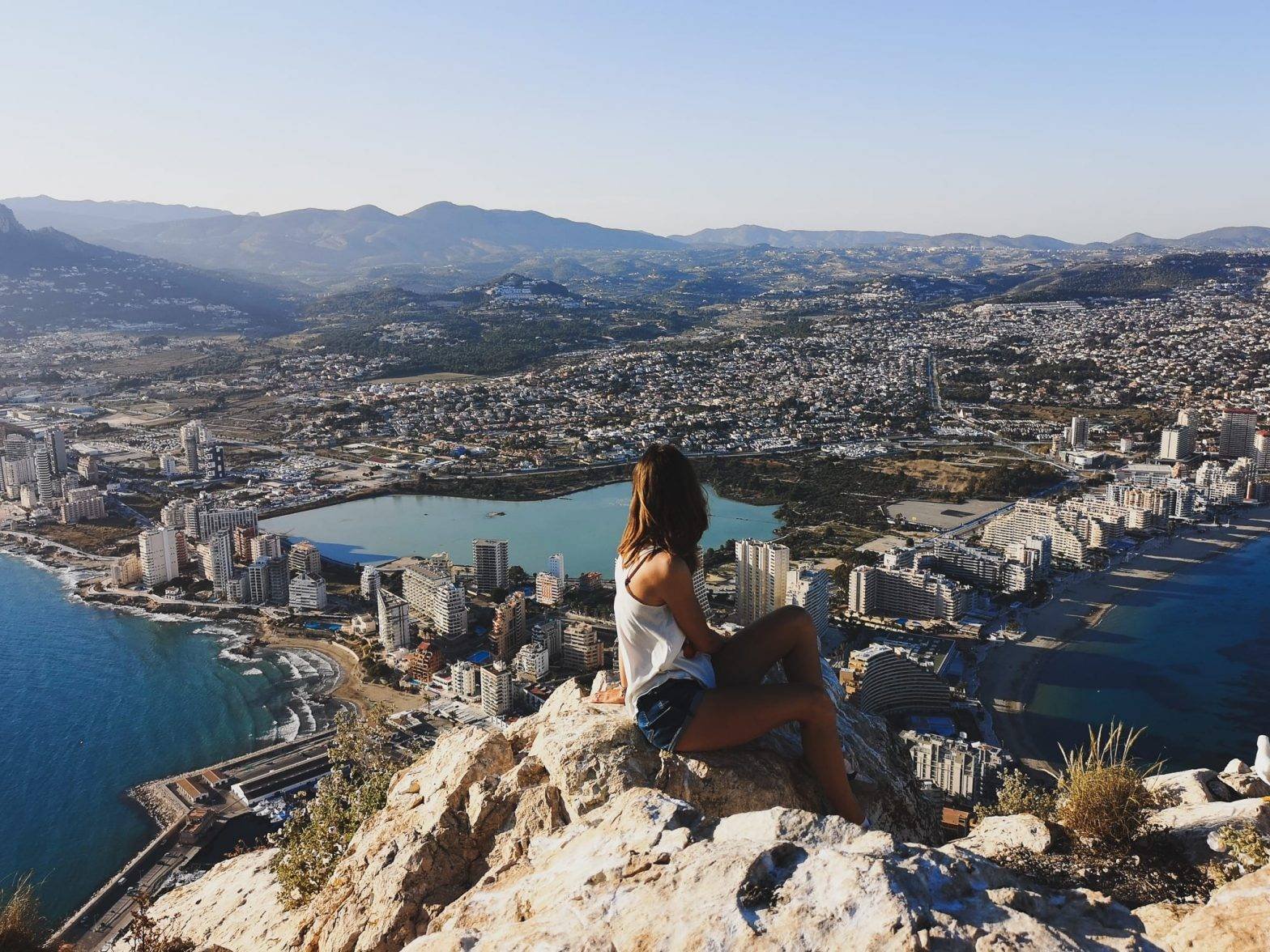
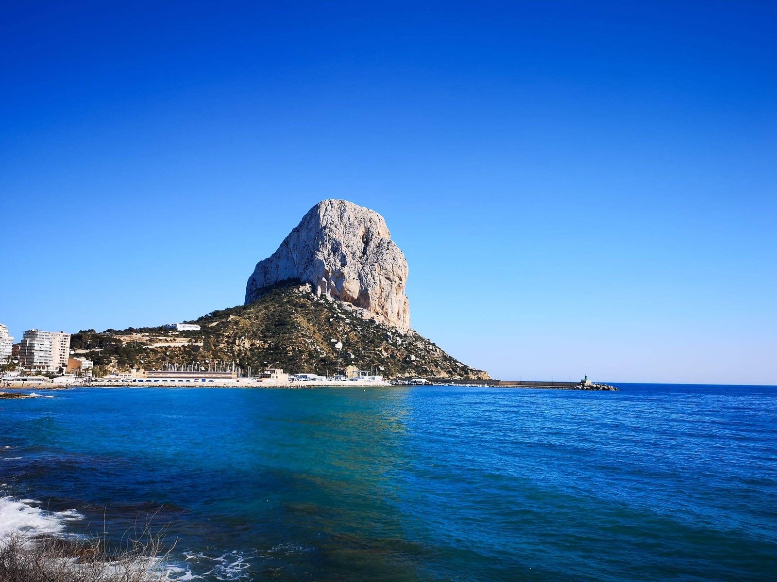
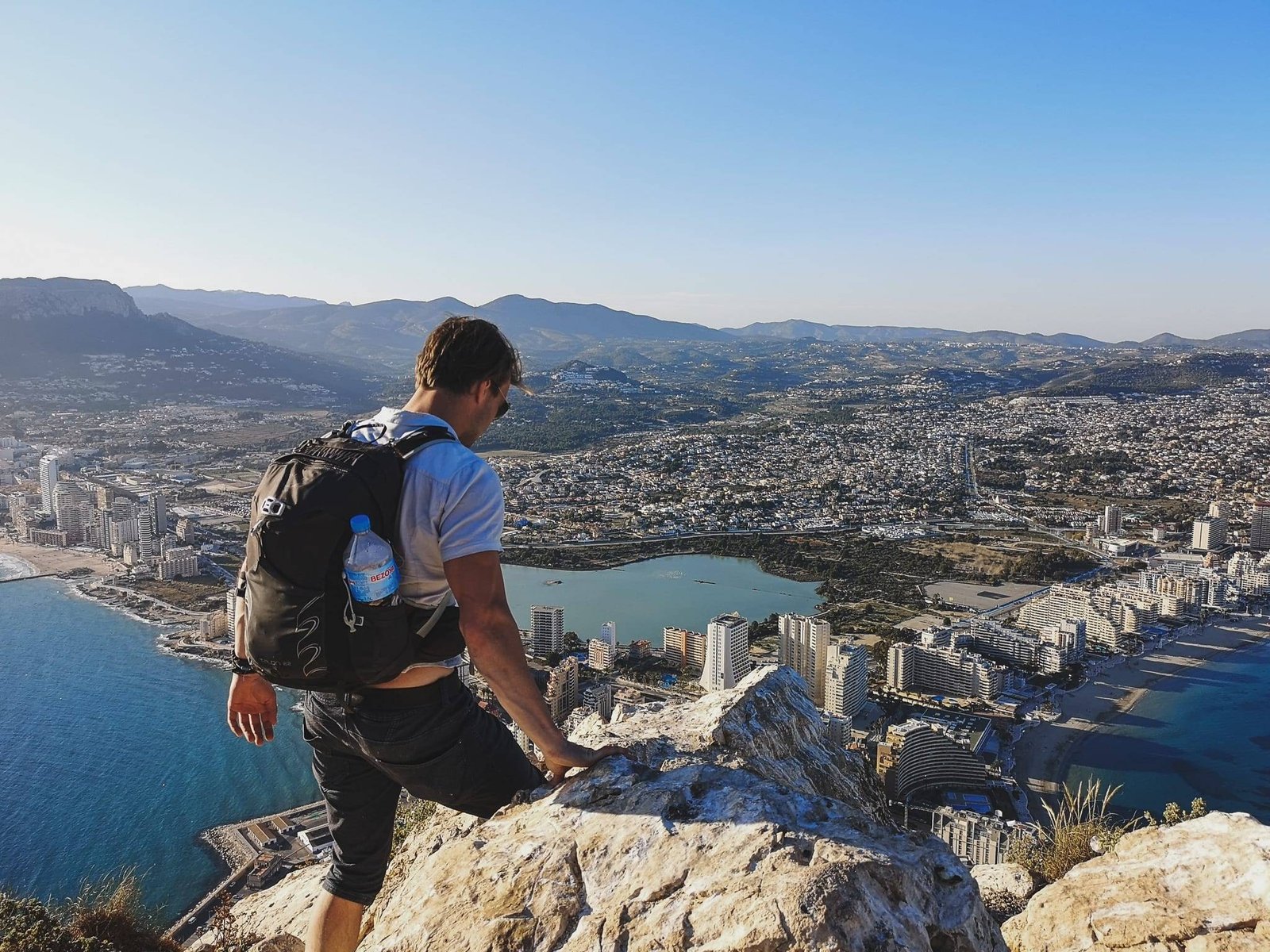
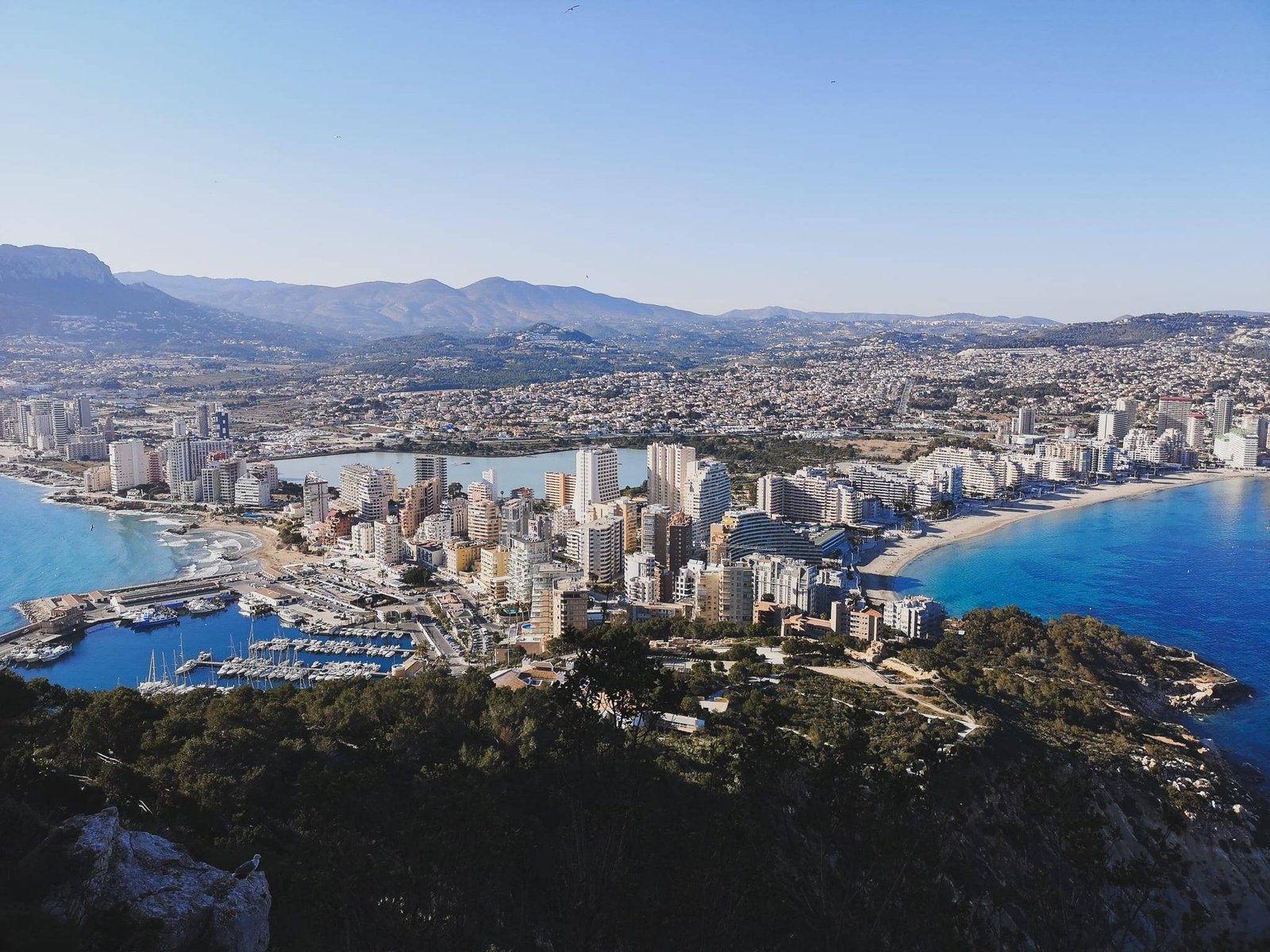
    From everything I’ve ever seen, there is only one place like legendary Gibraltar. Take away the strategic importance with its historical significance from Gibraltar, and add the remote beauty of the wild nature, you get Penon de Ifach. Located on the tip of Calpe City, it is separating the urban area’s beaches into two. Having in mind the Les Salines, a salt lagoon located in the middle of the city, the beauty of views from the top of Penon de Ifach is somewhat iconic on Instagram. This is certainly among the best things to do in Calpe and one of the best hikes near Benidorm, Costa Blanca overall.

    Penon de Ifach Calp Costa Blanca Spain
    Penon de Ifach from Calpe. Photo by Alis Monte [CC BY-SA 4.0], via Connecting the Dots

    Hiking Penon de Ifach Details

    • Location: Calpe
    • Region: Marina Alta
    • Starting location: Natural Park of Penon de Ifach
    • Target location: Penon de Ifach
    • Coordinates: 38.6351 ″ N, 0.0744 ″ W
    • Distance: 2km / 1,24mi
    • Duration: ~3h
    • Accomondation: Calpe, Altea, Albir & Benidorm
    • Difficulty: Hard – Unless you are fit, not recommended. Intermediate difficult to experienced people.
    • Permit: Limited access during peak times
    • More information: Official website

    Map of Costa Blanca Hikes

    About Penon de Ifach

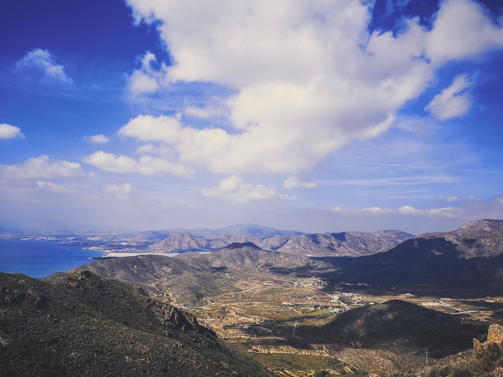
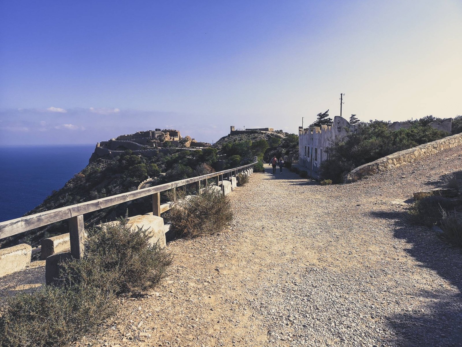
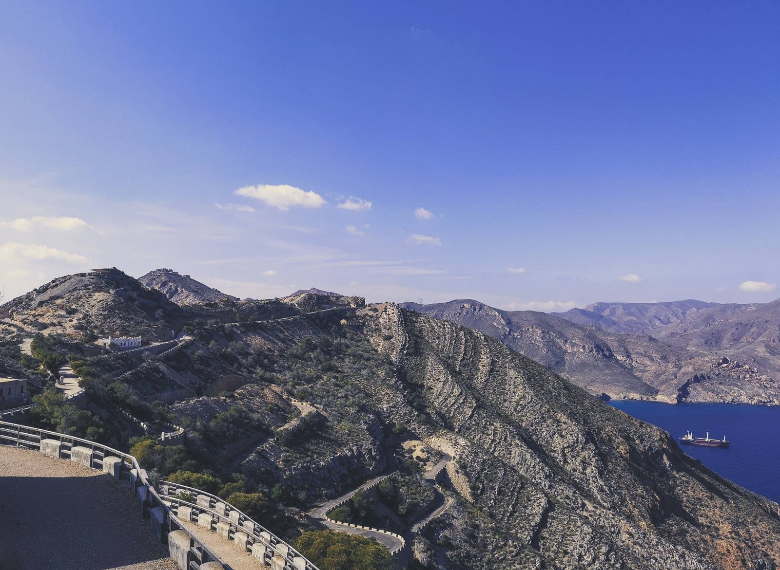
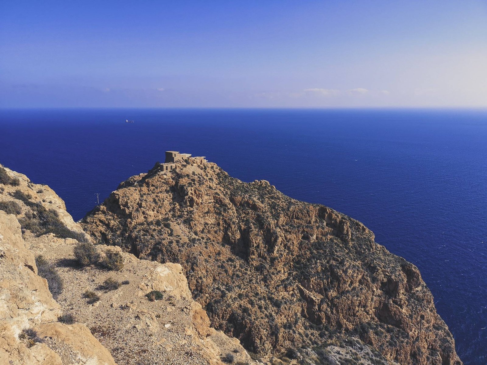
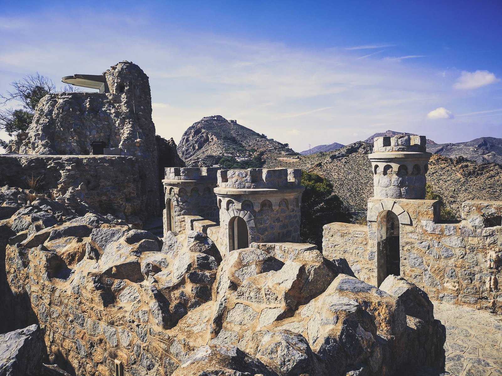
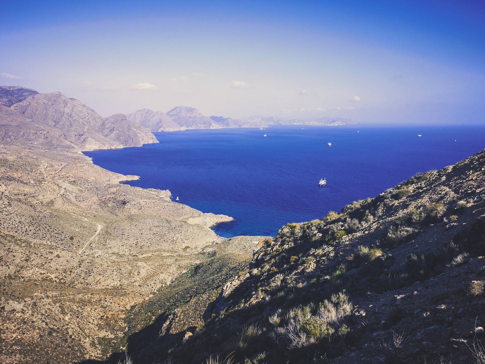
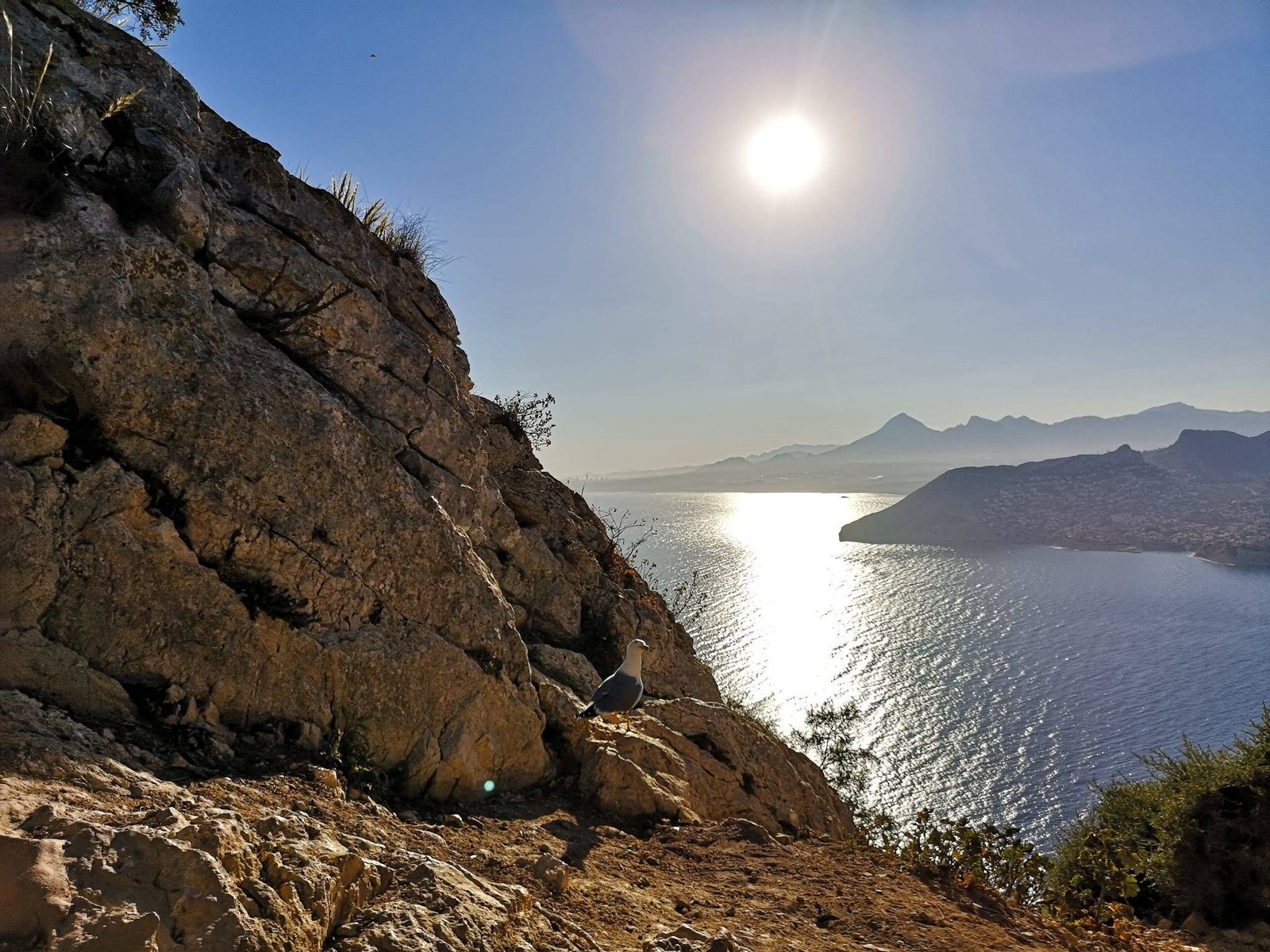
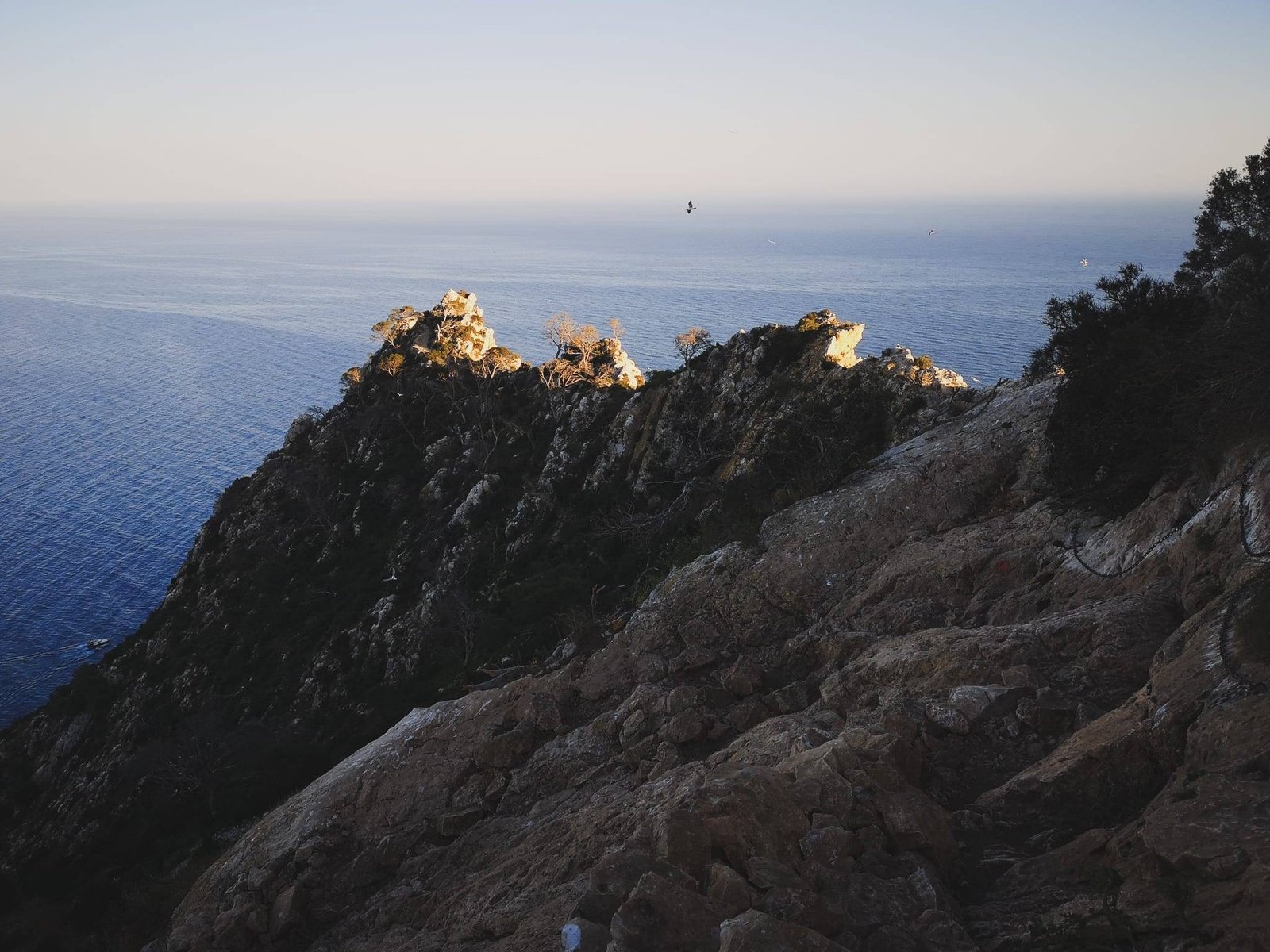
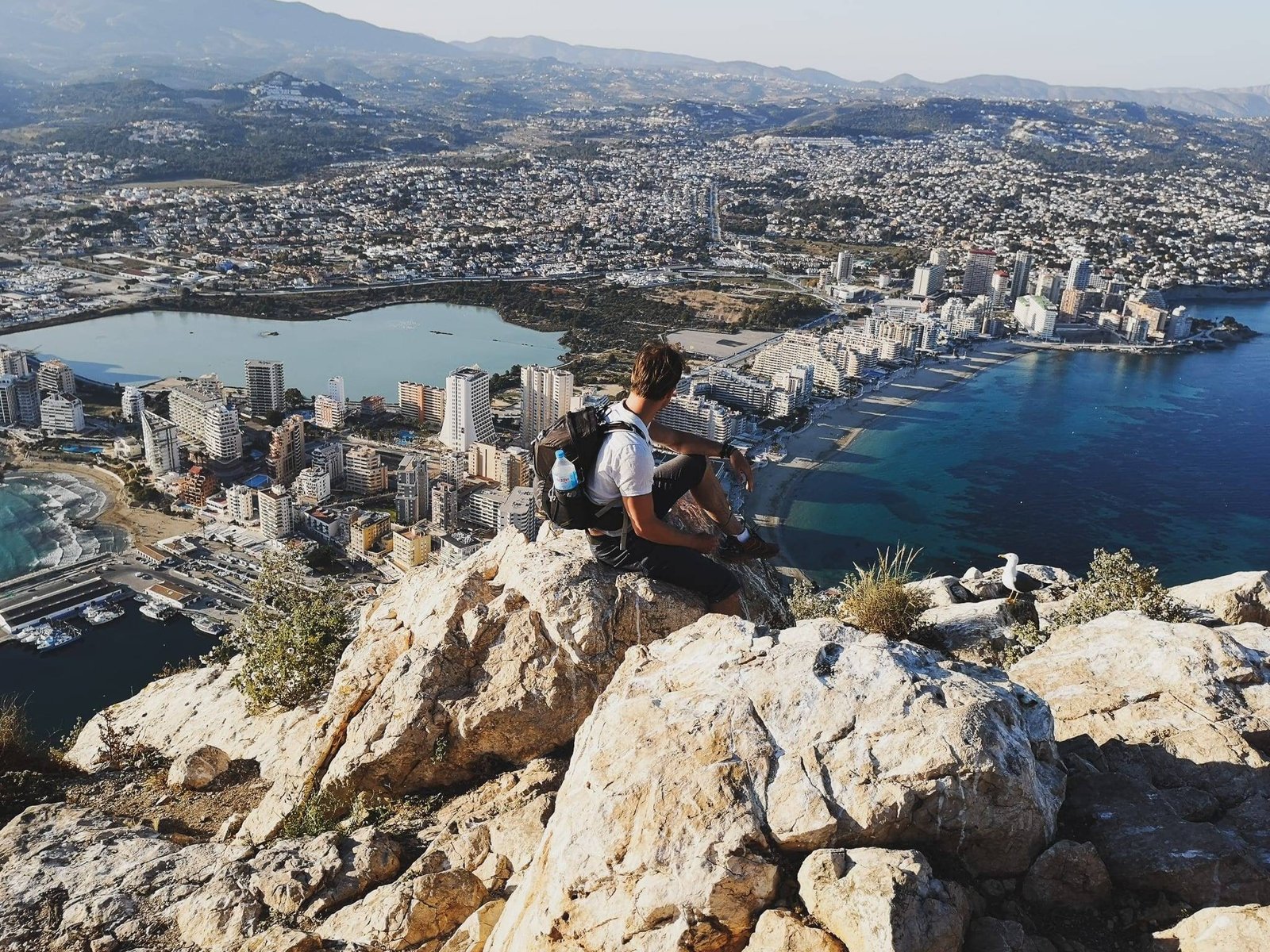
    Rising 332m above the sea level, which is right next to it, Penon de Ifach is a hard-to-miss wonder of nature of Costa Blanca. With a size of approx. 45 hectares or 62 soccer fields, the Natural Park of Penon de Ifach is the smallest regional park in Spain and one of the smallest in the whole of Europe. Nevertheless, it attracts more than 100,000 visitors each year. Due to its uniqueness, the rock creates many microhabitats perfect for rare specialized plants. If it is safe, be sure to smell various flowers growing around the path.

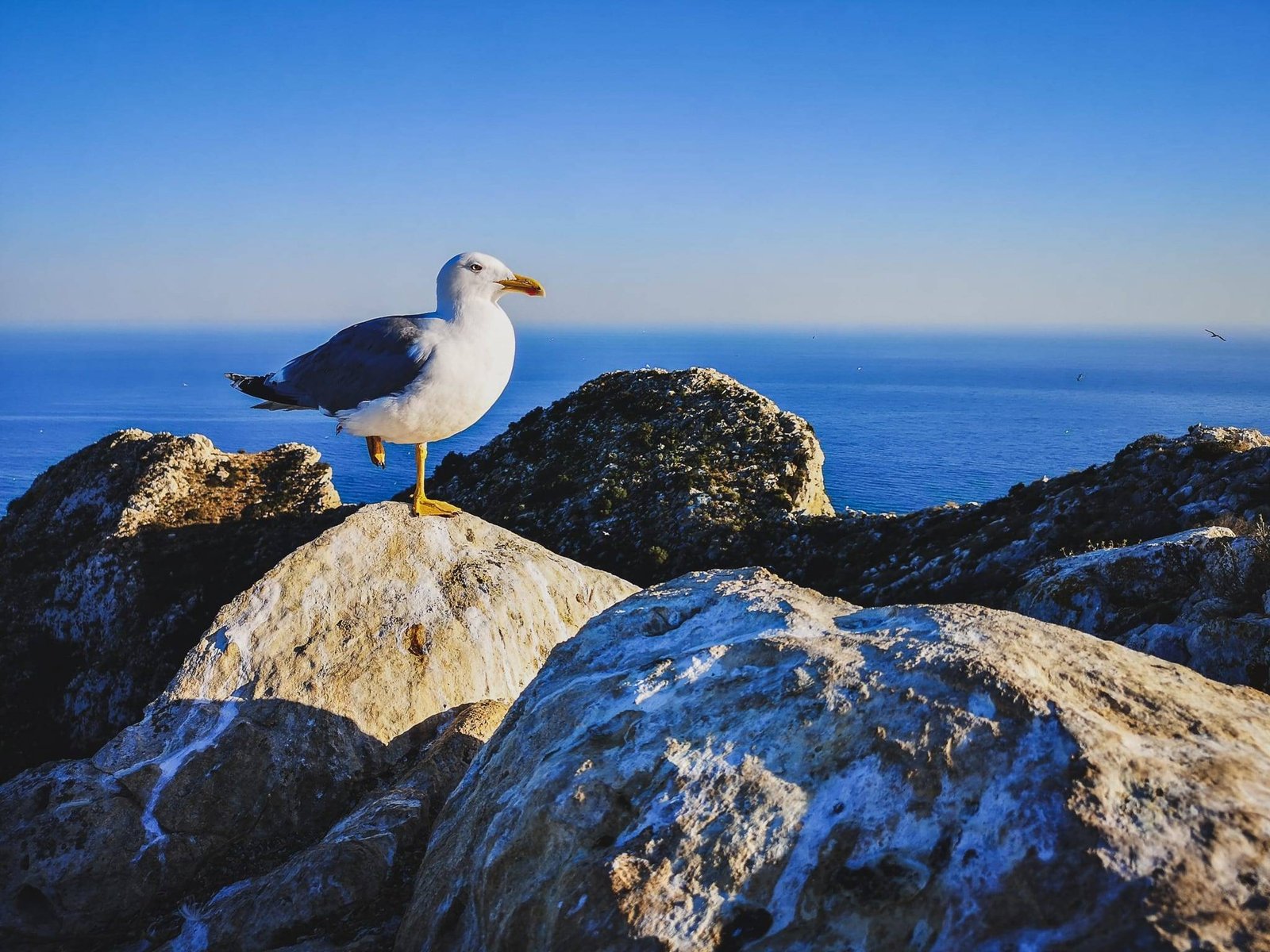
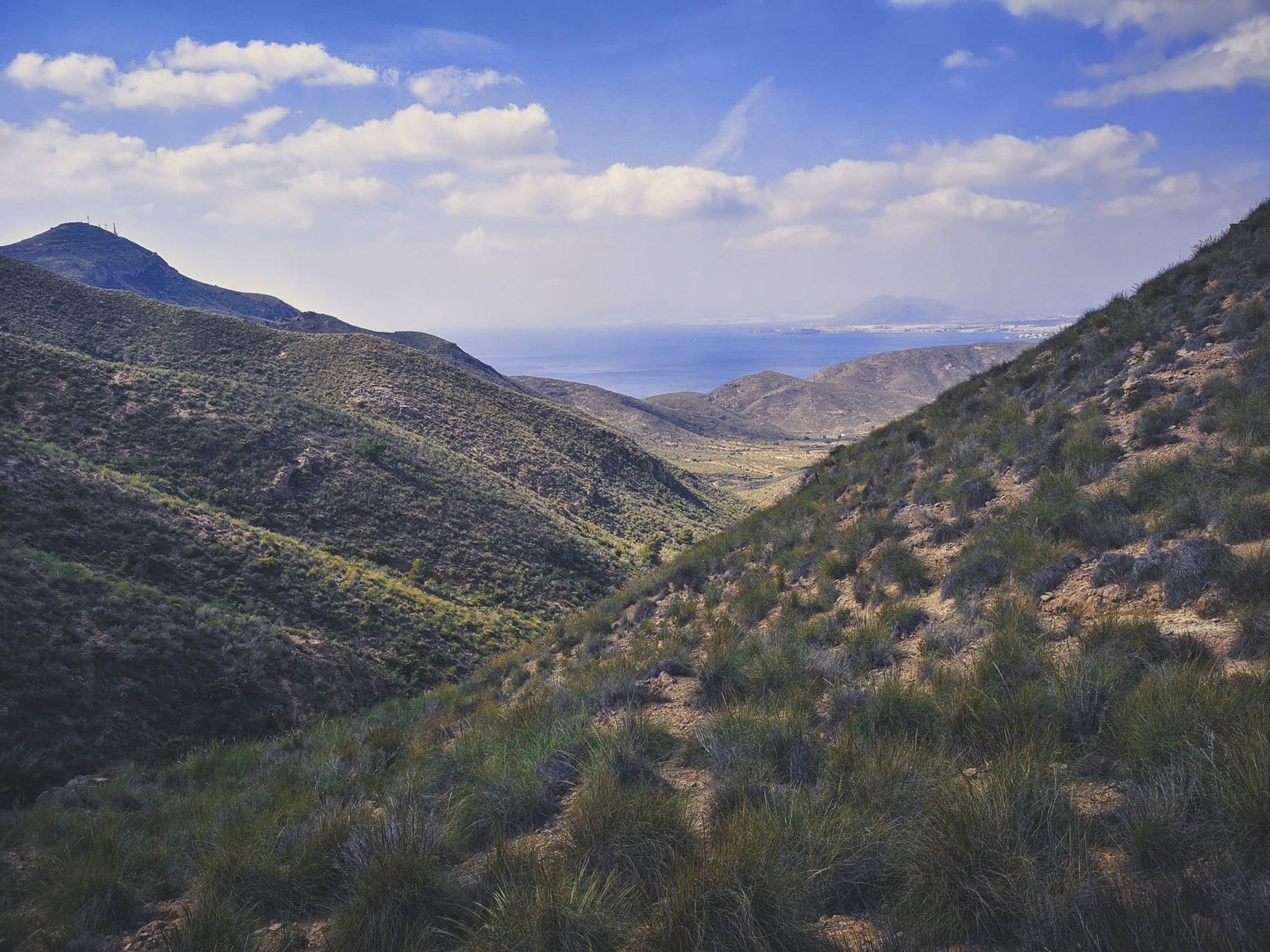
    Penon de Ifach is also a nesting site for many birds and for that reason it has some path restrictions from 1st April to 30th June. Even though you can meet some of the semi-domesticated cats in the park, during the mating season, it is the sea birds which will drive you crazy with their catlike sounds for seducing a partner. No matter how many tourists come here, there are more seagulls than anybody else. It is their rock, respect that. Birds are not the only ones to appreciate Penon de Ifach, humans used the rock to navigate since prehistoric times. Today, Penon de Ifach marks the entrance to Marina Alta – the hikers’s paradise.

    Penon de Ifach hike Seagull
    Sneak Peak. Photo by Alis Monte [CC BY-SA 4.0], via Connecting the Dots

    History of Penon de Ifach

    It is not surprising that I’m not the first to notice the similarity between Penon de Ifach and Gibraltar. Around 4.000 years ago, Phoenicians, the best sailors in the World at that time, called Gibraltar and Penon de Ifach – the Southern Rock and the Northern Rock, respectively. It served as a landmark for mariners ever since.

    Thank you for visiting Connecting the Dots Journal’s official website!

    You got lucky! We have no ad to show for you. If you still want to support my work in a different way, please, subscribe to newsletter or become a Patron

    Click on the Ad to support my work.

    Thank you for visiting Connecting the Dots Journal’s official website!

    You got lucky! We have no ad to show for you. If you still want to support my work in a different way, please, subscribe to newsletter or become a Patron

    Click on the Ad to support my work.

    Thank you for visiting Connecting the Dots Journal’s official website!

    You got lucky! We have no ad to show for you. If you still want to support my work in a different way, please, subscribe to newsletter or become a Patron

    Click on the Ad to support my work.

    From 4th to 3rd century BC, the rock was a place for Iberian settlement as it proved to be an outstanding strategic place to observe the shores of the surrounding areas and spot approaching pirates. But as technology advanced, the attacks from the sea became unbearable. Villagers had to move deeper into the land, somewhere where the modern Calp is.

    For more than a century, the area of Penon de Ifach has been privately owned and only in 1987 it was declared a public regional park after the Generalitat Valenciana Authority bought it.

    N-322 road to Penon de Ifach
    Getting to Calpe. Photo by Alis Monte [CC BY-SA 4.0], via Connecting the Dots

    Getting to Penon de Ifach, Calp

    By bus

    Calp is connected to any major city around. ALSA buses come and go from Valencia, Denia, Altea, Benidorm, and Alicante every day. You can find more information here: https://www.busbud.com/en/bus-calpe/c/snb5c5

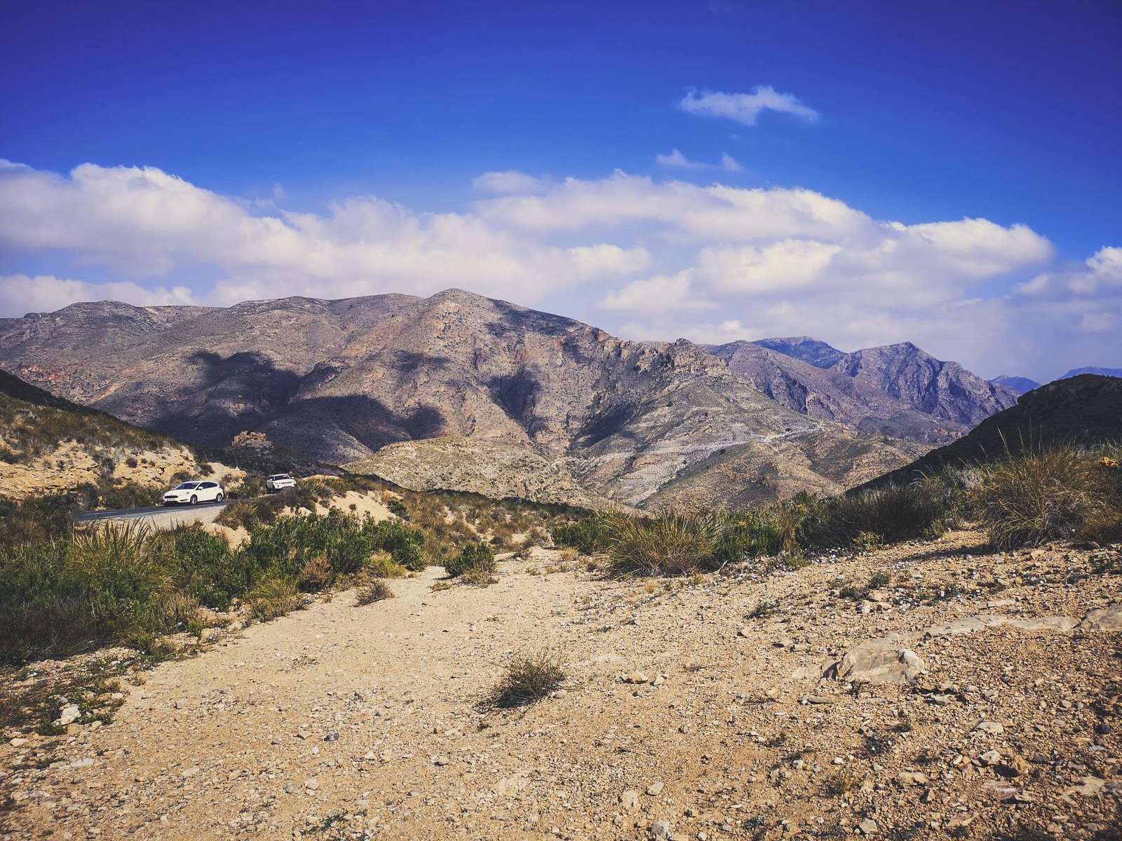
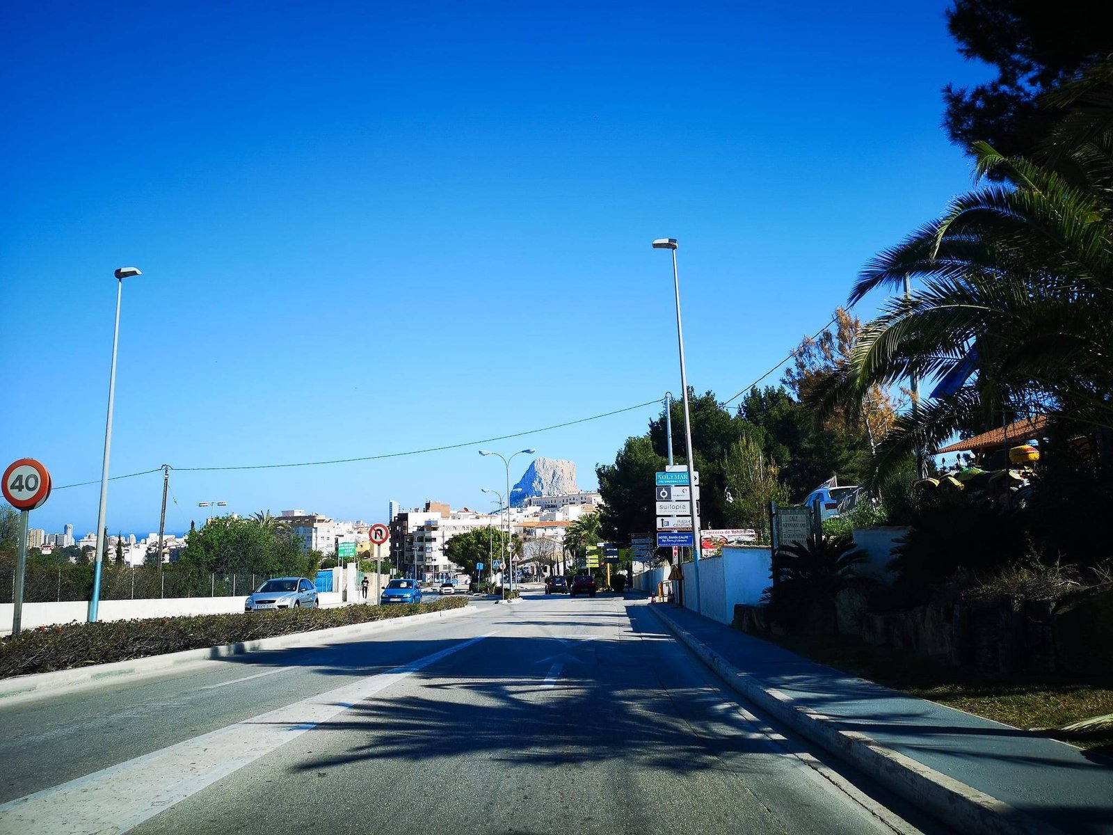
    By car – N-332 or AP-7 roads

    Like most other coastal cities in the region, the easiest way to reach Calp by N-332 road. The main problem with this road is traffic. The road goes through every town where it runs into the traffic lights, roundabouts and all the other stuff you can imagine to find in urban areas.

    Calp can be also reached by the Autopista del Mediterráneo, also known as AP-7, a tolled motorway running along the Mediterranean coast of Spain. If you approaching Calp from the South, exit AP-7  road to N-332 near Altea, or to Bonaire if you are coming from the North.

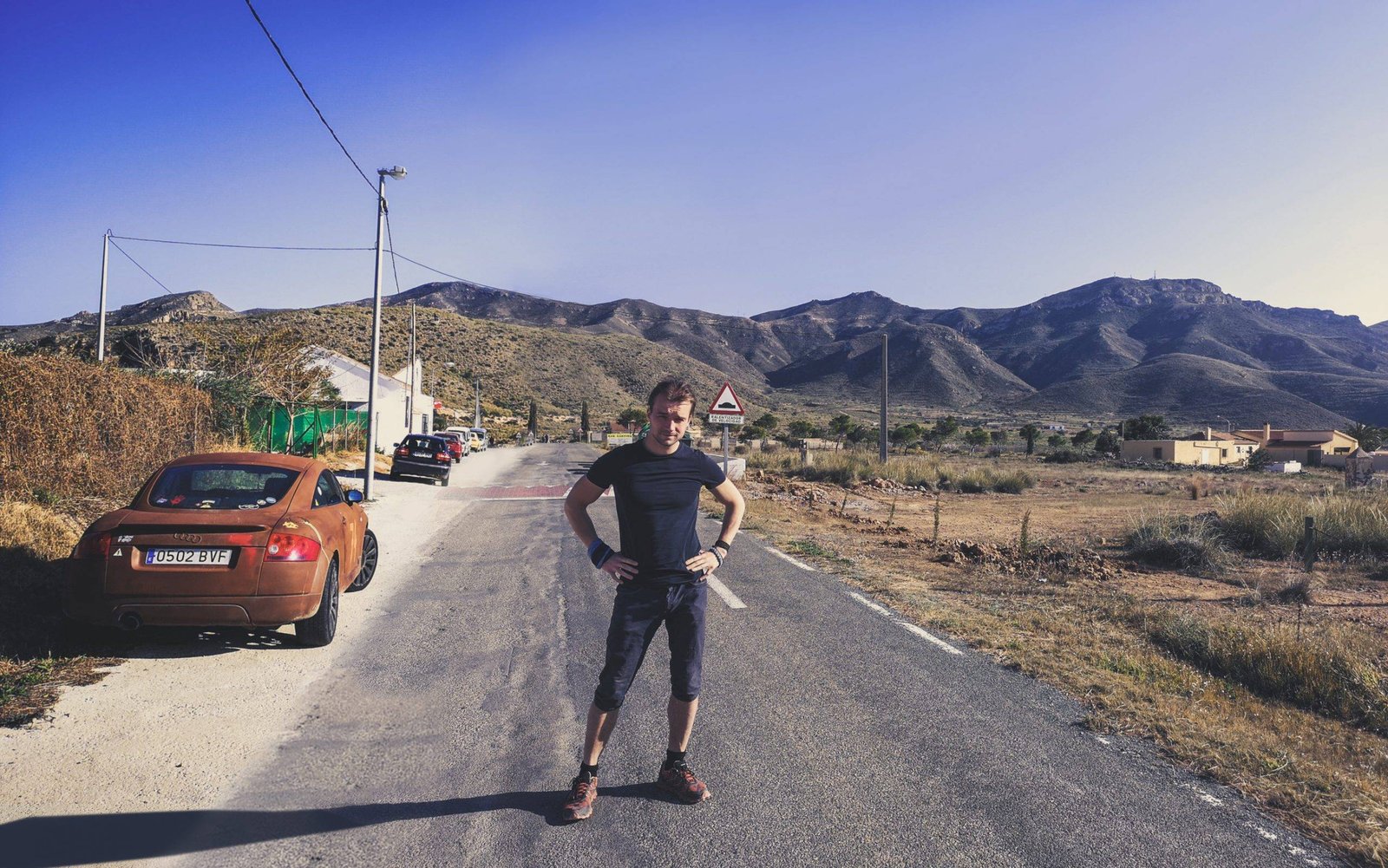
    Parking at the Natural Park of Penon de Ifach

    There are some parking spaces just next to the information center of the Natural Park of Penon de Ifach, but it seems to be closed. Instead use the parking down below, at the entrance to the park, or simply put the car anywhere in Calp and walk your way the information center of the Natural Park of Penon de Ifach, where the hike starts.

    Penon de Ifach Hike
    Calpe Rock near Mediterranean Sea. Photo by Alis Monte [CC BY-SA 4.0], via Connecting the Dots

    Is it Hard to Hike to Penon de Ifach?

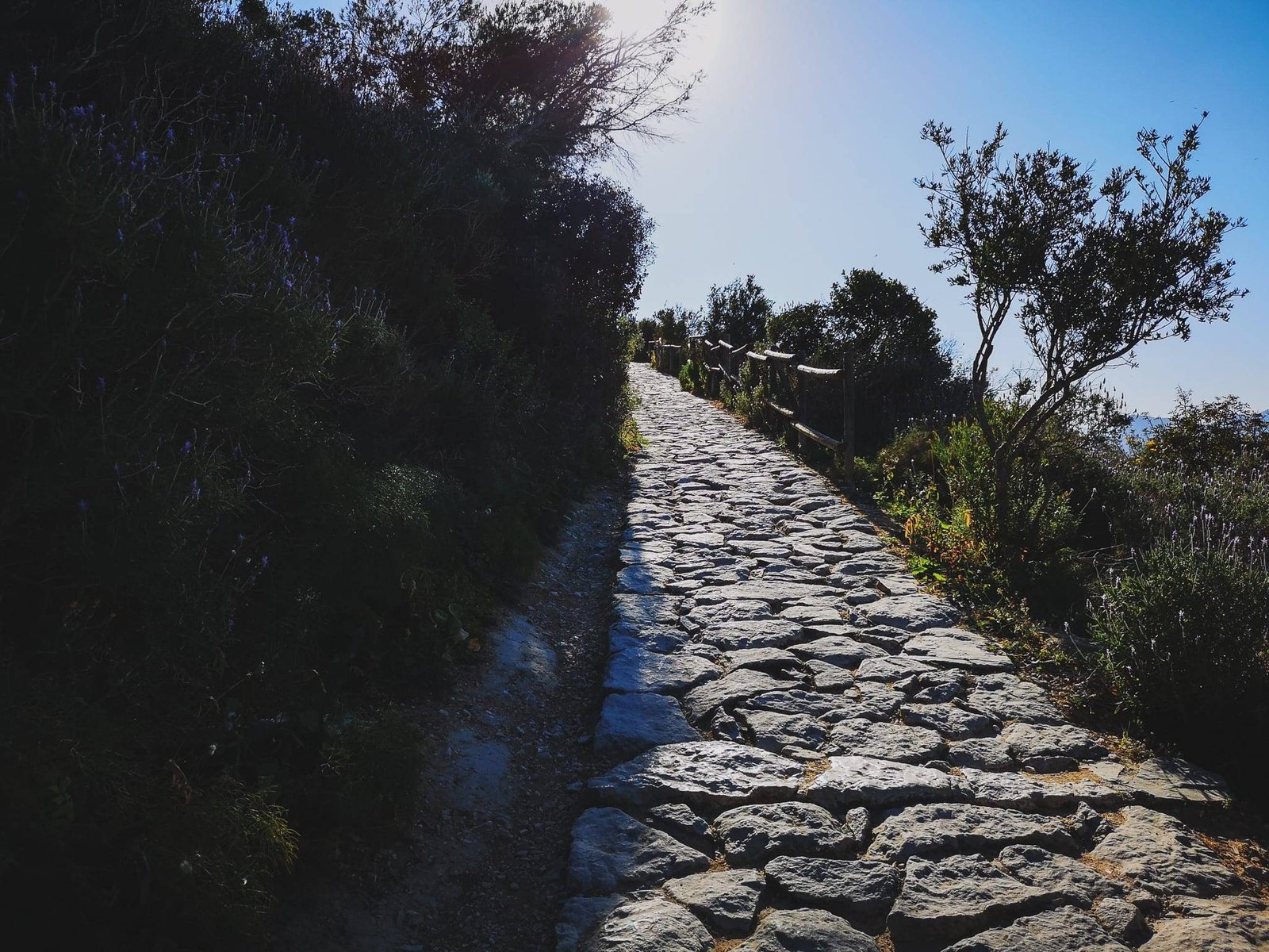
    The hike could be divided into two parts: the First one being really easy and recommended for everyone passing by; And the second should be attempted only by those who are fit, know what they are doing and have a good pair of hiking boots.

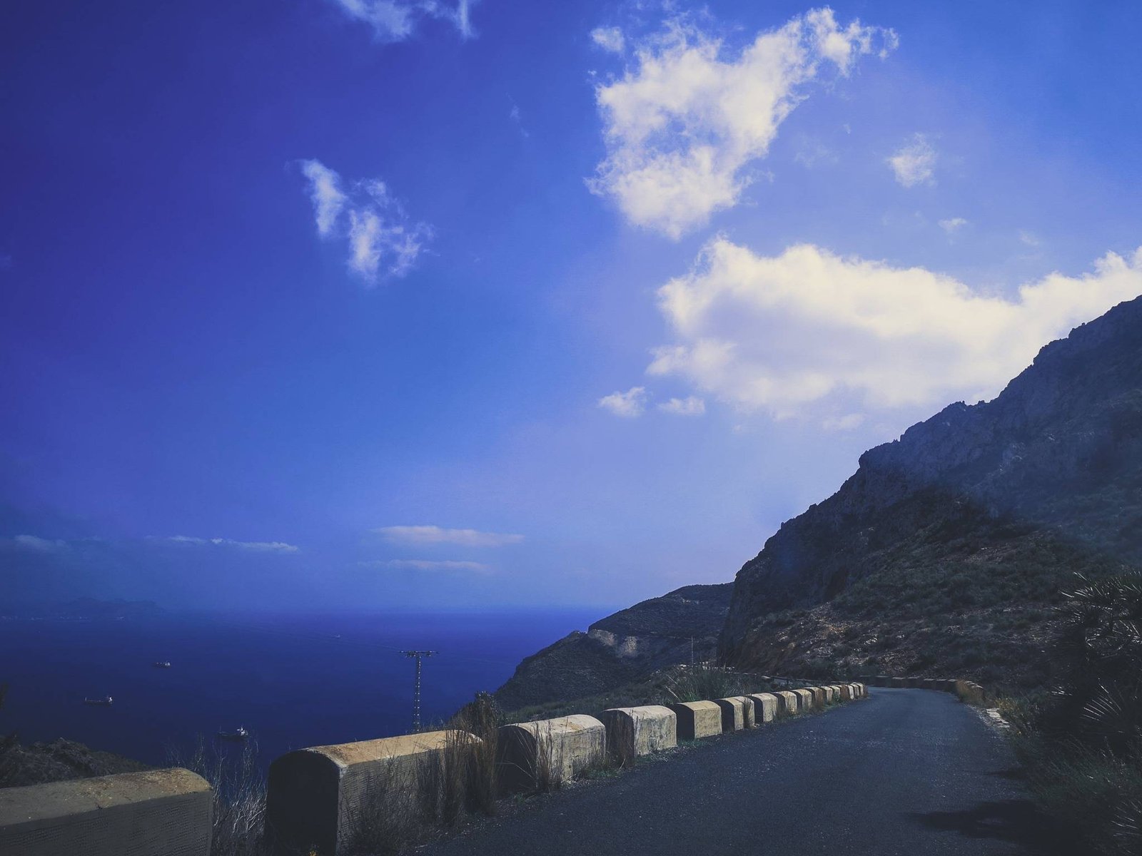
    The road quality, from the information center of the park to the rock, won’t change a bit. It is easy to walk and has plenty of places to take your breath and enjoy the amazing views. There are no steps just an uphill stone-grounded path.

    Penon de Ifach hike, road o the tunnel
    Road before the tunnel. Photo by Alis Monte [CC BY-SA 4.0], via Connecting the Dots

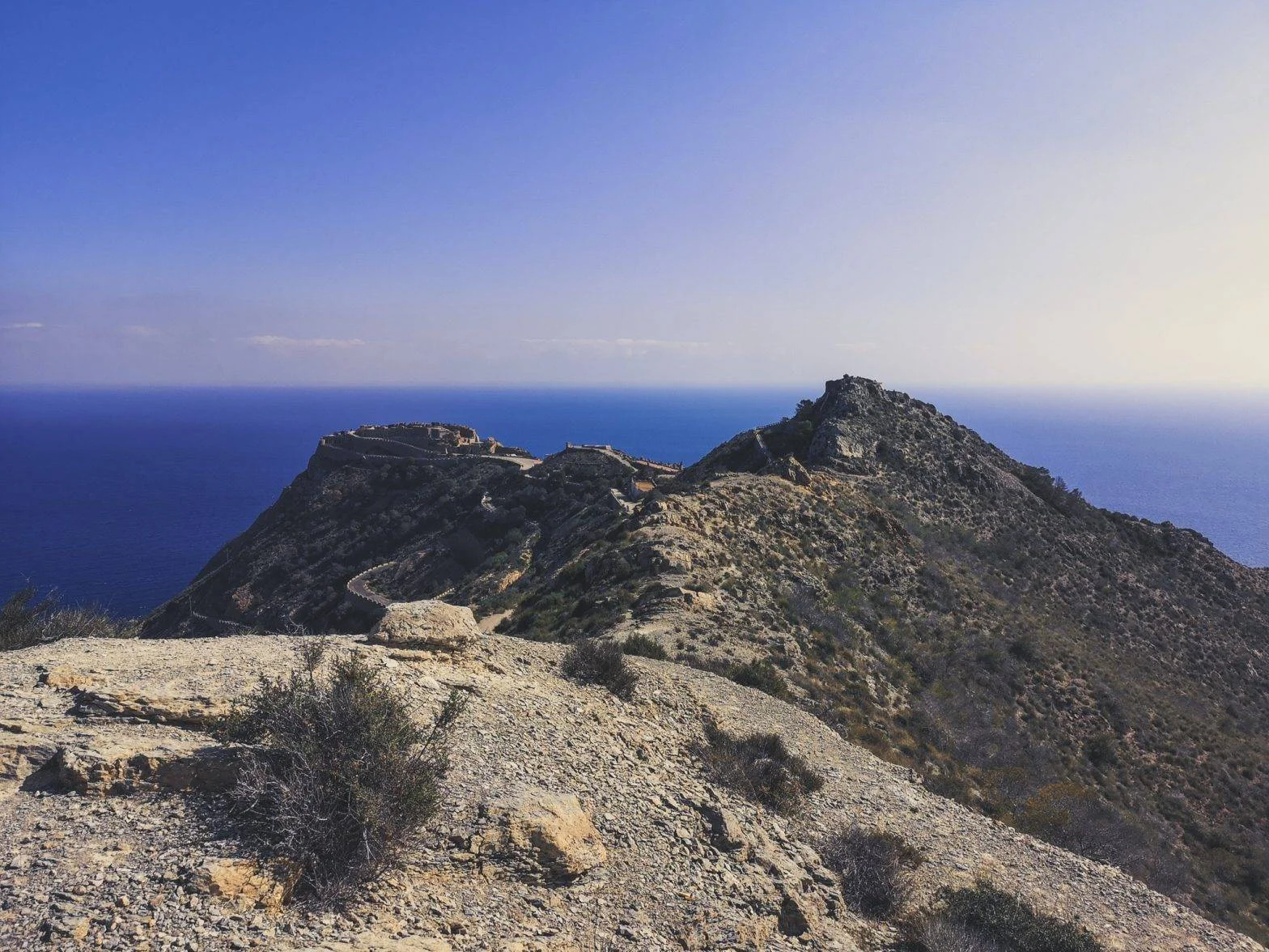
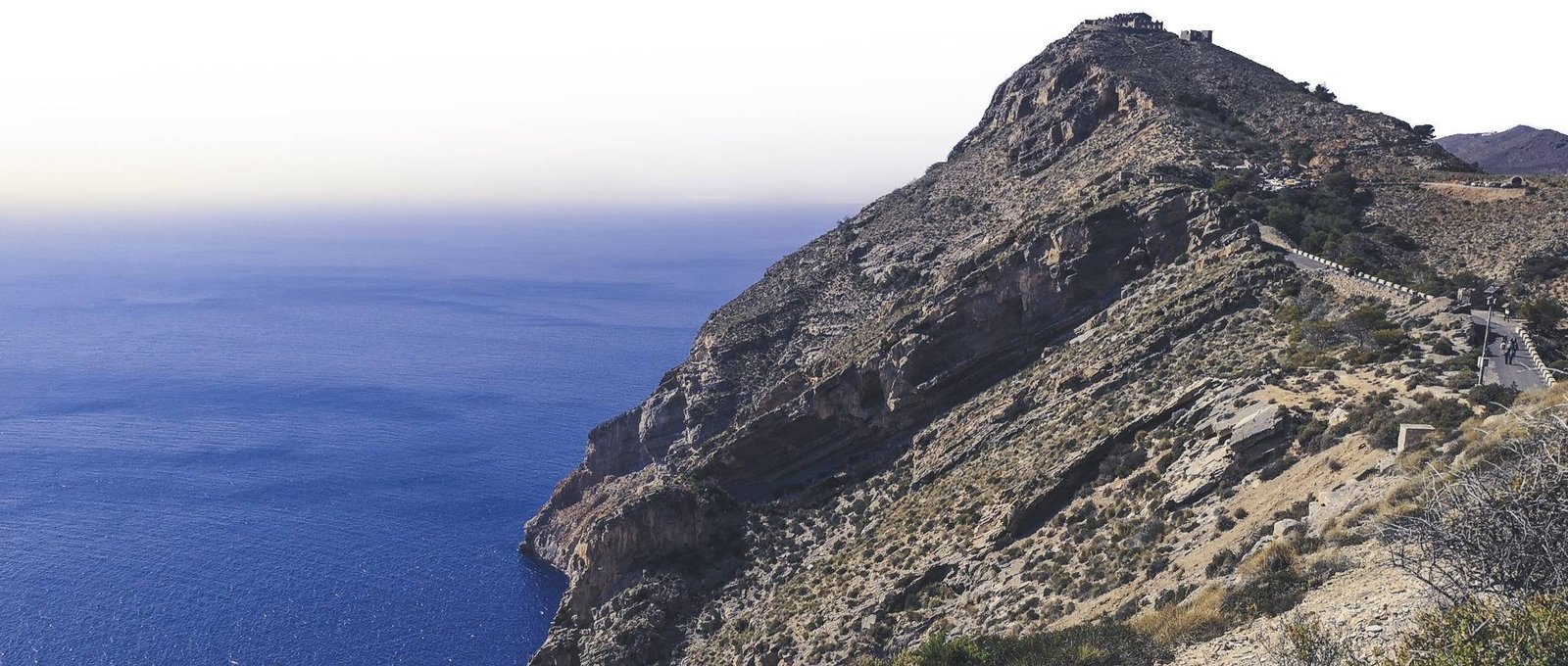
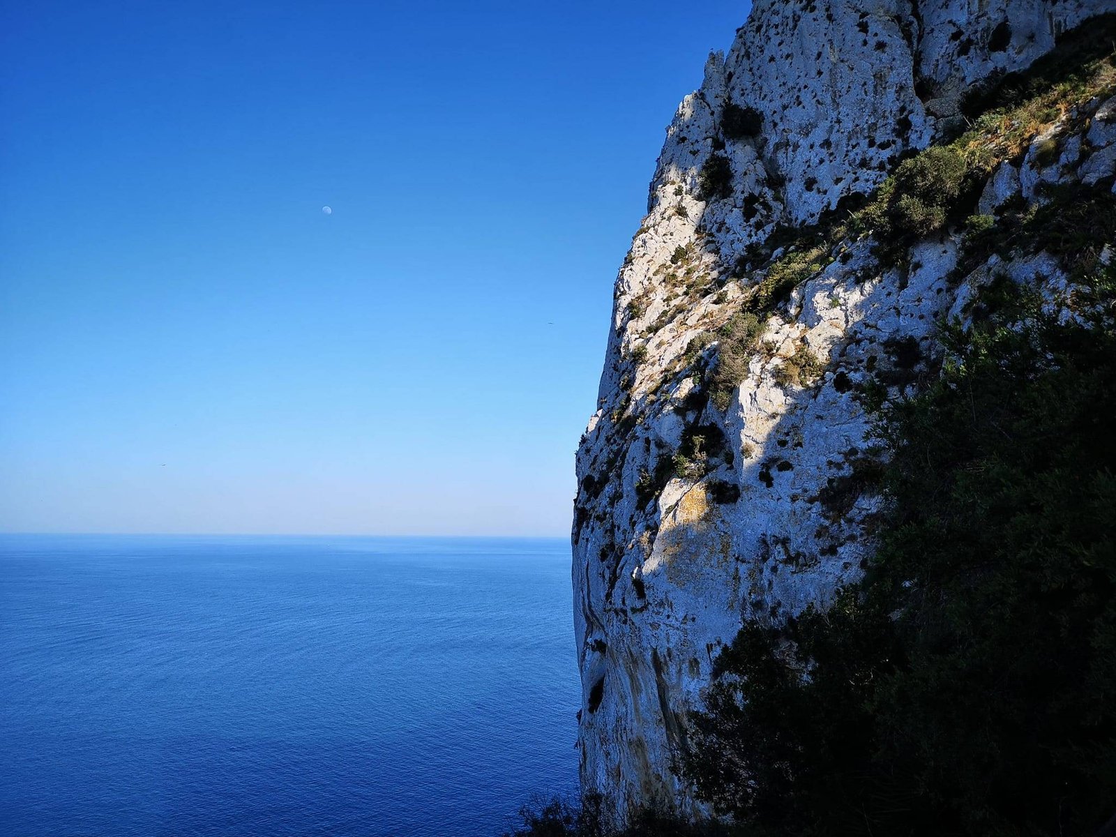
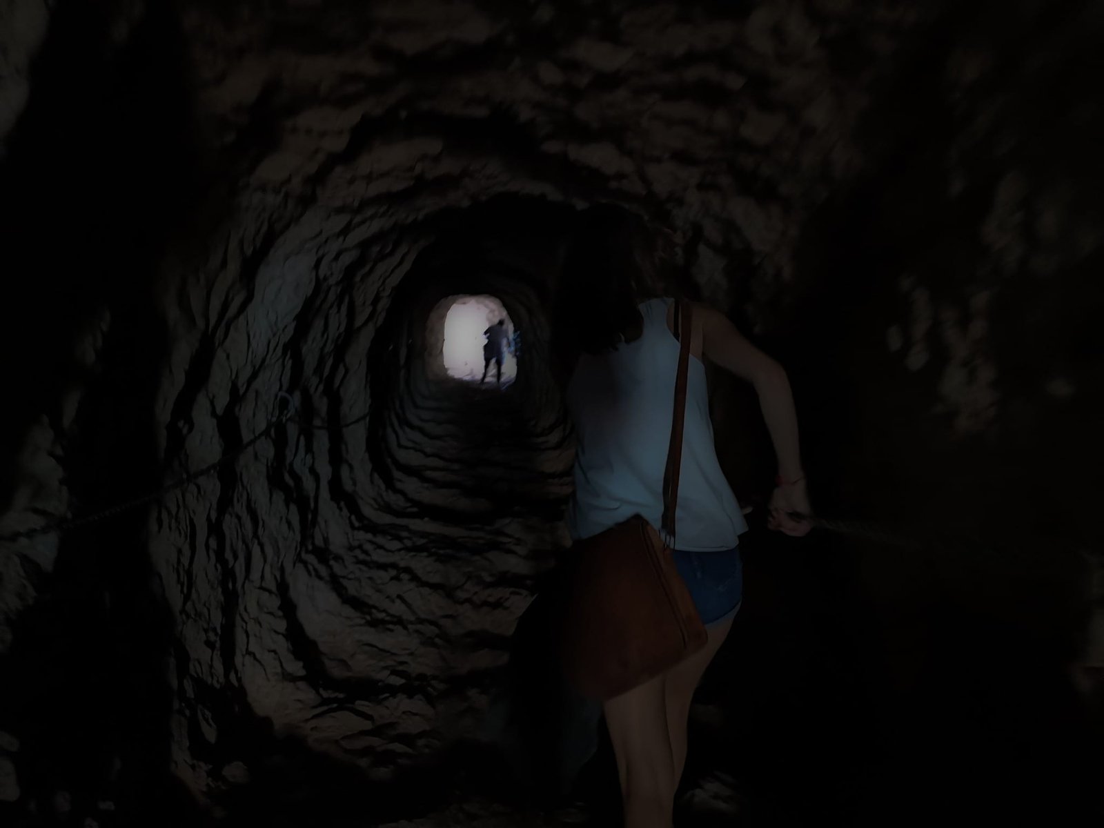
    Both parts of the hike are separated by a tunnel, which gives you a good taste of what is ahead in a safe manner. You’ll get to taste how good are your shoes for slippery stones and how comfortable you are holding onto the chains. Please note that there is no light in the tunnel. If you are afraid of the dark, I am sorry, but if you are afraid of the heights, enjoy while you can. Once you reach the light at the end of the tunnel, the steep cliffs down to the ocean won’t leave your sight for a second. From here on, the road up to Penon de Ifach will turn into a tough challenge for any regular person without any major experience in rock hiking.

    Penon de Ifach Hike tunnel
    Walking through the tunnel. Photo by Alis Monte [CC BY-SA 4.0], via Connecting the Dots

    The Hard Part of the Hike

    The second half of the hike couldn’t be more different from the first one. Instead of a man-made path, the hike will continue on slippery rocks with some chains to hold on. The road is marked with red paint, but sometimes you should consider a safer option next to the main path. There are way fewer people after the tunnel on the road, but with time, the long-lasting rocks have seen a lot of them. The hikers had grinded the surface of the stone like it has spent most of its life in the ocean. The main tips for hiking to the top of Penon de Ifach goes as it follows:

    • High hiking shoes with a deep sole are really useful here;
    • Always look where to put your feet;
    • Enjoy the views only when standing still;
    • Leave enough time to climb down before it gets dark or take a headlight.
    • Where the road is narrow, let incoming people pass it first;
    • Don’t go alone.
    Penon de Ifach Difficult Road
    The tip of Calpe Rock. Photo by Alis Monte [CC BY-SA 4.0], via Connecting the Dots

    If you will continue walking with a hope that the road will get any easier – DON’T. The hike to the top of Penon de Ifach will remain challenging right up to the peak. And it won’t be a pleasant walk. You have to remain conscious of the high probability that any miss-step might result in bye-bye-your-life all the time.


    On top of Penon de Ifach Calp Spain
    Reaching the peak. Photo by Aiste [CC BY-SA 4.0], via Connecting the Dots

    The Problem of Modern Selfie-photography Hiking

    I might be exaggerating a lot, but I’ve seen plenty of people on this hike who shouldn’t be there, and they didn’t look very happy. If you are one, I want to scare you away and save you some nerves. These days it is a common thing that people die trying to take a cool selfie or simply doing a hard hike trying to get to a beautiful vista. Some places are just simply not for everyone, but the motivation behind the possibility of rewarded attention on social media pushes some people beyond their capabilities. Personally, I enjoyed the hike a lot, I love climbing and hiking on rocks and it is really sad that after some misfortune incidents wonderful hikes like this gets closed.

    A man on top of Penon de Ifach
    Lone hiker. Photo by Alis Monte [CC BY-SA 4.0], via Connecting the Dots

    Of course, the real tragedy is the loss of life which could be avoided if the people get informed correctly in front. Instead, there is not much official information to be found in English, which is substituted by some random comments on TripAdvisor. Something like “The hike was challenging but totally worth it”, could mean many things, one of them is that somebody after reading a comment like this won’t get home. Better safe than sorry, right? That is the reason for my description being so harsh. In short – be smart, take that Instagram selfie before the tunnel, and get back home in one piece.

    Penon de Ifach Instagram photo view
    The view from the top. Photo by Aiste [CC BY-SA 4.0], via Connecting the Dots
    Penon de Ifach vista from tunnel
    The view from the tunnel. Photo by Alis Monte [CC BY-SA 4.0], via Connecting the Dots

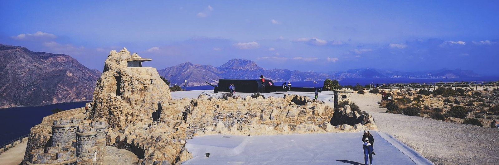
    Facilities by Penon de Ifach

    This hike leads to the top of the rock 3xx meters above the sea level, which is next to it. Obviously, there is not much of a space for cafes or bathrooms. The last bathroom is at the start of a hike, in the information center of the Natural Park of Penon de Ifach.

    Thank you for visiting Connecting the Dots Journal’s official website!

    You got lucky! We have no ad to show for you. If you still want to support my work in a different way, please, subscribe to newsletter or become a Patron

    Click on the Ad to support my work.

    Thank you for visiting Connecting the Dots Journal’s official website!

    You got lucky! We have no ad to show for you. If you still want to support my work in a different way, please, subscribe to newsletter or become a Patron

    Click on the Ad to support my work.

    Thank you for visiting Connecting the Dots Journal’s official website!

    You got lucky! We have no ad to show for you. If you still want to support my work in a different way, please, subscribe to newsletter or become a Patron

    Click on the Ad to support my work.

    There is a tap for water at the start of the hike, but I don’t recommend drinking from it. It is mainly to clean your hands after the walk, as you’ll definitely get your hands dirty during this one. If you are reading a guide for the hike, you’ll probably going to take at least 3 hours to complete it. Be sure to take your own water and snacks as the hike up will be exhausting and energy consuming.

    Climbing Penon de Ifach
    After climbing Penon de Ifach in Calpe. Photo by Alis Monte [CC BY-SA 4.0], via Connecting the Dots

    Is it Worth to Visit Penon de Ifach?

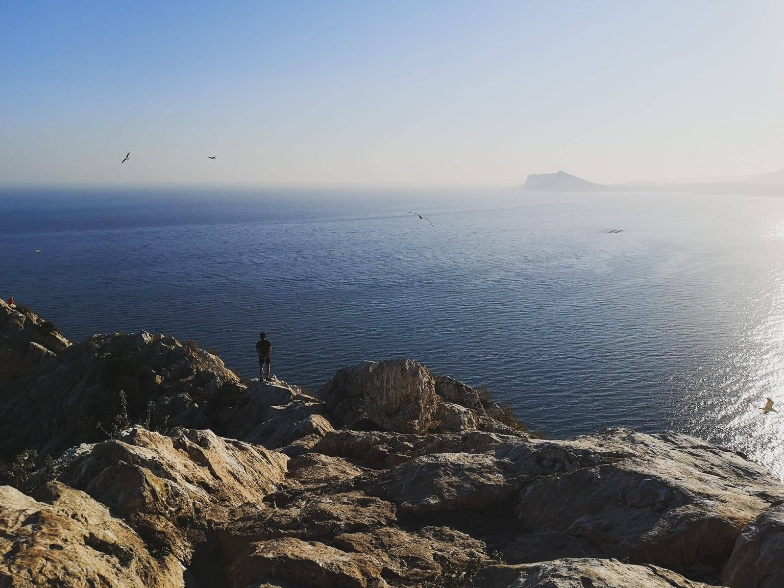
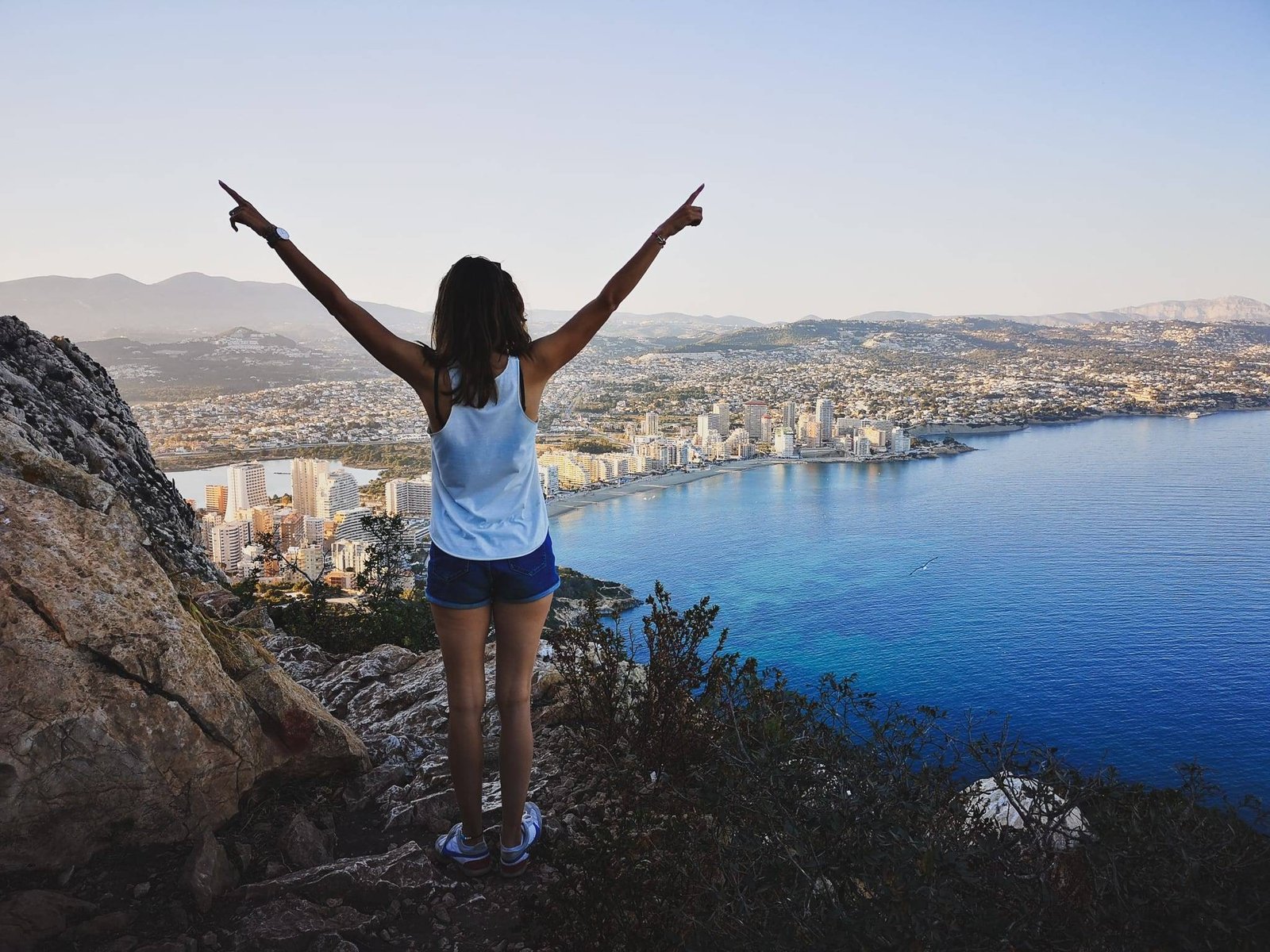
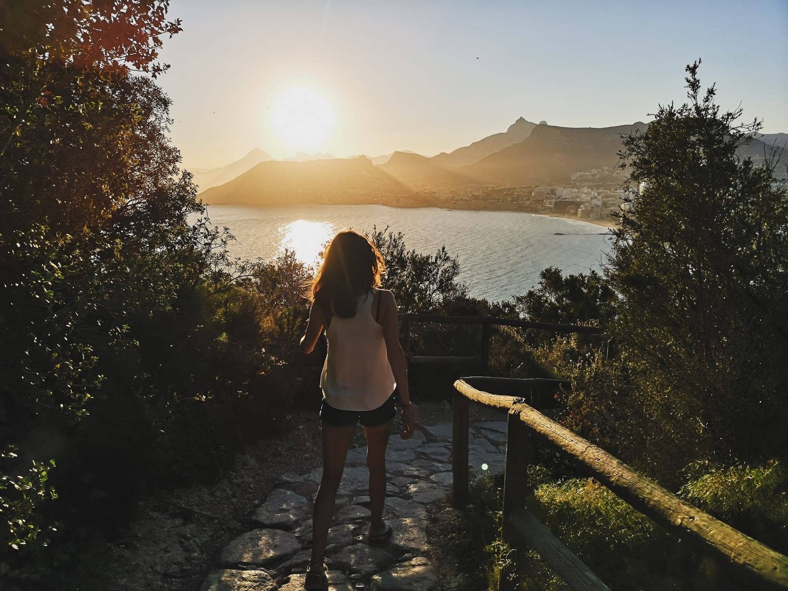
    It is definitely worth to visit Penon de Ifach, but climbing it to the top is a totally different topic. The views are amazing and worth seeing, but you can see almost the same from the area just before the tunnel without any unnecessary misery. If you are going for beautiful views and shots, getting to the tunnel is enough for you. If you are interested in a difficult and dangerous hike with rewarding views at the end of it, take a shot. With some luck on a beautiful day, you might get even to see the Balearic Islands from the top of Penon de Ifach.

    Hiking Penon de Ifach
    Sunset in Natural Park of Penon de Ifach. Photo by Alis Monte [CC BY-SA 4.0], via Connecting the Dots

    Personal Experience

    In Costa Blanca, one thing is for sure, you can hardly find any refuge from the noise and the crowds. Even in the off-season, late in the day, the hike was really crowded. Penon de Ifach literally stands out as an obvious thing to do if you are in a region. Many inexperienced hikers might misunderstand the challenge. Never-ever I heard so few “Thank you” when you let somebody coming from the opposing direction to cross a difficult part. Of course, I’m not complaining about the people being not polite, the problem here is a lack of understanding of the cooperation on a dangerous road.

    Nevertheless, I really enjoyed the hike, the views are amazing, and the road is very interesting. Attached chains will help you to keep safe, but the rocks are really easy to hold on as well. Rock climbing enthusiasts will be as pleased just as I was. Overall, if you’ll stay careful with the tourists wandering around, tolerate the birds who occupy the rock, you will appreciate what this unsung hike has to offer.

    Seagull on the top of Penon de Ifach
    Seagull on the top of Penon de Ifach. Photo by Alis Monte [CC BY-SA 4.0], via Connecting the Dots
  • Visiting Batería de Castillitos on Cabo Tiñoso Cape near Cartagena, Spain

    Visiting Batería de Castillitos on Cabo Tiñoso Cape near Cartagena, Spain

    Sierra de La Muela, Cabo Tiñoso and Roldán Nature Reserve

    When it comes to Spain many things come to my mind… from Gaudi’s masterpieces in Barcelona to Corridas in Seville… to white beaches in Valencian coast… to Moorish scars in Andalusia… and many many more, there is much to be told about this country. Many songs have been sung and many stories have been written about Spain or it’s crown jewels. The region of Murcia is not one of them, and it doesn’t feel like they want it to be one.

    I tried to find any information of hiking trails in what is called Sierra de La Muela, Cabo Tiñoso and Roldán Nature Reserve, just next to Cartagena, a major city in the region of Murcia, I was unsatisfied with what I found. Except for some basic description of the park in English and some promises of endless trails, there was nothing to hang on. Of course, there is plenty of TripAdvisor subjective comments recorded throughout the years, and some hiking paths mapped by people themselves, but none of it give you trust-worthy information of what to expect. ‘A lack of facilities may differ a lot based on a person who wrote that a marked trail without any insight or photos might be just a random path, of which I’ve seen many without any wish to remember or share it with anybody.

    Sierra de La Muela, Cabo Tiñoso and Roldán Nature Reserve
    Just because there is no information it doesn’t mean there is nothing to see. Photo by Alis Monte [CC BY-SA 4.0], via Connecting the Dots

    Mysterious Castle at a Tip of the World

    Once you enter “Sierra de La Muela, Cabo Tiñoso and Roldán Nature Reserve” to Google, all you get are these mysterious pictures of a castle with some rather modern cannons on it, without any significant explanation. But there is a story for everything, right?

    Batería de Castillitos disneyland-like fortifications, Cartagena
    The fortifications of Batería de Castillitos looks more like a castle from Disneyland rather than a military bulding. Photo by Alis Monte [CC BY-SA 4.0], via Connecting the Dots

    Baterías de Castillitos and el Jorel Baterías on Cabo Tiñoso

    This interesting site is actually a defensive anti-navy gun battery base, which for some reason was built as it was a part of Disneyland rather than a military base. The site includes the Batería de Castillitos near the parking lot and the smaller Batería de el Jorel at the very tip of the cape. The batteries are built within 1,5km range and exploring the whole site can take quite a lot of time. There is even a possibility to hike down to a beach on the other side of the bay to Cartagena.

    Thank you for visiting Connecting the Dots Journal’s official website!

    You got lucky! We have no ad to show for you. If you still want to support my work in a different way, please, subscribe to newsletter or become a Patron

    Click on the Ad to support my work.

    Thank you for visiting Connecting the Dots Journal’s official website!

    You got lucky! We have no ad to show for you. If you still want to support my work in a different way, please, subscribe to newsletter or become a Patron

    Click on the Ad to support my work.

    Thank you for visiting Connecting the Dots Journal’s official website!

    You got lucky! We have no ad to show for you. If you still want to support my work in a different way, please, subscribe to newsletter or become a Patron

    Click on the Ad to support my work.

    Even though it requires some better marketing and investment into infrastructure by the local authorities, today, Batería de Castillitos and el Jorel are slowly getting the attention it deserves.

    Batería de Castillitos on Cabo Tinoso, Cartagena
    The guns were abandoned by the military only in 1994 and the mysterious site was left behind alone ever after. Photo by Alis Monte [CC BY-SA 4.0], via Connecting the Dots

    Baterías de Castillitos and el Jorel Details

    Batería er Jorel on Cabo Tinoso, Cartagena
    Baterías de Castillitos and el Jorel were invisible to those from the sea level. Photo by Alis Monte [CC BY-SA 4.0], via Connecting the Dots

    History of Baterías de Castillitos and el Jorel

    Built on a very tip of Cabo Tiñoso (Cape Tinoso), Batería de Castillitos is a powerful defense system built somewhere in-between 1926 and 1933 to protect the important port Cartagena ant its military arsenal. Built by the British, the deployed cannons were the best of the kind in the world at that time and prove to be more than effective. It was placed strategically on the top of Cape Tinoso in a way so it wouldn’t be seen from the sea level.

    Thank you for visiting Connecting the Dots Journal’s official website!

    You got lucky! We have no ad to show for you. If you still want to support my work in a different way, please, subscribe to newsletter or become a Patron

    Click on the Ad to support my work.

    Thank you for visiting Connecting the Dots Journal’s official website!

    You got lucky! We have no ad to show for you. If you still want to support my work in a different way, please, subscribe to newsletter or become a Patron

    Click on the Ad to support my work.

    Thank you for visiting Connecting the Dots Journal’s official website!

    You got lucky! We have no ad to show for you. If you still want to support my work in a different way, please, subscribe to newsletter or become a Patron

    Click on the Ad to support my work.

    The cannons were used only once during the Spanish Civil War, in 1937 against Franco’s Nationalist fleet with devastating efficiency. Knowing its presence was more than enough to scare away the enemies. The guns were abandoned by the military only in 1994 and the mysterious site was left behind alone ever after.


    A man standing in the middle of Campillo de Adendrum, Cartagena
    There is one local restaurant in Campillo de Adentrum. Don’t expect a fine dining but it has more than anough to meet the basic needs. Photo by Aistė [CC BY-SA 4.0], via Connecting the Dots

    Getting to Batería de Castillitos, Cabo Tiñoso

    By bus

    Since there is no public transport going to Batería de Castillitos as late as 2020, you’ll either have to drive or walk there yourself.

    A road through Sierra de La Muela, Cabo Tiñoso and Roldán Nature Reserve
    The road leading to Batería de Castillitos is too extreme for buses. Photo by Alis Monte [CC BY-SA 4.0], via Connecting the Dots

    By car

    Sierra de La Muela, Cabo Tiñoso and Roldán Nature Reserve can be found in Murcia region between two major cities Cartagena and Mazarron, connected by AP-7, RM-332, and E-22 roads. Since the road to Batería de Castillitos can be reached only by RM-E23 road which is connected only to E-22, there is no point of using the different road to reach the park.

    RM-E23 road through Cabo Tinoso to Batería de Castillitos
    RM-E23 will keep you at the edge of your seat. The road is not recommended for inexperienced drivers. Photo by Alis Monte [CC BY-SA 4.0], via Connecting the Dots

    RM-E23 road to Batería de Castillitos

    And RM-E23 road is one of those roads which will keep you on the edge on your seat, but without a doubt, it will be very rewarding. The conditions of the road difficulty will build up slowly, so don’t get caught with your guard down. The first two kilometers will lead you through a beautiful green valley until the only town on the road, Campillo de Adentrum, and it won’t get much harder for another kilometer after you pass the town.

    RM-E23 road near cliff on Cabo Tinoso, Cartagena
    This road is not recommended for inexperienced drivers. Photo by Alis Monte [CC BY-SA 4.0], via Connecting the Dots

    Once the road goes steeper, things can get a bit ugly. The roads are relatively narrow and there is not much space to pass by with the other cars. To make things worse, there are no mirrors on U-turns and it is not a common practice to use a machine signal before one. And don‘t forget that you are sharing the road with cyclists and hikers.

    Hiking to Batería de Castillitos on Cabo Tinoso, Cartagena
    Most of the hiking route to Batería de Castillitos will lead through RM-E23 road. Photo by Alis Monte [CC BY-SA 4.0], via Connecting the Dots

    Hiking to Batería de Castillitos

    An alternative would be to park your car in Campillo de Adentrum and hike your way up for 8 km one way, which should take around two and a half hours. The hike might be demanding, and you’ll have to walk on the same road as you would go with a car, but at least you won’t have to worry about the difficulties passing each car.

    Thank you for visiting Connecting the Dots Journal’s official website!

    You got lucky! We have no ad to show for you. If you still want to support my work in a different way, please, subscribe to newsletter or become a Patron

    Click on the Ad to support my work.

    Thank you for visiting Connecting the Dots Journal’s official website!

    You got lucky! We have no ad to show for you. If you still want to support my work in a different way, please, subscribe to newsletter or become a Patron

    Click on the Ad to support my work.

    Thank you for visiting Connecting the Dots Journal’s official website!

    You got lucky! We have no ad to show for you. If you still want to support my work in a different way, please, subscribe to newsletter or become a Patron

    Click on the Ad to support my work.
    Parking at Baterías de Castillitos and el Jorel on Cabo Tinoso, Cartagena
    One thing is for sure – there ar emore cars on Cabo Tinoso than this parking can fit. Photo by Alis Monte [CC BY-SA 4.0], via Connecting the Dots

    Parking at Batería de Castillitos

    Even if you are a really experienced driver, the parking at Batería de Castillitos can drive you crazy. Be prepared for a couple of dozens of parking spots, located around a narrow gravel road, full of angry drivers, trying to do the same, with a very limited possibility to turn around. Most of the people just park their car on the left side of the road just before the parking lot.

    The military base on Cabo Tinoso, Cartagena
    The maze of the military base on Cabo Tiñoso. Photo by Alis Monte [CC BY-SA 4.0], via Connecting the Dots

    I would suggest either coming really early or a bit late, just before the sunset, to avoid the main crowds visiting the center. Another option would be parking your car on one a few vista parking spots 300-1,000m to the batteries and hike your way up.

    Panorama from Batería de Castillitos on Cabo Tinoso, Cartagena
    If park authorities going to implement either a bathroom or any other facility up here, please inform me at ctdots.eu@gmail.com Photo by Alis Monte [CC BY-SA 4.0], via Connecting the Dots

    Facilities at Batería de Castillitos

    Be advised that you won’t find either WC or café in the site so be sure to take your own snacks and water, or eat in Campillo de Adentro. If you have some spare time, my personal recommendation would be to go to a remote quiet resort town, La Azohia. It is located only 2.5 km from where E-22 connects to RM-E23 road and has plenty of places to eat or spend your evening.

    La Azohia - undiscovered resort town near Cartagena
    La Azohia is not only the main hub for hiking the park but has that surfer town feeling as well. Photo by Alis Monte [CC BY-SA 4.0], via Connecting the Dots

    Thank you for visiting Connecting the Dots Journal’s official website!

    You got lucky! We have no ad to show for you. If you still want to support my work in a different way, please, subscribe to newsletter or become a Patron

    Click on the Ad to support my work.

    Thank you for visiting Connecting the Dots Journal’s official website!

    You got lucky! We have no ad to show for you. If you still want to support my work in a different way, please, subscribe to newsletter or become a Patron

    Click on the Ad to support my work.

    Thank you for visiting Connecting the Dots Journal’s official website!

    You got lucky! We have no ad to show for you. If you still want to support my work in a different way, please, subscribe to newsletter or become a Patron

    Click on the Ad to support my work.
    Batería de Castillitos on the edge of Cabo Tiñoso, Cartagena
    After all said and done – visititing Cabo Tiñoso is well worth your time. Photo by Alis Monte [CC BY-SA 4.0], via Connecting the Dots

    Is it worth to visit Batería de Castillitos?

    If you have the nerves to drive the road, and the patience for horrible parking experience, you won’t regret visiting Batería de Castillitos at Cabo Tiñoso. The distant views of Cartagena in the Mediterranean Sea alone are worth the visit, but you get to see some of those old-school huge cannons on a full scale and Disneyland-like fortifications as well.

    Batería de Castillitos towers on Cabo Tinoso, Cartagena
    Is there any other military instalment which looks like from Disneyland in the whole world? Photo by Alis Monte [CC BY-SA 4.0], via Connecting the Dots

    Just be aware of a forecast. I would not suggest making this trip if the weather conditions are not suited for it. Avoid the rain and clouds, without the panorama the trip itself is just not worth all the struggle. Also, visiting Batería de Castillitos on Cabo Tiñoso during a bad weather might be dangerous.

    The beautiful view from Cabo Tinoso, Cartagena
    The view from Cabo Tiñoso is just priceless. Photo by Alis Monte [CC BY-SA 4.0], via Connecting the Dots

    My impressions of visiting Batería de Castillitos

    Despite the poorness of this forgotten region, Murcia has a lot to show off. If I sounded harsh describing my experience, it is just because I see so much potential, therefore, the lack of investment into tourism kind of upset me. With better marketing, Murcia can be described as a very interesting place to visit, the region definitely has beautiful nature, interesting cities, not to even mention the important role in Reconquista. Yeah, the reconquer of Iberian Peninsula by Christians from Islamic Moors, which was one of the precursors to the Renaissance of Europe. What I miss from the region of Murcia, is a bit of pride in their rich history. Take our money, build that infrastructure.

    Batería de Castillitos on Cabo Tinoso, Cartagena
    Visiting Baterías de Castillitos and el Jorel will leave very few people unsatisfied with what they saw. Photo by Alis Monte [CC BY-SA 4.0], via Connecting the Dots